Lago do Linho Surf Report
| Wave height * | 3ft / 0.9m |
|---|---|
| Swell period | 10s |
| Swell direction | |
| Wind | |
| Sea temp | 17°C / 63°F |

10 day Lago do Linho surf forecast
Mon
29/Dec
3.5ft
0
0
0
- Low 3:18am
- High 9:30am
- Low 3:53pm
- High 10:14pm
Tue
30/Dec
3ft
22
24
8
- Low 4:26am
- High 10:34am
- Low 4:51pm
- High 11:10pm
Wed
31/Dec
2ft
9
8
26
- Low 5:27am
- High 11:34am
- Low 5:45pm
Thu
1/Jan
8ft
30
29
29
- High 12:06am
- Low 6:22am
- High 12:29pm
- Low 6:35pm
Fri
2/Jan
10.5ft
27
19
18
- High 12:56am
- Low 7:12am
- High 1:19pm
- Low 7:22pm
Sat
3/Jan
9ft
23
22
25
- High 1:43am
- Low 8:01am
- High 2:06pm
- Low 8:08pm
Sun
4/Jan
6ft
21
19
20
- High 2:28am
- Low 8:47am
- High 2:53pm
- Low 8:52pm
Mon
5/Jan
7ft
18
13
14
- High 3:13am
- Low 9:32am
- High 3:38pm
- Low 9:36pm
Tue
6/Jan
0.5ft
15
17
17
- High 3:58am
- Low 10:18am
- High 4:23pm
- Low 10:20pm
Wed
7/Jan
1ft
18
20
23
- High 4:42am
- Low 11:05am
Mon 29th Dec
| 5:00 | 4.5ft | 11.5ft | 11s | 0mph (0mph) | |||
| 8:00 | 4.5ft | 10.5ft | 11s | 0mph (0mph) | |||
| 11:00 | 4ft | 9.6ft | 11s | 0mph (0mph) | |||
| 14:00 | 3.5ft | 8.7ft | 11s | 0mph (0mph) | |||
| 17:00 | 3.5ft | 8.1ft | 11s | 0mph (0mph) | |||
| 20:00 | 3.5ft | 7.5ft | 11s | 0mph (0mph) |
| Tide times |
|---|
| Low 3:18am (0.65m) |
| High 9:30am (1.44m) |
| Low 3:53pm (0.53m) |
| High 10:14pm (1.47m) |
| Daylight | |
|---|---|
| First light | 07:39 |
| Sunrise | 08:09 |
| Sunset | 17:39 |
| Dark | 18:09 |
Tue 30th Dec
| 5:00 | 2.5ft | 5.9ft | 10s | 15mph (20mph) | |||
| 8:00 | 2.5ft | 5.6ft | 10s | 22mph (26mph) | |||
| 11:00 | 3ft | 6.2ft | 9s | 25mph (30mph) | |||
| 14:00 | 3ft | 6.8ft | 8s | 24mph (30mph) | |||
| 17:00 | 2.5ft | 7ft | 9s | 4mph (8mph) | |||
| 20:00 | 3ft | 7.4ft | 12s | 8mph (8mph) |
| Tide times |
|---|
| Low 4:26am (0.58m) |
| High 10:34am (1.48m) |
| Low 4:51pm (0.48m) |
| High 11:10pm (1.55m) |
| Daylight | |
|---|---|
| First light | 07:39 |
| Sunrise | 08:09 |
| Sunset | 17:40 |
| Dark | 18:09 |
Wed 31st Dec
| 5:00 | 2.5ft | 6.9ft | 12s | 14mph (16mph) | |||
| 8:00 | 2.5ft | 6.5ft | 11s | 9mph (11mph) | |||
| 11:00 | 2ft | 6.2ft | 11s | 6mph (6mph) | |||
| 14:00 | 2ft | 6.1ft | 11s | 8mph (10mph) | |||
| 17:00 | 2.5ft | 6.5ft | 11s | 16mph (19mph) | |||
| 20:00 | 3ft | 7.7ft | 11s | 26mph (32mph) |
| Tide times |
|---|
| Low 5:27am (0.51m) |
| High 11:34am (1.51m) |
| Low 5:45pm (0.43m) |
| Daylight | |
|---|---|
| First light | 07:39 |
| Sunrise | 08:09 |
| Sunset | 17:41 |
| Dark | 18:10 |
Thu 1st Jan
| 5:00 | 5ft | 9.9ft | 9s | 25mph (29mph) | |||
| 8:00 | 7ft | 10.9ft | 8s | 30mph (32mph) | |||
| 11:00 | 7.5ft | 11ft | 8s | 29mph (34mph) | |||
| 14:00 | 8ft | 12ft | 9s | 29mph (32mph) | |||
| 17:00 | 9.5ft | 13.3ft | 9s | 29mph (32mph) | |||
| 20:00 | 11.5ft | 14.9ft | 10s | 29mph (32mph) |
| Tide times |
|---|
| High 12:06am (1.63m) |
| Low 6:22am (0.44m) |
| High 12:29pm (1.55m) |
| Low 6:35pm (0.39m) |
| Daylight | |
|---|---|
| First light | 07:40 |
| Sunrise | 08:09 |
| Sunset | 17:41 |
| Dark | 18:11 |
Fri 2nd Jan
| 5:00 | 12ft | 15.7ft | 11s | 29mph (31mph) | |||
| 8:00 | 11ft | 14.4ft | 10s | 27mph (28mph) | |||
| 11:00 | 10ft | 13.2ft | 10s | 22mph (23mph) | |||
| 14:00 | 10.5ft | 13.6ft | 10s | 19mph (21mph) | |||
| 17:00 | 11ft | 14.1ft | 11s | 17mph (17mph) | |||
| 20:00 | 11ft | 14ft | 11s | 18mph (19mph) |
| Tide times |
|---|
| High 12:56am (1.70m) |
| Low 7:12am (0.39m) |
| High 1:19pm (1.57m) |
| Low 7:22pm (0.37m) |
| Daylight | |
|---|---|
| First light | 07:40 |
| Sunrise | 08:09 |
| Sunset | 17:42 |
| Dark | 18:12 |
Sat 3rd Jan
| 5:00 | 11ft | 11.7ft | 12s | 23mph (24mph) | |||
| 8:00 | 10.5ft | 11.3ft | 12s | 23mph (27mph) | |||
| 11:00 | 9.5ft | 10.6ft | 12s | 22mph (23mph) | |||
| 14:00 | 9ft | 9.9ft | 11s | 22mph (25mph) | |||
| 17:00 | 8.5ft | 9.3ft | 11s | 24mph (26mph) | |||
| 20:00 | 7.5ft | 8.8ft | 11s | 25mph (28mph) |
| Tide times |
|---|
| High 1:43am (1.73m) |
| Low 8:01am (0.37m) |
| High 2:06pm (1.57m) |
| Low 8:08pm (0.38m) |
| Daylight | |
|---|---|
| First light | 07:40 |
| Sunrise | 08:09 |
| Sunset | 17:43 |
| Dark | 18:13 |
Sun 4th Jan
| 5:00 | 6.5ft | 7.3ft | 12s | 24mph (26mph) | |||
| 8:00 | 6.5ft | 7ft | 12s | 21mph (23mph) | |||
| 11:00 | 6ft | 6.7ft | 12s | 24mph (24mph) | |||
| 14:00 | 6ft | 6.5ft | 11s | 19mph (21mph) | |||
| 17:00 | 6ft | 6.3ft | 11s | 21mph (21mph) | |||
| 20:00 | 5.5ft | 6.3ft | 11s | 20mph (21mph) |
| Tide times |
|---|
| High 2:28am (1.73m) |
| Low 8:47am (0.38m) |
| High 2:53pm (1.54m) |
| Low 8:52pm (0.41m) |
| Daylight | |
|---|---|
| First light | 07:40 |
| Sunrise | 08:09 |
| Sunset | 17:44 |
| Dark | 18:13 |
Mon 5th Jan
| 5:00 | 6.5ft | 7.1ft | 12s | 19mph (20mph) | |||
| 8:00 | 6.5ft | 7.3ft | 12s | 18mph (19mph) | |||
| 11:00 | 7ft | 7.3ft | 13s | 17mph (18mph) | |||
| 14:00 | 7ft | 7.2ft | 12s | 13mph (13mph) | |||
| 17:00 | 6.5ft | 7.3ft | 12s | 12mph (12mph) | |||
| 20:00 | 6.5ft | 7.2ft | 12s | 14mph (14mph) |
| Tide times |
|---|
| High 3:13am (1.70m) |
| Low 9:32am (0.42m) |
| High 3:38pm (1.50m) |
| Low 9:36pm (0.47m) |
| Daylight | |
|---|---|
| First light | 07:40 |
| Sunrise | 08:09 |
| Sunset | 17:45 |
| Dark | 18:14 |
Tue 6th Jan
| 5:00 | 7ft | 7.4ft | 12s | 13mph (12mph) | |||
| 8:00 | 7ft | 7.5ft | 12s | 15mph (15mph) | |||
| 11:00 | 7.5ft | 7.8ft | 12s | 16mph (16mph) | |||
| 14:00 | 0.5ft | 8.2ft | 11s | 17mph (17mph) | |||
| 17:00 | 0ft | 8.1ft | 11s | 16mph (17mph) | |||
| 20:00 | 0.5ft | 8.1ft | 11s | 17mph (17mph) |
| Tide times |
|---|
| High 3:58am (1.64m) |
| Low 10:18am (0.48m) |
| High 4:23pm (1.43m) |
| Low 10:20pm (0.54m) |
| Daylight | |
|---|---|
| First light | 07:40 |
| Sunrise | 08:09 |
| Sunset | 17:46 |
| Dark | 18:15 |
Wed 7th Jan
| 5:00 | 0.5ft | 9.1ft | 7s | 18mph (19mph) | |||
| 8:00 | 1ft | 9.4ft | 8s | 18mph (20mph) | |||
| 11:00 | 1ft | 8.8ft | 8s | 19mph (21mph) | |||
| 14:00 | 1ft | 8.8ft | 8s | 20mph (22mph) | |||
| 17:00 | 0.5ft | 8ft | 8s | 21mph (24mph) | |||
| 20:00 | 0ft | 7.5ft | 8s | 23mph (24mph) |
| Tide times |
|---|
| High 4:42am (1.56m) |
| Low 11:05am (0.55m) |
| Daylight | |
|---|---|
| First light | 07:40 |
| Sunrise | 08:09 |
| Sunset | 17:47 |
| Dark | 18:16 |
Long, left pointbreak that can hold practically any swell that's thrown at it. Steep take off and various fat to hollow sections on the inside
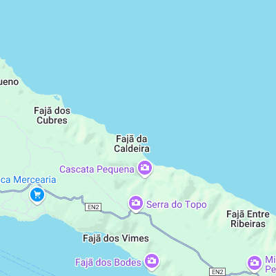
Surf spots nearby
Not Magic Seaweed (MSW)
Although we look a bit like Magic Seaweed we are not MagicSeaweed as they no longer exist...