Coffee Bay Point Surf Report
| Wave height * | 2.5ft / 0.8m |
|---|---|
| Swell period | 13s |
| Swell direction | |
| Wind | |
| Sea temp | 23°C / 74°F |

10 day Coffee Bay Point surf forecast
Fri
21/Nov
2.5ft
9
15
17
- High 4:23am
- Low 10:20am
- High 4:26pm
- Low 10:43pm
Sat
22/Nov
3.5ft
7
9
15
- High 4:54am
- Low 10:51am
- High 4:56pm
- Low 11:14pm
Sun
23/Nov
2.5ft
7
15
17
- High 5:28am
- Low 11:26am
- High 5:29pm
- Low 11:48pm
Mon
24/Nov
2ft
13
9
7
- High 6:06am
- Low 12:06pm
- High 6:08pm
Tue
25/Nov
2ft
10
20
26
- Low 12:27am
- High 6:54am
- Low 12:57pm
- High 6:58pm
Wed
26/Nov
2.5ft
9
1
19
- Low 1:18am
- High 7:58am
- Low 2:10pm
- High 8:12pm
Thu
27/Nov
2ft
17
22
24
- Low 2:29am
- High 9:20am
- Low 3:50pm
- High 9:51pm
Fri
28/Nov
6.5ft
31
34
31
- Low 3:59am
- High 10:44am
- Low 5:20pm
- High 11:19pm
Sat
29/Nov
6ft
9
22
12
- Low 5:20am
- High 11:53am
- Low 6:24pm
Sun
30/Nov
5.5ft
10
14
15
- High 12:25am
- Low 6:24am
- High 12:48pm
- Low 7:15pm
Fri 21st Nov
| 5:00 | 3ft | 8.8ft | 16s | 9mph (9mph) | |||
| 8:00 | 3ft | 8.7ft | 16s | 9mph (11mph) | |||
| 11:00 | 2.5ft | 8.6ft | 16s | 15mph (16mph) | |||
| 14:00 | 2.5ft | 8.5ft | 15s | 15mph (17mph) | |||
| 17:00 | 2.5ft | 8.5ft | 15s | 18mph (21mph) | |||
| 20:00 | 2.5ft | 8.3ft | 14s | 17mph (20mph) |
| Tide times |
|---|
| High 4:23am (1.75m) |
| Low 10:20am (0.52m) |
| High 4:26pm (1.82m) |
| Low 10:43pm (0.40m) |
| Daylight | |
|---|---|
| First light | 04:24 |
| Sunrise | 04:51 |
| Sunset | 18:47 |
| Dark | 19:14 |
Sat 22nd Nov
| 5:00 | 2.5ft | 7.9ft | 14s | 8mph (11mph) | |||
| 8:00 | 2.5ft | 8.1ft | 13s | 7mph (7mph) | |||
| 11:00 | 3ft | 8.6ft | 13s | 6mph (6mph) | |||
| 14:00 | 3.5ft | 8.8ft | 13s | 9mph (9mph) | |||
| 17:00 | 3ft | 8.6ft | 13s | 15mph (14mph) | |||
| 20:00 | 3ft | 8.1ft | 12s | 15mph (17mph) |
| Tide times |
|---|
| High 4:54am (1.71m) |
| Low 10:51am (0.57m) |
| High 4:56pm (1.75m) |
| Low 11:14pm (0.46m) |
| Daylight | |
|---|---|
| First light | 04:24 |
| Sunrise | 04:51 |
| Sunset | 18:47 |
| Dark | 19:15 |
Sun 23rd Nov
| 5:00 | 2ft | 7.1ft | 12s | 9mph (15mph) | |||
| 8:00 | 2ft | 6.8ft | 12s | 7mph (14mph) | |||
| 11:00 | 2.5ft | 6.5ft | 11s | 11mph (11mph) | |||
| 14:00 | 2.5ft | 6.6ft | 11s | 15mph (17mph) | |||
| 17:00 | 2.5ft | 7.1ft | 11s | 20mph (22mph) | |||
| 20:00 | 2.5ft | 7ft | 11s | 17mph (19mph) |
| Tide times |
|---|
| High 5:28am (1.66m) |
| Low 11:26am (0.64m) |
| High 5:29pm (1.67m) |
| Low 11:48pm (0.53m) |
| Daylight | |
|---|---|
| First light | 04:23 |
| Sunrise | 04:51 |
| Sunset | 18:48 |
| Dark | 19:16 |
Mon 24th Nov
| 5:00 | 2.5ft | 6.2ft | 11s | 17mph (19mph) | |||
| 8:00 | 2ft | 6.1ft | 10s | 13mph (15mph) | |||
| 11:00 | 2.5ft | 5.6ft | 10s | 9mph (10mph) | |||
| 14:00 | 2ft | 5.3ft | 10s | 9mph (9mph) | |||
| 17:00 | 2ft | 4.9ft | 10s | 9mph (9mph) | |||
| 20:00 | 2ft | 4.6ft | 10s | 7mph (7mph) |
| Tide times |
|---|
| High 6:06am (1.60m) |
| Low 12:06pm (0.73m) |
| High 6:08pm (1.57m) |
| Daylight | |
|---|---|
| First light | 04:23 |
| Sunrise | 04:50 |
| Sunset | 18:49 |
| Dark | 19:16 |
Tue 25th Nov
| 5:00 | 2ft | 5.4ft | 10s | 9mph (9mph) | |||
| 8:00 | 1.5ft | 5.7ft | 13s | 10mph (11mph) | |||
| 11:00 | 2ft | 6.1ft | 16s | 15mph (14mph) | |||
| 14:00 | 2ft | 6.6ft | 15s | 20mph (20mph) | |||
| 17:00 | 2ft | 6.9ft | 15s | 25mph (27mph) | |||
| 20:00 | 2ft | 6.8ft | 14s | 26mph (30mph) |
| Tide times |
|---|
| Low 12:27am (0.62m) |
| High 6:54am (1.54m) |
| Low 12:57pm (0.81m) |
| High 6:58pm (1.46m) |
| Daylight | |
|---|---|
| First light | 04:23 |
| Sunrise | 04:50 |
| Sunset | 18:50 |
| Dark | 19:17 |
Wed 26th Nov
| 5:00 | 2.5ft | 7.4ft | 13s | 10mph (11mph) | |||
| 8:00 | 2.5ft | 7.7ft | 13s | 9mph (10mph) | |||
| 11:00 | 2.5ft | 7.7ft | 13s | 10mph (9mph) | |||
| 14:00 | 2.5ft | 8.1ft | 14s | 1mph (5mph) | |||
| 17:00 | 3ft | 8.3ft | 15s | 19mph (23mph) | |||
| 20:00 | 2.5ft | 8.2ft | 15s | 19mph (24mph) |
| Tide times |
|---|
| Low 1:18am (0.71m) |
| High 7:58am (1.50m) |
| Low 2:10pm (0.87m) |
| High 8:12pm (1.37m) |
| Daylight | |
|---|---|
| First light | 04:23 |
| Sunrise | 04:50 |
| Sunset | 18:51 |
| Dark | 19:18 |
Thu 27th Nov
| 5:00 | 2ft | 6.8ft | 14s | 15mph (16mph) | |||
| 8:00 | 1.5ft | 6.5ft | 13s | 17mph (19mph) | |||
| 11:00 | 1.5ft | 6.3ft | 13s | 21mph (22mph) | |||
| 14:00 | 2ft | 6.8ft | 11s | 22mph (23mph) | |||
| 17:00 | 4.5ft | 8.2ft | 7s | 25mph (26mph) | |||
| 20:00 | 4ft | 8.8ft | 8s | 24mph (26mph) |
| Tide times |
|---|
| Low 2:29am (0.77m) |
| High 9:20am (1.49m) |
| Low 3:50pm (0.86m) |
| High 9:51pm (1.34m) |
| Daylight | |
|---|---|
| First light | 04:22 |
| Sunrise | 04:50 |
| Sunset | 18:52 |
| Dark | 19:19 |
Fri 28th Nov
| 5:00 | 4.5ft | 8.8ft | 9s | 29mph (33mph) | |||
| 8:00 | 4.5ft | 8.9ft | 9s | 31mph (36mph) | |||
| 11:00 | 6ft | 9.4ft | 8s | 32mph (40mph) | |||
| 14:00 | 6.5ft | 9.8ft | 8s | 34mph (43mph) | |||
| 17:00 | 7.5ft | 9.8ft | 8s | 33mph (44mph) | |||
| 20:00 | 8ft | 10.1ft | 8s | 31mph (38mph) |
| Tide times |
|---|
| Low 3:59am (0.78m) |
| High 10:44am (1.56m) |
| Low 5:20pm (0.77m) |
| High 11:19pm (1.40m) |
| Daylight | |
|---|---|
| First light | 04:22 |
| Sunrise | 04:50 |
| Sunset | 18:53 |
| Dark | 19:20 |
Sat 29th Nov
| 5:00 | 7.5ft | 8.4ft | 8s | 9mph (10mph) | |||
| 8:00 | 6.5ft | 7.5ft | 8s | 9mph (11mph) | |||
| 11:00 | 6ft | 6.9ft | 8s | 6mph (6mph) | |||
| 14:00 | 6ft | 7ft | 8s | 22mph (26mph) | |||
| 17:00 | 6.5ft | 6.9ft | 8s | 22mph (25mph) | |||
| 20:00 | 6ft | 6.6ft | 8s | 12mph (19mph) |
| Tide times |
|---|
| Low 5:20am (0.72m) |
| High 11:53am (1.68m) |
| Low 6:24pm (0.64m) |
| Daylight | |
|---|---|
| First light | 04:22 |
| Sunrise | 04:49 |
| Sunset | 18:54 |
| Dark | 19:21 |
Sun 30th Nov
| 5:00 | 5.5ft | 6.1ft | 9s | 14mph (17mph) | |||
| 8:00 | 5.5ft | 6.1ft | 9s | 10mph (11mph) | |||
| 11:00 | 6ft | 6.2ft | 9s | 5mph (5mph) | |||
| 14:00 | 5.5ft | 6ft | 9s | 14mph (14mph) | |||
| 17:00 | 5.5ft | 5.8ft | 9s | 17mph (19mph) | |||
| 20:00 | 6ft | 6.1ft | 8s | 15mph (16mph) |
| Tide times |
|---|
| High 12:25am (1.51m) |
| Low 6:24am (0.61m) |
| High 12:48pm (1.80m) |
| Low 7:15pm (0.51m) |
| Daylight | |
|---|---|
| First light | 04:22 |
| Sunrise | 04:49 |
| Sunset | 18:54 |
| Dark | 19:22 |
Pretty inconsistent point break requiring an easterly swell to work. Can be good when it's on, but rarely worth being shark bait for!
Surf spots nearby
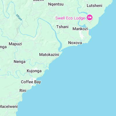
- Coffee Bay Beach (0.9 mi)
- Mdumbi (6.2 mi)
- Whale Rock (7.6 mi)
Not Magic Seaweed (MSW)
Although we look a bit like Magic Seaweed we are not MagicSeaweed as they no longer exist...