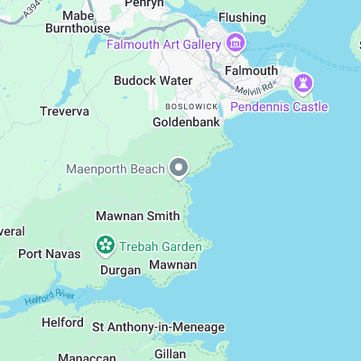
Maenporth Surf Report
| Wave height * | 0.5ft / 0.2m |
|---|---|
| Swell period | 12s |
| Swell direction | |
| Wind | |
| Sea temp | 12°C / 54°F |

10 day Maenporth surf forecast
Sat
20/Dec
0.5ft
18
26
19
- High 4:39am
- Low 11:17am
- High 4:55pm
- Low 11:31pm
Sun
21/Dec
0.5ft
1
11
7
- High 5:14am
- Low 11:54am
- High 5:30pm
Mon
22/Dec
0.5ft
6
11
8
- Low 12:07am
- High 5:49am
- Low 12:30pm
- High 6:06pm
Tue
23/Dec
0ft
6
14
16
- Low 12:43am
- High 6:25am
- Low 1:07pm
- High 6:43pm
Wed
24/Dec
0.5ft
16
19
20
- Low 1:20am
- High 7:02am
- Low 1:45pm
- High 7:21pm
Thu
25/Dec
0.5ft
17
14
9
- Low 1:58am
- High 7:41am
- Low 2:25pm
- High 8:02pm
Fri
26/Dec
6.5ft
16
17
15
- Low 2:39am
- High 8:24am
- Low 3:09pm
- High 8:48pm
Sat
27/Dec
0.5ft
19
20
16
- Low 3:25am
- High 9:13am
- Low 3:59pm
- High 9:41pm
Sun
28/Dec
0.5ft
14
11
12
- Low 4:21am
- High 10:10am
- Low 4:59pm
- High 10:44pm
Mon
29/Dec
0ft
12
15
14
- Low 5:28am
- High 11:17am
Sat 20th Dec
| 3:00 | 0.5ft | 9.9ft | 14s | 14mph (27mph) | |||
| 6:00 | 0.5ft | 10ft | 14s | 18mph (31mph) | |||
| 9:00 | 0.5ft | 10.8ft | 12s | 24mph (34mph) | |||
| 12:00 | 0.5ft | 11.5ft | 12s | 26mph (35mph) | |||
| 15:00 | 0.5ft | 12.6ft | 11s | 27mph (41mph) | |||
| 18:00 | 0ft | 12.2ft | 11s | 19mph (28mph) | |||
| 21:00 | 0ft | 11ft | 11s | 12mph (23mph) |
| Tide times |
|---|
| High 4:39am (5.18m) |
| Low 11:17am (1.43m) |
| High 4:55pm (5.01m) |
| Low 11:31pm (1.40m) |
| Daylight | |
|---|---|
| First light | 07:37 |
| Sunrise | 08:16 |
| Sunset | 16:19 |
| Dark | 16:58 |
Sun 21st Dec
| 3:00 | 0.5ft | 12.2ft | 16s | 9mph (15mph) | |||
| 6:00 | 0ft | 12.5ft | 16s | 1mph (2mph) | |||
| 9:00 | 0ft | 12.4ft | 16s | 5mph (9mph) | |||
| 12:00 | 0.5ft | 12.1ft | 16s | 11mph (16mph) | |||
| 15:00 | 0.5ft | 11.5ft | 15s | 8mph (13mph) | |||
| 18:00 | 0.5ft | 10.6ft | 15s | 7mph (12mph) | |||
| 21:00 | 0.5ft | 9.6ft | 15s | 6mph (10mph) |
| Tide times |
|---|
| High 5:14am (5.26m) |
| Low 11:54am (1.36m) |
| High 5:30pm (5.03m) |
| Daylight | |
|---|---|
| First light | 07:38 |
| Sunrise | 08:16 |
| Sunset | 16:20 |
| Dark | 16:58 |
Mon 22nd Dec
| 3:00 | 1ft | 8ft | 14s | 9mph (19mph) | |||
| 6:00 | 0.5ft | 7.3ft | 14s | 6mph (9mph) | |||
| 9:00 | 0.5ft | 6.7ft | 13s | 9mph (17mph) | |||
| 12:00 | 0.5ft | 6.3ft | 13s | 11mph (16mph) | |||
| 15:00 | 0.5ft | 6ft | 13s | 8mph (12mph) | |||
| 18:00 | 0.5ft | 5.6ft | 12s | 8mph (13mph) | |||
| 21:00 | 0.5ft | 5.2ft | 12s | 8mph (14mph) |
| Tide times |
|---|
| Low 12:07am (1.38m) |
| High 5:49am (5.28m) |
| Low 12:30pm (1.33m) |
| High 6:06pm (5.01m) |
| Daylight | |
|---|---|
| First light | 07:38 |
| Sunrise | 08:17 |
| Sunset | 16:20 |
| Dark | 16:59 |
Tue 23rd Dec
| 3:00 | 0ft | 4.5ft | 12s | 4mph (5mph) | |||
| 6:00 | 0ft | 4.3ft | 11s | 6mph (7mph) | |||
| 9:00 | 0ft | 4.1ft | 11s | 7mph (12mph) | |||
| 12:00 | 0ft | 4ft | 11s | 14mph (22mph) | |||
| 15:00 | 0ft | 4.3ft | 11s | 16mph (26mph) | |||
| 18:00 | 0.5ft | 4.8ft | 14s | 16mph (31mph) | |||
| 21:00 | 0.5ft | 5.2ft | 14s | 16mph (27mph) |
| Tide times |
|---|
| Low 12:43am (1.39m) |
| High 6:25am (5.25m) |
| Low 1:07pm (1.34m) |
| High 6:43pm (4.94m) |
| Daylight | |
|---|---|
| First light | 07:39 |
| Sunrise | 08:17 |
| Sunset | 16:21 |
| Dark | 16:59 |
Wed 24th Dec
| 3:00 | 0.5ft | 5.9ft | 13s | 16mph (26mph) | |||
| 6:00 | 0.5ft | 6.3ft | 13s | 16mph (26mph) | |||
| 9:00 | 0.5ft | 6.5ft | 12s | 16mph (26mph) | |||
| 12:00 | 0.5ft | 6.9ft | 12s | 19mph (27mph) | |||
| 15:00 | 1ft | 7.6ft | 9s | 20mph (29mph) | |||
| 18:00 | 1ft | 8.1ft | 9s | 20mph (30mph) | |||
| 21:00 | 1ft | 8.7ft | 9s | 22mph (33mph) |
| Tide times |
|---|
| Low 1:20am (1.44m) |
| High 7:02am (5.18m) |
| Low 1:45pm (1.38m) |
| High 7:21pm (4.85m) |
| Daylight | |
|---|---|
| First light | 07:39 |
| Sunrise | 08:18 |
| Sunset | 16:21 |
| Dark | 17:00 |
Thu 25th Dec
| 3:00 | 1ft | 8.4ft | 9s | 19mph (30mph) | |||
| 6:00 | 1ft | 7.7ft | 9s | 17mph (27mph) | |||
| 9:00 | 0.5ft | 7ft | 9s | 11mph (22mph) | |||
| 12:00 | 0.5ft | 6.4ft | 9s | 14mph (22mph) | |||
| 15:00 | 5.5ft | 6ft | 8s | 11mph (18mph) | |||
| 18:00 | 5.5ft | 5.9ft | 8s | 9mph (21mph) | |||
| 21:00 | 5.5ft | 6ft | 7s | 12mph (26mph) |
| Tide times |
|---|
| Low 1:58am (1.52m) |
| High 7:41am (5.10m) |
| Low 2:25pm (1.46m) |
| High 8:02pm (4.76m) |
| Daylight | |
|---|---|
| First light | 07:40 |
| Sunrise | 08:18 |
| Sunset | 16:22 |
| Dark | 17:01 |
Fri 26th Dec
| 3:00 | 6.5ft | 7.2ft | 7s | 14mph (26mph) | |||
| 6:00 | 6.5ft | 7.3ft | 7s | 16mph (25mph) | |||
| 9:00 | 6ft | 7.2ft | 8s | 15mph (24mph) | |||
| 12:00 | 6.5ft | 7.5ft | 7s | 17mph (22mph) | |||
| 15:00 | 0.5ft | 7.8ft | 8s | 15mph (23mph) | |||
| 18:00 | 0.5ft | 7.7ft | 8s | 15mph (25mph) | |||
| 21:00 | 0.5ft | 8.3ft | 8s | 17mph (27mph) |
| Tide times |
|---|
| Low 2:39am (1.61m) |
| High 8:24am (5.00m) |
| Low 3:09pm (1.55m) |
| High 8:48pm (4.67m) |
| Daylight | |
|---|---|
| First light | 07:40 |
| Sunrise | 08:18 |
| Sunset | 16:23 |
| Dark | 17:01 |
Sat 27th Dec
| 3:00 | 0.5ft | 8.9ft | 9s | 20mph (30mph) | |||
| 6:00 | 0.5ft | 8ft | 9s | 19mph (28mph) | |||
| 9:00 | 0.5ft | 7.4ft | 9s | 18mph (29mph) | |||
| 12:00 | 0.5ft | 6.8ft | 9s | 20mph (30mph) | |||
| 15:00 | 0.5ft | 6.4ft | 8s | 19mph (28mph) | |||
| 18:00 | 0ft | 6.5ft | 8s | 16mph (27mph) | |||
| 21:00 | 0ft | 7.4ft | 8s | 17mph (26mph) |
| Tide times |
|---|
| Low 3:25am (1.71m) |
| High 9:13am (4.91m) |
| Low 3:59pm (1.63m) |
| High 9:41pm (4.60m) |
| Daylight | |
|---|---|
| First light | 07:40 |
| Sunrise | 08:18 |
| Sunset | 16:24 |
| Dark | 17:02 |
Sun 28th Dec
| 3:00 | 6.5ft | 7.8ft | 8s | 10mph (19mph) | |||
| 6:00 | 0.5ft | 7.6ft | 10s | 14mph (22mph) | |||
| 9:00 | 0.5ft | 7.2ft | 9s | 11mph (18mph) | |||
| 12:00 | 0.5ft | 6.7ft | 9s | 11mph (19mph) | |||
| 15:00 | 0.5ft | 5.9ft | 11s | 10mph (17mph) | |||
| 18:00 | 0ft | 5.6ft | 12s | 12mph (19mph) | |||
| 21:00 | 0.5ft | 6.2ft | 8s | 14mph (24mph) |
| Tide times |
|---|
| Low 4:21am (1.79m) |
| High 10:10am (4.82m) |
| Low 4:59pm (1.70m) |
| High 10:44pm (4.57m) |
| Daylight | |
|---|---|
| First light | 07:40 |
| Sunrise | 08:19 |
| Sunset | 16:24 |
| Dark | 17:03 |
Mon 29th Dec
| 3:00 | 0ft | 4.4ft | 12s | 13mph (23mph) | |||
| 6:00 | 0ft | 4.4ft | 12s | 12mph (21mph) | |||
| 9:00 | 0ft | 4.8ft | 9s | 14mph (25mph) | |||
| 12:00 | 0ft | 5.2ft | 7s | 15mph (23mph) | |||
| 15:00 | 0ft | 5ft | 7s | 15mph (23mph) | |||
| 18:00 | 6.5ft | 8ft | 6s | 14mph (24mph) | |||
| 21:00 | 7.5ft | 8.8ft | 7s | 14mph (23mph) |
| Tide times |
|---|
| Low 5:28am (1.83m) |
| High 11:17am (4.77m) |
| Daylight | |
|---|---|
| First light | 07:40 |
| Sunrise | 08:19 |
| Sunset | 16:25 |
| Dark | 17:04 |
Nearest buoys
Fickle spot that takes monster south coast swell to get going. The good news is it's offshore in the howling westerlies that are likely to accompany the swell
Surf spots nearby
- Gyllyngvase (1.7 mi)
- Pendower (8.5 mi)
- Kennack Sands (8.8 mi)
- Gunwalloe (9.5 mi)
- Church Cove (9.8 mi)
- Poldhu Cove (9.8 mi)
- Porthleven Pier (10.4 mi)
- Porthleven (10.5 mi)
- Portreath (12.9 mi)
- Portreath Harbour Wall (12.9 mi)
Not Magic Seaweed (MSW)
Although we look a bit like Magic Seaweed we are not MagicSeaweed as they no longer exist...