Curl Curl Surf Report
| Wave height * | 3ft / 0.8m |
|---|---|
| Swell period | 7s |
| Swell direction | |
| Wind | |
| Sea temp | 21°C / 71°F |

10 day Curl Curl surf forecast
Tue
6/Jan
2.5ft
6
10
9
- High 12:13am
- Low 5:41am
- High 12:01pm
- Low 6:48pm
Wed
7/Jan
2ft
2
13
14
- High 1:00am
- Low 6:34am
- High 12:49pm
- Low 7:31pm
Thu
8/Jan
2ft
4
13
16
- High 1:46am
- Low 7:28am
- High 1:37pm
- Low 8:13pm
Fri
9/Jan
3ft
4
15
17
- High 2:31am
- Low 8:22am
- High 2:26pm
- Low 8:54pm
Sat
10/Jan
3ft
7
12
9
- High 3:16am
- Low 9:18am
- High 3:16pm
- Low 9:35pm
Sun
11/Jan
6ft
13
13
8
- High 4:00am
- Low 10:13am
- High 4:07pm
- Low 10:15pm
Mon
12/Jan
4ft
2
12
3
- High 4:43am
- Low 11:06am
- High 4:58pm
- Low 10:56pm
Tue
13/Jan
3ft
5
8
10
- High 5:26am
- Low 11:56am
- High 5:47pm
- Low 11:36pm
Wed
14/Jan
3ft
9
12
13
- High 6:07am
- Low 12:42pm
- High 6:32pm
Tue 6th Jan
| 5:00 | 2.5ft | 3.1ft | 8s | 7mph (11mph) | |||
| 8:00 | 3ft | 3ft | 7s | 6mph (8mph) | |||
| 11:00 | 2.5ft | 2.8ft | 8s | 5mph (3mph) | |||
| 14:00 | 2.5ft | 2.7ft | 9s | 10mph (6mph) | |||
| 17:00 | 2ft | 2.6ft | 10s | 11mph (12mph) | |||
| 20:00 | 2ft | 2.6ft | 9s | 9mph (18mph) |
| Tide times |
|---|
| High 12:13am (1.24m) |
| Low 5:41am (0.48m) |
| High 12:01pm (1.68m) |
| Low 6:48pm (0.14m) |
| Daylight | |
|---|---|
| First light | 05:21 |
| Sunrise | 05:50 |
| Sunset | 20:09 |
| Dark | 20:38 |
Wed 7th Jan
| 5:00 | 1.5ft | 2.3ft | 9s | 2mph (2mph) | |||
| 8:00 | 2ft | 2.2ft | 9s | 2mph (4mph) | |||
| 11:00 | 1.5ft | 2.1ft | 8s | 8mph (8mph) | |||
| 14:00 | 2ft | 2.4ft | 8s | 13mph (13mph) | |||
| 17:00 | 2.5ft | 3.3ft | 5s | 15mph (24mph) | |||
| 20:00 | 2ft | 3.7ft | 5s | 14mph (32mph) |
| Tide times |
|---|
| High 1:00am (1.29m) |
| Low 6:34am (0.47m) |
| High 12:49pm (1.62m) |
| Low 7:31pm (0.17m) |
| Daylight | |
|---|---|
| First light | 05:22 |
| Sunrise | 05:51 |
| Sunset | 20:09 |
| Dark | 20:38 |
Thu 8th Jan
| 5:00 | 2ft | 3.5ft | 6s | 7mph (13mph) | |||
| 8:00 | 2ft | 3.6ft | 6s | 4mph (7mph) | |||
| 11:00 | 2ft | 3.4ft | 6s | 8mph (10mph) | |||
| 14:00 | 2ft | 4.1ft | 6s | 13mph (15mph) | |||
| 17:00 | 3ft | 5.1ft | 6s | 17mph (28mph) | |||
| 20:00 | 3.5ft | 6ft | 7s | 16mph (37mph) |
| Tide times |
|---|
| High 1:46am (1.32m) |
| Low 7:28am (0.47m) |
| High 1:37pm (1.55m) |
| Low 8:13pm (0.21m) |
| Daylight | |
|---|---|
| First light | 05:23 |
| Sunrise | 05:52 |
| Sunset | 20:09 |
| Dark | 20:38 |
Fri 9th Jan
| 5:00 | 3ft | 5.6ft | 8s | 8mph (16mph) | |||
| 8:00 | 3ft | 5.3ft | 8s | 4mph (5mph) | |||
| 11:00 | 3ft | 5ft | 8s | 9mph (7mph) | |||
| 14:00 | 3ft | 5.5ft | 8s | 15mph (19mph) | |||
| 17:00 | 4ft | 7.1ft | 7s | 17mph (28mph) | |||
| 20:00 | 4.5ft | 8.5ft | 8s | 17mph (38mph) |
| Tide times |
|---|
| High 2:31am (1.36m) |
| Low 8:22am (0.47m) |
| High 2:26pm (1.47m) |
| Low 8:54pm (0.26m) |
| Daylight | |
|---|---|
| First light | 05:24 |
| Sunrise | 05:53 |
| Sunset | 20:09 |
| Dark | 20:38 |
Sat 10th Jan
| 5:00 | 3.5ft | 6.6ft | 8s | 4mph (5mph) | |||
| 8:00 | 3ft | 5.8ft | 8s | 7mph (17mph) | |||
| 11:00 | 3ft | 5.3ft | 8s | 9mph (15mph) | |||
| 14:00 | 3ft | 5.6ft | 8s | 12mph (18mph) | |||
| 17:00 | 4ft | 7.3ft | 7s | 3mph (15mph) | |||
| 20:00 | 4.5ft | 8.3ft | 8s | 9mph (12mph) |
| Tide times |
|---|
| High 3:16am (1.42m) |
| Low 9:18am (0.47m) |
| High 3:16pm (1.39m) |
| Low 9:35pm (0.31m) |
| Daylight | |
|---|---|
| First light | 05:25 |
| Sunrise | 05:54 |
| Sunset | 20:09 |
| Dark | 20:37 |
Sun 11th Jan
| 5:00 | 6ft | 8.2ft | 8s | 16mph (21mph) | |||
| 8:00 | 6ft | 8.1ft | 7s | 13mph (16mph) | |||
| 11:00 | 6.5ft | 7.9ft | 7s | 13mph (14mph) | |||
| 14:00 | 6ft | 7.5ft | 8s | 13mph (14mph) | |||
| 17:00 | 5.5ft | 7ft | 8s | 13mph (14mph) | |||
| 20:00 | 5.5ft | 6.6ft | 8s | 8mph (11mph) |
| Tide times |
|---|
| High 4:00am (1.48m) |
| Low 10:13am (0.45m) |
| High 4:07pm (1.34m) |
| Low 10:15pm (0.34m) |
| Daylight | |
|---|---|
| First light | 05:26 |
| Sunrise | 05:54 |
| Sunset | 20:09 |
| Dark | 20:37 |
Mon 12th Jan
| 5:00 | 5ft | 5.5ft | 7s | 2mph (3mph) | |||
| 8:00 | 4.5ft | 5.2ft | 8s | 2mph (2mph) | |||
| 11:00 | 4ft | 5ft | 8s | 7mph (6mph) | |||
| 14:00 | 4ft | 5ft | 8s | 12mph (10mph) | |||
| 17:00 | 4.5ft | 5ft | 8s | 12mph (12mph) | |||
| 20:00 | 4ft | 4.9ft | 8s | 3mph (6mph) |
| Tide times |
|---|
| High 4:43am (1.55m) |
| Low 11:06am (0.41m) |
| High 4:58pm (1.30m) |
| Low 10:56pm (0.35m) |
| Daylight | |
|---|---|
| First light | 05:27 |
| Sunrise | 05:55 |
| Sunset | 20:09 |
| Dark | 20:37 |
Tue 13th Jan
| 5:00 | 3.5ft | 4.5ft | 7s | 2mph (3mph) | |||
| 8:00 | 3.5ft | 4.4ft | 7s | 5mph (5mph) | |||
| 11:00 | 3.5ft | 4.3ft | 7s | 5mph (5mph) | |||
| 14:00 | 3ft | 4.1ft | 8s | 8mph (7mph) | |||
| 17:00 | 3ft | 4.3ft | 8s | 16mph (19mph) | |||
| 20:00 | 3ft | 4.5ft | 8s | 10mph (18mph) |
| Tide times |
|---|
| High 5:26am (1.63m) |
| Low 11:56am (0.36m) |
| High 5:47pm (1.28m) |
| Low 11:36pm (0.35m) |
| Daylight | |
|---|---|
| First light | 05:28 |
| Sunrise | 05:56 |
| Sunset | 20:09 |
| Dark | 20:37 |
Wed 14th Jan
| 5:00 | 3ft | 4.6ft | 6s | 6mph (12mph) | |||
| 8:00 | 3ft | 4.6ft | 8s | 9mph (15mph) | |||
| 11:00 | 3ft | 4.9ft | 7s | 10mph (12mph) | |||
| 14:00 | 3ft | 5.8ft | 6s | 12mph (13mph) | |||
| 17:00 | 4ft | 7.2ft | 6s | 12mph (14mph) | |||
| 20:00 | 4.5ft | 8.2ft | 7s | 13mph (20mph) |
| Tide times |
|---|
| High 6:07am (1.71m) |
| Low 12:42pm (0.29m) |
| High 6:32pm (1.28m) |
| Daylight | |
|---|---|
| First light | 05:29 |
| Sunrise | 05:57 |
| Sunset | 20:09 |
| Dark | 20:37 |
Thu 15th Jan
| 5:00 | 4ft | 7ft | 8s | 9mph (14mph) | |||
| 8:00 | 4ft | 6.7ft | 8s | 9mph (14mph) | |||
| 11:00 | 4ft | 6.2ft | 8s | 11mph (11mph) |
Consistent beachbreak with variety of waves. North Curlie is sheltered from N/NE winds and there is an occasional left of the point. On bigger swells there is a decent outside wave in the middle and a heavy hollow right at the southern end
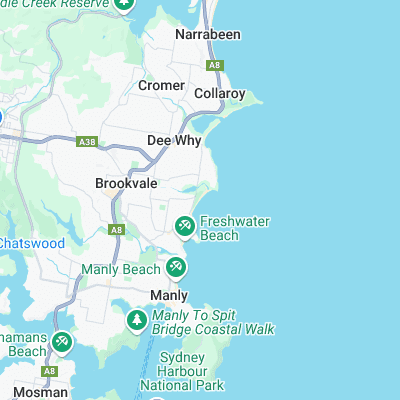
Surf spots nearby
- Freshwater Beach (0.8 mi)
- Queenscliff (1 mi)
- Dee Why Point (1.1 mi)
- The Trench (1.1 mi)
- North Steyne (1.3 mi)
- Queensie Bombie (1.3 mi)
- Dee why (1.4 mi)
- Manly (1.9 mi)
- Fairy Bower (2 mi)
- Collaroy End (2.6 mi)
Not Magic Seaweed (MSW)
Although we look a bit like Magic Seaweed we are not MagicSeaweed as they no longer exist...