Ours (Cape Solander) Surf Report
| Wave height * | 3.5ft / 1m |
|---|---|
| Swell period | 10s |
| Swell direction | |
| Wind | |
| Sea temp | 21°C / 70°F |

10 day Ours surf forecast
Fri
2/Jan
3.5ft
5
8
10
- Low 1:25am
- High 8:04am
- Low 2:55pm
- High 8:50pm
Sat
3/Jan
2ft
5
21
21
- Low 2:20am
- High 8:57am
- Low 3:48pm
- High 9:43pm
Sun
4/Jan
3.5ft
25
25
12
- Low 3:14am
- High 9:48am
- Low 4:36pm
- High 10:33pm
Mon
5/Jan
3.5ft
3
13
10
- Low 4:05am
- High 10:36am
- Low 5:23pm
- High 11:21pm
Tue
6/Jan
2.5ft
14
11
7
- Low 4:55am
- High 11:23am
- Low 6:07pm
Wed
7/Jan
2.5ft
5
18
19
- High 12:08am
- Low 5:45am
- High 12:08pm
- Low 6:49pm
Thu
8/Jan
3ft
10
19
26
- High 12:54am
- Low 6:35am
- High 12:52pm
- Low 7:29pm
Fri
9/Jan
5ft
12
22
27
- High 1:41am
- Low 7:28am
- High 1:36pm
- Low 8:07pm
Sat
10/Jan
5.5ft
15
24
28
- High 2:29am
- Low 8:25am
- High 2:21pm
- Low 8:46pm
Fri 2nd Jan
| 5:00 | 4.5ft | 5.6ft | 11s | 8mph (8mph) | |||
| 8:00 | 4ft | 5.3ft | 11s | 5mph (5mph) | |||
| 11:00 | 4ft | 5ft | 11s | 6mph (6mph) | |||
| 14:00 | 3.5ft | 4.8ft | 10s | 8mph (8mph) | |||
| 17:00 | 3ft | 4.7ft | 10s | 10mph (10mph) | |||
| 20:00 | 3ft | 4.5ft | 9s | 10mph (11mph) |
| Tide times |
|---|
| Low 1:25am (0.37m) |
| High 8:04am (1.82m) |
| Low 2:55pm (0.16m) |
| High 8:50pm (1.21m) |
| Daylight | |
|---|---|
| First light | 05:19 |
| Sunrise | 05:47 |
| Sunset | 20:09 |
| Dark | 20:38 |
Sat 3rd Jan
| 5:00 | 2ft | 3.9ft | 8s | 7mph (9mph) | |||
| 8:00 | 2.5ft | 3.6ft | 8s | 5mph (6mph) | |||
| 11:00 | 2ft | 3.5ft | 8s | 16mph (17mph) | |||
| 14:00 | 2ft | 3.5ft | 8s | 21mph (21mph) | |||
| 17:00 | 2.5ft | 4.1ft | 8s | 25mph (29mph) | |||
| 20:00 | 3ft | 4.4ft | 7s | 21mph (27mph) |
| Tide times |
|---|
| Low 2:20am (0.34m) |
| High 8:57am (1.88m) |
| Low 3:48pm (0.10m) |
| High 9:43pm (1.24m) |
| Daylight | |
|---|---|
| First light | 05:19 |
| Sunrise | 05:48 |
| Sunset | 20:10 |
| Dark | 20:38 |
Sun 4th Jan
| 5:00 | 3ft | 4.4ft | 6s | 11mph (14mph) | |||
| 8:00 | 3.5ft | 4.5ft | 6s | 25mph (32mph) | |||
| 11:00 | 3ft | 4.3ft | 6s | 19mph (26mph) | |||
| 14:00 | 3.5ft | 4.5ft | 6s | 25mph (21mph) | |||
| 17:00 | 4ft | 5ft | 6s | 22mph (27mph) | |||
| 20:00 | 5ft | 5.7ft | 7s | 12mph (16mph) |
| Tide times |
|---|
| Low 3:14am (0.32m) |
| High 9:48am (1.90m) |
| Low 4:36pm (0.08m) |
| High 10:33pm (1.25m) |
| Daylight | |
|---|---|
| First light | 05:20 |
| Sunrise | 05:49 |
| Sunset | 20:10 |
| Dark | 20:39 |
Mon 5th Jan
| 5:00 | 4ft | 5ft | 7s | 9mph (16mph) | |||
| 8:00 | 4ft | 4.5ft | 7s | 3mph (4mph) | |||
| 11:00 | 3.5ft | 4.3ft | 7s | 16mph (17mph) | |||
| 14:00 | 3.5ft | 4.4ft | 7s | 13mph (23mph) | |||
| 17:00 | 4.5ft | 4.9ft | 7s | 16mph (20mph) | |||
| 20:00 | 4ft | 4.4ft | 7s | 10mph (10mph) |
| Tide times |
|---|
| Low 4:05am (0.32m) |
| High 10:36am (1.87m) |
| Low 5:23pm (0.10m) |
| High 11:21pm (1.26m) |
| Daylight | |
|---|---|
| First light | 05:21 |
| Sunrise | 05:50 |
| Sunset | 20:10 |
| Dark | 20:39 |
Tue 6th Jan
| 5:00 | 4ft | 5.6ft | 7s | 20mph (22mph) | |||
| 8:00 | 3.5ft | 5.1ft | 7s | 14mph (15mph) | |||
| 11:00 | 3ft | 4.7ft | 7s | 11mph (10mph) | |||
| 14:00 | 2.5ft | 4.3ft | 7s | 11mph (10mph) | |||
| 17:00 | 2.5ft | 4ft | 6s | 11mph (12mph) | |||
| 20:00 | 2ft | 3.7ft | 6s | 7mph (8mph) |
| Tide times |
|---|
| Low 4:55am (0.35m) |
| High 11:23am (1.79m) |
| Low 6:07pm (0.15m) |
| Daylight | |
|---|---|
| First light | 05:22 |
| Sunrise | 05:51 |
| Sunset | 20:10 |
| Dark | 20:39 |
Wed 7th Jan
| 5:00 | 2.5ft | 3ft | 7s | 5mph (4mph) | |||
| 8:00 | 2.5ft | 2.9ft | 7s | 5mph (6mph) | |||
| 11:00 | 2.5ft | 2.8ft | 8s | 11mph (11mph) | |||
| 14:00 | 2.5ft | 3ft | 8s | 18mph (19mph) | |||
| 17:00 | 3ft | 3.3ft | 7s | 20mph (26mph) | |||
| 20:00 | 3ft | 3.6ft | 6s | 19mph (29mph) |
| Tide times |
|---|
| High 12:08am (1.27m) |
| Low 5:45am (0.40m) |
| High 12:08pm (1.68m) |
| Low 6:49pm (0.23m) |
| Daylight | |
|---|---|
| First light | 05:23 |
| Sunrise | 05:51 |
| Sunset | 20:10 |
| Dark | 20:39 |
Thu 8th Jan
| 5:00 | 3ft | 3.3ft | 5s | 11mph (17mph) | |||
| 8:00 | 3ft | 3.2ft | 5s | 10mph (13mph) | |||
| 11:00 | 3ft | 3.2ft | 5s | 15mph (15mph) | |||
| 14:00 | 3ft | 4ft | 5s | 19mph (22mph) | |||
| 17:00 | 4ft | 4.8ft | 5s | 24mph (36mph) | |||
| 20:00 | 4.5ft | 5.3ft | 6s | 26mph (43mph) |
| Tide times |
|---|
| High 12:54am (1.27m) |
| Low 6:35am (0.47m) |
| High 12:52pm (1.54m) |
| Low 7:29pm (0.31m) |
| Daylight | |
|---|---|
| First light | 05:24 |
| Sunrise | 05:52 |
| Sunset | 20:10 |
| Dark | 20:39 |
Fri 9th Jan
| 5:00 | 4.5ft | 5.7ft | 7s | 8mph (13mph) | |||
| 8:00 | 4.5ft | 5.5ft | 8s | 12mph (17mph) | |||
| 11:00 | 4.5ft | 5.6ft | 7s | 16mph (16mph) | |||
| 14:00 | 5ft | 6.1ft | 7s | 22mph (25mph) | |||
| 17:00 | 6ft | 8ft | 7s | 23mph (34mph) | |||
| 20:00 | 7ft | 8.9ft | 8s | 27mph (44mph) |
| Tide times |
|---|
| High 1:41am (1.27m) |
| Low 7:28am (0.54m) |
| High 1:36pm (1.39m) |
| Low 8:07pm (0.39m) |
| Daylight | |
|---|---|
| First light | 05:25 |
| Sunrise | 05:53 |
| Sunset | 20:10 |
| Dark | 20:38 |
Sat 10th Jan
| 5:00 | 6.5ft | 8.4ft | 8s | 20mph (29mph) | |||
| 8:00 | 6ft | 7.3ft | 8s | 15mph (19mph) | |||
| 11:00 | 5ft | 6.6ft | 8s | 19mph (18mph) | |||
| 14:00 | 5.5ft | 7.1ft | 8s | 24mph (31mph) | |||
| 17:00 | 6.5ft | 8.5ft | 8s | 28mph (43mph) | |||
| 20:00 | 7ft | 8.6ft | 8s | 28mph (48mph) |
| Tide times |
|---|
| High 2:29am (1.28m) |
| Low 8:25am (0.61m) |
| High 2:21pm (1.26m) |
| Low 8:46pm (0.46m) |
| Daylight | |
|---|---|
| First light | 05:26 |
| Sunrise | 05:54 |
| Sunset | 20:10 |
| Dark | 20:38 |
Sun 11th Jan
| 5:00 | 7ft | 7.7ft | 8s | 26mph (32mph) | |||
| 8:00 | 5ft | 8.3ft | 8s | 28mph (33mph) | |||
| 11:00 | 5ft | 8.3ft | 7s | 22mph (24mph) |
One in a long line of insane Ozzy slabs. Ours is just has heavy as the others but breaks in front of a rock ledge and is dominated by the Bra boys. Also a little sharky!
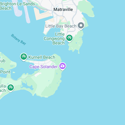
Surf spots nearby
- Voodoo (2.6 mi)
- Maroubra Beach (4.5 mi)
- Maroubra North End Point (4.8 mi)
- The Ally (5 mi)
- Cronulla (5.1 mi)
- Cronulla Point (5.3 mi)
- Honeycomb (5.3 mi)
- Shark Island (5.3 mi)
- Coogee (6.4 mi)
- Coogee Reef (6.5 mi)
Not Magic Seaweed (MSW)
Although we look a bit like Magic Seaweed we are not MagicSeaweed as they no longer exist...