Prickly Point Surf Report
| Wave height * | 1ft / 0.2m |
|---|---|
| Swell period | 6s |
| Swell direction | |
| Wind | |
| Sea temp | 29°C / 84°F |

10 day Prickly Point surf forecast
Thu
6/Nov
1ft
12
11
10
- High 4:47am
- Low 7:43am
- High 3:09pm
- Low 11:17pm
Fri
7/Nov
1ft
13
11
13
- High 6:14am
- Low 7:48am
- High 3:55pm
Sat
8/Nov
1ft
11
10
12
- Low 12:22am
- High 4:45pm
Sun
9/Nov
1.5ft
17
12
15
- Low 1:35am
- High 5:41pm
Mon
10/Nov
1.5ft
15
15
14
- Low 2:54am
- High 6:49pm
Tue
11/Nov
1.5ft
13
15
13
- Low 4:07am
- High 8:25pm
Wed
12/Nov
1ft
13
14
13
- Low 5:05am
- High 12:47pm
- Low 4:44pm
- High 10:22pm
Thu
13/Nov
1ft
12
10
13
- Low 5:46am
- High 12:36pm
- Low 6:20pm
Fri
14/Nov
1ft
12
12
12
- High 12:02am
- Low 6:13am
- High 12:38pm
- Low 7:17pm
Thu 6th Nov
| 5:00 | 0.5ft | 4ft | 7s | 12mph (18mph) | |||
| 8:00 | 1ft | 4.1ft | 5s | 12mph (18mph) | |||
| 11:00 | 1ft | 4.2ft | 6s | 12mph (17mph) | |||
| 14:00 | 1ft | 4.2ft | 6s | 11mph (15mph) | |||
| 17:00 | 1ft | 4.2ft | 7s | 10mph (15mph) | |||
| 20:00 | 1ft | 4.2ft | 7s | 10mph (15mph) |
| Tide times |
|---|
| High 4:47am (0.48m) |
| Low 7:43am (0.45m) |
| High 3:09pm (0.79m) |
| Low 11:17pm (0.26m) |
| Daylight | |
|---|---|
| First light | 05:39 |
| Sunrise | 06:01 |
| Sunset | 17:40 |
| Dark | 18:02 |
Fri 7th Nov
| 5:00 | 1ft | 4.3ft | 7s | 11mph (17mph) | |||
| 8:00 | 1ft | 4.5ft | 7s | 13mph (18mph) | |||
| 11:00 | 1ft | 4.6ft | 7s | 12mph (18mph) | |||
| 14:00 | 1ft | 4.7ft | 7s | 11mph (16mph) | |||
| 17:00 | 1ft | 4.9ft | 7s | 12mph (18mph) | |||
| 20:00 | 1ft | 5.1ft | 7s | 13mph (19mph) |
| Tide times |
|---|
| High 6:14am (0.46m) |
| Low 7:48am (0.45m) |
| High 3:55pm (0.78m) |
| Daylight | |
|---|---|
| First light | 05:39 |
| Sunrise | 06:01 |
| Sunset | 17:39 |
| Dark | 18:01 |
Sat 8th Nov
| 5:00 | 1ft | 4.8ft | 8s | 10mph (14mph) | |||
| 8:00 | 1ft | 4.6ft | 8s | 11mph (14mph) | |||
| 11:00 | 1ft | 4.3ft | 8s | 11mph (14mph) | |||
| 14:00 | 1ft | 4.1ft | 8s | 10mph (15mph) | |||
| 17:00 | 1ft | 4.1ft | 8s | 11mph (16mph) | |||
| 20:00 | 1ft | 4.3ft | 8s | 12mph (17mph) |
| Tide times |
|---|
| Low 12:22am (0.27m) |
| High 4:45pm (0.75m) |
| Daylight | |
|---|---|
| First light | 05:39 |
| Sunrise | 06:01 |
| Sunset | 17:39 |
| Dark | 18:01 |
Sun 9th Nov
| 5:00 | 2ft | 6.9ft | 8s | 16mph (20mph) | |||
| 8:00 | 1.5ft | 5.8ft | 8s | 17mph (22mph) | |||
| 11:00 | 1.5ft | 5.6ft | 8s | 16mph (21mph) | |||
| 14:00 | 1.5ft | 5.6ft | 8s | 12mph (18mph) | |||
| 17:00 | 1.5ft | 5.8ft | 8s | 15mph (21mph) | |||
| 20:00 | 1.5ft | 5.6ft | 8s | 15mph (23mph) |
| Tide times |
|---|
| Low 1:35am (0.30m) |
| High 5:41pm (0.71m) |
| Daylight | |
|---|---|
| First light | 05:40 |
| Sunrise | 06:02 |
| Sunset | 17:39 |
| Dark | 18:01 |
Mon 10th Nov
| 5:00 | 1.5ft | 5.9ft | 8s | 13mph (19mph) | |||
| 8:00 | 1.5ft | 5.9ft | 8s | 15mph (20mph) | |||
| 11:00 | 1.5ft | 5.9ft | 8s | 15mph (19mph) | |||
| 14:00 | 1.5ft | 5.6ft | 8s | 15mph (19mph) | |||
| 17:00 | 1.5ft | 5.4ft | 8s | 15mph (19mph) | |||
| 20:00 | 1.5ft | 5.6ft | 8s | 14mph (19mph) |
| Tide times |
|---|
| Low 2:54am (0.32m) |
| High 6:49pm (0.66m) |
| Daylight | |
|---|---|
| First light | 05:40 |
| Sunrise | 06:02 |
| Sunset | 17:39 |
| Dark | 18:01 |
Tue 11th Nov
| 5:00 | 1.5ft | 5.5ft | 8s | 13mph (19mph) | |||
| 8:00 | 1.5ft | 5.5ft | 8s | 13mph (18mph) | |||
| 11:00 | 1.5ft | 5.5ft | 8s | 15mph (17mph) | |||
| 14:00 | 1.5ft | 5.7ft | 8s | 15mph (17mph) | |||
| 17:00 | 1.5ft | 5.7ft | 8s | 13mph (17mph) | |||
| 20:00 | 1.5ft | 5.6ft | 8s | 13mph (19mph) |
| Tide times |
|---|
| Low 4:07am (0.34m) |
| High 8:25pm (0.61m) |
| Daylight | |
|---|---|
| First light | 05:40 |
| Sunrise | 06:02 |
| Sunset | 17:39 |
| Dark | 18:01 |
Wed 12th Nov
| 5:00 | 1.5ft | 4.9ft | 8s | 11mph (17mph) | |||
| 8:00 | 1.5ft | 5.2ft | 8s | 13mph (18mph) | |||
| 11:00 | 1.5ft | 5.3ft | 8s | 14mph (17mph) | |||
| 14:00 | 1ft | 5.2ft | 8s | 14mph (17mph) | |||
| 17:00 | 1ft | 4.9ft | 8s | 14mph (19mph) | |||
| 20:00 | 1ft | 4.7ft | 8s | 13mph (19mph) |
| Tide times |
|---|
| Low 5:05am (0.37m) |
| High 12:47pm (0.54m) |
| Low 4:44pm (0.51m) |
| High 10:22pm (0.58m) |
| Daylight | |
|---|---|
| First light | 05:41 |
| Sunrise | 06:03 |
| Sunset | 17:39 |
| Dark | 18:01 |
Thu 13th Nov
| 5:00 | 1ft | 5.2ft | 8s | 12mph (18mph) | |||
| 8:00 | 1ft | 5ft | 8s | 12mph (17mph) | |||
| 11:00 | 1ft | 4.7ft | 8s | 14mph (18mph) | |||
| 14:00 | 1ft | 4.6ft | 8s | 10mph (15mph) | |||
| 17:00 | 1ft | 4.6ft | 8s | 11mph (17mph) | |||
| 20:00 | 1ft | 4.9ft | 8s | 13mph (19mph) |
| Tide times |
|---|
| Low 5:46am (0.40m) |
| High 12:36pm (0.56m) |
| Low 6:20pm (0.47m) |
| Daylight | |
|---|---|
| First light | 05:41 |
| Sunrise | 06:03 |
| Sunset | 17:39 |
| Dark | 18:01 |
Fri 14th Nov
| 5:00 | 1ft | 4.5ft | 8s | 12mph (17mph) | |||
| 8:00 | 1ft | 4.4ft | 8s | 12mph (15mph) | |||
| 11:00 | 1ft | 4.4ft | 8s | 12mph (15mph) | |||
| 14:00 | 1ft | 4.3ft | 8s | 12mph (14mph) | |||
| 17:00 | 1ft | 4.3ft | 8s | 13mph (16mph) | |||
| 20:00 | 1ft | 4.3ft | 8s | 12mph (17mph) |
| Tide times |
|---|
| High 12:02am (0.55m) |
| Low 6:13am (0.44m) |
| High 12:38pm (0.58m) |
| Low 7:17pm (0.42m) |
| Daylight | |
|---|---|
| First light | 05:41 |
| Sunrise | 06:04 |
| Sunset | 17:39 |
| Dark | 18:01 |
Sat 15th Nov
| 5:00 | 1ft | 4ft | 8s | 10mph (15mph) | |||
| 8:00 | 0.5ft | 3.9ft | 8s | 11mph (15mph) | |||
| 11:00 | 0.5ft | 3.8ft | 8s | 13mph (16mph) | |||
| 14:00 | 0.5ft | 3.6ft | 8s | 13mph (16mph) | |||
| 17:00 | 0.5ft | 3.5ft | 8s | 13mph (16mph) | |||
| 20:00 | 0.5ft | 3.5ft | 8s | 12mph (17mph) |
| Tide times |
|---|
| High 1:25am (0.54m) |
| Low 6:25am (0.47m) |
| High 12:43pm (0.61m) |
| Low 8:02pm (0.38m) |
| Daylight | |
|---|---|
| First light | 05:42 |
| Sunrise | 06:04 |
| Sunset | 17:38 |
| Dark | 18:01 |
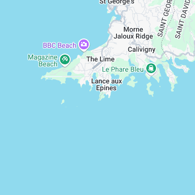
Surf spots nearby
Not Magic Seaweed (MSW)
Although we look a bit like Magic Seaweed we are not MagicSeaweed as they no longer exist...