Scar Reef Surf Report
| Wave height * | 2.5ft / 0.7m |
|---|---|
| Swell period | 11s |
| Swell direction | |
| Wind | |
| Sea temp | 29°C / 85°F |

10 day Scar Reef surf forecast
Wed
31/Dec
2.5ft
5
10
6
- Low 4:18am
- High 11:09am
- Low 2:20pm
- High 9:09pm
Thu
1/Jan
2.5ft
6
11
8
- Low 4:56am
- High 11:53am
- Low 3:18pm
- High 9:51pm
Fri
2/Jan
2ft
3
6
3
- Low 5:35am
- High 12:35pm
- Low 4:09pm
- High 10:31pm
Sat
3/Jan
2ft
0
10
7
- Low 6:13am
- High 1:16pm
- Low 4:55pm
- High 11:10pm
Sun
4/Jan
2.5ft
4
11
6
- Low 6:51am
- High 1:58pm
- Low 5:37pm
- High 11:46pm
Mon
5/Jan
2ft
2
12
10
- Low 7:28am
- High 2:40pm
- Low 6:20pm
Tue
6/Jan
2.5ft
7
13
8
- High 12:21am
- Low 8:03am
- High 3:23pm
- Low 7:06pm
Wed
7/Jan
2ft
5
11
5
- High 12:53am
- Low 8:37am
- High 4:06pm
- Low 8:03pm
Thu
8/Jan
2.5ft
1
4
5
- High 1:24am
- Low 9:07am
- High 4:48pm
- Low 9:32pm
Wed 31st Dec
| 5:00 | 2.5ft | 4.6ft | 11s | 5mph (8mph) | |||
| 8:00 | 2.5ft | 4.7ft | 11s | 5mph (7mph) | |||
| 11:00 | 2ft | 4.8ft | 11s | 3mph (5mph) | |||
| 14:00 | 2.5ft | 4.9ft | 11s | 10mph (10mph) | |||
| 17:00 | 2.5ft | 5.1ft | 11s | 10mph (11mph) | |||
| 20:00 | 2.5ft | 5.1ft | 11s | 6mph (7mph) |
| Tide times |
|---|
| Low 4:18am (0.36m) |
| High 11:09am (1.62m) |
| Low 2:20pm (1.47m) |
| High 9:09pm (2.80m) |
| Daylight | |
|---|---|
| First light | 05:34 |
| Sunrise | 05:56 |
| Sunset | 18:34 |
| Dark | 18:57 |
Thu 1st Jan
| 5:00 | 2.5ft | 5.3ft | 13s | 4mph (7mph) | |||
| 8:00 | 2.5ft | 5.2ft | 11s | 6mph (8mph) | |||
| 11:00 | 2.5ft | 5ft | 11s | 8mph (9mph) | |||
| 14:00 | 2.5ft | 4.9ft | 11s | 11mph (11mph) | |||
| 17:00 | 2.5ft | 4.8ft | 13s | 11mph (13mph) | |||
| 20:00 | 2.5ft | 4.6ft | 13s | 8mph (10mph) |
| Tide times |
|---|
| Low 4:56am (0.14m) |
| High 11:53am (1.73m) |
| Low 3:18pm (1.52m) |
| High 9:51pm (2.87m) |
| Daylight | |
|---|---|
| First light | 05:34 |
| Sunrise | 05:57 |
| Sunset | 18:35 |
| Dark | 18:58 |
Fri 2nd Jan
| 5:00 | 2ft | 4ft | 12s | 2mph (4mph) | |||
| 8:00 | 2ft | 3.8ft | 12s | 3mph (4mph) | |||
| 11:00 | 2ft | 3.8ft | 12s | 4mph (5mph) | |||
| 14:00 | 2ft | 3.8ft | 12s | 6mph (4mph) | |||
| 17:00 | 2ft | 3.9ft | 12s | 2mph (2mph) | |||
| 20:00 | 2ft | 3.9ft | 12s | 3mph (3mph) |
| Tide times |
|---|
| Low 5:35am (0.01m) |
| High 12:35pm (1.81m) |
| Low 4:09pm (1.55m) |
| High 10:31pm (2.90m) |
| Daylight | |
|---|---|
| First light | 05:35 |
| Sunrise | 05:57 |
| Sunset | 18:35 |
| Dark | 18:58 |
Sat 3rd Jan
| 5:00 | 2ft | 4ft | 20s | 2mph (4mph) | |||
| 8:00 | 2ft | 3.9ft | 19s | 0mph (1mph) | |||
| 11:00 | 2ft | 4.1ft | 18s | 5mph (5mph) | |||
| 14:00 | 2ft | 4.3ft | 18s | 10mph (9mph) | |||
| 17:00 | 2ft | 4.2ft | 18s | 9mph (10mph) | |||
| 20:00 | 2ft | 4.2ft | 17s | 7mph (8mph) |
| Tide times |
|---|
| Low 6:13am (-0.05m) |
| High 1:16pm (1.85m) |
| Low 4:55pm (1.57m) |
| High 11:10pm (2.86m) |
| Daylight | |
|---|---|
| First light | 05:35 |
| Sunrise | 05:58 |
| Sunset | 18:36 |
| Dark | 18:58 |
Sun 4th Jan
| 5:00 | 2ft | 4.2ft | 16s | 2mph (3mph) | |||
| 8:00 | 2ft | 4.2ft | 15s | 4mph (5mph) | |||
| 11:00 | 2ft | 4.3ft | 15s | 6mph (6mph) | |||
| 14:00 | 2.5ft | 4.4ft | 15s | 11mph (10mph) | |||
| 17:00 | 2.5ft | 4.5ft | 15s | 10mph (10mph) | |||
| 20:00 | 2ft | 4.4ft | 14s | 6mph (7mph) |
| Tide times |
|---|
| Low 6:51am (-0.02m) |
| High 1:58pm (1.88m) |
| Low 5:37pm (1.60m) |
| High 11:46pm (2.76m) |
| Daylight | |
|---|---|
| First light | 05:36 |
| Sunrise | 05:59 |
| Sunset | 18:36 |
| Dark | 18:59 |
Mon 5th Jan
| 5:00 | 2ft | 4.1ft | 14s | 1mph (3mph) | |||
| 8:00 | 2ft | 4ft | 13s | 2mph (3mph) | |||
| 11:00 | 2ft | 4ft | 13s | 7mph (8mph) | |||
| 14:00 | 2ft | 4ft | 13s | 12mph (11mph) | |||
| 17:00 | 2ft | 4.1ft | 13s | 12mph (12mph) | |||
| 20:00 | 2ft | 4.2ft | 13s | 10mph (13mph) |
| Tide times |
|---|
| Low 7:28am (0.07m) |
| High 2:40pm (1.88m) |
| Low 6:20pm (1.64m) |
| Daylight | |
|---|---|
| First light | 05:36 |
| Sunrise | 05:59 |
| Sunset | 18:36 |
| Dark | 18:59 |
Tue 6th Jan
| 5:00 | 2.5ft | 4.5ft | 12s | 9mph (12mph) | |||
| 8:00 | 2.5ft | 4.5ft | 12s | 7mph (9mph) | |||
| 11:00 | 2.5ft | 4.4ft | 12s | 6mph (8mph) | |||
| 14:00 | 2.5ft | 4.4ft | 12s | 13mph (13mph) | |||
| 17:00 | 2.5ft | 4.5ft | 12s | 12mph (14mph) | |||
| 20:00 | 2.5ft | 4.4ft | 12s | 8mph (10mph) |
| Tide times |
|---|
| High 12:21am (2.60m) |
| Low 8:03am (0.22m) |
| High 3:23pm (1.89m) |
| Low 7:06pm (1.67m) |
| Daylight | |
|---|---|
| First light | 05:37 |
| Sunrise | 06:00 |
| Sunset | 18:37 |
| Dark | 18:59 |
Wed 7th Jan
| 5:00 | 2.5ft | 4.1ft | 12s | 4mph (6mph) | |||
| 8:00 | 2.5ft | 4ft | 11s | 5mph (6mph) | |||
| 11:00 | 2ft | 3.9ft | 11s | 8mph (9mph) | |||
| 14:00 | 2ft | 3.9ft | 11s | 11mph (11mph) | |||
| 17:00 | 2ft | 3.9ft | 11s | 7mph (8mph) | |||
| 20:00 | 2ft | 3.9ft | 11s | 5mph (7mph) |
| Tide times |
|---|
| High 12:53am (2.39m) |
| Low 8:37am (0.43m) |
| High 4:06pm (1.89m) |
| Low 8:03pm (1.69m) |
| Daylight | |
|---|---|
| First light | 05:37 |
| Sunrise | 06:00 |
| Sunset | 18:37 |
| Dark | 19:00 |
Thu 8th Jan
| 5:00 | 2ft | 3.9ft | 18s | 2mph (2mph) | |||
| 8:00 | 2ft | 3.9ft | 18s | 1mph (1mph) | |||
| 11:00 | 2ft | 4ft | 16s | 1mph (2mph) | |||
| 14:00 | 2.5ft | 4.4ft | 16s | 4mph (5mph) | |||
| 17:00 | 2.5ft | 4.5ft | 16s | 7mph (9mph) | |||
| 20:00 | 2.5ft | 4.5ft | 15s | 5mph (9mph) |
| Tide times |
|---|
| High 1:24am (2.14m) |
| Low 9:07am (0.66m) |
| High 4:48pm (1.91m) |
| Low 9:32pm (1.68m) |
| Daylight | |
|---|---|
| First light | 05:38 |
| Sunrise | 06:01 |
| Sunset | 18:37 |
| Dark | 19:00 |
Fri 9th Jan
| 5:00 | 2.5ft | 4.9ft | 15s | 4mph (9mph) | |||
| 8:00 | 2.5ft | 4.9ft | 14s | 3mph (3mph) | |||
| 20:00 | 2.5ft | 5.1ft | 13s | 12mph (17mph) |
Epic barrelling, walling left over sometimes very shallow coral reef - hence the name!
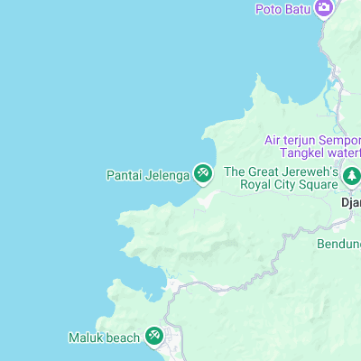
Surf spots nearby
- Benete (2.8 mi)
- Super Suck (5.6 mi)
- Ekas (21 mi)
Not Magic Seaweed (MSW)
Although we look a bit like Magic Seaweed we are not MagicSeaweed as they no longer exist...