Mysteries Surf Report
| Wave height * | 2.5ft / 0.7m |
|---|---|
| Swell period | 16s |
| Swell direction | |
| Wind | |
| Sea temp | 17°C / 63°F |

10 day Mysteries surf forecast
Tue
30/Dec
2ft
2
4
8
- Low 5:55am
- High 12:07pm
- Low 6:18pm
Wed
31/Dec
3ft
5
6
4
- High 12:34am
- Low 6:55am
- High 1:06pm
- Low 7:13pm
Thu
1/Jan
2ft
13
17
9
- High 1:28am
- Low 7:48am
- High 1:58pm
- Low 8:02pm
Fri
2/Jan
4ft
15
19
15
- High 2:17am
- Low 8:37am
- High 2:46pm
- Low 8:48pm
Sat
3/Jan
5.5ft
15
8
10
- High 3:02am
- Low 9:23am
- High 3:31pm
- Low 9:32pm
Sun
4/Jan
5.5ft
23
12
4
- High 3:46am
- Low 10:06am
- High 4:14pm
- Low 10:15pm
Mon
5/Jan
3.5ft
6
6
7
- High 4:28am
- Low 10:48am
- High 4:56pm
- Low 10:56pm
Tue
6/Jan
2.5ft
2
3
4
- High 5:10am
- Low 11:30am
- High 5:38pm
- Low 11:37pm
Wed
7/Jan
2.5ft
2
7
9
- High 5:51am
- Low 12:12pm
- High 6:20pm
Thu
8/Jan
1.5ft
20
21
22
- Low 12:21am
- High 6:34am
- Low 12:56pm
Tue 30th Dec
| 4:00 | 2.5ft | 3.8ft | 14s | 3mph (3mph) | |||
| 7:00 | 2ft | 3.6ft | 13s | 2mph (2mph) | |||
| 10:00 | 2ft | 3.5ft | 13s | 1mph (1mph) | |||
| 13:00 | 2ft | 3.5ft | 13s | 4mph (2mph) | |||
| 16:00 | 2.5ft | 3.8ft | 14s | 5mph (4mph) | |||
| 19:00 | 2.5ft | 4ft | 16s | 8mph (8mph) |
| Tide times |
|---|
| Low 5:55am (1.23m) |
| High 12:07pm (3.13m) |
| Low 6:18pm (1.18m) |
| Daylight | |
|---|---|
| First light | 08:09 |
| Sunrise | 08:35 |
| Sunset | 18:47 |
| Dark | 19:13 |
Wed 31st Dec
| 4:00 | 3ft | 4.6ft | 15s | 6mph (5mph) | |||
| 7:00 | 3ft | 4.7ft | 14s | 5mph (6mph) | |||
| 10:00 | 2.5ft | 4.8ft | 14s | 5mph (5mph) | |||
| 13:00 | 3ft | 4.7ft | 14s | 6mph (6mph) | |||
| 16:00 | 3ft | 4.6ft | 13s | 5mph (4mph) | |||
| 19:00 | 2.5ft | 4.4ft | 13s | 4mph (4mph) |
| Tide times |
|---|
| High 12:34am (3.31m) |
| Low 6:55am (1.08m) |
| High 1:06pm (3.22m) |
| Low 7:13pm (1.09m) |
| Daylight | |
|---|---|
| First light | 08:09 |
| Sunrise | 08:35 |
| Sunset | 18:48 |
| Dark | 19:14 |
Thu 1st Jan
| 4:00 | 2ft | 3.7ft | 12s | 8mph (9mph) | |||
| 7:00 | 2ft | 3.6ft | 12s | 13mph (18mph) | |||
| 10:00 | 2ft | 3.7ft | 12s | 15mph (23mph) | |||
| 13:00 | 2ft | 3.6ft | 12s | 17mph (23mph) | |||
| 16:00 | 2ft | 3.5ft | 15s | 13mph (17mph) | |||
| 19:00 | 2.5ft | 4.1ft | 14s | 9mph (15mph) |
| Tide times |
|---|
| High 1:28am (3.45m) |
| Low 7:48am (0.94m) |
| High 1:58pm (3.31m) |
| Low 8:02pm (1.01m) |
| Daylight | |
|---|---|
| First light | 08:09 |
| Sunrise | 08:35 |
| Sunset | 18:48 |
| Dark | 19:15 |
Fri 2nd Jan
| 4:00 | 3.5ft | 5.5ft | 12s | 21mph (31mph) | |||
| 7:00 | 4ft | 6.2ft | 11s | 15mph (20mph) | |||
| 10:00 | 4ft | 6.6ft | 11s | 14mph (20mph) | |||
| 13:00 | 4ft | 7ft | 11s | 19mph (29mph) | |||
| 16:00 | 4.5ft | 7.2ft | 11s | 10mph (23mph) | |||
| 19:00 | 4.5ft | 7.7ft | 11s | 15mph (23mph) |
| Tide times |
|---|
| High 2:17am (3.56m) |
| Low 8:37am (0.84m) |
| High 2:46pm (3.36m) |
| Low 8:48pm (0.97m) |
| Daylight | |
|---|---|
| First light | 08:09 |
| Sunrise | 08:36 |
| Sunset | 18:49 |
| Dark | 19:15 |
Sat 3rd Jan
| 4:00 | 5.5ft | 8.8ft | 11s | 15mph (13mph) | |||
| 7:00 | 5ft | 9.2ft | 12s | 15mph (16mph) | |||
| 10:00 | 5.5ft | 10.2ft | 12s | 10mph (11mph) | |||
| 13:00 | 5.5ft | 10.7ft | 13s | 8mph (11mph) | |||
| 16:00 | 6ft | 10.6ft | 12s | 11mph (17mph) | |||
| 19:00 | 5ft | 10.4ft | 12s | 10mph (15mph) |
| Tide times |
|---|
| High 3:02am (3.62m) |
| Low 9:23am (0.81m) |
| High 3:31pm (3.36m) |
| Low 9:32pm (0.97m) |
| Daylight | |
|---|---|
| First light | 08:10 |
| Sunrise | 08:36 |
| Sunset | 18:50 |
| Dark | 19:16 |
Sun 4th Jan
| 4:00 | 5.5ft | 11.5ft | 12s | 21mph (30mph) | |||
| 7:00 | 6.5ft | 12.5ft | 13s | 23mph (32mph) | |||
| 10:00 | 6ft | 11.8ft | 13s | 18mph (25mph) | |||
| 13:00 | 5.5ft | 10.6ft | 12s | 12mph (17mph) | |||
| 16:00 | 5ft | 10.2ft | 11s | 11mph (15mph) | |||
| 19:00 | 5ft | 9.6ft | 11s | 4mph (5mph) |
| Tide times |
|---|
| High 3:46am (3.61m) |
| Low 10:06am (0.83m) |
| High 4:14pm (3.32m) |
| Low 10:15pm (1.02m) |
| Daylight | |
|---|---|
| First light | 08:10 |
| Sunrise | 08:36 |
| Sunset | 18:51 |
| Dark | 19:17 |
Mon 5th Jan
| 4:00 | 4.5ft | 8.4ft | 10s | 8mph (9mph) | |||
| 7:00 | 3.5ft | 9.2ft | 12s | 6mph (8mph) | |||
| 10:00 | 3.5ft | 9.3ft | 12s | 6mph (7mph) | |||
| 13:00 | 3.5ft | 8.6ft | 11s | 6mph (6mph) | |||
| 16:00 | 3ft | 7.9ft | 11s | 5mph (4mph) | |||
| 19:00 | 3ft | 7.2ft | 11s | 7mph (7mph) |
| Tide times |
|---|
| High 4:28am (3.55m) |
| Low 10:48am (0.92m) |
| High 4:56pm (3.23m) |
| Low 10:56pm (1.11m) |
| Daylight | |
|---|---|
| First light | 08:10 |
| Sunrise | 08:36 |
| Sunset | 18:51 |
| Dark | 19:18 |
Tue 6th Jan
| 4:00 | 2.5ft | 6.7ft | 11s | 6mph (7mph) | |||
| 7:00 | 2.5ft | 6.7ft | 10s | 2mph (3mph) | |||
| 10:00 | 2.5ft | 6.7ft | 10s | 5mph (6mph) | |||
| 13:00 | 2.5ft | 6.8ft | 11s | 3mph (5mph) | |||
| 16:00 | 2.5ft | 7.2ft | 11s | 5mph (7mph) | |||
| 19:00 | 2.5ft | 7.6ft | 11s | 4mph (5mph) |
| Tide times |
|---|
| High 5:10am (3.43m) |
| Low 11:30am (1.05m) |
| High 5:38pm (3.11m) |
| Low 11:37pm (1.24m) |
| Daylight | |
|---|---|
| First light | 08:10 |
| Sunrise | 08:36 |
| Sunset | 18:52 |
| Dark | 19:18 |
Wed 7th Jan
| 4:00 | 2.5ft | 6.9ft | 11s | 5mph (6mph) | |||
| 7:00 | 2.5ft | 7ft | 11s | 2mph (3mph) | |||
| 10:00 | 2.5ft | 6.9ft | 11s | 4mph (4mph) | |||
| 13:00 | 2.5ft | 6.8ft | 11s | 7mph (12mph) | |||
| 16:00 | 2.5ft | 6.6ft | 11s | 3mph (5mph) | |||
| 19:00 | 2ft | 6.4ft | 11s | 9mph (9mph) |
| Tide times |
|---|
| High 5:51am (3.27m) |
| Low 12:12pm (1.20m) |
| High 6:20pm (2.98m) |
| Daylight | |
|---|---|
| First light | 08:10 |
| Sunrise | 08:36 |
| Sunset | 18:53 |
| Dark | 19:19 |
Thu 8th Jan
| 4:00 | 2ft | 5.9ft | 10s | 13mph (23mph) | |||
| 7:00 | 2ft | 5.6ft | 10s | 20mph (31mph) | |||
| 10:00 | 2ft | 5.4ft | 10s | 23mph (31mph) | |||
| 13:00 | 1.5ft | 5ft | 10s | 21mph (29mph) | |||
| 16:00 | 1.5ft | 4.6ft | 10s | 22mph (32mph) | |||
| 19:00 | 1.5ft | 4.5ft | 9s | 22mph (33mph) |
| Tide times |
|---|
| Low 12:21am (1.39m) |
| High 6:34am (3.09m) |
| Low 12:56pm (1.36m) |
| Daylight | |
|---|---|
| First light | 08:10 |
| Sunrise | 08:36 |
| Sunset | 18:54 |
| Dark | 19:20 |
Decent rights off a sand covered reef with the odd left. Often fun and often busy with less experienced surfers not wanting to take on the points. Gets shallow to the point of being exposed at low tide
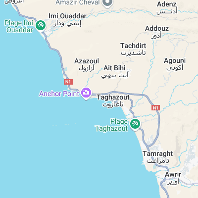
Surf spots nearby
- Hash Point (0.3 mi)
- Anchor Point (0.5 mi)
- Panoramas (0.6 mi)
- La Source (0.9 mi)
- Killer Point (1.4 mi)
- Devil's rock (3.2 mi)
- 14th Km (3.3 mi)
- Banana Point (3.5 mi)
- Banana Beach (4 mi)
- The Kms (6 mi)
Not Magic Seaweed (MSW)
Although we look a bit like Magic Seaweed we are not MagicSeaweed as they no longer exist...