Contendas Surf Report
| Wave height * | 0.5ft / 0.1m |
|---|---|
| Swell period | 9s |
| Swell direction | |
| Wind | |
| Sea temp | 17°C / 62°F |

10 day Contendas surf forecast
Mon
29/Dec
0.5ft
0
0
0
- Low 3:18am
- High 9:30am
- Low 3:53pm
- High 10:14pm
Tue
30/Dec
3ft
12
19
5
- Low 4:26am
- High 10:34am
- Low 4:51pm
- High 11:10pm
Wed
31/Dec
1ft
7
7
9
- Low 5:27am
- High 11:34am
- Low 5:45pm
Thu
1/Jan
2ft
29
30
30
- High 12:06am
- Low 6:22am
- High 12:29pm
- Low 6:35pm
Fri
2/Jan
5ft
28
25
22
- High 12:56am
- Low 7:12am
- High 1:19pm
- Low 7:22pm
Sat
3/Jan
5ft
25
23
24
- High 1:43am
- Low 8:01am
- High 2:06pm
- Low 8:08pm
Sun
4/Jan
4ft
23
21
21
- High 2:28am
- Low 8:47am
- High 2:53pm
- Low 8:52pm
Mon
5/Jan
4ft
18
16
15
- High 3:13am
- Low 9:32am
- High 3:38pm
- Low 9:36pm
Tue
6/Jan
4ft
16
17
17
- High 3:58am
- Low 10:18am
- High 4:23pm
- Low 10:20pm
Wed
7/Jan
3.5ft
19
20
21
- High 4:42am
- Low 11:05am
Mon 29th Dec
| 5:00 | 1ft | 11.8ft | 9s | 0mph (0mph) | |||
| 8:00 | 0.5ft | 10.7ft | 9s | 0mph (0mph) | |||
| 11:00 | 0.5ft | 9.8ft | 9s | 0mph (0mph) | |||
| 14:00 | 0.5ft | 9ft | 9s | 0mph (0mph) | |||
| 17:00 | 0.5ft | 8.4ft | 10s | 0mph (0mph) | |||
| 20:00 | 0ft | 7.9ft | 10s | 0mph (0mph) |
| Tide times |
|---|
| Low 3:18am (0.65m) |
| High 9:30am (1.44m) |
| Low 3:53pm (0.53m) |
| High 10:14pm (1.47m) |
| Daylight | |
|---|---|
| First light | 07:36 |
| Sunrise | 08:05 |
| Sunset | 17:36 |
| Dark | 18:05 |
Tue 30th Dec
| 5:00 | 0ft | 6.4ft | 10s | 13mph (15mph) | |||
| 8:00 | 0ft | 6ft | 9s | 12mph (15mph) | |||
| 11:00 | 0ft | 6.1ft | 9s | 13mph (17mph) | |||
| 14:00 | 3ft | 6.6ft | 7s | 19mph (24mph) | |||
| 17:00 | 3ft | 6.6ft | 7s | 15mph (21mph) | |||
| 20:00 | 0.5ft | 6.9ft | 9s | 5mph (5mph) |
| Tide times |
|---|
| Low 4:26am (0.58m) |
| High 10:34am (1.48m) |
| Low 4:51pm (0.48m) |
| High 11:10pm (1.55m) |
| Daylight | |
|---|---|
| First light | 07:36 |
| Sunrise | 08:05 |
| Sunset | 17:36 |
| Dark | 18:06 |
Wed 31st Dec
| 5:00 | 1ft | 6.9ft | 10s | 8mph (10mph) | |||
| 8:00 | 1ft | 6.6ft | 11s | 7mph (8mph) | |||
| 11:00 | 1ft | 6.2ft | 11s | 5mph (7mph) | |||
| 14:00 | 1ft | 6ft | 11s | 7mph (8mph) | |||
| 17:00 | 0.5ft | 6.2ft | 10s | 13mph (15mph) | |||
| 20:00 | 1ft | 7ft | 10s | 9mph (13mph) |
| Tide times |
|---|
| Low 5:27am (0.51m) |
| High 11:34am (1.51m) |
| Low 5:45pm (0.43m) |
| Daylight | |
|---|---|
| First light | 07:36 |
| Sunrise | 08:06 |
| Sunset | 17:37 |
| Dark | 18:07 |
Thu 1st Jan
| 5:00 | 0ft | 9.7ft | 8s | 19mph (23mph) | |||
| 8:00 | 1ft | 10.5ft | 8s | 29mph (32mph) | |||
| 11:00 | 1.5ft | 10.4ft | 8s | 29mph (34mph) | |||
| 14:00 | 2ft | 11.4ft | 9s | 30mph (35mph) | |||
| 17:00 | 2.5ft | 12.9ft | 9s | 30mph (36mph) | |||
| 20:00 | 3.5ft | 14.3ft | 10s | 30mph (36mph) |
| Tide times |
|---|
| High 12:06am (1.63m) |
| Low 6:22am (0.44m) |
| High 12:29pm (1.55m) |
| Low 6:35pm (0.39m) |
| Daylight | |
|---|---|
| First light | 07:36 |
| Sunrise | 08:06 |
| Sunset | 17:38 |
| Dark | 18:08 |
Fri 2nd Jan
| 5:00 | 3.5ft | 14.3ft | 11s | 31mph (36mph) | |||
| 8:00 | 3ft | 12.8ft | 10s | 28mph (32mph) | |||
| 11:00 | 4ft | 12.6ft | 10s | 26mph (30mph) | |||
| 14:00 | 5ft | 13.5ft | 10s | 25mph (28mph) | |||
| 17:00 | 4ft | 13.9ft | 11s | 23mph (25mph) | |||
| 20:00 | 4ft | 13.5ft | 11s | 22mph (24mph) |
| Tide times |
|---|
| High 12:56am (1.70m) |
| Low 7:12am (0.39m) |
| High 1:19pm (1.57m) |
| Low 7:22pm (0.37m) |
| Daylight | |
|---|---|
| First light | 07:36 |
| Sunrise | 08:06 |
| Sunset | 17:39 |
| Dark | 18:08 |
Sat 3rd Jan
| 5:00 | 5.5ft | 11.6ft | 12s | 25mph (28mph) | |||
| 8:00 | 5ft | 11ft | 12s | 25mph (30mph) | |||
| 11:00 | 4.5ft | 10.2ft | 11s | 25mph (28mph) | |||
| 14:00 | 5ft | 9.7ft | 11s | 23mph (26mph) | |||
| 17:00 | 5ft | 9.3ft | 11s | 24mph (28mph) | |||
| 20:00 | 3ft | 9ft | 11s | 24mph (28mph) |
| Tide times |
|---|
| High 1:43am (1.73m) |
| Low 8:01am (0.37m) |
| High 2:06pm (1.57m) |
| Low 8:08pm (0.38m) |
| Daylight | |
|---|---|
| First light | 07:36 |
| Sunrise | 08:06 |
| Sunset | 17:40 |
| Dark | 18:09 |
Sun 4th Jan
| 5:00 | 4.5ft | 7.7ft | 12s | 22mph (25mph) | |||
| 8:00 | 4ft | 7.4ft | 12s | 23mph (25mph) | |||
| 11:00 | 4ft | 7.1ft | 12s | 22mph (23mph) | |||
| 14:00 | 4ft | 7ft | 11s | 21mph (22mph) | |||
| 17:00 | 4ft | 6.9ft | 11s | 22mph (24mph) | |||
| 20:00 | 4ft | 6.8ft | 11s | 21mph (23mph) |
| Tide times |
|---|
| High 2:28am (1.73m) |
| Low 8:47am (0.38m) |
| High 2:53pm (1.54m) |
| Low 8:52pm (0.41m) |
| Daylight | |
|---|---|
| First light | 07:36 |
| Sunrise | 08:06 |
| Sunset | 17:41 |
| Dark | 18:10 |
Mon 5th Jan
| 5:00 | 4ft | 7.5ft | 12s | 19mph (20mph) | |||
| 8:00 | 4ft | 7.5ft | 12s | 18mph (19mph) | |||
| 11:00 | 4ft | 7.4ft | 12s | 19mph (19mph) | |||
| 14:00 | 4ft | 7.4ft | 12s | 16mph (16mph) | |||
| 17:00 | 3.5ft | 7.2ft | 12s | 16mph (16mph) | |||
| 20:00 | 3.5ft | 7.1ft | 12s | 15mph (17mph) |
| Tide times |
|---|
| High 3:13am (1.70m) |
| Low 9:32am (0.42m) |
| High 3:38pm (1.50m) |
| Low 9:36pm (0.47m) |
| Daylight | |
|---|---|
| First light | 07:36 |
| Sunrise | 08:06 |
| Sunset | 17:42 |
| Dark | 18:11 |
Tue 6th Jan
| 5:00 | 3ft | 7ft | 12s | 12mph (13mph) | |||
| 8:00 | 4ft | 7.1ft | 13s | 16mph (17mph) | |||
| 11:00 | 4ft | 7.6ft | 13s | 17mph (18mph) | |||
| 14:00 | 4ft | 7.7ft | 10s | 17mph (17mph) | |||
| 17:00 | 3.5ft | 7.7ft | 10s | 16mph (17mph) | |||
| 20:00 | 3.5ft | 7.6ft | 10s | 17mph (19mph) |
| Tide times |
|---|
| High 3:58am (1.64m) |
| Low 10:18am (0.48m) |
| High 4:23pm (1.43m) |
| Low 10:20pm (0.54m) |
| Daylight | |
|---|---|
| First light | 07:36 |
| Sunrise | 08:06 |
| Sunset | 17:42 |
| Dark | 18:12 |
Wed 7th Jan
| 5:00 | 4ft | 8.8ft | 7s | 19mph (21mph) | |||
| 8:00 | 3.5ft | 8.9ft | 8s | 19mph (21mph) | |||
| 11:00 | 2.5ft | 8.3ft | 8s | 20mph (23mph) | |||
| 14:00 | 3.5ft | 8.8ft | 8s | 20mph (23mph) | |||
| 17:00 | 3.5ft | 8.8ft | 8s | 21mph (24mph) | |||
| 20:00 | 3ft | 8.2ft | 8s | 21mph (24mph) |
| Tide times |
|---|
| High 4:42am (1.56m) |
| Low 11:05am (0.55m) |
| Daylight | |
|---|---|
| First light | 07:36 |
| Sunrise | 08:06 |
| Sunset | 17:43 |
| Dark | 18:13 |
Fairly average reef-break located in a sheltered cove. Takes an E'ly swell or a big S swell to wrap round an get it going.
There is a right off the point here but it's rarely worth the bother!
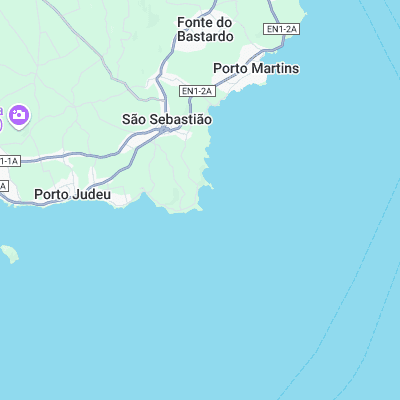
Surf spots nearby
- Ponta Negra (3.4 mi)
- Santa Catarina (4.6 mi)
- Praia da Vitoria (5.2 mi)
- Vila Nova (10.4 mi)
Not Magic Seaweed (MSW)
Although we look a bit like Magic Seaweed we are not MagicSeaweed as they no longer exist...