Paul do Mar (Paúl do Mar) Surf Report
| Wave height * | 6.5ft / 2.1m |
|---|---|
| Swell period | 15s |
| Swell direction | |
| Wind | |
| Sea temp | 20°C / 67°F |

10 day Paul do Mar surf forecast
Mon
29/Dec
4.5ft
0
0
0
- Low 3:42am
- High 9:56am
- Low 4:16pm
- High 10:37pm
Tue
30/Dec
6ft
5
6
5
- Low 4:50am
- High 11:01am
- Low 5:15pm
- High 11:32pm
Wed
31/Dec
5.5ft
8
14
14
- Low 5:51am
- High 12:02pm
- Low 6:08pm
Thu
1/Jan
8ft
29
27
26
- High 12:27am
- Low 6:44am
- High 12:56pm
- Low 6:57pm
Fri
2/Jan
9.5ft
20
24
24
- High 1:15am
- Low 7:34am
- High 1:45pm
- Low 7:44pm
Sat
3/Jan
10ft
23
20
18
- High 2:02am
- Low 8:22am
- High 2:31pm
- Low 8:28pm
Sun
4/Jan
6ft
18
13
16
- High 2:46am
- Low 9:07am
- High 3:16pm
- Low 9:11pm
Mon
5/Jan
5ft
17
19
17
- High 3:30am
- Low 9:51am
- High 4:00pm
- Low 9:54pm
Tue
6/Jan
5ft
17
19
20
- High 4:14am
- Low 10:35am
- High 4:43pm
- Low 10:37pm
Wed
7/Jan
3.5ft
12
5
18
- High 4:57am
- Low 11:20am
- High 5:28pm
Mon 29th Dec
| 3:00 | 2.5ft | 5.7ft | 11s | 0mph (0mph) | |||
| 6:00 | 5ft | 5.7ft | 11s | 0mph (0mph) | |||
| 9:00 | 4.5ft | 5.6ft | 13s | 0mph (0mph) | |||
| 12:00 | 4.5ft | 5.6ft | 13s | 0mph (0mph) | |||
| 15:00 | 5.5ft | 6.2ft | 13s | 0mph (0mph) | |||
| 18:00 | 6ft | 7.4ft | 12s | 0mph (0mph) | |||
| 21:00 | 7ft | 8.4ft | 12s | 0mph (0mph) |
| Tide times |
|---|
| Low 3:42am (0.85m) |
| High 9:56am (2.08m) |
| Low 4:16pm (0.71m) |
| High 10:37pm (2.12m) |
| Daylight | |
|---|---|
| First light | 07:43 |
| Sunrise | 08:10 |
| Sunset | 18:12 |
| Dark | 18:39 |
Tue 30th Dec
| 3:00 | 7ft | 8.3ft | 16s | 8mph (11mph) | |||
| 6:00 | 6.5ft | 8ft | 15s | 5mph (7mph) | |||
| 9:00 | 6.5ft | 7.7ft | 15s | 5mph (8mph) | |||
| 12:00 | 6ft | 7.4ft | 14s | 6mph (8mph) | |||
| 15:00 | 6ft | 7ft | 14s | 5mph (6mph) | |||
| 18:00 | 5.5ft | 6.7ft | 14s | 5mph (7mph) | |||
| 21:00 | 5.5ft | 6.4ft | 13s | 3mph (6mph) |
| Tide times |
|---|
| Low 4:50am (0.73m) |
| High 11:01am (2.14m) |
| Low 5:15pm (0.63m) |
| High 11:32pm (2.26m) |
| Daylight | |
|---|---|
| First light | 07:43 |
| Sunrise | 08:11 |
| Sunset | 18:13 |
| Dark | 18:40 |
Wed 31st Dec
| 3:00 | 5ft | 5.7ft | 13s | 6mph (8mph) | |||
| 6:00 | 4.5ft | 5.6ft | 13s | 8mph (10mph) | |||
| 9:00 | 5ft | 5.9ft | 12s | 12mph (14mph) | |||
| 12:00 | 5.5ft | 6.3ft | 12s | 14mph (20mph) | |||
| 15:00 | 5.5ft | 7.1ft | 8s | 18mph (27mph) | |||
| 18:00 | 7.5ft | 8.5ft | 8s | 14mph (23mph) | |||
| 21:00 | 9.5ft | 9.8ft | 9s | 21mph (31mph) |
| Tide times |
|---|
| Low 5:51am (0.60m) |
| High 12:02pm (2.20m) |
| Low 6:08pm (0.57m) |
| Daylight | |
|---|---|
| First light | 07:44 |
| Sunrise | 08:11 |
| Sunset | 18:13 |
| Dark | 18:40 |
Thu 1st Jan
| 3:00 | 12.5ft | 13.1ft | 10s | 27mph (35mph) | |||
| 6:00 | 11.5ft | 12ft | 10s | 29mph (41mph) | |||
| 9:00 | 9.5ft | 10.5ft | 11s | 25mph (32mph) | |||
| 12:00 | 8ft | 9.6ft | 12s | 27mph (36mph) | |||
| 15:00 | 7.5ft | 9.2ft | 12s | 28mph (37mph) | |||
| 18:00 | 8ft | 9ft | 11s | 26mph (36mph) | |||
| 21:00 | 8ft | 8.9ft | 11s | 22mph (28mph) |
| Tide times |
|---|
| High 12:27am (2.39m) |
| Low 6:44am (0.47m) |
| High 12:56pm (2.27m) |
| Low 6:57pm (0.50m) |
| Daylight | |
|---|---|
| First light | 07:44 |
| Sunrise | 08:11 |
| Sunset | 18:14 |
| Dark | 18:41 |
Fri 2nd Jan
| 3:00 | 8.5ft | 10ft | 12s | 13mph (17mph) | |||
| 6:00 | 9.5ft | 11.1ft | 12s | 20mph (25mph) | |||
| 9:00 | 9.5ft | 11.3ft | 11s | 22mph (25mph) | |||
| 12:00 | 9.5ft | 12.1ft | 12s | 24mph (30mph) | |||
| 15:00 | 10.5ft | 13.2ft | 12s | 24mph (33mph) | |||
| 18:00 | 10.5ft | 14.5ft | 12s | 24mph (32mph) | |||
| 21:00 | 11ft | 14.9ft | 12s | 25mph (32mph) |
| Tide times |
|---|
| High 1:15am (2.49m) |
| Low 7:34am (0.38m) |
| High 1:45pm (2.31m) |
| Low 7:44pm (0.47m) |
| Daylight | |
|---|---|
| First light | 07:44 |
| Sunrise | 08:11 |
| Sunset | 18:15 |
| Dark | 18:42 |
Sat 3rd Jan
| 3:00 | 12ft | 16ft | 12s | 24mph (30mph) | |||
| 6:00 | 12ft | 16.4ft | 12s | 23mph (29mph) | |||
| 9:00 | 11.5ft | 15.8ft | 12s | 23mph (29mph) | |||
| 12:00 | 10ft | 14.7ft | 12s | 20mph (30mph) | |||
| 15:00 | 10ft | 13.5ft | 11s | 17mph (22mph) | |||
| 18:00 | 9ft | 12.4ft | 11s | 18mph (23mph) | |||
| 21:00 | 8.5ft | 11.4ft | 11s | 21mph (28mph) |
| Tide times |
|---|
| High 2:02am (2.56m) |
| Low 8:22am (0.34m) |
| High 2:31pm (2.32m) |
| Low 8:28pm (0.47m) |
| Daylight | |
|---|---|
| First light | 07:44 |
| Sunrise | 08:11 |
| Sunset | 18:16 |
| Dark | 18:43 |
Sun 4th Jan
| 3:00 | 7.5ft | 10.3ft | 10s | 24mph (30mph) | |||
| 6:00 | 6ft | 10.7ft | 11s | 18mph (22mph) | |||
| 9:00 | 6ft | 11.3ft | 12s | 14mph (17mph) | |||
| 12:00 | 6ft | 11.1ft | 12s | 13mph (16mph) | |||
| 15:00 | 5ft | 10.6ft | 12s | 15mph (18mph) | |||
| 18:00 | 5ft | 10.1ft | 12s | 16mph (18mph) | |||
| 21:00 | 5ft | 10.2ft | 12s | 15mph (18mph) |
| Tide times |
|---|
| High 2:46am (2.57m) |
| Low 9:07am (0.35m) |
| High 3:16pm (2.28m) |
| Low 9:11pm (0.50m) |
| Daylight | |
|---|---|
| First light | 07:44 |
| Sunrise | 08:11 |
| Sunset | 18:16 |
| Dark | 18:43 |
Mon 5th Jan
| 3:00 | 5ft | 10.2ft | 11s | 15mph (17mph) | |||
| 6:00 | 5ft | 9.9ft | 11s | 17mph (20mph) | |||
| 9:00 | 5ft | 9.7ft | 11s | 18mph (21mph) | |||
| 12:00 | 5ft | 9.6ft | 11s | 19mph (24mph) | |||
| 15:00 | 5ft | 9.7ft | 11s | 18mph (26mph) | |||
| 18:00 | 4.5ft | 9.6ft | 11s | 17mph (25mph) | |||
| 21:00 | 4.5ft | 9.5ft | 12s | 16mph (23mph) |
| Tide times |
|---|
| High 3:30am (2.53m) |
| Low 9:51am (0.41m) |
| High 4:00pm (2.21m) |
| Low 9:54pm (0.57m) |
| Daylight | |
|---|---|
| First light | 07:44 |
| Sunrise | 08:11 |
| Sunset | 18:17 |
| Dark | 18:44 |
Tue 6th Jan
| 3:00 | 4.5ft | 9.2ft | 13s | 18mph (25mph) | |||
| 6:00 | 4.5ft | 9ft | 12s | 17mph (26mph) | |||
| 9:00 | 4ft | 8.9ft | 12s | 17mph (26mph) | |||
| 12:00 | 5ft | 8.8ft | 12s | 19mph (27mph) | |||
| 15:00 | 5ft | 8.6ft | 12s | 22mph (28mph) | |||
| 18:00 | 5ft | 8.4ft | 12s | 20mph (25mph) | |||
| 21:00 | 4.5ft | 8.1ft | 12s | 18mph (26mph) |
| Tide times |
|---|
| High 4:14am (2.45m) |
| Low 10:35am (0.51m) |
| High 4:43pm (2.12m) |
| Low 10:37pm (0.67m) |
| Daylight | |
|---|---|
| First light | 07:45 |
| Sunrise | 08:11 |
| Sunset | 18:18 |
| Dark | 18:45 |
Wed 7th Jan
| 3:00 | 4ft | 7.3ft | 12s | 13mph (18mph) | |||
| 6:00 | 4ft | 7ft | 12s | 12mph (15mph) | |||
| 9:00 | 4ft | 6.6ft | 11s | 7mph (8mph) | |||
| 12:00 | 3.5ft | 6.3ft | 11s | 5mph (6mph) | |||
| 15:00 | 3.5ft | 6ft | 11s | 8mph (10mph) | |||
| 18:00 | 3.5ft | 5.8ft | 11s | 18mph (23mph) | |||
| 21:00 | 3ft | 5.5ft | 11s | 18mph (23mph) |
| Tide times |
|---|
| High 4:57am (2.32m) |
| Low 11:20am (0.63m) |
| High 5:28pm (2.01m) |
| Daylight | |
|---|---|
| First light | 07:45 |
| Sunrise | 08:11 |
| Sunset | 18:19 |
| Dark | 18:46 |
Consistent break over flat boulder reef situated in front of the town. Set up varies according to swell but it is always powerful and usually treacherously shallow at low tide
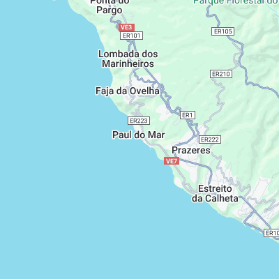
Surf spots nearby
- Jardim do Mar (0.1 mi)
- Ponta Pequena (1.7 mi)
- Ponta do Tristao (8.3 mi)
- Faja da Aeria (11.7 mi)
Not Magic Seaweed (MSW)
Although we look a bit like Magic Seaweed we are not MagicSeaweed as they no longer exist...