Jardim do Mar Surf Report
| Wave height * | 5ft / 1.5m |
|---|---|
| Swell period | 15s |
| Swell direction | |
| Wind | |
| Sea temp | 20°C / 67°F |

10 day Jardim do Mar surf forecast
Tue
30/Dec
4.5ft
5
6
5
- Low 3:42am
- High 9:56am
- Low 4:16pm
- High 10:37pm
Wed
31/Dec
3ft
8
14
14
- Low 4:50am
- High 11:01am
- Low 5:15pm
- High 11:32pm
Thu
1/Jan
9ft
29
27
26
- Low 5:51am
- High 12:02pm
- Low 6:08pm
Fri
2/Jan
7.5ft
20
24
24
- High 12:27am
- Low 6:44am
- High 12:56pm
- Low 6:57pm
Sat
3/Jan
7.5ft
23
20
18
- High 1:15am
- Low 7:34am
- High 1:45pm
- Low 7:44pm
Sun
4/Jan
4.5ft
18
13
16
- High 2:02am
- Low 8:22am
- High 2:31pm
- Low 8:28pm
Mon
5/Jan
2ft
17
19
17
- High 2:46am
- Low 9:07am
- High 3:16pm
- Low 9:11pm
Tue
6/Jan
1ft
17
19
20
- High 3:30am
- Low 9:51am
- High 4:00pm
- Low 9:54pm
Wed
7/Jan
0.5ft
12
5
18
- High 4:14am
- Low 10:35am
- High 4:43pm
- Low 10:37pm
Thu
8/Jan
0ft
13
6
5
- High 4:57am
- Low 11:20am
- High 5:28pm
Tue 30th Dec
| 3:00 | 5ft | 8.2ft | 16s | 8mph (11mph) | |||
| 6:00 | 5ft | 8ft | 15s | 5mph (7mph) | |||
| 9:00 | 4.5ft | 7.7ft | 15s | 5mph (8mph) | |||
| 12:00 | 4.5ft | 7.4ft | 14s | 6mph (8mph) | |||
| 15:00 | 4.5ft | 7ft | 14s | 5mph (6mph) | |||
| 18:00 | 4ft | 6.7ft | 14s | 5mph (7mph) | |||
| 21:00 | 4ft | 6.4ft | 13s | 3mph (6mph) |
| Tide times |
|---|
| Low 3:42am (0.85m) |
| High 9:56am (2.08m) |
| Low 4:16pm (0.71m) |
| High 10:37pm (2.12m) |
| Daylight | |
|---|---|
| First light | 07:43 |
| Sunrise | 08:10 |
| Sunset | 18:12 |
| Dark | 18:39 |
Wed 31st Dec
| 3:00 | 3.5ft | 5.6ft | 13s | 6mph (8mph) | |||
| 6:00 | 3ft | 5.3ft | 13s | 8mph (10mph) | |||
| 9:00 | 3ft | 5.1ft | 12s | 12mph (14mph) | |||
| 12:00 | 3ft | 5.3ft | 12s | 14mph (20mph) | |||
| 15:00 | 3.5ft | 6.1ft | 12s | 18mph (27mph) | |||
| 18:00 | 5ft | 7.3ft | 7s | 14mph (23mph) | |||
| 21:00 | 6ft | 8.9ft | 8s | 21mph (31mph) |
| Tide times |
|---|
| Low 4:50am (0.73m) |
| High 11:01am (2.14m) |
| Low 5:15pm (0.63m) |
| High 11:32pm (2.26m) |
| Daylight | |
|---|---|
| First light | 07:43 |
| Sunrise | 08:11 |
| Sunset | 18:13 |
| Dark | 18:40 |
Thu 1st Jan
| 3:00 | 7.5ft | 11.5ft | 9s | 27mph (35mph) | |||
| 6:00 | 10ft | 13.3ft | 9s | 29mph (41mph) | |||
| 9:00 | 9.5ft | 12.5ft | 9s | 25mph (32mph) | |||
| 12:00 | 9ft | 11.8ft | 9s | 27mph (36mph) | |||
| 15:00 | 9ft | 11.7ft | 9s | 28mph (37mph) | |||
| 18:00 | 8.5ft | 11.8ft | 10s | 26mph (36mph) | |||
| 21:00 | 8ft | 11.6ft | 10s | 22mph (28mph) |
| Tide times |
|---|
| Low 5:51am (0.60m) |
| High 12:02pm (2.20m) |
| Low 6:08pm (0.57m) |
| Daylight | |
|---|---|
| First light | 07:44 |
| Sunrise | 08:11 |
| Sunset | 18:13 |
| Dark | 18:40 |
Fri 2nd Jan
| 3:00 | 8ft | 11.9ft | 11s | 13mph (17mph) | |||
| 6:00 | 8ft | 11.9ft | 11s | 20mph (25mph) | |||
| 9:00 | 8ft | 12.2ft | 11s | 22mph (25mph) | |||
| 12:00 | 7.5ft | 12.8ft | 11s | 24mph (30mph) | |||
| 15:00 | 7.5ft | 15.1ft | 12s | 24mph (33mph) | |||
| 18:00 | 8.5ft | 16.9ft | 12s | 24mph (32mph) | |||
| 21:00 | 8.5ft | 17.2ft | 12s | 25mph (32mph) |
| Tide times |
|---|
| High 12:27am (2.39m) |
| Low 6:44am (0.47m) |
| High 12:56pm (2.27m) |
| Low 6:57pm (0.50m) |
| Daylight | |
|---|---|
| First light | 07:44 |
| Sunrise | 08:11 |
| Sunset | 18:14 |
| Dark | 18:41 |
Sat 3rd Jan
| 3:00 | 7.5ft | 16.9ft | 12s | 24mph (30mph) | |||
| 6:00 | 7.5ft | 16.8ft | 12s | 23mph (29mph) | |||
| 9:00 | 7.5ft | 16.6ft | 12s | 23mph (29mph) | |||
| 12:00 | 7.5ft | 16.7ft | 12s | 20mph (30mph) | |||
| 15:00 | 7ft | 17.4ft | 13s | 17mph (22mph) | |||
| 18:00 | 6.5ft | 16.8ft | 13s | 18mph (23mph) | |||
| 21:00 | 6ft | 15.8ft | 12s | 21mph (28mph) |
| Tide times |
|---|
| High 1:15am (2.49m) |
| Low 7:34am (0.38m) |
| High 1:45pm (2.31m) |
| Low 7:44pm (0.47m) |
| Daylight | |
|---|---|
| First light | 07:44 |
| Sunrise | 08:11 |
| Sunset | 18:15 |
| Dark | 18:42 |
Sun 4th Jan
| 3:00 | 5ft | 12.8ft | 11s | 24mph (30mph) | |||
| 6:00 | 5ft | 11.5ft | 10s | 18mph (22mph) | |||
| 9:00 | 4.5ft | 10.6ft | 10s | 14mph (17mph) | |||
| 12:00 | 4.5ft | 10ft | 10s | 13mph (16mph) | |||
| 15:00 | 4.5ft | 10.1ft | 9s | 15mph (18mph) | |||
| 18:00 | 2.5ft | 11.5ft | 12s | 16mph (18mph) | |||
| 21:00 | 3ft | 13.1ft | 13s | 15mph (18mph) |
| Tide times |
|---|
| High 2:02am (2.56m) |
| Low 8:22am (0.34m) |
| High 2:31pm (2.32m) |
| Low 8:28pm (0.47m) |
| Daylight | |
|---|---|
| First light | 07:44 |
| Sunrise | 08:11 |
| Sunset | 18:16 |
| Dark | 18:43 |
Mon 5th Jan
| 3:00 | 3ft | 13ft | 13s | 15mph (17mph) | |||
| 6:00 | 2.5ft | 12.7ft | 12s | 17mph (20mph) | |||
| 9:00 | 2ft | 12.1ft | 12s | 18mph (21mph) | |||
| 12:00 | 2ft | 12ft | 12s | 19mph (24mph) | |||
| 15:00 | 2ft | 12.2ft | 12s | 18mph (26mph) | |||
| 18:00 | 2ft | 12.2ft | 12s | 17mph (25mph) | |||
| 21:00 | 1.5ft | 12.4ft | 13s | 16mph (23mph) |
| Tide times |
|---|
| High 2:46am (2.57m) |
| Low 9:07am (0.35m) |
| High 3:16pm (2.28m) |
| Low 9:11pm (0.50m) |
| Daylight | |
|---|---|
| First light | 07:44 |
| Sunrise | 08:11 |
| Sunset | 18:16 |
| Dark | 18:43 |
Tue 6th Jan
| 3:00 | 1.5ft | 12.5ft | 12s | 18mph (25mph) | |||
| 6:00 | 1.5ft | 12.6ft | 12s | 17mph (26mph) | |||
| 9:00 | 1ft | 12.8ft | 12s | 17mph (26mph) | |||
| 12:00 | 1ft | 12.8ft | 12s | 19mph (27mph) | |||
| 15:00 | 1ft | 12.9ft | 12s | 22mph (28mph) | |||
| 18:00 | 1ft | 13.3ft | 12s | 20mph (25mph) | |||
| 21:00 | 1ft | 13.9ft | 12s | 18mph (26mph) |
| Tide times |
|---|
| High 3:30am (2.53m) |
| Low 9:51am (0.41m) |
| High 4:00pm (2.21m) |
| Low 9:54pm (0.57m) |
| Daylight | |
|---|---|
| First light | 07:44 |
| Sunrise | 08:11 |
| Sunset | 18:17 |
| Dark | 18:44 |
Wed 7th Jan
| 3:00 | 1ft | 15.2ft | 12s | 13mph (18mph) | |||
| 6:00 | 1ft | 15.2ft | 12s | 12mph (15mph) | |||
| 9:00 | 1ft | 14.7ft | 12s | 7mph (8mph) | |||
| 12:00 | 0.5ft | 13.6ft | 11s | 5mph (6mph) | |||
| 15:00 | 0.5ft | 12.4ft | 11s | 8mph (10mph) | |||
| 18:00 | 1ft | 11.4ft | 11s | 18mph (23mph) | |||
| 21:00 | 0.5ft | 10.7ft | 10s | 18mph (23mph) |
| Tide times |
|---|
| High 4:14am (2.45m) |
| Low 10:35am (0.51m) |
| High 4:43pm (2.12m) |
| Low 10:37pm (0.67m) |
| Daylight | |
|---|---|
| First light | 07:45 |
| Sunrise | 08:11 |
| Sunset | 18:18 |
| Dark | 18:45 |
Thu 8th Jan
| 3:00 | 0ft | 9.4ft | 10s | 20mph (23mph) | |||
| 6:00 | 0ft | 8.5ft | 10s | 13mph (15mph) | |||
| 9:00 | 0ft | 8.3ft | 9s | 10mph (11mph) | |||
| 12:00 | 0ft | 8.4ft | 9s | 6mph (11mph) | |||
| 15:00 | 0ft | 7.9ft | 9s | 6mph (9mph) | |||
| 18:00 | 0ft | 7.5ft | 9s | 5mph (8mph) | |||
| 21:00 | 0ft | 7.1ft | 9s | 11mph (15mph) |
| Tide times |
|---|
| High 4:57am (2.32m) |
| Low 11:20am (0.63m) |
| High 5:28pm (2.01m) |
| Daylight | |
|---|---|
| First light | 07:45 |
| Sunrise | 08:11 |
| Sunset | 18:19 |
| Dark | 18:46 |
Long, extremely powerful walling right that will hold any swell thrown at it. Can be epic but tends to be backwashy at anything except dead low tide
Once one of the best big waves in the World but the construction of a breakwater in 2003 means the wave is out of bounds at all tides except low.
Jardim do Mar was already a dangerous wave, with boulders the size of cars on the inside, massive power and tricky (terrifying) entry and exit. Now with the added backwash and the fact the wave breaks even closer to the point this spot is best left to the hell men!
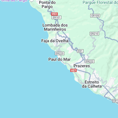
Surf spots nearby
- Paul do Mar (0.1 mi)
- Ponta Pequena (1.8 mi)
- Ponta do Tristao (8.2 mi)
- Faja da Aeria (11.7 mi)
Not Magic Seaweed (MSW)
Although we look a bit like Magic Seaweed we are not MagicSeaweed as they no longer exist...