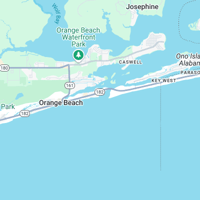
Alabama Point (The Jetties) Surf Report
| Wave height * | 1.5ft / 0.5m |
|---|---|
| Swell period | 4s |
| Swell direction | |
| Wind | |
| Sea temp | 16°C / 61°F |

10 day Alabama Point surf forecast
Tue
6/Jan
1.5ft
7
10
10
- High 1:25am
- Low 9:34am
- High 5:51pm
- Low 7:56pm
Wed
7/Jan
1ft
8
10
7
- High 1:54am
- Low 9:05am
- High 5:01pm
- Low 10:14pm
Thu
8/Jan
0.5ft
6
10
15
- High 2:19am
- Low 8:49am
- High 4:21pm
Fri
9/Jan
2ft
10
13
13
- Low 12:05am
- High 2:34am
- Low 8:10am
- High 4:15pm
Sat
10/Jan
3.5ft
10
11
0
- Low 6:30am
- High 4:30pm
Sun
11/Jan
0.5ft
21
18
21
- Low 5:45am
- High 4:56pm
Mon
12/Jan
1ft
17
10
9
- Low 6:10am
- High 5:31pm
Tue
13/Jan
0.5ft
6
5
5
- Low 6:48am
- High 6:19pm
Wed
14/Jan
0.5ft
14
19
11
- Low 7:27am
- High 7:36pm
Tue 6th Jan
| 3:00 | 1.5ft | 1.8ft | 4s | 8mph (9mph) | |||
| 6:00 | 1.5ft | 2ft | 4s | 7mph (8mph) | |||
| 9:00 | 1.5ft | 1.9ft | 4s | 9mph (13mph) | |||
| 12:00 | 1.5ft | 1.7ft | 4s | 10mph (15mph) | |||
| 15:00 | 1.5ft | 1.7ft | 4s | 10mph (15mph) | |||
| 18:00 | 1.5ft | 1.8ft | 4s | 10mph (15mph) | |||
| 21:00 | 1.5ft | 2.2ft | 4s | 11mph (19mph) |
| Tide times |
|---|
| High 1:25am (1.24m) |
| Low 9:34am (-0.20m) |
| High 5:51pm (0.61m) |
| Low 7:56pm (0.57m) |
| Daylight | |
|---|---|
| First light | 06:21 |
| Sunrise | 06:47 |
| Sunset | 17:04 |
| Dark | 17:30 |
Wed 7th Jan
| 3:00 | 1.5ft | 2.4ft | 4s | 11mph (20mph) | |||
| 6:00 | 1ft | 2.1ft | 4s | 8mph (13mph) | |||
| 9:00 | 1ft | 1.8ft | 4s | 9mph (13mph) | |||
| 12:00 | 1ft | 1.6ft | 4s | 10mph (13mph) | |||
| 15:00 | 1ft | 1.4ft | 4s | 10mph (14mph) | |||
| 18:00 | 0.5ft | 1.2ft | 4s | 7mph (8mph) | |||
| 21:00 | 0.5ft | 1ft | 4s | 5mph (6mph) |
| Tide times |
|---|
| High 1:54am (0.93m) |
| Low 9:05am (-0.08m) |
| High 5:01pm (0.75m) |
| Low 10:14pm (0.48m) |
| Daylight | |
|---|---|
| First light | 06:21 |
| Sunrise | 06:47 |
| Sunset | 17:05 |
| Dark | 17:31 |
Thu 8th Jan
| 3:00 | 0.5ft | 1ft | 4s | 5mph (5mph) | |||
| 6:00 | 0.5ft | 1ft | 4s | 6mph (6mph) | |||
| 9:00 | 0.5ft | 1ft | 4s | 10mph (14mph) | |||
| 12:00 | 0.5ft | 1.1ft | 3s | 10mph (14mph) | |||
| 15:00 | 1ft | 1.5ft | 3s | 11mph (17mph) | |||
| 18:00 | 1.5ft | 2.1ft | 4s | 15mph (26mph) | |||
| 21:00 | 2ft | 2.5ft | 4s | 15mph (25mph) |
| Tide times |
|---|
| High 2:19am (0.62m) |
| Low 8:49am (0.00m) |
| High 4:21pm (0.95m) |
| Daylight | |
|---|---|
| First light | 06:21 |
| Sunrise | 06:47 |
| Sunset | 17:06 |
| Dark | 17:32 |
Fri 9th Jan
| 3:00 | 2ft | 2.6ft | 5s | 10mph (15mph) | |||
| 6:00 | 2ft | 2.5ft | 5s | 10mph (13mph) | |||
| 9:00 | 2ft | 2.7ft | 5s | 12mph (18mph) | |||
| 12:00 | 2ft | 2.9ft | 5s | 13mph (21mph) | |||
| 15:00 | 2.5ft | 3.3ft | 5s | 13mph (21mph) | |||
| 18:00 | 3ft | 3.8ft | 5s | 13mph (23mph) | |||
| 21:00 | 4ft | 4.3ft | 6s | 14mph (26mph) |
| Tide times |
|---|
| Low 12:05am (0.28m) |
| High 2:34am (0.32m) |
| Low 8:10am (0.06m) |
| High 4:15pm (1.17m) |
| Daylight | |
|---|---|
| First light | 06:21 |
| Sunrise | 06:47 |
| Sunset | 17:07 |
| Dark | 17:33 |
Sat 10th Jan
| 3:00 | 4ft | 4.4ft | 6s | 13mph (24mph) | |||
| 6:00 | 4ft | 4.4ft | 6s | 10mph (16mph) | |||
| 9:00 | 3.5ft | 4.2ft | 6s | 12mph (18mph) | |||
| 12:00 | 3.5ft | 3.9ft | 6s | 11mph (17mph) | |||
| 15:00 | 3.5ft | 3.8ft | 6s | 11mph (15mph) | |||
| 18:00 | 3.5ft | 3.8ft | 6s | 0mph (0mph) | |||
| 21:00 | 0ft | 3.8ft | 5s | 16mph (26mph) |
| Tide times |
|---|
| Low 6:30am (-0.02m) |
| High 4:30pm (1.34m) |
| Daylight | |
|---|---|
| First light | 06:21 |
| Sunrise | 06:47 |
| Sunset | 17:08 |
| Dark | 17:34 |
Sun 11th Jan
| 3:00 | 0.5ft | 4ft | 4s | 20mph (29mph) | |||
| 6:00 | 1ft | 3.6ft | 4s | 21mph (32mph) | |||
| 9:00 | 0.5ft | 3.1ft | 4s | 21mph (30mph) | |||
| 12:00 | 0.5ft | 2.7ft | 4s | 18mph (21mph) | |||
| 15:00 | 0ft | 2.8ft | 4s | 21mph (24mph) | |||
| 18:00 | 0.5ft | 3.1ft | 4s | 21mph (25mph) | |||
| 21:00 | 0ft | 3.6ft | 4s | 19mph (27mph) |
| Tide times |
|---|
| Low 5:45am (-0.24m) |
| High 4:56pm (1.45m) |
| Daylight | |
|---|---|
| First light | 06:21 |
| Sunrise | 06:47 |
| Sunset | 17:08 |
| Dark | 17:34 |
Mon 12th Jan
| 3:00 | 1ft | 3.9ft | 5s | 16mph (25mph) | |||
| 6:00 | 1.5ft | 3.7ft | 5s | 17mph (26mph) | |||
| 9:00 | 1.5ft | 3.3ft | 5s | 13mph (17mph) | |||
| 12:00 | 1ft | 2.5ft | 5s | 10mph (13mph) | |||
| 15:00 | 1ft | 1.7ft | 5s | 8mph (10mph) | |||
| 18:00 | 0.5ft | 1.3ft | 4s | 9mph (9mph) | |||
| 21:00 | 1ft | 1.2ft | 4s | 8mph (7mph) |
| Tide times |
|---|
| Low 6:10am (-0.47m) |
| High 5:31pm (1.50m) |
| Daylight | |
|---|---|
| First light | 06:21 |
| Sunrise | 06:47 |
| Sunset | 17:09 |
| Dark | 17:35 |
Tue 13th Jan
| 3:00 | 0.5ft | 1.1ft | 3s | 8mph (7mph) | |||
| 6:00 | 1ft | 1.1ft | 3s | 6mph (6mph) | |||
| 9:00 | 1ft | 1.1ft | 4s | 8mph (9mph) | |||
| 12:00 | 0.5ft | 1.1ft | 4s | 5mph (6mph) | |||
| 15:00 | 0.5ft | 1ft | 4s | 4mph (4mph) | |||
| 18:00 | 0.5ft | 0.9ft | 4s | 5mph (4mph) | |||
| 21:00 | 0.5ft | 0.8ft | 4s | 7mph (7mph) |
| Tide times |
|---|
| Low 6:48am (-0.66m) |
| High 6:19pm (1.50m) |
| Daylight | |
|---|---|
| First light | 06:21 |
| Sunrise | 06:47 |
| Sunset | 17:10 |
| Dark | 17:36 |
Wed 14th Jan
| 3:00 | 0.5ft | 0.8ft | 5s | 10mph (13mph) | |||
| 6:00 | 0.5ft | 0.8ft | 5s | 14mph (15mph) | |||
| 9:00 | 0.5ft | 0.8ft | 5s | 17mph (19mph) | |||
| 12:00 | 0.5ft | 0.8ft | 5s | 19mph (21mph) | |||
| 15:00 | 0.5ft | 0.7ft | 5s | 20mph (24mph) | |||
| 18:00 | 0.5ft | 0.7ft | 4s | 11mph (15mph) | |||
| 21:00 | 0.5ft | 0.6ft | 4s | 20mph (20mph) |
| Tide times |
|---|
| Low 7:27am (-0.81m) |
| High 7:36pm (1.49m) |
| Daylight | |
|---|---|
| First light | 06:21 |
| Sunrise | 06:47 |
| Sunset | 17:11 |
| Dark | 17:37 |
Thu 15th Jan
| 3:00 | 0ft | 1.5ft | 3s | 21mph (26mph) | |||
| 6:00 | 0ft | 1.6ft | 3s | 20mph (26mph) | |||
| 9:00 | 0ft | 1.6ft | 3s | 21mph (27mph) | |||
| 12:00 | 0.5ft | 1.9ft | 3s | 22mph (26mph) | |||
| 15:00 | 0.5ft | 2.5ft | 4s | 20mph (24mph) | |||
| 18:00 | 0.5ft | 2.6ft | 4s | 19mph (25mph) |
| Tide times |
|---|
| Low 8:05am (-0.89m) |
| High 8:59pm (1.49m) |
| Daylight | |
|---|---|
| First light | 06:21 |
| Sunrise | 06:47 |
| Sunset | 17:12 |
| Dark | 17:38 |
Nearest buoys
Long peeling lefthand point/jetty wave that has often been surfed at overhead during the winter or hurricane season. Popular with longboarders but steepens up and reforms to a left and right on the inside
Surf spots nearby
- Terry's Cove (1.2 mi)
- Sea n Suds (6.7 mi)
- West Beach (10.9 mi)
Not Magic Seaweed (MSW)
Although we look a bit like Magic Seaweed we are not MagicSeaweed as they no longer exist...