Camp Hero Surf Report
| Wave height * | 1ft / 0.3m |
|---|---|
| Swell period | 5s |
| Swell direction | |
| Wind | |
| Sea temp | 6°C / 44°F |

10 day Camp Hero surf forecast
Tue
16/Dec
1ft
21
16
19
- High 5:53am
- Low 11:54am
- High 6:10pm
- Low 11:20pm
Wed
17/Dec
2.5ft
27
30
29
- High 6:33am
- Low 12:30pm
- High 6:48pm
- Low 11:59pm
Thu
18/Dec
1.5ft
9
15
16
- High 7:08am
- Low 1:05pm
- High 7:26pm
Fri
19/Dec
6ft
37
33
27
- Low 12:39am
- High 7:40am
- Low 1:41pm
- High 8:02pm
Sat
20/Dec
3.5ft
25
14
17
- Low 1:19am
- High 8:10am
- Low 2:16pm
- High 8:37pm
Sun
21/Dec
3ft
28
21
33
- Low 2:00am
- High 8:41am
- Low 2:52pm
- High 9:13pm
Mon
22/Dec
0.5ft
32
28
27
- Low 2:42am
- High 9:15am
- Low 3:29pm
- High 9:51pm
Tue
23/Dec
2ft
18
29
36
- Low 3:27am
- High 9:53am
- Low 4:07pm
- High 10:31pm
Wed
24/Dec
2ft
26
22
18
- Low 4:16am
- High 10:36am
- Low 4:49pm
- High 11:15pm
Tue 16th Dec
| 4:00 | 0.5ft | 2.9ft | 6s | 20mph (21mph) | |||
| 7:00 | 1ft | 3.5ft | 6s | 21mph (24mph) | |||
| 10:00 | 1ft | 3.1ft | 6s | 17mph (20mph) | |||
| 13:00 | 1ft | 2.7ft | 6s | 16mph (19mph) | |||
| 16:00 | 1ft | 2.8ft | 5s | 17mph (19mph) | |||
| 19:00 | 1ft | 3.3ft | 5s | 19mph (22mph) |
| Tide times |
|---|
| High 5:53am (2.62m) |
| Low 11:54am (0.20m) |
| High 6:10pm (1.92m) |
| Low 11:20pm (0.25m) |
| Daylight | |
|---|---|
| First light | 06:35 |
| Sunrise | 07:06 |
| Sunset | 16:20 |
| Dark | 16:51 |
Wed 17th Dec
| 4:00 | 1.5ft | 4.9ft | 6s | 27mph (32mph) | |||
| 7:00 | 2ft | 5.5ft | 6s | 27mph (36mph) | |||
| 10:00 | 2.5ft | 6.2ft | 6s | 29mph (41mph) | |||
| 13:00 | 2.5ft | 7.1ft | 7s | 30mph (42mph) | |||
| 16:00 | 2.5ft | 7.3ft | 7s | 29mph (47mph) | |||
| 19:00 | 2.5ft | 6.9ft | 7s | 29mph (41mph) |
| Tide times |
|---|
| High 6:33am (2.65m) |
| Low 12:30pm (0.11m) |
| High 6:48pm (1.99m) |
| Low 11:59pm (0.19m) |
| Daylight | |
|---|---|
| First light | 06:36 |
| Sunrise | 07:07 |
| Sunset | 16:21 |
| Dark | 16:52 |
Thu 18th Dec
| 4:00 | 1.5ft | 4ft | 8s | 8mph (8mph) | |||
| 7:00 | 1.5ft | 3.4ft | 8s | 9mph (10mph) | |||
| 10:00 | 1.5ft | 3.2ft | 7s | 9mph (11mph) | |||
| 13:00 | 1.5ft | 3.5ft | 7s | 15mph (19mph) | |||
| 16:00 | 1.5ft | 3.5ft | 7s | 14mph (19mph) | |||
| 19:00 | 2ft | 3.6ft | 7s | 16mph (25mph) |
| Tide times |
|---|
| High 7:08am (2.67m) |
| Low 1:05pm (0.03m) |
| High 7:26pm (2.04m) |
| Daylight | |
|---|---|
| First light | 06:37 |
| Sunrise | 07:08 |
| Sunset | 16:21 |
| Dark | 16:52 |
Fri 19th Dec
| 4:00 | 3ft | 5.4ft | 6s | 25mph (41mph) | |||
| 7:00 | 3.5ft | 6.8ft | 6s | 37mph (58mph) | |||
| 10:00 | 5.5ft | 9ft | 7s | 43mph (68mph) | |||
| 13:00 | 6ft | 10.3ft | 8s | 33mph (49mph) | |||
| 16:00 | 6.5ft | 10.4ft | 10s | 22mph (30mph) | |||
| 19:00 | 6.5ft | 11.2ft | 10s | 27mph (36mph) |
| Tide times |
|---|
| Low 12:39am (0.16m) |
| High 7:40am (2.67m) |
| Low 1:41pm (-0.02m) |
| High 8:02pm (2.08m) |
| Daylight | |
|---|---|
| First light | 06:37 |
| Sunrise | 07:08 |
| Sunset | 16:21 |
| Dark | 16:52 |
Sat 20th Dec
| 4:00 | 5ft | 8.5ft | 11s | 29mph (36mph) | |||
| 7:00 | 4ft | 7.2ft | 11s | 25mph (28mph) | |||
| 10:00 | 3.5ft | 6.2ft | 10s | 20mph (23mph) | |||
| 13:00 | 3.5ft | 5.7ft | 10s | 14mph (14mph) | |||
| 16:00 | 3.5ft | 5.7ft | 10s | 10mph (11mph) | |||
| 19:00 | 4ft | 6.5ft | 9s | 17mph (19mph) |
| Tide times |
|---|
| Low 1:19am (0.15m) |
| High 8:10am (2.65m) |
| Low 2:16pm (-0.06m) |
| High 8:37pm (2.11m) |
| Daylight | |
|---|---|
| First light | 06:38 |
| Sunrise | 07:09 |
| Sunset | 16:22 |
| Dark | 16:53 |
Sun 21st Dec
| 4:00 | 3.5ft | 7.7ft | 8s | 31mph (43mph) | |||
| 7:00 | 3ft | 7.3ft | 8s | 28mph (35mph) | |||
| 10:00 | 3.5ft | 6.6ft | 8s | 22mph (28mph) | |||
| 13:00 | 3ft | 6.1ft | 8s | 21mph (27mph) | |||
| 16:00 | 3ft | 5.9ft | 8s | 21mph (30mph) | |||
| 19:00 | 2ft | 6.2ft | 7s | 33mph (36mph) |
| Tide times |
|---|
| Low 2:00am (0.17m) |
| High 8:41am (2.61m) |
| Low 2:52pm (-0.06m) |
| High 9:13pm (2.13m) |
| Daylight | |
|---|---|
| First light | 06:38 |
| Sunrise | 07:09 |
| Sunset | 16:22 |
| Dark | 16:53 |
Mon 22nd Dec
| 4:00 | 0ft | 5.3ft | 6s | 29mph (33mph) | |||
| 7:00 | 0ft | 5ft | 6s | 32mph (38mph) | |||
| 10:00 | 0ft | 4.6ft | 6s | 31mph (35mph) | |||
| 13:00 | 0.5ft | 4.4ft | 5s | 28mph (32mph) | |||
| 16:00 | 0.5ft | 4.3ft | 5s | 28mph (31mph) | |||
| 19:00 | 0.5ft | 4.1ft | 5s | 27mph (33mph) |
| Tide times |
|---|
| Low 2:42am (0.20m) |
| High 9:15am (2.55m) |
| Low 3:29pm (-0.05m) |
| High 9:51pm (2.17m) |
| Daylight | |
|---|---|
| First light | 06:39 |
| Sunrise | 07:10 |
| Sunset | 16:23 |
| Dark | 16:54 |
Tue 23rd Dec
| 4:00 | 0ft | 1.7ft | 10s | 14mph (15mph) | |||
| 7:00 | 1ft | 1.2ft | 10s | 18mph (22mph) | |||
| 10:00 | 1ft | 2.5ft | 4s | 26mph (30mph) | |||
| 13:00 | 2ft | 5.6ft | 5s | 29mph (38mph) | |||
| 16:00 | 2.5ft | 8.3ft | 7s | 33mph (45mph) | |||
| 19:00 | 2.5ft | 9.6ft | 8s | 36mph (45mph) |
| Tide times |
|---|
| Low 3:27am (0.25m) |
| High 9:53am (2.46m) |
| Low 4:07pm (-0.03m) |
| High 10:31pm (2.22m) |
| Daylight | |
|---|---|
| First light | 06:39 |
| Sunrise | 07:10 |
| Sunset | 16:24 |
| Dark | 16:55 |
Wed 24th Dec
| 4:00 | 2.5ft | 6.9ft | 8s | 26mph (43mph) | |||
| 7:00 | 2.5ft | 5.9ft | 8s | 26mph (38mph) | |||
| 10:00 | 2ft | 5.1ft | 8s | 23mph (34mph) | |||
| 13:00 | 2ft | 4.3ft | 8s | 22mph (30mph) | |||
| 16:00 | 1.5ft | 3.8ft | 8s | 16mph (25mph) | |||
| 19:00 | 1.5ft | 3.3ft | 7s | 18mph (24mph) |
| Tide times |
|---|
| Low 4:16am (0.29m) |
| High 10:36am (2.35m) |
| Low 4:49pm (0.00m) |
| High 11:15pm (2.31m) |
| Daylight | |
|---|---|
| First light | 06:39 |
| Sunrise | 07:10 |
| Sunset | 16:24 |
| Dark | 16:55 |
Thu 25th Dec
| 4:00 | 1.5ft | 3.1ft | 7s | 9mph (9mph) | |||
| 7:00 | 2.5ft | 5.1ft | 5s | 13mph (14mph) | |||
| 10:00 | 3ft | 7.1ft | 7s | 22mph (28mph) | |||
| 13:00 | 3ft | 7.3ft | 7s | 26mph (40mph) | |||
| 16:00 | 2.5ft | 6.8ft | 7s | 33mph (51mph) | |||
| 19:00 | 3ft | 6.4ft | 7s | 23mph (35mph) |
| Tide times |
|---|
| Low 5:11am (0.32m) |
| High 11:25am (2.22m) |
| Low 5:35pm (0.03m) |
| Daylight | |
|---|---|
| First light | 06:40 |
| Sunrise | 07:11 |
| Sunset | 16:25 |
| Dark | 16:56 |
Nearest buoys
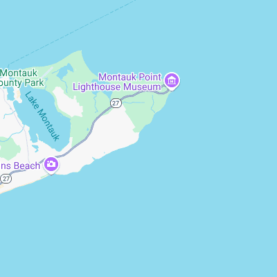
Surf spots nearby
- Montauk Point - Turtles (1.4 mi)
- North Bar (1.7 mi)
- Trailer Park (2.2 mi)
- Ditch Plains (2.3 mi)
- Poles (2.7 mi)
- Terrace (3.6 mi)
- Hither Hills (7.8 mi)
- Napeague (10.1 mi)
- Indian Wells (15.1 mi)
- Block Island (16.3 mi)
Not Magic Seaweed (MSW)
Although we look a bit like Magic Seaweed we are not MagicSeaweed as they no longer exist...