Linda Lane Beach Surf Report
| Wave height * | 3.5ft / 1.1m |
|---|---|
| Swell period | 16s |
| Swell direction | |
| Wind | |
| Sea temp | 17°C / 62°F |

10 day Linda Lane Beach surf forecast
Sun
4/Jan
3.5ft
4
4
4
- Low 2:41am
- High 8:51am
- Low 4:09pm
- High 10:30pm
Mon
5/Jan
2.5ft
3
7
3
- Low 3:31am
- High 9:36am
- Low 4:49pm
- High 11:13pm
Tue
6/Jan
2ft
5
6
3
- Low 4:23am
- High 10:22am
- Low 5:27pm
- High 11:57pm
Wed
7/Jan
2.5ft
5
6
4
- Low 5:19am
- High 11:08am
- Low 6:04pm
Thu
8/Jan
2ft
7
5
3
- High 12:42am
- Low 6:23am
- High 11:58am
- Low 6:40pm
Fri
9/Jan
2ft
6
1
8
- High 1:31am
- Low 7:45am
- High 1:03pm
- Low 7:15pm
Sat
10/Jan
1.5ft
11
3
9
- High 2:23am
- Low 9:28am
- High 2:39pm
- Low 7:55pm
Sun
11/Jan
1.5ft
7
2
4
- High 3:16am
- Low 11:06am
- High 4:48pm
- Low 8:46pm
Mon
12/Jan
1.5ft
6
2
7
- High 4:09am
- Low 12:06pm
- High 6:34pm
- Low 9:56pm
Sun 4th Jan
| 4:00 | 3.5ft | 4.5ft | 11s | 5mph (7mph) | |||
| 7:00 | 3.5ft | 4.7ft | 16s | 4mph (4mph) | |||
| 10:00 | 3.5ft | 5ft | 16s | 6mph (7mph) | |||
| 13:00 | 3.5ft | 5.2ft | 14s | 4mph (7mph) | |||
| 16:00 | 3.5ft | 5.2ft | 12s | 5mph (8mph) | |||
| 19:00 | 3.5ft | 5ft | 12s | 4mph (5mph) |
| Tide times |
|---|
| Low 2:41am (1.72m) |
| High 8:51am (6.64m) |
| Low 4:09pm (-1.54m) |
| High 10:30pm (4.03m) |
| Daylight | |
|---|---|
| First light | 06:27 |
| Sunrise | 06:54 |
| Sunset | 16:56 |
| Dark | 17:23 |
Mon 5th Jan
| 4:00 | 2.5ft | 4ft | 11s | 2mph (2mph) | |||
| 7:00 | 3ft | 3.7ft | 14s | 3mph (4mph) | |||
| 10:00 | 3ft | 3.5ft | 15s | 4mph (5mph) | |||
| 13:00 | 2.5ft | 3.3ft | 15s | 7mph (6mph) | |||
| 16:00 | 2.5ft | 3.1ft | 15s | 4mph (4mph) | |||
| 19:00 | 2.5ft | 2.9ft | 15s | 3mph (3mph) |
| Tide times |
|---|
| Low 3:31am (1.69m) |
| High 9:36am (6.25m) |
| Low 4:49pm (-1.18m) |
| High 11:13pm (4.11m) |
| Daylight | |
|---|---|
| First light | 06:27 |
| Sunrise | 06:55 |
| Sunset | 16:57 |
| Dark | 17:24 |
Tue 6th Jan
| 4:00 | 2.5ft | 2.6ft | 15s | 6mph (6mph) | |||
| 7:00 | 2ft | 2.5ft | 15s | 5mph (4mph) | |||
| 10:00 | 2ft | 2.4ft | 15s | 4mph (6mph) | |||
| 13:00 | 2ft | 2.4ft | 15s | 6mph (6mph) | |||
| 16:00 | 2ft | 2.5ft | 14s | 6mph (5mph) | |||
| 19:00 | 2.5ft | 2.6ft | 14s | 3mph (3mph) |
| Tide times |
|---|
| Low 4:23am (1.74m) |
| High 10:22am (5.66m) |
| Low 5:27pm (-0.68m) |
| High 11:57pm (4.17m) |
| Daylight | |
|---|---|
| First light | 06:27 |
| Sunrise | 06:55 |
| Sunset | 16:57 |
| Dark | 17:25 |
Wed 7th Jan
| 4:00 | 2.5ft | 3ft | 13s | 5mph (5mph) | |||
| 7:00 | 2.5ft | 2.9ft | 13s | 5mph (4mph) | |||
| 10:00 | 2.5ft | 2.7ft | 13s | 4mph (5mph) | |||
| 13:00 | 2.5ft | 2.5ft | 13s | 6mph (4mph) | |||
| 16:00 | 2ft | 2.4ft | 13s | 7mph (7mph) | |||
| 19:00 | 2ft | 2.5ft | 13s | 4mph (4mph) |
| Tide times |
|---|
| Low 5:19am (1.84m) |
| High 11:08am (4.91m) |
| Low 6:04pm (-0.09m) |
| Daylight | |
|---|---|
| First light | 06:27 |
| Sunrise | 06:55 |
| Sunset | 16:58 |
| Dark | 17:25 |
Thu 8th Jan
| 4:00 | 2ft | 2.4ft | 13s | 9mph (8mph) | |||
| 7:00 | 2ft | 2.4ft | 15s | 7mph (7mph) | |||
| 10:00 | 2ft | 2.4ft | 15s | 1mph (2mph) | |||
| 13:00 | 2ft | 2.4ft | 15s | 5mph (3mph) | |||
| 16:00 | 2ft | 2.3ft | 15s | 4mph (4mph) | |||
| 19:00 | 2ft | 2.3ft | 15s | 3mph (3mph) |
| Tide times |
|---|
| High 12:42am (4.23m) |
| Low 6:23am (1.95m) |
| High 11:58am (4.09m) |
| Low 6:40pm (0.53m) |
| Daylight | |
|---|---|
| First light | 06:28 |
| Sunrise | 06:55 |
| Sunset | 16:59 |
| Dark | 17:26 |
Fri 9th Jan
| 4:00 | 2ft | 2.3ft | 13s | 5mph (5mph) | |||
| 7:00 | 2ft | 2.3ft | 13s | 6mph (6mph) | |||
| 10:00 | 2ft | 2.2ft | 13s | 2mph (3mph) | |||
| 13:00 | 2ft | 2.1ft | 13s | 1mph (3mph) | |||
| 16:00 | 1.5ft | 2.1ft | 14s | 3mph (4mph) | |||
| 19:00 | 1.5ft | 2.1ft | 14s | 8mph (7mph) |
| Tide times |
|---|
| High 1:31am (4.29m) |
| Low 7:45am (1.95m) |
| High 1:03pm (3.29m) |
| Low 7:15pm (1.15m) |
| Daylight | |
|---|---|
| First light | 06:28 |
| Sunrise | 06:55 |
| Sunset | 17:00 |
| Dark | 17:27 |
Sat 10th Jan
| 4:00 | 1.5ft | 2.1ft | 13s | 11mph (11mph) | |||
| 7:00 | 1.5ft | 2.1ft | 13s | 11mph (10mph) | |||
| 10:00 | 1.5ft | 2.1ft | 13s | 6mph (7mph) | |||
| 13:00 | 1.5ft | 2ft | 14s | 3mph (4mph) | |||
| 16:00 | 1.5ft | 2ft | 14s | 3mph (4mph) | |||
| 19:00 | 2ft | 2.1ft | 14s | 9mph (8mph) |
| Tide times |
|---|
| High 2:23am (4.37m) |
| Low 9:28am (1.71m) |
| High 2:39pm (2.69m) |
| Low 7:55pm (1.71m) |
| Daylight | |
|---|---|
| First light | 06:27 |
| Sunrise | 06:54 |
| Sunset | 17:01 |
| Dark | 17:28 |
Sun 11th Jan
| 4:00 | 2ft | 2ft | 13s | 8mph (7mph) | |||
| 7:00 | 1.5ft | 1.9ft | 13s | 7mph (6mph) | |||
| 10:00 | 1.5ft | 1.8ft | 13s | 3mph (4mph) | |||
| 13:00 | 1.5ft | 1.7ft | 13s | 2mph (2mph) | |||
| 16:00 | 1.5ft | 1.7ft | 13s | 4mph (4mph) | |||
| 19:00 | 1.5ft | 1.9ft | 13s | 4mph (4mph) |
| Tide times |
|---|
| High 3:16am (4.48m) |
| Low 11:06am (1.22m) |
| High 4:48pm (2.51m) |
| Low 8:46pm (2.15m) |
| Daylight | |
|---|---|
| First light | 06:27 |
| Sunrise | 06:54 |
| Sunset | 17:02 |
| Dark | 17:29 |
Mon 12th Jan
| 4:00 | 1.5ft | 1.7ft | 12s | 5mph (5mph) | |||
| 7:00 | 1.5ft | 1.7ft | 12s | 6mph (6mph) | |||
| 10:00 | 1.5ft | 1.8ft | 12s | 3mph (4mph) | |||
| 13:00 | 1.5ft | 1.9ft | 13s | 2mph (3mph) | |||
| 16:00 | 1.5ft | 2.2ft | 18s | 3mph (3mph) | |||
| 19:00 | 1.5ft | 2.4ft | 18s | 7mph (6mph) |
| Tide times |
|---|
| High 4:09am (4.64m) |
| Low 12:06pm (0.68m) |
| High 6:34pm (2.70m) |
| Low 9:56pm (2.43m) |
| Daylight | |
|---|---|
| First light | 06:27 |
| Sunrise | 06:54 |
| Sunset | 17:03 |
| Dark | 17:30 |
Tue 13th Jan
| 4:00 | 1.5ft | 2.3ft | 14s | 11mph (10mph) | |||
| 7:00 | 1.5ft | 2.3ft | 14s | 11mph (10mph) | |||
| 10:00 | 1.5ft | 2.2ft | 14s | 8mph (9mph) | |||
| 13:00 | 1.5ft | 2.2ft | 13s | 6mph (9mph) | |||
| 16:00 | 1.5ft | 2.3ft | 13s | 6mph (6mph) |
| Tide times |
|---|
| High 4:57am (4.84m) |
| Low 12:48pm (0.22m) |
| High 7:26pm (2.94m) |
| Daylight | |
|---|---|
| First light | 06:27 |
| Sunrise | 06:54 |
| Sunset | 17:03 |
| Dark | 17:30 |
Nearest buoys
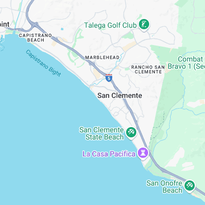
Surf spots nearby
- San Clemente Pier (0.2 mi)
- 204s (0.4 mi)
- T-Street (0.6 mi)
- Riviera (1.5 mi)
- Poche (1.7 mi)
- San Clemente State Park (1.9 mi)
- Cottons Point (2.9 mi)
- Upper Trestles (2.9 mi)
- Trestles (3.4 mi)
- San Clemente Island - Birdhits (3.6 mi)
Not Magic Seaweed (MSW)
Although we look a bit like Magic Seaweed we are not MagicSeaweed as they no longer exist...