Pleasure Point Surf Report
| Wave height * | 2ft / 0.6m |
|---|---|
| Swell period | 11s |
| Swell direction | |
| Wind | |
| Sea temp | 14°C / 58°F |

10 day Pleasure Point surf forecast
Fri
6
7
9
- Low 3:25am
- High 9:15am
- Low 4:34pm
- High 11:37pm
Sat
13
11
14
- Low 4:20am
- High 10:06am
- Low 5:19pm
Sun
15
12
6
- High 12:20am
- Low 5:15am
- High 10:57am
- Low 6:03pm
Mon
10
10
11
- High 1:01am
- Low 6:13am
- High 11:48am
- Low 6:45pm
Tue
5
3
4
- High 1:41am
- Low 7:14am
- High 12:41pm
- Low 7:27pm
Wed
4
7
5
- High 2:21am
- Low 8:19am
- High 1:40pm
- Low 8:09pm
Thu
4
12
8
- High 3:00am
- Low 9:29am
- High 2:51pm
- Low 8:54pm
Fri
4
3
4
- High 3:40am
- Low 10:38am
- High 4:23pm
- Low 9:44pm
Sat
3
2
3
- High 4:20am
- Low 11:43am
- High 6:11pm
- Low 10:41pm
Fri 2nd Jan
| 4:00 | 2ft | 5.3ft | 11s | 6mph (12mph) | |||
| 7:00 | 2ft | 5.1ft | 11s | 6mph (11mph) | |||
| 10:00 | 2ft | 5.5ft | 11s | 8mph (13mph) | |||
| 13:00 | 5.5ft | 6.6ft | 7s | 7mph (17mph) | |||
| 16:00 | 6.5ft | 7.5ft | 7s | 14mph (30mph) | |||
| 19:00 | 7ft | 7.7ft | 7s | 9mph (23mph) |
| Tide times |
|---|
| Low 3:25am (3.01m) |
| High 9:15am (6.56m) |
| Low 4:34pm (-1.69m) |
| High 11:37pm (4.61m) |
| Daylight | |
|---|---|
| First light | 06:52 |
| Sunrise | 07:21 |
| Sunset | 17:03 |
| Dark | 17:31 |
Sat 3rd Jan
| 4:00 | 7ft | 9.8ft | 9s | 17mph (28mph) | |||
| 7:00 | 6.5ft | 8.5ft | 9s | 13mph (25mph) | |||
| 10:00 | 5.5ft | 8.3ft | 9s | 13mph (25mph) | |||
| 13:00 | 5.5ft | 8.4ft | 9s | 11mph (24mph) | |||
| 16:00 | 5.5ft | 8.1ft | 9s | 12mph (21mph) | |||
| 19:00 | 4ft | 8.7ft | 12s | 14mph (24mph) |
| Tide times |
|---|
| Low 4:20am (2.88m) |
| High 10:06am (6.37m) |
| Low 5:19pm (-1.47m) |
| Daylight | |
|---|---|
| First light | 06:52 |
| Sunrise | 07:21 |
| Sunset | 17:03 |
| Dark | 17:32 |
Sun 4th Jan
| 4:00 | 5ft | 11.4ft | 15s | 9mph (24mph) | |||
| 7:00 | 4.5ft | 12.7ft | 14s | 15mph (27mph) | |||
| 10:00 | 4.5ft | 11.5ft | 13s | 17mph (26mph) | |||
| 13:00 | 3.5ft | 10.1ft | 12s | 12mph (21mph) | |||
| 16:00 | 3.5ft | 9.1ft | 12s | 12mph (21mph) | |||
| 19:00 | 3ft | 8.2ft | 12s | 6mph (10mph) |
| Tide times |
|---|
| High 12:20am (4.71m) |
| Low 5:15am (2.74m) |
| High 10:57am (6.00m) |
| Low 6:03pm (-1.08m) |
| Daylight | |
|---|---|
| First light | 06:52 |
| Sunrise | 07:21 |
| Sunset | 17:04 |
| Dark | 17:33 |
Mon 5th Jan
| 4:00 | 2ft | 7.1ft | 11s | 5mph (8mph) | |||
| 7:00 | 2.5ft | 6.6ft | 10s | 10mph (17mph) | |||
| 10:00 | 2ft | 6ft | 10s | 10mph (20mph) | |||
| 13:00 | 2ft | 5.7ft | 10s | 10mph (21mph) | |||
| 16:00 | 2ft | 5.7ft | 9s | 11mph (24mph) | |||
| 19:00 | 2ft | 5.9ft | 9s | 11mph (21mph) |
| Tide times |
|---|
| High 1:01am (4.80m) |
| Low 6:13am (2.59m) |
| High 11:48am (5.47m) |
| Low 6:45pm (-0.55m) |
| Daylight | |
|---|---|
| First light | 06:52 |
| Sunrise | 07:21 |
| Sunset | 17:05 |
| Dark | 17:34 |
Tue 6th Jan
| 4:00 | 2ft | 5.9ft | 10s | 1mph (3mph) | |||
| 7:00 | 2ft | 5.9ft | 12s | 5mph (6mph) | |||
| 10:00 | 2.5ft | 6.2ft | 10s | 6mph (11mph) | |||
| 13:00 | 2.5ft | 6.1ft | 11s | 3mph (2mph) | |||
| 16:00 | 2ft | 5.6ft | 11s | 3mph (5mph) | |||
| 19:00 | 2ft | 5.2ft | 11s | 4mph (5mph) |
| Tide times |
|---|
| High 1:41am (4.88m) |
| Low 7:14am (2.42m) |
| High 12:41pm (4.81m) |
| Low 7:27pm (0.09m) |
| Daylight | |
|---|---|
| First light | 06:52 |
| Sunrise | 07:21 |
| Sunset | 17:06 |
| Dark | 17:34 |
Wed 7th Jan
| 4:00 | 1.5ft | 4.7ft | 11s | 3mph (5mph) | |||
| 7:00 | 1.5ft | 4.6ft | 11s | 4mph (6mph) | |||
| 10:00 | 1.5ft | 4.9ft | 11s | 5mph (9mph) | |||
| 13:00 | 1.5ft | 4.9ft | 10s | 7mph (12mph) | |||
| 16:00 | 1.5ft | 4.7ft | 14s | 13mph (22mph) | |||
| 19:00 | 1.5ft | 5ft | 21s | 5mph (11mph) |
| Tide times |
|---|
| High 2:21am (4.95m) |
| Low 8:19am (2.20m) |
| High 1:40pm (4.11m) |
| Low 8:09pm (0.79m) |
| Daylight | |
|---|---|
| First light | 06:52 |
| Sunrise | 07:21 |
| Sunset | 17:07 |
| Dark | 17:35 |
Thu 8th Jan
| 4:00 | 2.5ft | 7.3ft | 18s | 4mph (9mph) | |||
| 7:00 | 2ft | 7ft | 18s | 4mph (5mph) | |||
| 10:00 | 2ft | 6.8ft | 17s | 8mph (17mph) | |||
| 13:00 | 2ft | 6.9ft | 17s | 12mph (16mph) | |||
| 16:00 | 2ft | 7.1ft | 17s | 9mph (13mph) | |||
| 19:00 | 2.5ft | 7.3ft | 16s | 8mph (13mph) |
| Tide times |
|---|
| High 3:00am (5.01m) |
| Low 9:29am (1.90m) |
| High 2:51pm (3.47m) |
| Low 8:54pm (1.50m) |
| Daylight | |
|---|---|
| First light | 06:52 |
| Sunrise | 07:21 |
| Sunset | 17:08 |
| Dark | 17:36 |
Fri 9th Jan
| 4:00 | 2.5ft | 7.4ft | 16s | 4mph (4mph) | |||
| 7:00 | 2ft | 7.1ft | 16s | 4mph (4mph) | |||
| 10:00 | 2ft | 6.8ft | 15s | 3mph (4mph) | |||
| 13:00 | 2ft | 6.5ft | 15s | 3mph (6mph) | |||
| 16:00 | 2ft | 6.2ft | 15s | 1mph (3mph) | |||
| 19:00 | 2ft | 6ft | 15s | 4mph (6mph) |
| Tide times |
|---|
| High 3:40am (5.06m) |
| Low 10:38am (1.52m) |
| High 4:23pm (3.04m) |
| Low 9:44pm (2.16m) |
| Daylight | |
|---|---|
| First light | 06:52 |
| Sunrise | 07:21 |
| Sunset | 17:09 |
| Dark | 17:37 |
Sat 10th Jan
| 4:00 | 1.5ft | 5ft | 14s | 3mph (3mph) | |||
| 7:00 | 1.5ft | 4.7ft | 14s | 3mph (3mph) | |||
| 10:00 | 1.5ft | 4.3ft | 14s | 2mph (3mph) | |||
| 13:00 | 1.5ft | 4ft | 13s | 2mph (4mph) | |||
| 16:00 | 1ft | 3.8ft | 13s | 2mph (2mph) | |||
| 19:00 | 1ft | 3.9ft | 14s | 3mph (4mph) |
| Tide times |
|---|
| High 4:20am (5.11m) |
| Low 11:43am (1.09m) |
| High 6:11pm (2.98m) |
| Low 10:41pm (2.72m) |
| Daylight | |
|---|---|
| First light | 06:52 |
| Sunrise | 07:20 |
| Sunset | 17:10 |
| Dark | 17:38 |
Sun 11th Jan
| 4:00 | 1.5ft | 4.6ft | 13s | 4mph (4mph) | |||
| 7:00 | 2ft | 4.8ft | 13s | 4mph (4mph) | |||
| 10:00 | 2ft | 5ft | 12s | 2mph (2mph) | |||
| 13:00 | 1.5ft | 5.5ft | 19s | 1mph (4mph) | |||
| 16:00 | 2ft | 6.2ft | 18s | 1mph (3mph) |
| Tide times |
|---|
| High 5:03am (5.15m) |
| Low 12:40pm (0.66m) |
| High 7:40pm (3.21m) |
| Low 11:43pm (3.11m) |
| Daylight | |
|---|---|
| First light | 06:52 |
| Sunrise | 07:20 |
| Sunset | 17:11 |
| Dark | 17:39 |
Nearest buoys
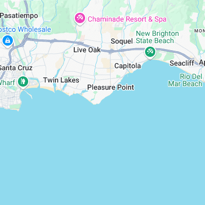
Series of quality breaks that roughly follow Opal Cliffs down to Capitola beach. Consistent, always busy, sometimes epic. Various take off zones and breaks offer something for everyone
Pleasure Point is divided into several different spots: Sewer Peak Best of the bunch. barrelling lefts and rights over a rock ledge. First Peak Quality right that can, on it's day join up with Insides SecondPeak Less impressive than first peak, can still produce a workable wall Insides Rather un-inspiring left/right reef that's popular with longboarders All these spots benefit from the kelp forest below, which smooths out the imperfections, as well as sometimes wrapping round your leash or catching on your fins!
Surf spots nearby
- Santa Cruz - RockView St (0.3 mi)
- The Hook (0.4 mi)
- 26th Avenue (0.6 mi)
- Privates (0.9 mi)
- Black's Beach (1.4 mi)
- Capitola (1.5 mi)
- Santa Cruz Harbor (1.8 mi)
- The Rivermouth (2.4 mi)
- Cowells Cove (3 mi)
- Steamer Lane (3.1 mi)
Not Magic Seaweed (MSW)
Although we look a bit like Magic Seaweed we are not MagicSeaweed as they no longer exist...