Alexandra Bay Surf Report
| Wave height * | 3.5ft / 1.1m |
|---|---|
| Swell period | 7s |
| Swell direction | |
| Wind | |
| Sea temp | 25°C / 77°F |

10 day Alexandra Bay surf forecast
Tue
16/Dec
3.5ft
6
10
6
- High 5:45am
- Low 11:55am
- High 5:19pm
- Low 11:34pm
Wed
17/Dec
5.5ft
7
10
7
- High 6:24am
- Low 12:41pm
- High 6:02pm
Thu
18/Dec
4.5ft
5
8
2
- Low 12:10am
- High 7:01am
- Low 1:23pm
- High 6:44pm
Fri
19/Dec
3ft
2
9
3
- Low 12:46am
- High 7:37am
- Low 2:04pm
- High 7:24pm
Sat
20/Dec
3ft
4
9
5
- Low 1:22am
- High 8:12am
- Low 2:43pm
- High 8:04pm
Sun
21/Dec
3ft
5
10
7
- Low 1:57am
- High 8:48am
- Low 3:21pm
- High 8:44pm
Mon
22/Dec
3ft
7
9
5
- Low 2:33am
- High 9:23am
- Low 4:00pm
- High 9:24pm
Tue
23/Dec
2.5ft
1
1
3
- Low 3:10am
- High 9:59am
- Low 4:38pm
- High 10:05pm
Wed
24/Dec
2.5ft
2
5
7
- Low 3:49am
- High 10:37am
- Low 5:17pm
- High 10:51pm
Tue 16th Dec
| 4:00 | 3ft | 3.1ft | 8s | 4mph (14mph) | |||
| 7:00 | 2.5ft | 4ft | 7s | 6mph (19mph) | |||
| 10:00 | 3.5ft | 5.2ft | 6s | 9mph (22mph) | |||
| 13:00 | 3.5ft | 6ft | 7s | 10mph (24mph) | |||
| 16:00 | 3.5ft | 6.1ft | 7s | 9mph (23mph) | |||
| 19:00 | 3.5ft | 5.5ft | 7s | 6mph (18mph) |
| Tide times |
|---|
| High 5:45am (1.66m) |
| Low 11:55am (0.80m) |
| High 5:19pm (1.38m) |
| Low 11:34pm (0.44m) |
| Daylight | |
|---|---|
| First light | 04:23 |
| Sunrise | 04:49 |
| Sunset | 18:36 |
| Dark | 19:02 |
Wed 17th Dec
| 4:00 | 3.5ft | 5.2ft | 8s | 3mph (9mph) | |||
| 7:00 | 4ft | 5.9ft | 8s | 7mph (18mph) | |||
| 10:00 | 4.5ft | 6.8ft | 8s | 9mph (21mph) | |||
| 13:00 | 5.5ft | 7.5ft | 7s | 10mph (19mph) | |||
| 16:00 | 5.5ft | 7.2ft | 7s | 10mph (16mph) | |||
| 19:00 | 5.5ft | 6.7ft | 7s | 7mph (17mph) |
| Tide times |
|---|
| High 6:24am (1.77m) |
| Low 12:41pm (0.76m) |
| High 6:02pm (1.38m) |
| Daylight | |
|---|---|
| First light | 04:23 |
| Sunrise | 04:49 |
| Sunset | 18:37 |
| Dark | 19:03 |
Thu 18th Dec
| 4:00 | 4.5ft | 5.6ft | 7s | 5mph (17mph) | |||
| 7:00 | 5ft | 5.3ft | 7s | 5mph (13mph) | |||
| 10:00 | 4.5ft | 5ft | 7s | 7mph (10mph) | |||
| 13:00 | 4.5ft | 4.8ft | 8s | 8mph (9mph) | |||
| 16:00 | 4ft | 4.6ft | 8s | 7mph (8mph) | |||
| 19:00 | 4ft | 4.3ft | 8s | 2mph (4mph) |
| Tide times |
|---|
| Low 12:10am (0.40m) |
| High 7:01am (1.86m) |
| Low 1:23pm (0.71m) |
| High 6:44pm (1.38m) |
| Daylight | |
|---|---|
| First light | 04:24 |
| Sunrise | 04:50 |
| Sunset | 18:37 |
| Dark | 19:03 |
Fri 19th Dec
| 4:00 | 3.5ft | 3.8ft | 8s | 3mph (2mph) | |||
| 7:00 | 3.5ft | 3.7ft | 8s | 2mph (2mph) | |||
| 10:00 | 3ft | 3.6ft | 8s | 4mph (4mph) | |||
| 13:00 | 3ft | 3.5ft | 8s | 9mph (7mph) | |||
| 16:00 | 3ft | 3.5ft | 8s | 7mph (10mph) | |||
| 19:00 | 3ft | 3.5ft | 8s | 3mph (7mph) |
| Tide times |
|---|
| Low 12:46am (0.38m) |
| High 7:37am (1.93m) |
| Low 2:04pm (0.67m) |
| High 7:24pm (1.37m) |
| Daylight | |
|---|---|
| First light | 04:24 |
| Sunrise | 04:50 |
| Sunset | 18:38 |
| Dark | 19:04 |
Sat 20th Dec
| 4:00 | 3ft | 3.3ft | 8s | 3mph (3mph) | |||
| 7:00 | 3ft | 3.2ft | 8s | 4mph (9mph) | |||
| 10:00 | 3ft | 3.1ft | 8s | 4mph (4mph) | |||
| 13:00 | 3ft | 3.6ft | 8s | 9mph (8mph) | |||
| 16:00 | 3ft | 4.4ft | 5s | 9mph (15mph) | |||
| 19:00 | 3.5ft | 5ft | 5s | 5mph (16mph) |
| Tide times |
|---|
| Low 1:22am (0.37m) |
| High 8:12am (1.97m) |
| Low 2:43pm (0.63m) |
| High 8:04pm (1.35m) |
| Daylight | |
|---|---|
| First light | 04:24 |
| Sunrise | 04:51 |
| Sunset | 18:38 |
| Dark | 19:05 |
Sun 21st Dec
| 4:00 | 2.5ft | 3.7ft | 5s | 3mph (4mph) | |||
| 7:00 | 2.5ft | 3.5ft | 5s | 5mph (17mph) | |||
| 10:00 | 3ft | 3.1ft | 6s | 5mph (9mph) | |||
| 13:00 | 3ft | 4.3ft | 5s | 10mph (10mph) | |||
| 16:00 | 3.5ft | 5.2ft | 5s | 11mph (20mph) | |||
| 19:00 | 3.5ft | 5.2ft | 5s | 7mph (23mph) |
| Tide times |
|---|
| Low 1:57am (0.38m) |
| High 8:48am (1.99m) |
| Low 3:21pm (0.60m) |
| High 8:44pm (1.33m) |
| Daylight | |
|---|---|
| First light | 04:25 |
| Sunrise | 04:51 |
| Sunset | 18:39 |
| Dark | 19:05 |
Mon 22nd Dec
| 4:00 | 3ft | 4.3ft | 6s | 5mph (17mph) | |||
| 7:00 | 3ft | 3.9ft | 6s | 7mph (19mph) | |||
| 10:00 | 2.5ft | 3.6ft | 6s | 6mph (10mph) | |||
| 13:00 | 3ft | 4.2ft | 6s | 9mph (11mph) | |||
| 16:00 | 3.5ft | 5.4ft | 6s | 2mph (11mph) | |||
| 19:00 | 3.5ft | 5.1ft | 6s | 5mph (10mph) |
| Tide times |
|---|
| Low 2:33am (0.39m) |
| High 9:23am (1.98m) |
| Low 4:00pm (0.58m) |
| High 9:24pm (1.31m) |
| Daylight | |
|---|---|
| First light | 04:25 |
| Sunrise | 04:52 |
| Sunset | 18:39 |
| Dark | 19:06 |
Tue 23rd Dec
| 4:00 | 2.5ft | 3.4ft | 6s | 1mph (0mph) | |||
| 7:00 | 2ft | 3.2ft | 6s | 1mph (1mph) | |||
| 10:00 | 2.5ft | 3ft | 8s | 1mph (2mph) | |||
| 13:00 | 2.5ft | 2.9ft | 10s | 1mph (2mph) | |||
| 16:00 | 2ft | 2.8ft | 10s | 2mph (6mph) | |||
| 19:00 | 2.5ft | 3.1ft | 8s | 3mph (9mph) |
| Tide times |
|---|
| Low 3:10am (0.42m) |
| High 9:59am (1.96m) |
| Low 4:38pm (0.57m) |
| High 10:05pm (1.30m) |
| Daylight | |
|---|---|
| First light | 04:26 |
| Sunrise | 04:52 |
| Sunset | 18:40 |
| Dark | 19:06 |
Wed 24th Dec
| 4:00 | 2ft | 2.8ft | 10s | 2mph (2mph) | |||
| 7:00 | 2ft | 2.7ft | 10s | 2mph (2mph) | |||
| 10:00 | 2.5ft | 2.8ft | 10s | 4mph (10mph) | |||
| 13:00 | 2.5ft | 3.4ft | 10s | 5mph (14mph) | |||
| 16:00 | 3.5ft | 5.2ft | 6s | 8mph (20mph) | |||
| 19:00 | 3.5ft | 5.7ft | 6s | 7mph (21mph) |
| Tide times |
|---|
| Low 3:49am (0.46m) |
| High 10:37am (1.91m) |
| Low 5:17pm (0.57m) |
| High 10:51pm (1.30m) |
| Daylight | |
|---|---|
| First light | 04:27 |
| Sunrise | 04:53 |
| Sunset | 18:40 |
| Dark | 19:06 |
Thu 25th Dec
| 4:00 | 5.5ft | 7.3ft | 7s | 11mph (28mph) | |||
| 7:00 | 6ft | 7.7ft | 7s | 13mph (29mph) | |||
| 10:00 | 6ft | 7.8ft | 7s | 15mph (31mph) |
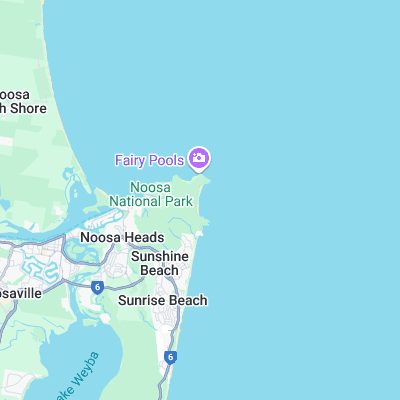
Pristine beach set in Noosa Heads national park. Is fairly consistent picking up more swell than the heads. Works on similar conditions to Sunshine round the corner but access is more difficult so less crowds
Also a nudist beach with rumours of gay action so stay out of the dunes unless you want a suprise!
Surf spots nearby
- T-Tree Bay (0.8 mi)
- Boiling Pot (1.1 mi)
- Noosa First Point (1.4 mi)
- Noosa Main Beach (1.8 mi)
- Sunshine Beach (2.3 mi)
- Peregian (6.7 mi)
- Coolum Beach (9.8 mi)
- Yaroomba (11.3 mi)
- Maroochydore (18.6 mi)
- Alexandra Headlands (19.7 mi)
Not Magic Seaweed (MSW)
Although we look a bit like Magic Seaweed we are not MagicSeaweed as they no longer exist...