Lennox Head Surf Report
| Wave height * | 3ft / 0.9m |
|---|---|
| Swell period | 7s |
| Swell direction | |
| Wind | |
| Sea temp | 26°C / 79°F |

10 day Lennox Head surf forecast
Mon
5/Jan
2.5ft
1
10
5
- Low 3:57am
- High 10:40am
- Low 5:26pm
- High 11:04pm
Tue
6/Jan
2.5ft
0
6
4
- Low 4:46am
- High 11:23am
- Low 6:07pm
- High 11:50pm
Wed
7/Jan
2.5ft
1
8
3
- Low 5:33am
- High 12:04pm
- Low 6:46pm
Thu
8/Jan
3ft
1
8
5
- High 12:37am
- Low 6:21am
- High 12:44pm
- Low 7:24pm
Fri
9/Jan
3.5ft
0
8
6
- High 1:26am
- Low 7:10am
- High 1:22pm
- Low 8:01pm
Sat
10/Jan
5ft
6
11
8
- High 2:18am
- Low 8:04am
- High 2:01pm
- Low 8:38pm
Sun
11/Jan
5ft
3
11
10
- High 3:18am
- Low 9:06am
- High 2:43pm
- Low 9:17pm
Mon
12/Jan
5ft
5
11
10
- High 4:23am
- Low 10:24am
- High 3:34pm
- Low 10:01pm
Tue
13/Jan
5.5ft
6
8
8
- High 5:26am
- Low 11:52am
- High 4:39pm
- Low 10:51pm
Mon 5th Jan
| 5:00 | 2ft | 3.5ft | 8s | 1mph (1mph) | |||
| 8:00 | 2ft | 3.3ft | 8s | 1mph (2mph) | |||
| 11:00 | 2ft | 3.2ft | 8s | 4mph (6mph) | |||
| 14:00 | 2.5ft | 3.6ft | 7s | 10mph (8mph) | |||
| 17:00 | 3.5ft | 3.9ft | 7s | 9mph (12mph) | |||
| 20:00 | 3.5ft | 4ft | 7s | 5mph (16mph) |
| Tide times |
|---|
| Low 3:57am (0.13m) |
| High 10:40am (1.79m) |
| Low 5:26pm (0.13m) |
| High 11:04pm (1.08m) |
| Daylight | |
|---|---|
| First light | 05:26 |
| Sunrise | 05:53 |
| Sunset | 19:48 |
| Dark | 20:14 |
Tue 6th Jan
| 5:00 | 2.5ft | 3.2ft | 9s | 2mph (2mph) | |||
| 8:00 | 2.5ft | 3.1ft | 9s | 0mph (0mph) | |||
| 11:00 | 2.5ft | 3ft | 11s | 4mph (6mph) | |||
| 14:00 | 2.5ft | 3ft | 12s | 6mph (7mph) | |||
| 17:00 | 2.5ft | 3.1ft | 12s | 8mph (8mph) | |||
| 20:00 | 2.5ft | 3ft | 9s | 4mph (11mph) |
| Tide times |
|---|
| Low 4:46am (0.16m) |
| High 11:23am (1.69m) |
| Low 6:07pm (0.14m) |
| High 11:50pm (1.06m) |
| Daylight | |
|---|---|
| First light | 05:27 |
| Sunrise | 05:54 |
| Sunset | 19:48 |
| Dark | 20:14 |
Wed 7th Jan
| 5:00 | 2.5ft | 2.9ft | 9s | 1mph (1mph) | |||
| 8:00 | 2.5ft | 3ft | 9s | 1mph (3mph) | |||
| 11:00 | 2.5ft | 3ft | 8s | 7mph (8mph) | |||
| 14:00 | 2.5ft | 3.2ft | 8s | 8mph (9mph) | |||
| 17:00 | 3ft | 3.3ft | 8s | 7mph (9mph) | |||
| 20:00 | 3ft | 3.4ft | 8s | 3mph (8mph) |
| Tide times |
|---|
| Low 5:33am (0.22m) |
| High 12:04pm (1.55m) |
| Low 6:46pm (0.17m) |
| Daylight | |
|---|---|
| First light | 05:28 |
| Sunrise | 05:54 |
| Sunset | 19:48 |
| Dark | 20:14 |
Thu 8th Jan
| 5:00 | 3ft | 3.6ft | 6s | 1mph (1mph) | |||
| 8:00 | 3ft | 3.6ft | 6s | 1mph (4mph) | |||
| 11:00 | 3ft | 3.6ft | 6s | 7mph (7mph) | |||
| 14:00 | 3ft | 3.6ft | 7s | 8mph (9mph) | |||
| 17:00 | 3ft | 3.7ft | 7s | 8mph (10mph) | |||
| 20:00 | 3ft | 3.8ft | 7s | 5mph (14mph) |
| Tide times |
|---|
| High 12:37am (1.05m) |
| Low 6:21am (0.29m) |
| High 12:44pm (1.40m) |
| Low 7:24pm (0.20m) |
| Daylight | |
|---|---|
| First light | 05:29 |
| Sunrise | 05:55 |
| Sunset | 19:48 |
| Dark | 20:15 |
Fri 9th Jan
| 5:00 | 3.5ft | 4.1ft | 7s | 1mph (1mph) | |||
| 8:00 | 3.5ft | 4ft | 8s | 0mph (7mph) | |||
| 11:00 | 3.5ft | 4ft | 7s | 7mph (9mph) | |||
| 14:00 | 3.5ft | 3.9ft | 7s | 8mph (11mph) | |||
| 17:00 | 3.5ft | 4ft | 7s | 9mph (11mph) | |||
| 20:00 | 4ft | 4.2ft | 7s | 6mph (17mph) |
| Tide times |
|---|
| High 1:26am (1.04m) |
| Low 7:10am (0.39m) |
| High 1:22pm (1.25m) |
| Low 8:01pm (0.24m) |
| Daylight | |
|---|---|
| First light | 05:30 |
| Sunrise | 05:56 |
| Sunset | 19:48 |
| Dark | 20:15 |
Sat 10th Jan
| 5:00 | 4.5ft | 4.8ft | 8s | 4mph (15mph) | |||
| 8:00 | 4.5ft | 5.2ft | 8s | 6mph (13mph) | |||
| 11:00 | 5ft | 5.4ft | 8s | 8mph (13mph) | |||
| 14:00 | 5ft | 5.3ft | 8s | 11mph (13mph) | |||
| 17:00 | 5ft | 5.5ft | 8s | 11mph (16mph) | |||
| 20:00 | 5ft | 5.7ft | 8s | 8mph (20mph) |
| Tide times |
|---|
| High 2:18am (1.05m) |
| Low 8:04am (0.49m) |
| High 2:01pm (1.12m) |
| Low 8:38pm (0.28m) |
| Daylight | |
|---|---|
| First light | 05:30 |
| Sunrise | 05:57 |
| Sunset | 19:48 |
| Dark | 20:15 |
Sun 11th Jan
| 5:00 | 5ft | 5.7ft | 8s | 3mph (5mph) | |||
| 8:00 | 5ft | 5.7ft | 8s | 3mph (14mph) | |||
| 11:00 | 4.5ft | 5.6ft | 9s | 8mph (15mph) | |||
| 14:00 | 5ft | 5.7ft | 9s | 11mph (14mph) | |||
| 17:00 | 5ft | 6ft | 9s | 12mph (17mph) | |||
| 20:00 | 5.5ft | 6.3ft | 8s | 10mph (24mph) |
| Tide times |
|---|
| High 3:18am (1.08m) |
| Low 9:06am (0.58m) |
| High 2:43pm (1.01m) |
| Low 9:17pm (0.31m) |
| Daylight | |
|---|---|
| First light | 05:31 |
| Sunrise | 05:58 |
| Sunset | 19:48 |
| Dark | 20:14 |
Mon 12th Jan
| 5:00 | 5ft | 6ft | 9s | 2mph (5mph) | |||
| 8:00 | 5ft | 5.9ft | 9s | 5mph (7mph) | |||
| 11:00 | 5ft | 5.8ft | 9s | 11mph (23mph) | |||
| 14:00 | 5ft | 5.8ft | 9s | 11mph (21mph) | |||
| 17:00 | 5ft | 6ft | 9s | 11mph (23mph) | |||
| 20:00 | 6ft | 6.6ft | 9s | 10mph (22mph) |
| Tide times |
|---|
| High 4:23am (1.13m) |
| Low 10:24am (0.64m) |
| High 3:34pm (0.93m) |
| Low 10:01pm (0.34m) |
| Daylight | |
|---|---|
| First light | 05:32 |
| Sunrise | 05:58 |
| Sunset | 19:48 |
| Dark | 20:14 |
Tue 13th Jan
| 5:00 | 6.5ft | 7.5ft | 9s | 3mph (7mph) | |||
| 8:00 | 6ft | 7.4ft | 9s | 6mph (18mph) | |||
| 11:00 | 6ft | 7.3ft | 9s | 8mph (20mph) | |||
| 14:00 | 5.5ft | 7.1ft | 9s | 8mph (19mph) | |||
| 17:00 | 5.5ft | 6.9ft | 9s | 8mph (20mph) | |||
| 20:00 | 5.5ft | 6.8ft | 9s | 8mph (21mph) |
| Tide times |
|---|
| High 5:26am (1.22m) |
| Low 11:52am (0.65m) |
| High 4:39pm (0.89m) |
| Low 10:51pm (0.37m) |
| Daylight | |
|---|---|
| First light | 05:33 |
| Sunrise | 05:59 |
| Sunset | 19:48 |
| Dark | 20:14 |
Wed 14th Jan
| 5:00 | 5.5ft | 6.4ft | 9s | 8mph (21mph) | |||
| 8:00 | 5ft | 6.4ft | 9s | 7mph (19mph) | |||
| 11:00 | 5ft | 6.4ft | 9s | 6mph (15mph) |
Quality point-break that can produce a long walling right with a couple of barrel sections. The jump in off the point is renown as being a bit sketchy
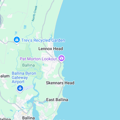
Surf spots nearby
- Boulder Beach (0.5 mi)
- Backsides (2.7 mi)
- Shelly Beach (3.9 mi)
- North Wall (4.9 mi)
- South Wall (5.1 mi)
- Broken Head (7 mi)
- Suffolk Park (8.4 mi)
- Tallow Beach (11 mi)
- The Wreck (11.6 mi)
- The Pass (Byron Bay) (11.7 mi)
Not Magic Seaweed (MSW)
Although we look a bit like Magic Seaweed we are not MagicSeaweed as they no longer exist...