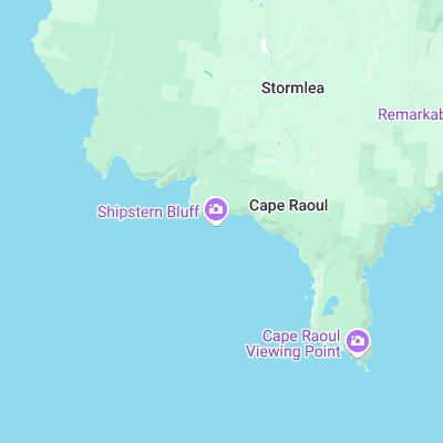
Shipsterns Bluff Surf Report
| Wave height * | 3.5ft / 1.1m |
|---|---|
| Swell period | 8s |
| Swell direction | |
| Wind | |
| Sea temp | 14°C / 57°F |

10 day Shipsterns Bluff surf forecast
Sat
20/Dec
4ft
8
14
10
- High 7:59am
- Low 4:16pm
Sun
21/Dec
3ft
1
17
19
- High 8:40am
- Low 4:58pm
Mon
22/Dec
3.5ft
17
24
14
- High 9:22am
- Low 5:40pm
Tue
23/Dec
5ft
23
30
26
- High 10:07am
- Low 6:22pm
Wed
24/Dec
7.5ft
34
33
34
- High 2:22am
- Low 4:02am
- High 10:57am
- Low 7:04pm
Thu
25/Dec
7.5ft
32
29
31
- High 2:45am
- Low 5:48am
- High 11:52am
- Low 7:46pm
Fri
26/Dec
5ft
28
29
26
- High 3:12am
- Low 7:29am
- High 12:57pm
- Low 8:27pm
Sat
27/Dec
4ft
8
11
14
- High 3:40am
- Low 9:02am
- High 2:12pm
- Low 9:07pm
Sun
28/Dec
4ft
15
23
23
- High 4:10am
- Low 10:23am
- High 3:37pm
- Low 9:45pm
Sat 20th Dec
| 5:00 | 5.5ft | 6.3ft | 7s | 21mph (35mph) | |||
| 8:00 | 5ft | 5.1ft | 7s | 8mph (11mph) | |||
| 11:00 | 4ft | 4.5ft | 8s | 7mph (9mph) | |||
| 14:00 | 4ft | 4.6ft | 8s | 14mph (15mph) | |||
| 17:00 | 4ft | 4.8ft | 8s | 11mph (11mph) | |||
| 20:00 | 3.5ft | 5.1ft | 8s | 10mph (9mph) |
| Tide times |
|---|
| High 7:59am (1.19m) |
| Low 4:16pm (0.07m) |
| Daylight | |
|---|---|
| First light | 04:49 |
| Sunrise | 05:24 |
| Sunset | 20:48 |
| Dark | 21:23 |
Sun 21st Dec
| 5:00 | 3.5ft | 3.5ft | 8s | 5mph (4mph) | |||
| 8:00 | 3ft | 3.3ft | 8s | 1mph (2mph) | |||
| 11:00 | 3ft | 3.2ft | 8s | 8mph (8mph) | |||
| 14:00 | 3ft | 3.3ft | 8s | 17mph (19mph) | |||
| 17:00 | 3.5ft | 3.4ft | 8s | 19mph (26mph) | |||
| 20:00 | 2.5ft | 3.7ft | 9s | 19mph (27mph) |
| Tide times |
|---|
| High 8:40am (1.19m) |
| Low 4:58pm (0.05m) |
| Daylight | |
|---|---|
| First light | 04:49 |
| Sunrise | 05:25 |
| Sunset | 20:48 |
| Dark | 21:24 |
Mon 22nd Dec
| 5:00 | 2ft | 3.9ft | 8s | 12mph (15mph) | |||
| 8:00 | 3ft | 4.7ft | 6s | 17mph (19mph) | |||
| 11:00 | 4.5ft | 5.2ft | 6s | 25mph (32mph) | |||
| 14:00 | 3.5ft | 5.2ft | 6s | 24mph (28mph) | |||
| 17:00 | 4ft | 5.8ft | 6s | 20mph (26mph) | |||
| 20:00 | 3.5ft | 5.1ft | 6s | 14mph (22mph) |
| Tide times |
|---|
| High 9:22am (1.18m) |
| Low 5:40pm (0.03m) |
| Daylight | |
|---|---|
| First light | 04:50 |
| Sunrise | 05:25 |
| Sunset | 20:49 |
| Dark | 21:24 |
Tue 23rd Dec
| 5:00 | 2ft | 4.3ft | 7s | 22mph (25mph) | |||
| 8:00 | 3.5ft | 5.5ft | 5s | 23mph (30mph) | |||
| 11:00 | 4ft | 6.7ft | 6s | 25mph (32mph) | |||
| 14:00 | 5ft | 7.7ft | 10s | 30mph (37mph) | |||
| 17:00 | 5.5ft | 9ft | 12s | 30mph (36mph) | |||
| 20:00 | 5.5ft | 9.1ft | 15s | 26mph (37mph) |
| Tide times |
|---|
| High 10:07am (1.16m) |
| Low 6:22pm (0.03m) |
| Daylight | |
|---|---|
| First light | 04:50 |
| Sunrise | 05:26 |
| Sunset | 20:49 |
| Dark | 21:25 |
Wed 24th Dec
| 5:00 | 6ft | 9ft | 16s | 34mph (46mph) | |||
| 8:00 | 4.5ft | 9.9ft | 14s | 34mph (46mph) | |||
| 11:00 | 7ft | 11.8ft | 12s | 31mph (44mph) | |||
| 14:00 | 7.5ft | 11.7ft | 12s | 33mph (44mph) | |||
| 17:00 | 7.5ft | 11.8ft | 12s | 36mph (45mph) | |||
| 20:00 | 7.5ft | 11.9ft | 12s | 34mph (41mph) |
| Tide times |
|---|
| High 2:22am (0.71m) |
| Low 4:02am (0.70m) |
| High 10:57am (1.11m) |
| Low 7:04pm (0.03m) |
| Daylight | |
|---|---|
| First light | 04:51 |
| Sunrise | 05:26 |
| Sunset | 20:50 |
| Dark | 21:25 |
Thu 25th Dec
| 5:00 | 9ft | 12.9ft | 13s | 33mph (41mph) | |||
| 8:00 | 8ft | 11.8ft | 13s | 32mph (41mph) | |||
| 11:00 | 7.5ft | 11ft | 13s | 32mph (41mph) | |||
| 14:00 | 7.5ft | 10.7ft | 13s | 29mph (42mph) | |||
| 17:00 | 7ft | 10.5ft | 12s | 26mph (42mph) | |||
| 20:00 | 6.5ft | 9.8ft | 12s | 31mph (43mph) |
| Tide times |
|---|
| High 2:45am (0.76m) |
| Low 5:48am (0.71m) |
| High 11:52am (1.05m) |
| Low 7:46pm (0.06m) |
| Daylight | |
|---|---|
| First light | 04:52 |
| Sunrise | 05:27 |
| Sunset | 20:50 |
| Dark | 21:25 |
Fri 26th Dec
| 5:00 | 5.5ft | 8.4ft | 11s | 28mph (34mph) | |||
| 8:00 | 5.5ft | 7.7ft | 11s | 28mph (33mph) | |||
| 11:00 | 5.5ft | 7.2ft | 10s | 27mph (27mph) | |||
| 14:00 | 5ft | 6.9ft | 10s | 29mph (32mph) | |||
| 17:00 | 5ft | 6.6ft | 9s | 29mph (36mph) | |||
| 20:00 | 5ft | 6.3ft | 9s | 26mph (31mph) |
| Tide times |
|---|
| High 3:12am (0.82m) |
| Low 7:29am (0.68m) |
| High 12:57pm (0.96m) |
| Low 8:27pm (0.11m) |
| Daylight | |
|---|---|
| First light | 04:52 |
| Sunrise | 05:28 |
| Sunset | 20:50 |
| Dark | 21:26 |
Sat 27th Dec
| 5:00 | 4ft | 5.1ft | 10s | 10mph (12mph) | |||
| 8:00 | 4ft | 5.1ft | 15s | 8mph (9mph) | |||
| 11:00 | 4ft | 5.3ft | 15s | 5mph (4mph) | |||
| 14:00 | 4ft | 5.3ft | 13s | 11mph (10mph) | |||
| 17:00 | 4ft | 5.2ft | 13s | 13mph (11mph) | |||
| 20:00 | 3.5ft | 4.8ft | 12s | 14mph (15mph) |
| Tide times |
|---|
| High 3:40am (0.89m) |
| Low 9:02am (0.60m) |
| High 2:12pm (0.86m) |
| Low 9:07pm (0.18m) |
| Daylight | |
|---|---|
| First light | 04:53 |
| Sunrise | 05:28 |
| Sunset | 20:51 |
| Dark | 21:26 |
Sun 28th Dec
| 5:00 | 3ft | 4.5ft | 11s | 13mph (21mph) | |||
| 8:00 | 3.5ft | 4.5ft | 10s | 15mph (22mph) | |||
| 11:00 | 3ft | 4.7ft | 10s | 20mph (26mph) | |||
| 14:00 | 4ft | 5.2ft | 8s | 23mph (30mph) | |||
| 17:00 | 5ft | 5.7ft | 8s | 23mph (31mph) | |||
| 20:00 | 4.5ft | 5ft | 9s | 23mph (36mph) |
| Tide times |
|---|
| High 4:10am (0.97m) |
| Low 10:23am (0.47m) |
| High 3:37pm (0.77m) |
| Low 9:45pm (0.28m) |
| Daylight | |
|---|---|
| First light | 04:54 |
| Sunrise | 05:29 |
| Sunset | 20:51 |
| Dark | 21:26 |
Mon 29th Dec
| 5:00 | 3ft | 3.8ft | 10s | 8mph (13mph) | |||
| 8:00 | 2.5ft | 3.5ft | 10s | 4mph (5mph) | |||
| 11:00 | 2.5ft | 3.6ft | 10s | 3mph (3mph) |
Awesome, mutant wave that comes in from deep water peaks outside and then goes berserk on the inside. Can be ledgey and unpredictable as well as super-heavy
Originally known as Devil’s Point, Shipstern’s gets its name from the 200ft high rocky outcrop that resembles a fossilized sinking Titanic.
Besides the wave itself other dangers include some of the biggest great white sharks on the planet
Surf spots nearby
- May's Point (22.9 mi)
- Coal Point (23.1 mi)
Not Magic Seaweed (MSW)
Although we look a bit like Magic Seaweed we are not MagicSeaweed as they no longer exist...