Pors-ar-Villec Surf Report
| Wave height * | 2ft / 0.5m |
|---|---|
| Swell period | 12s |
| Swell direction | |
| Wind | |
| Sea temp | 11°C / 52°F |

10 day Pors-ar-Villec surf forecast
Sun
4/Jan
2.5ft
11
11
13
- Low 1:58am
- High 7:57am
- Low 2:24pm
- High 8:24pm
Mon
5/Jan
3.5ft
5
17
20
- Low 2:41am
- High 8:40am
- Low 3:07pm
- High 9:07pm
Tue
6/Jan
2ft
8
4
10
- Low 3:23am
- High 9:23am
- Low 3:49pm
- High 9:49pm
Wed
7/Jan
3.5ft
16
15
18
- Low 4:05am
- High 10:06am
- Low 4:32pm
- High 10:34pm
Thu
8/Jan
4ft
15
10
27
- Low 4:50am
- High 10:53am
- Low 5:17pm
- High 11:24pm
Fri
9/Jan
17ft
32
37
41
- Low 5:39am
- High 11:46am
- Low 6:09pm
Sat
10/Jan
8ft
25
29
30
- High 12:21am
- Low 6:37am
- High 12:49pm
- Low 7:12pm
Sun
11/Jan
6ft
36
23
16
- High 1:27am
- Low 7:52am
- High 2:00pm
- Low 8:27pm
Mon
12/Jan
11ft
15
20
25
- High 2:36am
- Low 9:09am
- High 3:10pm
- Low 9:37pm
Tue
13/Jan
6ft
26
20
18
Sun 4th Jan
| 4:00 | 3.5ft | 3.8ft | 5s | 14mph (17mph) | |||
| 7:00 | 3ft | 3.4ft | 5s | 11mph (15mph) | |||
| 10:00 | 3ft | 2.9ft | 5s | 9mph (9mph) | |||
| 13:00 | 2.5ft | 2.7ft | 5s | 11mph (13mph) | |||
| 16:00 | 2.5ft | 2.8ft | 5s | 15mph (17mph) | |||
| 19:00 | 2ft | 2.9ft | 13s | 13mph (16mph) |
| Tide times |
|---|
| Low 1:58am (1.46m) |
| High 7:57am (9.04m) |
| Low 2:24pm (1.22m) |
| High 8:24pm (8.59m) |
| Daylight | |
|---|---|
| First light | 08:30 |
| Sunrise | 09:06 |
| Sunset | 17:33 |
| Dark | 18:09 |
Mon 5th Jan
| 4:00 | 2ft | 2.9ft | 12s | 8mph (11mph) | |||
| 7:00 | 1.5ft | 2.8ft | 12s | 5mph (6mph) | |||
| 10:00 | 2ft | 2.9ft | 12s | 8mph (11mph) | |||
| 13:00 | 3.5ft | 3.7ft | 5s | 17mph (20mph) | |||
| 16:00 | 4ft | 4.3ft | 5s | 21mph (23mph) | |||
| 19:00 | 4ft | 4.3ft | 5s | 20mph (24mph) |
| Tide times |
|---|
| Low 2:41am (1.65m) |
| High 8:40am (8.84m) |
| Low 3:07pm (1.52m) |
| High 9:07pm (8.32m) |
| Daylight | |
|---|---|
| First light | 08:30 |
| Sunrise | 09:06 |
| Sunset | 17:34 |
| Dark | 18:10 |
Tue 6th Jan
| 4:00 | 3.5ft | 3.9ft | 5s | 11mph (15mph) | |||
| 7:00 | 3.5ft | 3.6ft | 5s | 8mph (13mph) | |||
| 10:00 | 3ft | 3.2ft | 5s | 7mph (10mph) | |||
| 13:00 | 2ft | 2.9ft | 9s | 4mph (7mph) | |||
| 16:00 | 2ft | 2.7ft | 9s | 5mph (7mph) | |||
| 19:00 | 1.5ft | 2.5ft | 9s | 10mph (12mph) |
| Tide times |
|---|
| Low 3:23am (1.97m) |
| High 9:23am (8.49m) |
| Low 3:49pm (1.94m) |
| High 9:49pm (7.97m) |
| Daylight | |
|---|---|
| First light | 08:29 |
| Sunrise | 09:06 |
| Sunset | 17:35 |
| Dark | 18:11 |
Wed 7th Jan
| 4:00 | 2.5ft | 4.4ft | 5s | 19mph (31mph) | |||
| 7:00 | 3ft | 5.6ft | 6s | 16mph (23mph) | |||
| 10:00 | 3.5ft | 5.6ft | 6s | 19mph (25mph) | |||
| 13:00 | 3.5ft | 5.9ft | 7s | 15mph (20mph) | |||
| 16:00 | 3.5ft | 6.1ft | 8s | 13mph (20mph) | |||
| 19:00 | 3.5ft | 6ft | 8s | 18mph (35mph) |
| Tide times |
|---|
| Low 4:05am (2.39m) |
| High 10:06am (8.06m) |
| Low 4:32pm (2.43m) |
| High 10:34pm (7.58m) |
| Daylight | |
|---|---|
| First light | 08:29 |
| Sunrise | 09:05 |
| Sunset | 17:36 |
| Dark | 18:13 |
Thu 8th Jan
| 4:00 | 4ft | 6.7ft | 8s | 20mph (28mph) | |||
| 7:00 | 4ft | 6.7ft | 8s | 15mph (22mph) | |||
| 10:00 | 4ft | 6.8ft | 8s | 11mph (15mph) | |||
| 13:00 | 4ft | 6.8ft | 8s | 10mph (17mph) | |||
| 16:00 | 5ft | 8.6ft | 8s | 25mph (38mph) | |||
| 19:00 | 6ft | 10ft | 9s | 27mph (40mph) |
| Tide times |
|---|
| Low 4:50am (2.86m) |
| High 10:53am (7.59m) |
| Low 5:17pm (2.94m) |
| High 11:24pm (7.20m) |
| Daylight | |
|---|---|
| First light | 08:29 |
| Sunrise | 09:05 |
| Sunset | 17:38 |
| Dark | 18:14 |
Fri 9th Jan
| 4:00 | 9ft | 15.5ft | 11s | 32mph (42mph) | |||
| 7:00 | 14.5ft | 22.7ft | 13s | 32mph (43mph) | |||
| 10:00 | 17ft | 27.1ft | 15s | 33mph (42mph) | |||
| 13:00 | 17ft | 27ft | 15s | 37mph (46mph) | |||
| 16:00 | 16.5ft | 26ft | 14s | 38mph (48mph) | |||
| 19:00 | 15.5ft | 24.3ft | 14s | 41mph (53mph) |
| Tide times |
|---|
| Low 5:39am (3.31m) |
| High 11:46am (7.14m) |
| Low 6:09pm (3.40m) |
| Daylight | |
|---|---|
| First light | 08:28 |
| Sunrise | 09:04 |
| Sunset | 17:39 |
| Dark | 18:15 |
Sat 10th Jan
| 4:00 | 12.5ft | 19.9ft | 13s | 31mph (39mph) | |||
| 7:00 | 11ft | 17.6ft | 13s | 25mph (33mph) | |||
| 10:00 | 9.5ft | 15.3ft | 12s | 22mph (30mph) | |||
| 13:00 | 8ft | 13ft | 12s | 29mph (39mph) | |||
| 16:00 | 7ft | 11ft | 12s | 30mph (42mph) | |||
| 19:00 | 6ft | 9.4ft | 12s | 30mph (45mph) |
| Tide times |
|---|
| High 12:21am (6.89m) |
| Low 6:37am (3.68m) |
| High 12:49pm (6.79m) |
| Low 7:12pm (3.72m) |
| Daylight | |
|---|---|
| First light | 08:28 |
| Sunrise | 09:04 |
| Sunset | 17:40 |
| Dark | 18:16 |
Sun 11th Jan
| 4:00 | 6ft | 9.4ft | 11s | 33mph (50mph) | |||
| 7:00 | 6ft | 10.2ft | 11s | 36mph (56mph) | |||
| 10:00 | 6ft | 10.2ft | 11s | 39mph (61mph) | |||
| 13:00 | 6ft | 10.5ft | 11s | 23mph (36mph) | |||
| 16:00 | 6ft | 10.3ft | 11s | 20mph (30mph) | |||
| 19:00 | 6ft | 10.2ft | 11s | 16mph (24mph) |
| Tide times |
|---|
| High 1:27am (6.72m) |
| Low 7:52am (3.86m) |
| High 2:00pm (6.63m) |
| Low 8:27pm (3.83m) |
| Daylight | |
|---|---|
| First light | 08:27 |
| Sunrise | 09:03 |
| Sunset | 17:42 |
| Dark | 18:17 |
Mon 12th Jan
| 4:00 | 7ft | 12.4ft | 11s | 22mph (33mph) | |||
| 7:00 | 10.5ft | 17ft | 12s | 15mph (25mph) | |||
| 10:00 | 12ft | 19.2ft | 12s | 16mph (29mph) | |||
| 13:00 | 11ft | 17.8ft | 13s | 20mph (33mph) | |||
| 16:00 | 10ft | 16ft | 13s | 21mph (34mph) | |||
| 19:00 | 9.5ft | 14.8ft | 13s | 25mph (24mph) |
| Tide times |
|---|
| High 2:36am (6.74m) |
| Low 9:09am (3.77m) |
| High 3:10pm (6.68m) |
| Low 9:37pm (3.69m) |
| Daylight | |
|---|---|
| First light | 08:27 |
| Sunrise | 09:03 |
| Sunset | 17:43 |
| Dark | 18:19 |
Tue 13th Jan
| 4:00 | 6.5ft | 10.4ft | 12s | 28mph (37mph) | |||
| 7:00 | 6ft | 9.4ft | 12s | 26mph (32mph) | |||
| 10:00 | 6ft | 9.4ft | 12s | 19mph (24mph) | |||
| 13:00 | 6ft | 9.5ft | 12s | 20mph (23mph) | |||
| 16:00 | 6ft | 9.8ft | 12s | 20mph (24mph) | |||
| 19:00 | 7ft | 10.9ft | 12s | 18mph (24mph) |
| Tide times |
|---|
| Daylight | |
|---|---|
| First light | 08:26 |
| Sunrise | 09:02 |
| Sunset | 17:44 |
| Dark | 18:20 |
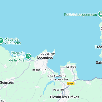
Surf spots nearby
- Locquirec (0.1 mi)
- Les Sables Blancs (0.6 mi)
- Les Sables Blancs - La Plate (0.7 mi)
- Beg L (5.6 mi)
- Trestraou (12.2 mi)
- Pors-Nevez (12.5 mi)
- Trestrignel (13.1 mi)
- Dossen (18.8 mi)
- Mauvaise Gr (19.9 mi)
Not Magic Seaweed (MSW)
Although we look a bit like Magic Seaweed we are not MagicSeaweed as they no longer exist...