Matosinhos Surf Report
| Wave height * | 10ft / 3.1m |
|---|---|
| Swell period | 15s |
| Swell direction | |
| Wind | |
| Sea temp | 15°C / 59°F |

10 day Matosinhos surf forecast
Sun
21/Dec
10ft
19
17
14
- High 2:47am
- Low 9:02am
- High 3:16pm
- Low 9:06pm
Mon
22/Dec
7ft
12
3
17
- High 3:36am
- Low 9:56am
- High 4:12pm
- Low 10:01pm
Tue
23/Dec
5ft
5
8
10
- High 4:32am
- Low 10:56am
- High 5:15pm
- Low 11:03pm
Wed
24/Dec
4.5ft
11
9
6
- High 5:33am
- Low 11:59am
- High 6:17pm
Thu
25/Dec
3ft
12
12
6
- Low 12:09am
- High 6:33am
- Low 12:59pm
- High 7:15pm
Fri
26/Dec
2ft
9
4
3
- Low 1:11am
- High 7:29am
- Low 1:53pm
- High 8:08pm
Sat
27/Dec
2ft
16
19
11
- Low 2:07am
- High 8:22am
- Low 2:43pm
- High 8:57pm
Sun
28/Dec
2.5ft
18
13
10
- Low 2:59am
- High 9:12am
- Low 3:30pm
- High 9:44pm
Mon
29/Dec
1.5ft
11
6
3
- Low 3:48am
- High 10:00am
- Low 4:16pm
- High 10:30pm
Tue
30/Dec
2ft
6
4
8
- Low 4:36am
- High 10:48am
Sun 21st Dec
| 3:00 | 10ft | 14.9ft | 14s | 23mph (25mph) | |||
| 6:00 | 10.5ft | 15.4ft | 15s | 19mph (22mph) | |||
| 9:00 | 10ft | 15.2ft | 15s | 16mph (19mph) | |||
| 12:00 | 10ft | 14.9ft | 15s | 17mph (20mph) | |||
| 15:00 | 10ft | 14.7ft | 15s | 17mph (21mph) | |||
| 18:00 | 9.5ft | 14.5ft | 15s | 14mph (18mph) | |||
| 21:00 | 9.5ft | 14ft | 15s | 10mph (13mph) |
| Tide times |
|---|
| High 2:47am (2.78m) |
| Low 9:02am (1.26m) |
| High 3:16pm (2.50m) |
| Low 9:06pm (1.35m) |
| Daylight | |
|---|---|
| First light | 07:25 |
| Sunrise | 07:56 |
| Sunset | 17:09 |
| Dark | 17:40 |
Mon 22nd Dec
| 3:00 | 8ft | 12.7ft | 15s | 10mph (13mph) | |||
| 6:00 | 7.5ft | 12.4ft | 15s | 12mph (15mph) | |||
| 9:00 | 7.5ft | 12.1ft | 15s | 6mph (10mph) | |||
| 12:00 | 7ft | 11.7ft | 14s | 3mph (4mph) | |||
| 15:00 | 7ft | 11.1ft | 14s | 16mph (17mph) | |||
| 18:00 | 6.5ft | 10.6ft | 14s | 17mph (21mph) | |||
| 21:00 | 6ft | 9.9ft | 13s | 15mph (20mph) |
| Tide times |
|---|
| High 3:36am (2.71m) |
| Low 9:56am (1.31m) |
| High 4:12pm (2.46m) |
| Low 10:01pm (1.40m) |
| Daylight | |
|---|---|
| First light | 07:26 |
| Sunrise | 07:57 |
| Sunset | 17:09 |
| Dark | 17:40 |
Tue 23rd Dec
| 3:00 | 5.5ft | 8.8ft | 13s | 9mph (12mph) | |||
| 6:00 | 5.5ft | 9ft | 12s | 5mph (8mph) | |||
| 9:00 | 5.5ft | 8.5ft | 12s | 7mph (8mph) | |||
| 12:00 | 5ft | 7.8ft | 12s | 8mph (9mph) | |||
| 15:00 | 4.5ft | 7.3ft | 11s | 10mph (12mph) | |||
| 18:00 | 4.5ft | 7.1ft | 11s | 10mph (11mph) | |||
| 21:00 | 4.5ft | 6.9ft | 11s | 12mph (19mph) |
| Tide times |
|---|
| High 4:32am (2.69m) |
| Low 10:56am (1.31m) |
| High 5:15pm (2.46m) |
| Low 11:03pm (1.41m) |
| Daylight | |
|---|---|
| First light | 07:26 |
| Sunrise | 07:57 |
| Sunset | 17:10 |
| Dark | 17:41 |
Wed 24th Dec
| 3:00 | 4.5ft | 7.1ft | 14s | 11mph (16mph) | |||
| 6:00 | 4.5ft | 7.2ft | 13s | 11mph (16mph) | |||
| 9:00 | 4.5ft | 7.2ft | 13s | 9mph (13mph) | |||
| 12:00 | 4.5ft | 6.9ft | 12s | 9mph (15mph) | |||
| 15:00 | 4ft | 6.8ft | 16s | 9mph (11mph) | |||
| 18:00 | 4ft | 6.4ft | 16s | 6mph (7mph) | |||
| 21:00 | 4ft | 6.4ft | 15s | 5mph (5mph) |
| Tide times |
|---|
| High 5:33am (2.72m) |
| Low 11:59am (1.25m) |
| High 6:17pm (2.53m) |
| Daylight | |
|---|---|
| First light | 07:26 |
| Sunrise | 07:58 |
| Sunset | 17:10 |
| Dark | 17:41 |
Thu 25th Dec
| 3:00 | 3.5ft | 5.9ft | 14s | 10mph (15mph) | |||
| 6:00 | 3.5ft | 5.5ft | 14s | 12mph (18mph) | |||
| 9:00 | 3ft | 5.1ft | 13s | 11mph (17mph) | |||
| 12:00 | 3ft | 4.6ft | 13s | 12mph (14mph) | |||
| 15:00 | 2.5ft | 4.3ft | 13s | 8mph (10mph) | |||
| 18:00 | 2.5ft | 4ft | 12s | 6mph (9mph) | |||
| 21:00 | 2.5ft | 3.9ft | 12s | 8mph (10mph) |
| Tide times |
|---|
| Low 12:09am (1.35m) |
| High 6:33am (2.81m) |
| Low 12:59pm (1.13m) |
| High 7:15pm (2.66m) |
| Daylight | |
|---|---|
| First light | 07:27 |
| Sunrise | 07:58 |
| Sunset | 17:11 |
| Dark | 17:42 |
Fri 26th Dec
| 3:00 | 2.5ft | 4.7ft | 11s | 10mph (12mph) | |||
| 6:00 | 2.5ft | 5.3ft | 8s | 9mph (11mph) | |||
| 9:00 | 2ft | 4.7ft | 9s | 7mph (9mph) | |||
| 12:00 | 2ft | 4ft | 8s | 4mph (6mph) | |||
| 15:00 | 2ft | 4.3ft | 8s | 5mph (6mph) | |||
| 18:00 | 2.5ft | 4.7ft | 8s | 3mph (3mph) | |||
| 21:00 | 2.5ft | 4.6ft | 8s | 5mph (6mph) |
| Tide times |
|---|
| Low 1:11am (1.23m) |
| High 7:29am (2.95m) |
| Low 1:53pm (0.97m) |
| High 8:08pm (2.82m) |
| Daylight | |
|---|---|
| First light | 07:27 |
| Sunrise | 07:58 |
| Sunset | 17:12 |
| Dark | 17:43 |
Sat 27th Dec
| 3:00 | 2ft | 4.4ft | 10s | 13mph (19mph) | |||
| 6:00 | 2.5ft | 4.6ft | 11s | 16mph (23mph) | |||
| 9:00 | 2.5ft | 4.4ft | 11s | 16mph (26mph) | |||
| 12:00 | 2ft | 4ft | 13s | 19mph (23mph) | |||
| 15:00 | 2ft | 3.6ft | 12s | 13mph (14mph) | |||
| 18:00 | 2ft | 3.3ft | 12s | 11mph (19mph) | |||
| 21:00 | 2ft | 3.3ft | 12s | 14mph (26mph) |
| Tide times |
|---|
| Low 2:07am (1.06m) |
| High 8:22am (3.10m) |
| Low 2:43pm (0.79m) |
| High 8:57pm (3.01m) |
| Daylight | |
|---|---|
| First light | 07:28 |
| Sunrise | 07:59 |
| Sunset | 17:12 |
| Dark | 17:43 |
Sun 28th Dec
| 3:00 | 2ft | 3.2ft | 12s | 16mph (28mph) | |||
| 6:00 | 2.5ft | 3.2ft | 12s | 18mph (30mph) | |||
| 9:00 | 2.5ft | 3.5ft | 12s | 17mph (28mph) | |||
| 12:00 | 2.5ft | 3.3ft | 12s | 13mph (17mph) | |||
| 15:00 | 2ft | 2.8ft | 12s | 10mph (12mph) | |||
| 18:00 | 2ft | 2.5ft | 11s | 10mph (16mph) | |||
| 21:00 | 1.5ft | 2.6ft | 11s | 9mph (15mph) |
| Tide times |
|---|
| Low 2:59am (0.88m) |
| High 9:12am (3.26m) |
| Low 3:30pm (0.63m) |
| High 9:44pm (3.19m) |
| Daylight | |
|---|---|
| First light | 07:28 |
| Sunrise | 07:59 |
| Sunset | 17:13 |
| Dark | 17:44 |
Mon 29th Dec
| 3:00 | 1.5ft | 2.3ft | 11s | 12mph (18mph) | |||
| 6:00 | 1.5ft | 2.3ft | 13s | 11mph (15mph) | |||
| 9:00 | 1.5ft | 2.1ft | 12s | 9mph (15mph) | |||
| 12:00 | 1.5ft | 2.1ft | 12s | 6mph (7mph) | |||
| 15:00 | 1.5ft | 2.1ft | 12s | 1mph (3mph) | |||
| 18:00 | 1.5ft | 2.1ft | 14s | 3mph (5mph) | |||
| 21:00 | 1.5ft | 2.2ft | 13s | 6mph (7mph) |
| Tide times |
|---|
| Low 3:48am (0.71m) |
| High 10:00am (3.37m) |
| Low 4:16pm (0.51m) |
| High 10:30pm (3.35m) |
| Daylight | |
|---|---|
| First light | 07:28 |
| Sunrise | 07:59 |
| Sunset | 17:14 |
| Dark | 17:45 |
Tue 30th Dec
| 3:00 | 2ft | 2.5ft | 13s | 6mph (6mph) | |||
| 6:00 | 2ft | 2.5ft | 12s | 6mph (6mph) | |||
| 9:00 | 2ft | 2.6ft | 12s | 5mph (5mph) | |||
| 12:00 | 2ft | 2.6ft | 12s | 4mph (5mph) | |||
| 15:00 | 2ft | 2.5ft | 11s | 7mph (7mph) | |||
| 18:00 | 2ft | 2.5ft | 11s | 8mph (8mph) | |||
| 21:00 | 2ft | 2.5ft | 11s | 4mph (4mph) |
| Tide times |
|---|
| Low 4:36am (0.57m) |
| High 10:48am (3.44m) |
| Daylight | |
|---|---|
| First light | 07:28 |
| Sunrise | 07:59 |
| Sunset | 17:14 |
| Dark | 17:45 |
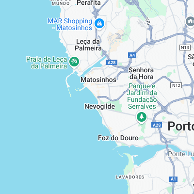
Porto's most consistent spot. Doesn't pick up as much swell as you'd expect and not as heavy as many spots on the coast. On bigger swells there is a wave off the harbor wall towards high tide.
Matosinhos is one of the most polluted beaches in Portugal with city sewers, major oil terminal and abattoir nearby. Nice!
Surf spots nearby
- Cabedelo (2.7 mi)
- Praia do Aterro (2.9 mi)
- Mindelo (9.7 mi)
- Espinho (11.5 mi)
- Azurara (11.8 mi)
- Praia do Rock (13.1 mi)
- Esmoriz (13.6 mi)
- A Ver-o-Mar (15.7 mi)
- Cortega (16.2 mi)
- Cavalos de f (23.5 mi)
Not Magic Seaweed (MSW)
Although we look a bit like Magic Seaweed we are not MagicSeaweed as they no longer exist...