Populo Surf Report
| Wave height * | 2.5ft / 0.8m |
|---|---|
| Swell period | 13s |
| Swell direction | |
| Wind | |
| Sea temp | 17°C / 63°F |

10 day Populo surf forecast
Mon
29/Dec
4ft
0
0
0
- Low 3:23am
- High 9:36am
- Low 3:59pm
- High 10:18pm
Tue
30/Dec
2ft
3
8
5
- Low 4:30am
- High 10:39am
- Low 4:57pm
- High 11:13pm
Wed
31/Dec
3.5ft
5
4
6
- Low 5:28am
- High 11:35am
- Low 5:47pm
Thu
1/Jan
4ft
11
23
23
- High 12:04am
- Low 6:21am
- High 12:27pm
- Low 6:36pm
Fri
2/Jan
1.5ft
22
21
18
- High 12:52am
- Low 7:10am
- High 1:16pm
- Low 7:22pm
Sat
3/Jan
0ft
19
18
19
- High 1:38am
- Low 7:58am
- High 2:02pm
- Low 8:06pm
Sun
4/Jan
0ft
12
12
13
- High 2:23am
- Low 8:43am
- High 2:47pm
- Low 8:49pm
Mon
5/Jan
1ft
9
10
10
- High 3:06am
- Low 9:28am
- High 3:31pm
- Low 9:32pm
Tue
6/Jan
0.5ft
13
15
16
- High 3:50am
- Low 10:12am
- High 4:16pm
- Low 10:15pm
Wed
7/Jan
0.5ft
18
18
14
- High 4:34am
Mon 29th Dec
| 5:00 | 4ft | 9.8ft | 12s | 0mph (0mph) | |||
| 8:00 | 4ft | 9.6ft | 14s | 0mph (0mph) | |||
| 11:00 | 4ft | 9.7ft | 15s | 0mph (0mph) | |||
| 14:00 | 4ft | 9.6ft | 14s | 0mph (0mph) | |||
| 17:00 | 4ft | 9.4ft | 14s | 0mph (0mph) | |||
| 20:00 | 3.5ft | 8.7ft | 13s | 0mph (0mph) |
| Tide times |
|---|
| Low 3:23am (2.14m) |
| High 9:36am (5.07m) |
| Low 3:59pm (1.77m) |
| High 10:18pm (5.15m) |
| Daylight | |
|---|---|
| First light | 07:28 |
| Sunrise | 07:57 |
| Sunset | 17:32 |
| Dark | 18:02 |
Tue 30th Dec
| 5:00 | 2.5ft | 6.5ft | 12s | 2mph (3mph) | |||
| 8:00 | 2.5ft | 6ft | 12s | 3mph (4mph) | |||
| 11:00 | 2ft | 5.6ft | 11s | 5mph (8mph) | |||
| 14:00 | 2ft | 5.6ft | 10s | 8mph (15mph) | |||
| 17:00 | 4ft | 5.7ft | 7s | 9mph (21mph) | |||
| 20:00 | 2.5ft | 5.9ft | 10s | 5mph (17mph) |
| Tide times |
|---|
| Low 4:30am (1.87m) |
| High 10:39am (5.25m) |
| Low 4:57pm (1.55m) |
| High 11:13pm (5.50m) |
| Daylight | |
|---|---|
| First light | 07:28 |
| Sunrise | 07:57 |
| Sunset | 17:33 |
| Dark | 18:02 |
Wed 31st Dec
| 5:00 | 3.5ft | 8.6ft | 12s | 7mph (14mph) | |||
| 8:00 | 4ft | 8.2ft | 12s | 5mph (7mph) | |||
| 11:00 | 3.5ft | 7.7ft | 12s | 3mph (5mph) | |||
| 14:00 | 3.5ft | 7.4ft | 11s | 4mph (5mph) | |||
| 17:00 | 4ft | 7.5ft | 11s | 4mph (5mph) | |||
| 20:00 | 4ft | 7.7ft | 11s | 6mph (9mph) |
| Tide times |
|---|
| Low 5:28am (1.55m) |
| High 11:35am (5.44m) |
| Low 5:47pm (1.33m) |
| Daylight | |
|---|---|
| First light | 07:28 |
| Sunrise | 07:57 |
| Sunset | 17:34 |
| Dark | 18:03 |
Thu 1st Jan
| 5:00 | 4.5ft | 10.6ft | 9s | 3mph (4mph) | |||
| 8:00 | 4.5ft | 11.8ft | 8s | 11mph (21mph) | |||
| 11:00 | 4ft | 12.4ft | 9s | 21mph (29mph) | |||
| 14:00 | 4ft | 12.6ft | 9s | 23mph (33mph) | |||
| 17:00 | 4.5ft | 13.9ft | 9s | 22mph (33mph) | |||
| 20:00 | 4ft | 15.7ft | 10s | 23mph (34mph) |
| Tide times |
|---|
| High 12:04am (5.83m) |
| Low 6:21am (1.27m) |
| High 12:27pm (5.60m) |
| Low 6:36pm (1.15m) |
| Daylight | |
|---|---|
| First light | 07:28 |
| Sunrise | 07:57 |
| Sunset | 17:35 |
| Dark | 18:04 |
Fri 2nd Jan
| 5:00 | 3.5ft | 16.3ft | 11s | 22mph (34mph) | |||
| 8:00 | 3ft | 14.6ft | 10s | 22mph (34mph) | |||
| 11:00 | 3ft | 14.5ft | 10s | 21mph (31mph) | |||
| 14:00 | 1.5ft | 15.3ft | 10s | 21mph (31mph) | |||
| 17:00 | 1ft | 15.7ft | 11s | 20mph (30mph) | |||
| 20:00 | 0ft | 15ft | 11s | 18mph (27mph) |
| Tide times |
|---|
| High 12:52am (6.08m) |
| Low 7:10am (1.05m) |
| High 1:16pm (5.68m) |
| Low 7:22pm (1.06m) |
| Daylight | |
|---|---|
| First light | 07:28 |
| Sunrise | 07:57 |
| Sunset | 17:35 |
| Dark | 18:05 |
Sat 3rd Jan
| 5:00 | 0ft | 13.4ft | 11s | 19mph (29mph) | |||
| 8:00 | 0.5ft | 12.5ft | 11s | 19mph (28mph) | |||
| 11:00 | 0.5ft | 11.3ft | 11s | 19mph (27mph) | |||
| 14:00 | 0ft | 10.4ft | 11s | 18mph (26mph) | |||
| 17:00 | 0ft | 10.2ft | 11s | 18mph (26mph) | |||
| 20:00 | 0ft | 10ft | 12s | 19mph (26mph) |
| Tide times |
|---|
| High 1:38am (6.21m) |
| Low 7:58am (0.96m) |
| High 2:02pm (5.67m) |
| Low 8:06pm (1.06m) |
| Daylight | |
|---|---|
| First light | 07:28 |
| Sunrise | 07:57 |
| Sunset | 17:36 |
| Dark | 18:05 |
Sun 4th Jan
| 5:00 | 0.5ft | 8.6ft | 12s | 11mph (21mph) | |||
| 8:00 | 0ft | 8.3ft | 12s | 12mph (24mph) | |||
| 11:00 | 1ft | 7.8ft | 12s | 12mph (21mph) | |||
| 14:00 | 0ft | 7.6ft | 11s | 12mph (19mph) | |||
| 17:00 | 0ft | 7.5ft | 11s | 12mph (20mph) | |||
| 20:00 | 0ft | 7.4ft | 11s | 13mph (21mph) |
| Tide times |
|---|
| High 2:23am (6.22m) |
| Low 8:43am (0.99m) |
| High 2:47pm (5.55m) |
| Low 8:49pm (1.17m) |
| Daylight | |
|---|---|
| First light | 07:28 |
| Sunrise | 07:57 |
| Sunset | 17:37 |
| Dark | 18:06 |
Mon 5th Jan
| 5:00 | 1ft | 7.8ft | 11s | 9mph (16mph) | |||
| 8:00 | 1ft | 7.8ft | 12s | 9mph (16mph) | |||
| 11:00 | 1ft | 7.7ft | 12s | 9mph (17mph) | |||
| 14:00 | 1ft | 7.6ft | 12s | 10mph (15mph) | |||
| 17:00 | 1ft | 7.4ft | 12s | 10mph (17mph) | |||
| 20:00 | 1ft | 7.2ft | 12s | 10mph (17mph) |
| Tide times |
|---|
| High 3:06am (6.10m) |
| Low 9:28am (1.14m) |
| High 3:31pm (5.34m) |
| Low 9:32pm (1.39m) |
| Daylight | |
|---|---|
| First light | 07:29 |
| Sunrise | 07:57 |
| Sunset | 17:38 |
| Dark | 18:07 |
Tue 6th Jan
| 5:00 | 0.5ft | 6.8ft | 12s | 10mph (18mph) | |||
| 8:00 | 0.5ft | 6.7ft | 12s | 13mph (21mph) | |||
| 11:00 | 1ft | 6.7ft | 12s | 16mph (24mph) | |||
| 14:00 | 0.5ft | 6.8ft | 12s | 15mph (22mph) | |||
| 17:00 | 1ft | 6.9ft | 12s | 13mph (21mph) | |||
| 20:00 | 1ft | 6.9ft | 12s | 16mph (24mph) |
| Tide times |
|---|
| High 3:50am (5.85m) |
| Low 10:12am (1.39m) |
| High 4:16pm (5.07m) |
| Low 10:15pm (1.68m) |
| Daylight | |
|---|---|
| First light | 07:29 |
| Sunrise | 07:57 |
| Sunset | 17:39 |
| Dark | 18:08 |
Wed 7th Jan
| 5:00 | 6ft | 6.6ft | 12s | 18mph (28mph) | |||
| 8:00 | 5.5ft | 6.7ft | 10s | 18mph (29mph) | |||
| 11:00 | 0.5ft | 6.8ft | 9s | 19mph (28mph) | |||
| 14:00 | 0.5ft | 7.1ft | 8s | 18mph (28mph) | |||
| 17:00 | 5.5ft | 7.2ft | 8s | 18mph (28mph) | |||
| 20:00 | 5ft | 7ft | 8s | 14mph (26mph) |
| Tide times |
|---|
| High 4:34am (5.51m) |
| Daylight | |
|---|---|
| First light | 07:28 |
| Sunrise | 07:57 |
| Sunset | 17:40 |
| Dark | 18:09 |
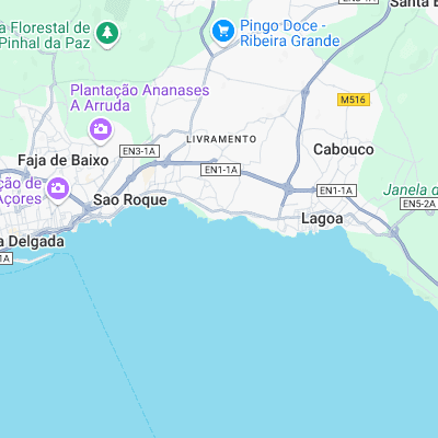
Consistent beach/reefs that'll work on just about any swell. Situated on the edge of the Azores' capital means it is also the busiest spot on the islands.
Surf spots nearby
Not Magic Seaweed (MSW)
Although we look a bit like Magic Seaweed we are not MagicSeaweed as they no longer exist...