Praia Grande Surf Report
| Wave height * | 7ft / 2.2m |
|---|---|
| Swell period | 11s |
| Swell direction | |
| Wind | |
| Sea temp | 15°C / 59°F |

10 day Praia Grande surf forecast
Mon
5/Jan
7ft
27
28
29
- High 3:35am
- Low 9:52am
- High 4:06pm
- Low 10:00pm
Tue
6/Jan
7ft
32
29
30
- High 4:21am
- Low 10:37am
- High 4:51pm
- Low 10:43pm
Wed
7/Jan
5.5ft
10
24
24
- High 5:05am
- Low 11:22am
- High 5:35pm
- Low 11:27pm
Thu
8/Jan
3.5ft
5
4
12
- High 5:50am
- Low 12:07pm
- High 6:20pm
Fri
9/Jan
8ft
21
17
16
- Low 12:13am
- High 6:37am
- Low 12:54pm
- High 7:09pm
Sat
10/Jan
7ft
10
8
7
- Low 1:03am
- High 7:27am
- Low 1:47pm
- High 8:03pm
Sun
11/Jan
4.5ft
9
16
22
- Low 2:04am
- High 8:24am
- Low 2:48pm
- High 9:05pm
Mon
12/Jan
8ft
24
9
23
- Low 3:18am
- High 9:31am
- Low 3:55pm
- High 10:14pm
Tue
13/Jan
7ft
32
22
24
- Low 4:35am
- High 10:43am
- Low 5:00pm
- High 11:19pm
Wed
14/Jan
15.5ft
45
38
33
- Low 5:41am
- High 11:48am
Mon 5th Jan
| 3:00 | 7ft | 10.1ft | 11s | 21mph (25mph) | |||
| 6:00 | 7.5ft | 11ft | 11s | 27mph (30mph) | |||
| 9:00 | 7ft | 11.1ft | 11s | 27mph (31mph) | |||
| 12:00 | 7ft | 10.9ft | 10s | 28mph (32mph) | |||
| 15:00 | 7ft | 11ft | 10s | 35mph (42mph) | |||
| 18:00 | 6.5ft | 9.9ft | 9s | 29mph (36mph) | |||
| 21:00 | 5.5ft | 8.5ft | 9s | 31mph (35mph) |
| Tide times |
|---|
| High 3:35am (3.61m) |
| Low 9:52am (0.56m) |
| High 4:06pm (3.26m) |
| Low 10:00pm (0.76m) |
| Daylight | |
|---|---|
| First light | 07:26 |
| Sunrise | 07:56 |
| Sunset | 17:30 |
| Dark | 17:59 |
Tue 6th Jan
| 3:00 | 7.5ft | 10.9ft | 9s | 33mph (37mph) | |||
| 6:00 | 7ft | 10.6ft | 9s | 32mph (34mph) | |||
| 9:00 | 7ft | 10.1ft | 9s | 30mph (32mph) | |||
| 12:00 | 7ft | 9.8ft | 9s | 29mph (30mph) | |||
| 15:00 | 6.5ft | 9.4ft | 9s | 30mph (32mph) | |||
| 18:00 | 6ft | 9.4ft | 9s | 30mph (33mph) | |||
| 21:00 | 5.5ft | 8.7ft | 9s | 26mph (30mph) |
| Tide times |
|---|
| High 4:21am (3.56m) |
| Low 10:37am (0.64m) |
| High 4:51pm (3.17m) |
| Low 10:43pm (0.86m) |
| Daylight | |
|---|---|
| First light | 07:26 |
| Sunrise | 07:56 |
| Sunset | 17:31 |
| Dark | 18:00 |
Wed 7th Jan
| 3:00 | 4.5ft | 6.6ft | 9s | 18mph (21mph) | |||
| 6:00 | 4ft | 5.9ft | 9s | 10mph (15mph) | |||
| 9:00 | 5ft | 7ft | 8s | 24mph (27mph) | |||
| 12:00 | 5.5ft | 7.8ft | 7s | 24mph (28mph) | |||
| 15:00 | 5.5ft | 8.8ft | 8s | 22mph (25mph) | |||
| 18:00 | 6ft | 8.6ft | 9s | 24mph (27mph) | |||
| 21:00 | 5.5ft | 7.6ft | 9s | 15mph (20mph) |
| Tide times |
|---|
| High 5:05am (3.45m) |
| Low 11:22am (0.78m) |
| High 5:35pm (3.05m) |
| Low 11:27pm (0.99m) |
| Daylight | |
|---|---|
| First light | 07:26 |
| Sunrise | 07:56 |
| Sunset | 17:32 |
| Dark | 18:01 |
Thu 8th Jan
| 3:00 | 4.5ft | 6.2ft | 9s | 7mph (11mph) | |||
| 6:00 | 4ft | 5.8ft | 9s | 5mph (9mph) | |||
| 9:00 | 3.5ft | 5.4ft | 9s | 3mph (6mph) | |||
| 12:00 | 3.5ft | 5ft | 9s | 4mph (5mph) | |||
| 15:00 | 3.5ft | 4.7ft | 9s | 9mph (10mph) | |||
| 18:00 | 4ft | 4.5ft | 11s | 12mph (15mph) | |||
| 21:00 | 3.5ft | 4.5ft | 10s | 13mph (18mph) |
| Tide times |
|---|
| High 5:50am (3.28m) |
| Low 12:07pm (0.95m) |
| High 6:20pm (2.91m) |
| Daylight | |
|---|---|
| First light | 07:26 |
| Sunrise | 07:56 |
| Sunset | 17:32 |
| Dark | 18:02 |
Fri 9th Jan
| 3:00 | 4ft | 5.2ft | 10s | 17mph (27mph) | |||
| 6:00 | 5ft | 6.3ft | 10s | 21mph (30mph) | |||
| 9:00 | 6ft | 7.7ft | 10s | 15mph (19mph) | |||
| 12:00 | 8ft | 9.5ft | 12s | 17mph (19mph) | |||
| 15:00 | 8.5ft | 10.2ft | 12s | 17mph (19mph) | |||
| 18:00 | 8.5ft | 9.9ft | 12s | 16mph (17mph) | |||
| 21:00 | 8ft | 9.5ft | 12s | 13mph (15mph) |
| Tide times |
|---|
| Low 12:13am (1.15m) |
| High 6:37am (3.09m) |
| Low 12:54pm (1.13m) |
| High 7:09pm (2.77m) |
| Daylight | |
|---|---|
| First light | 07:26 |
| Sunrise | 07:56 |
| Sunset | 17:33 |
| Dark | 18:03 |
Sat 10th Jan
| 3:00 | 8ft | 9.1ft | 12s | 13mph (15mph) | |||
| 6:00 | 7ft | 9.3ft | 12s | 10mph (12mph) | |||
| 9:00 | 7ft | 9.4ft | 13s | 9mph (11mph) | |||
| 12:00 | 7ft | 9.4ft | 13s | 8mph (9mph) | |||
| 15:00 | 7ft | 9.2ft | 13s | 9mph (10mph) | |||
| 18:00 | 6.5ft | 9ft | 12s | 7mph (8mph) | |||
| 21:00 | 6.5ft | 8.7ft | 12s | 3mph (3mph) |
| Tide times |
|---|
| Low 1:03am (1.31m) |
| High 7:27am (2.89m) |
| Low 1:47pm (1.30m) |
| High 8:03pm (2.66m) |
| Daylight | |
|---|---|
| First light | 07:26 |
| Sunrise | 07:55 |
| Sunset | 17:34 |
| Dark | 18:04 |
Sun 11th Jan
| 3:00 | 6ft | 7.9ft | 12s | 5mph (7mph) | |||
| 6:00 | 5.5ft | 7.5ft | 12s | 9mph (11mph) | |||
| 9:00 | 5ft | 6.9ft | 11s | 12mph (13mph) | |||
| 12:00 | 4.5ft | 6.3ft | 11s | 16mph (17mph) | |||
| 15:00 | 4ft | 5.7ft | 11s | 19mph (23mph) | |||
| 18:00 | 4ft | 5.1ft | 11s | 22mph (28mph) | |||
| 21:00 | 4ft | 4.8ft | 10s | 19mph (26mph) |
| Tide times |
|---|
| Low 2:04am (1.45m) |
| High 8:24am (2.72m) |
| Low 2:48pm (1.42m) |
| High 9:05pm (2.60m) |
| Daylight | |
|---|---|
| First light | 07:26 |
| Sunrise | 07:55 |
| Sunset | 17:35 |
| Dark | 18:05 |
Mon 12th Jan
| 3:00 | 5ft | 6.4ft | 10s | 21mph (31mph) | |||
| 6:00 | 7.5ft | 8.6ft | 11s | 24mph (35mph) | |||
| 9:00 | 8.5ft | 9.4ft | 11s | 7mph (10mph) | |||
| 12:00 | 8ft | 8.5ft | 10s | 9mph (13mph) | |||
| 15:00 | 7ft | 7.6ft | 10s | 21mph (28mph) | |||
| 18:00 | 6ft | 6.8ft | 9s | 23mph (32mph) | |||
| 21:00 | 5.5ft | 6.5ft | 9s | 28mph (38mph) |
| Tide times |
|---|
| Low 3:18am (1.53m) |
| High 9:31am (2.60m) |
| Low 3:55pm (1.48m) |
| High 10:14pm (2.61m) |
| Daylight | |
|---|---|
| First light | 07:26 |
| Sunrise | 07:55 |
| Sunset | 17:36 |
| Dark | 18:06 |
Tue 13th Jan
| 3:00 | 6.5ft | 7.7ft | 12s | 37mph (46mph) | |||
| 6:00 | 7ft | 8.3ft | 12s | 32mph (43mph) | |||
| 9:00 | 7ft | 8.4ft | 12s | 29mph (36mph) | |||
| 12:00 | 7ft | 8.2ft | 12s | 22mph (26mph) | |||
| 15:00 | 7ft | 8.1ft | 12s | 21mph (26mph) | |||
| 18:00 | 7.5ft | 8.5ft | 12s | 24mph (31mph) | |||
| 21:00 | 8ft | 9.7ft | 13s | 32mph (44mph) |
| Tide times |
|---|
| Low 4:35am (1.52m) |
| High 10:43am (2.57m) |
| Low 5:00pm (1.46m) |
| High 11:19pm (2.68m) |
| Daylight | |
|---|---|
| First light | 07:26 |
| Sunrise | 07:55 |
| Sunset | 17:37 |
| Dark | 18:07 |
Wed 14th Jan
| 3:00 | 10.5ft | 13.3ft | 13s | 41mph (57mph) | |||
| 6:00 | 12.5ft | 14.4ft | 13s | 45mph (59mph) | |||
| 9:00 | 14.5ft | 16.8ft | 14s | 43mph (56mph) | |||
| 12:00 | 15.5ft | 18ft | 13s | 38mph (49mph) | |||
| 15:00 | 15.5ft | 17.9ft | 17s | 37mph (45mph) | |||
| 18:00 | 15.5ft | 18.2ft | 17s | 33mph (39mph) | |||
| 21:00 | 15.5ft | 18.2ft | 16s | 27mph (32mph) |
| Tide times |
|---|
| Low 5:41am (1.43m) |
| High 11:48am (2.61m) |
| Daylight | |
|---|---|
| First light | 07:25 |
| Sunrise | 07:54 |
| Sunset | 17:39 |
| Dark | 18:08 |
Good quality beachbreak picking up plenty of swell. Generally best at the southern end where there is some shelter from southerly winds too
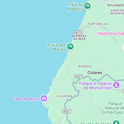
Surf spots nearby
- Praia Pequena (0.5 mi)
- Guincho (5.9 mi)
- Cresmina (6.1 mi)
- Sao Juliao (8.7 mi)
- Limipicos (8.7 mi)
- Foz do Lizandro (9.4 mi)
- Malhadinha (9.5 mi)
- Sao Pedro (10.2 mi)
- Praia do Peixe (10.8 mi)
- Praia do Norte (11 mi)
Not Magic Seaweed (MSW)
Although we look a bit like Magic Seaweed we are not MagicSeaweed as they no longer exist...