Praia do Peixe Surf Report
| Wave height * | 8ft / 2.4m |
|---|---|
| Swell period | 16s |
| Swell direction | |
| Wind | |
| Sea temp | 16°C / 61°F |

10 day Praia do Peixe surf forecast
Sat
20/Dec
8ft
13
22
18
- High 3:04am
- Low 9:15am
- High 3:26pm
- Low 9:19pm
Sun
21/Dec
11.5ft
25
25
24
- High 3:39am
- Low 9:49am
- High 4:02pm
- Low 9:53pm
Mon
22/Dec
10ft
22
20
19
- High 4:14am
- Low 10:26am
- High 4:39pm
- Low 10:30pm
Tue
23/Dec
6ft
17
24
27
- High 4:52am
- Low 11:04am
- High 5:19pm
- Low 11:10pm
Wed
24/Dec
6ft
19
21
24
- High 5:33am
- Low 11:48am
- High 6:03pm
- Low 11:55pm
Thu
25/Dec
6ft
26
21
16
- High 6:20am
- Low 12:37pm
- High 6:55pm
Fri
26/Dec
4ft
12
11
13
- Low 12:48am
- High 7:14am
- Low 1:35pm
- High 7:54pm
Sat
27/Dec
4ft
12
16
14
- Low 1:52am
- High 8:16am
- Low 2:41pm
- High 9:01pm
Sun
28/Dec
3ft
20
31
17
- Low 3:07am
- High 9:25am
- Low 3:50pm
- High 10:09pm
Mon
29/Dec
3ft
13
13
13
- Low 4:22am
Sat 20th Dec
| 3:00 | 9ft | 14.6ft | 17s | 17mph (19mph) | |||
| 6:00 | 8.5ft | 13.6ft | 16s | 13mph (16mph) | |||
| 9:00 | 8ft | 12.5ft | 16s | 16mph (19mph) | |||
| 12:00 | 8ft | 11.7ft | 15s | 22mph (24mph) | |||
| 15:00 | 7.5ft | 11.2ft | 14s | 20mph (22mph) | |||
| 18:00 | 8ft | 11.7ft | 14s | 18mph (20mph) | |||
| 21:00 | 9.5ft | 13.9ft | 14s | 25mph (30mph) |
| Tide times |
|---|
| High 3:04am (3.20m) |
| Low 9:15am (0.94m) |
| High 3:26pm (2.97m) |
| Low 9:19pm (1.03m) |
| Daylight | |
|---|---|
| First light | 07:22 |
| Sunrise | 07:52 |
| Sunset | 17:18 |
| Dark | 17:48 |
Sun 21st Dec
| 3:00 | 11.5ft | 17.1ft | 14s | 28mph (33mph) | |||
| 6:00 | 12ft | 17.7ft | 14s | 25mph (28mph) | |||
| 9:00 | 12ft | 17.5ft | 15s | 24mph (27mph) | |||
| 12:00 | 11.5ft | 17.1ft | 15s | 25mph (29mph) | |||
| 15:00 | 11.5ft | 16.8ft | 15s | 25mph (26mph) | |||
| 18:00 | 11ft | 16.1ft | 15s | 24mph (26mph) | |||
| 21:00 | 10.5ft | 15.6ft | 15s | 21mph (23mph) |
| Tide times |
|---|
| High 3:39am (3.20m) |
| Low 9:49am (0.95m) |
| High 4:02pm (2.95m) |
| Low 9:53pm (1.05m) |
| Daylight | |
|---|---|
| First light | 07:22 |
| Sunrise | 07:52 |
| Sunset | 17:18 |
| Dark | 17:48 |
Mon 22nd Dec
| 3:00 | 10.5ft | 15.1ft | 15s | 19mph (21mph) | |||
| 6:00 | 9.5ft | 15.2ft | 15s | 22mph (23mph) | |||
| 9:00 | 9.5ft | 15.1ft | 16s | 22mph (24mph) | |||
| 12:00 | 10ft | 14.6ft | 15s | 20mph (23mph) | |||
| 15:00 | 8.5ft | 13.7ft | 15s | 21mph (23mph) | |||
| 18:00 | 8ft | 12.9ft | 14s | 19mph (24mph) | |||
| 21:00 | 7.5ft | 12.2ft | 14s | 21mph (24mph) |
| Tide times |
|---|
| High 4:14am (3.18m) |
| Low 10:26am (0.98m) |
| High 4:39pm (2.91m) |
| Low 10:30pm (1.09m) |
| Daylight | |
|---|---|
| First light | 07:23 |
| Sunrise | 07:53 |
| Sunset | 17:19 |
| Dark | 17:49 |
Tue 23rd Dec
| 3:00 | 7.5ft | 10.7ft | 13s | 16mph (16mph) | |||
| 6:00 | 6ft | 9.9ft | 13s | 17mph (19mph) | |||
| 9:00 | 6ft | 9.2ft | 13s | 23mph (25mph) | |||
| 12:00 | 6ft | 9ft | 12s | 24mph (27mph) | |||
| 15:00 | 6.5ft | 9.5ft | 12s | 27mph (29mph) | |||
| 18:00 | 6ft | 9.7ft | 12s | 27mph (31mph) | |||
| 21:00 | 6.5ft | 9.2ft | 11s | 26mph (29mph) |
| Tide times |
|---|
| High 4:52am (3.14m) |
| Low 11:04am (1.02m) |
| High 5:19pm (2.86m) |
| Low 11:10pm (1.14m) |
| Daylight | |
|---|---|
| First light | 07:23 |
| Sunrise | 07:53 |
| Sunset | 17:19 |
| Dark | 17:49 |
Wed 24th Dec
| 3:00 | 6.5ft | 9.3ft | 10s | 19mph (27mph) | |||
| 6:00 | 6.5ft | 9.2ft | 10s | 19mph (24mph) | |||
| 9:00 | 6.5ft | 9.5ft | 11s | 21mph (25mph) | |||
| 12:00 | 6ft | 9.9ft | 14s | 21mph (24mph) | |||
| 15:00 | 6.5ft | 9.9ft | 12s | 24mph (26mph) | |||
| 18:00 | 6.5ft | 10.1ft | 16s | 24mph (27mph) | |||
| 21:00 | 6ft | 9.9ft | 16s | 25mph (26mph) |
| Tide times |
|---|
| High 5:33am (3.09m) |
| Low 11:48am (1.07m) |
| High 6:03pm (2.81m) |
| Low 11:55pm (1.20m) |
| Daylight | |
|---|---|
| First light | 07:24 |
| Sunrise | 07:54 |
| Sunset | 17:20 |
| Dark | 17:50 |
Thu 25th Dec
| 3:00 | 7ft | 10.5ft | 15s | 27mph (27mph) | |||
| 6:00 | 7ft | 10.3ft | 13s | 26mph (30mph) | |||
| 9:00 | 6.5ft | 10ft | 9s | 23mph (25mph) | |||
| 12:00 | 6ft | 9.5ft | 9s | 21mph (23mph) | |||
| 15:00 | 5.5ft | 9ft | 10s | 22mph (24mph) | |||
| 18:00 | 5.5ft | 8.6ft | 10s | 16mph (17mph) | |||
| 21:00 | 4.5ft | 7.9ft | 10s | 13mph (14mph) |
| Tide times |
|---|
| High 6:20am (3.03m) |
| Low 12:37pm (1.12m) |
| High 6:55pm (2.77m) |
| Daylight | |
|---|---|
| First light | 07:24 |
| Sunrise | 07:54 |
| Sunset | 17:21 |
| Dark | 17:50 |
Fri 26th Dec
| 3:00 | 4ft | 6.9ft | 9s | 8mph (11mph) | |||
| 6:00 | 4ft | 7ft | 9s | 12mph (12mph) | |||
| 9:00 | 4ft | 7.2ft | 10s | 6mph (5mph) | |||
| 12:00 | 4ft | 7.1ft | 10s | 11mph (11mph) | |||
| 15:00 | 4ft | 7ft | 10s | 11mph (10mph) | |||
| 18:00 | 3.5ft | 6.8ft | 9s | 13mph (13mph) | |||
| 21:00 | 3ft | 6.2ft | 9s | 10mph (10mph) |
| Tide times |
|---|
| Low 12:48am (1.27m) |
| High 7:14am (2.97m) |
| Low 1:35pm (1.17m) |
| High 7:54pm (2.75m) |
| Daylight | |
|---|---|
| First light | 07:25 |
| Sunrise | 07:54 |
| Sunset | 17:21 |
| Dark | 17:51 |
Sat 27th Dec
| 3:00 | 4ft | 5.4ft | 14s | 12mph (13mph) | |||
| 6:00 | 4ft | 5.4ft | 14s | 12mph (13mph) | |||
| 9:00 | 4ft | 5.4ft | 13s | 14mph (15mph) | |||
| 12:00 | 4ft | 5.5ft | 13s | 16mph (16mph) | |||
| 15:00 | 4ft | 5.6ft | 13s | 19mph (16mph) | |||
| 18:00 | 4ft | 5.6ft | 13s | 14mph (16mph) | |||
| 21:00 | 4ft | 5.5ft | 12s | 16mph (17mph) |
| Tide times |
|---|
| Low 1:52am (1.32m) |
| High 8:16am (2.93m) |
| Low 2:41pm (1.18m) |
| High 9:01pm (2.78m) |
| Daylight | |
|---|---|
| First light | 07:25 |
| Sunrise | 07:55 |
| Sunset | 17:22 |
| Dark | 17:52 |
Sun 28th Dec
| 3:00 | 3.5ft | 5ft | 12s | 25mph (30mph) | |||
| 6:00 | 3.5ft | 4.7ft | 12s | 20mph (28mph) | |||
| 9:00 | 3.5ft | 4.4ft | 12s | 25mph (34mph) | |||
| 12:00 | 3ft | 4.2ft | 12s | 31mph (36mph) | |||
| 15:00 | 3ft | 4ft | 13s | 25mph (28mph) | |||
| 18:00 | 2.5ft | 3.8ft | 12s | 17mph (23mph) | |||
| 21:00 | 3ft | 3.6ft | 13s | 14mph (19mph) |
| Tide times |
|---|
| Low 3:07am (1.31m) |
| High 9:25am (2.91m) |
| Low 3:50pm (1.15m) |
| High 10:09pm (2.87m) |
| Daylight | |
|---|---|
| First light | 07:25 |
| Sunrise | 07:55 |
| Sunset | 17:23 |
| Dark | 17:52 |
Mon 29th Dec
| 3:00 | 3ft | 3.6ft | 13s | 16mph (22mph) | |||
| 6:00 | 3ft | 3.6ft | 12s | 13mph (19mph) | |||
| 9:00 | 3ft | 3.7ft | 12s | 15mph (19mph) | |||
| 12:00 | 3ft | 3.7ft | 13s | 13mph (15mph) | |||
| 15:00 | 3ft | 3.7ft | 13s | 12mph (12mph) | |||
| 18:00 | 3ft | 3.7ft | 12s | 13mph (16mph) | |||
| 21:00 | 3ft | 3.6ft | 12s | 14mph (20mph) |
| Tide times |
|---|
| Low 4:22am (1.22m) |
| Daylight | |
|---|---|
| First light | 07:26 |
| Sunrise | 07:55 |
| Sunset | 17:23 |
| Dark | 17:53 |
Last blast spot when everywhere else in Ericeira is huge. Mediocre waves and low water quality
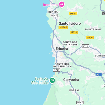
Surf spots nearby
- Praia do Norte (0.3 mi)
- Pedra Branca (1.1 mi)
- Reef (1.3 mi)
- Malhadinha (1.3 mi)
- Foz do Lizandro (1.5 mi)
- Ribeira D'Ilhas (1.7 mi)
- Cave (1.8 mi)
- Limipicos (2.1 mi)
- Sao Juliao (2.2 mi)
- Coxos (2.6 mi)
Not Magic Seaweed (MSW)
Although we look a bit like Magic Seaweed we are not MagicSeaweed as they no longer exist...