Coxos Surf Report
| Wave height * | 4.5ft / 1.3m |
|---|---|
| Swell period | 13s |
| Swell direction | |
| Wind | |
| Sea temp | 15°C / 59°F |

10 day Coxos surf forecast
Thu
1/Jan
5.5ft
21
28
28
- High 12:11am
- Low 6:31am
- High 12:45pm
- Low 6:51pm
Fri
2/Jan
7.5ft
28
28
29
- High 1:10am
- Low 7:26am
- High 1:41pm
- Low 7:42pm
Sat
3/Jan
8ft
24
25
24
- High 2:01am
- Low 8:17am
- High 2:32pm
- Low 8:30pm
Sun
4/Jan
6.5ft
26
22
21
- High 2:49am
- Low 9:05am
- High 3:20pm
- Low 9:15pm
Mon
5/Jan
7ft
27
19
25
- High 3:35am
- Low 9:52am
- High 4:06pm
- Low 10:00pm
Tue
6/Jan
5ft
21
23
24
- High 4:21am
- Low 10:37am
- High 4:51pm
- Low 10:43pm
Wed
7/Jan
4.5ft
25
26
18
- High 5:05am
- Low 11:22am
- High 5:35pm
- Low 11:27pm
Thu
8/Jan
4ft
10
7
12
- High 5:50am
- Low 12:07pm
- High 6:20pm
Fri
9/Jan
3.5ft
10
10
15
- Low 12:13am
- High 6:37am
- Low 12:54pm
- High 7:09pm
Sat
10/Jan
7ft
10
24
27
- Low 1:03am
- High 7:27am
Thu 1st Jan
| 3:00 | 3.5ft | 3.7ft | 12s | 17mph (25mph) | |||
| 6:00 | 3.5ft | 4ft | 12s | 21mph (28mph) | |||
| 9:00 | 4.5ft | 4.9ft | 13s | 26mph (34mph) | |||
| 12:00 | 5.5ft | 6ft | 9s | 28mph (37mph) | |||
| 15:00 | 5.5ft | 6.4ft | 8s | 27mph (39mph) | |||
| 18:00 | 6.5ft | 7.1ft | 9s | 28mph (40mph) | |||
| 21:00 | 4.5ft | 8.7ft | 7s | 30mph (43mph) |
| Tide times |
|---|
| High 12:11am (3.18m) |
| Low 6:31am (0.90m) |
| High 12:45pm (3.12m) |
| Low 6:51pm (0.88m) |
| Daylight | |
|---|---|
| First light | 07:26 |
| Sunrise | 07:56 |
| Sunset | 17:26 |
| Dark | 17:55 |
Fri 2nd Jan
| 3:00 | 9.5ft | 13.1ft | 11s | 35mph (47mph) | |||
| 6:00 | 10ft | 13.5ft | 11s | 28mph (42mph) | |||
| 9:00 | 9ft | 12.8ft | 10s | 29mph (37mph) | |||
| 12:00 | 7.5ft | 11.4ft | 10s | 28mph (40mph) | |||
| 15:00 | 7.5ft | 11.5ft | 10s | 31mph (43mph) | |||
| 18:00 | 6.5ft | 11.6ft | 9s | 29mph (44mph) | |||
| 21:00 | 6ft | 11.6ft | 9s | 35mph (49mph) |
| Tide times |
|---|
| High 1:10am (3.35m) |
| Low 7:26am (0.72m) |
| High 1:41pm (3.22m) |
| Low 7:42pm (0.79m) |
| Daylight | |
|---|---|
| First light | 07:26 |
| Sunrise | 07:56 |
| Sunset | 17:26 |
| Dark | 17:56 |
Sat 3rd Jan
| 3:00 | 5.5ft | 10.6ft | 9s | 27mph (38mph) | |||
| 6:00 | 6.5ft | 10.6ft | 10s | 24mph (33mph) | |||
| 9:00 | 7ft | 11.6ft | 10s | 25mph (34mph) | |||
| 12:00 | 8ft | 11.3ft | 11s | 25mph (34mph) | |||
| 15:00 | 7ft | 10.3ft | 10s | 19mph (27mph) | |||
| 18:00 | 6.5ft | 9.3ft | 10s | 24mph (29mph) | |||
| 21:00 | 4.5ft | 8.5ft | 9s | 23mph (29mph) |
| Tide times |
|---|
| High 2:01am (3.49m) |
| Low 8:17am (0.60m) |
| High 2:32pm (3.29m) |
| Low 8:30pm (0.73m) |
| Daylight | |
|---|---|
| First light | 07:27 |
| Sunrise | 07:56 |
| Sunset | 17:27 |
| Dark | 17:57 |
Sun 4th Jan
| 3:00 | 4.5ft | 7.3ft | 9s | 27mph (34mph) | |||
| 6:00 | 5.5ft | 6.8ft | 9s | 26mph (31mph) | |||
| 9:00 | 5.5ft | 6.9ft | 10s | 22mph (29mph) | |||
| 12:00 | 6.5ft | 7.2ft | 10s | 22mph (28mph) | |||
| 15:00 | 4.5ft | 7ft | 9s | 20mph (24mph) | |||
| 18:00 | 6ft | 7ft | 9s | 21mph (24mph) | |||
| 21:00 | 5ft | 7.3ft | 10s | 21mph (23mph) |
| Tide times |
|---|
| High 2:49am (3.59m) |
| Low 9:05am (0.54m) |
| High 3:20pm (3.30m) |
| Low 9:15pm (0.72m) |
| Daylight | |
|---|---|
| First light | 07:27 |
| Sunrise | 07:56 |
| Sunset | 17:28 |
| Dark | 17:58 |
Mon 5th Jan
| 3:00 | 6.5ft | 9.1ft | 11s | 26mph (29mph) | |||
| 6:00 | 7ft | 10.3ft | 11s | 27mph (26mph) | |||
| 9:00 | 7ft | 10.9ft | 10s | 19mph (18mph) | |||
| 12:00 | 7ft | 11ft | 10s | 19mph (21mph) | |||
| 15:00 | 7ft | 10.9ft | 10s | 21mph (23mph) | |||
| 18:00 | 7ft | 10.6ft | 10s | 25mph (25mph) | |||
| 21:00 | 6.5ft | 10.3ft | 10s | 27mph (30mph) |
| Tide times |
|---|
| High 3:35am (3.61m) |
| Low 9:52am (0.56m) |
| High 4:06pm (3.26m) |
| Low 10:00pm (0.76m) |
| Daylight | |
|---|---|
| First light | 07:27 |
| Sunrise | 07:56 |
| Sunset | 17:29 |
| Dark | 17:59 |
Tue 6th Jan
| 3:00 | 6.5ft | 9.2ft | 10s | 19mph (24mph) | |||
| 6:00 | 5.5ft | 8.8ft | 10s | 21mph (28mph) | |||
| 9:00 | 5.5ft | 8.2ft | 9s | 18mph (23mph) | |||
| 12:00 | 5ft | 7.4ft | 8s | 23mph (25mph) | |||
| 15:00 | 4.5ft | 7.2ft | 8s | 22mph (25mph) | |||
| 18:00 | 4.5ft | 7.1ft | 8s | 24mph (32mph) | |||
| 21:00 | 4.5ft | 6.6ft | 7s | 21mph (28mph) |
| Tide times |
|---|
| High 4:21am (3.56m) |
| Low 10:37am (0.64m) |
| High 4:51pm (3.17m) |
| Low 10:43pm (0.86m) |
| Daylight | |
|---|---|
| First light | 07:27 |
| Sunrise | 07:56 |
| Sunset | 17:30 |
| Dark | 17:59 |
Wed 7th Jan
| 3:00 | 3.5ft | 5.6ft | 7s | 25mph (29mph) | |||
| 6:00 | 3.5ft | 5.1ft | 8s | 25mph (31mph) | |||
| 9:00 | 4ft | 5.5ft | 8s | 27mph (33mph) | |||
| 12:00 | 4.5ft | 6.3ft | 8s | 26mph (32mph) | |||
| 15:00 | 4.5ft | 6.6ft | 8s | 24mph (28mph) | |||
| 18:00 | 4.5ft | 6.6ft | 8s | 18mph (20mph) | |||
| 21:00 | 4.5ft | 6.3ft | 8s | 14mph (17mph) |
| Tide times |
|---|
| High 5:05am (3.45m) |
| Low 11:22am (0.78m) |
| High 5:35pm (3.05m) |
| Low 11:27pm (0.99m) |
| Daylight | |
|---|---|
| First light | 07:27 |
| Sunrise | 07:56 |
| Sunset | 17:31 |
| Dark | 18:00 |
Thu 8th Jan
| 3:00 | 4ft | 5.6ft | 8s | 14mph (18mph) | |||
| 6:00 | 3.5ft | 5.3ft | 8s | 10mph (13mph) | |||
| 9:00 | 4.5ft | 5.1ft | 11s | 11mph (13mph) | |||
| 12:00 | 4ft | 4.8ft | 11s | 7mph (8mph) | |||
| 15:00 | 3.5ft | 4.6ft | 10s | 9mph (10mph) | |||
| 18:00 | 4ft | 4.4ft | 10s | 12mph (13mph) | |||
| 21:00 | 3.5ft | 4.2ft | 10s | 10mph (13mph) |
| Tide times |
|---|
| High 5:50am (3.28m) |
| Low 12:07pm (0.95m) |
| High 6:20pm (2.91m) |
| Daylight | |
|---|---|
| First light | 07:27 |
| Sunrise | 07:56 |
| Sunset | 17:32 |
| Dark | 18:01 |
Fri 9th Jan
| 3:00 | 3.5ft | 4ft | 12s | 9mph (13mph) | |||
| 6:00 | 3.5ft | 4ft | 13s | 10mph (13mph) | |||
| 9:00 | 3.5ft | 4ft | 12s | 11mph (14mph) | |||
| 12:00 | 3.5ft | 4.1ft | 12s | 10mph (14mph) | |||
| 15:00 | 3.5ft | 4.2ft | 12s | 16mph (16mph) | |||
| 18:00 | 4ft | 4.5ft | 12s | 15mph (16mph) | |||
| 21:00 | 4ft | 5.2ft | 14s | 12mph (13mph) |
| Tide times |
|---|
| Low 12:13am (1.15m) |
| High 6:37am (3.09m) |
| Low 12:54pm (1.13m) |
| High 7:09pm (2.77m) |
| Daylight | |
|---|---|
| First light | 07:26 |
| Sunrise | 07:56 |
| Sunset | 17:33 |
| Dark | 18:02 |
Sat 10th Jan
| 3:00 | 5.5ft | 7ft | 12s | 11mph (12mph) | |||
| 6:00 | 6ft | 7.6ft | 12s | 10mph (15mph) | |||
| 9:00 | 7ft | 7.9ft | 11s | 18mph (22mph) | |||
| 12:00 | 7ft | 8.1ft | 11s | 24mph (32mph) | |||
| 15:00 | 5.5ft | 8.2ft | 12s | 29mph (34mph) | |||
| 18:00 | 6ft | 8.7ft | 14s | 27mph (31mph) | |||
| 21:00 | 6.5ft | 9.1ft | 14s | 24mph (28mph) |
| Tide times |
|---|
| Low 1:03am (1.31m) |
| High 7:27am (2.89m) |
| Daylight | |
|---|---|
| First light | 07:26 |
| Sunrise | 07:56 |
| Sunset | 17:34 |
| Dark | 18:03 |
One of the best right-handers in Europe. A heavy, powerful, hollow reef/point break that hold up to a triple head high swell
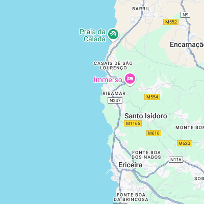
Surf spots nearby
- Cave (0.7 mi)
- Sao Lourenco (0.8 mi)
- Ribeira D'Ilhas (0.9 mi)
- Reef (1.2 mi)
- Pedra Branca (1.5 mi)
- Praia do Norte (2.3 mi)
- Praia do Peixe (2.6 mi)
- Malhadinha (3.9 mi)
- Foz do Lizandro (4 mi)
- Limipicos (4.7 mi)
Not Magic Seaweed (MSW)
Although we look a bit like Magic Seaweed we are not MagicSeaweed as they no longer exist...