Tonel Surf Report
| Wave height * | 3.5ft / 1m |
|---|---|
| Swell period | 11s |
| Swell direction | |
| Wind | |
| Sea temp | 16°C / 61°F |

10 day Tonel surf forecast
Sun
28/Dec
5ft
27
27
18
- Low 2:49am
- High 9:10am
- Low 3:32pm
- High 9:55pm
Mon
29/Dec
3ft
9
4
4
- Low 4:04am
- High 10:22am
- Low 4:39pm
- High 11:00pm
Tue
30/Dec
3ft
3
7
4
- Low 5:13am
- High 11:29am
- Low 5:39pm
- High 11:56pm
Wed
31/Dec
3ft
11
16
16
- Low 6:15am
- High 12:30pm
- Low 6:35pm
Thu
1/Jan
4ft
16
20
25
- High 12:54am
- Low 7:11am
- High 1:25pm
- Low 7:26pm
Fri
2/Jan
9ft
38
33
27
- High 1:44am
- Low 8:02am
- High 2:15pm
- Low 8:15pm
Sat
3/Jan
6.5ft
18
14
14
- High 2:32am
- Low 8:50am
- High 3:03pm
- Low 9:00pm
Sun
4/Jan
7.5ft
19
25
14
- High 3:18am
- Low 9:37am
- High 3:48pm
- Low 9:44pm
Mon
5/Jan
5ft
22
18
17
- High 4:03am
- Low 10:22am
- High 4:33pm
- Low 10:28pm
Tue
6/Jan
3.5ft
14
16
12
- High 4:48am
- Low 11:06am
- High 5:17pm
Sun 28th Dec
| 3:00 | 7.5ft | 8.7ft | 9s | 30mph (30mph) | |||
| 6:00 | 6.5ft | 8ft | 10s | 27mph (27mph) | |||
| 9:00 | 6ft | 7.2ft | 10s | 31mph (32mph) | |||
| 12:00 | 5ft | 6.6ft | 11s | 27mph (31mph) | |||
| 15:00 | 5ft | 6.2ft | 12s | 21mph (25mph) | |||
| 18:00 | 4.5ft | 5.5ft | 12s | 18mph (21mph) | |||
| 21:00 | 4ft | 4.9ft | 11s | 13mph (16mph) |
| Tide times |
|---|
| Low 2:49am (1.23m) |
| High 9:10am (2.83m) |
| Low 3:32pm (1.08m) |
| High 9:55pm (2.80m) |
| Daylight | |
|---|---|
| First light | 07:19 |
| Sunrise | 07:48 |
| Sunset | 17:27 |
| Dark | 17:56 |
Mon 29th Dec
| 3:00 | 3.5ft | 4.2ft | 11s | 7mph (7mph) | |||
| 6:00 | 3ft | 4.1ft | 10s | 9mph (9mph) | |||
| 9:00 | 3ft | 3.8ft | 11s | 7mph (6mph) | |||
| 12:00 | 3ft | 3.5ft | 13s | 4mph (3mph) | |||
| 15:00 | 3ft | 3.3ft | 14s | 6mph (6mph) | |||
| 18:00 | 2.5ft | 3.1ft | 14s | 4mph (4mph) | |||
| 21:00 | 2.5ft | 3ft | 14s | 3mph (4mph) |
| Tide times |
|---|
| Low 4:04am (1.14m) |
| High 10:22am (2.88m) |
| Low 4:39pm (1.00m) |
| High 11:00pm (2.94m) |
| Daylight | |
|---|---|
| First light | 07:19 |
| Sunrise | 07:48 |
| Sunset | 17:28 |
| Dark | 17:57 |
Tue 30th Dec
| 3:00 | 2.5ft | 2.9ft | 13s | 3mph (2mph) | |||
| 6:00 | 2.5ft | 2.9ft | 16s | 3mph (3mph) | |||
| 9:00 | 2.5ft | 3.1ft | 17s | 5mph (4mph) | |||
| 12:00 | 3ft | 3.4ft | 16s | 7mph (6mph) | |||
| 15:00 | 3ft | 3.5ft | 16s | 3mph (3mph) | |||
| 18:00 | 3ft | 3.7ft | 16s | 4mph (4mph) | |||
| 21:00 | 3.5ft | 3.9ft | 15s | 5mph (5mph) |
| Tide times |
|---|
| Low 5:13am (0.99m) |
| High 11:29am (2.97m) |
| Low 5:39pm (0.90m) |
| High 11:56pm (3.11m) |
| Daylight | |
|---|---|
| First light | 07:20 |
| Sunrise | 07:48 |
| Sunset | 17:28 |
| Dark | 17:57 |
Wed 31st Dec
| 3:00 | 3ft | 3.8ft | 14s | 9mph (8mph) | |||
| 6:00 | 3ft | 3.7ft | 14s | 11mph (11mph) | |||
| 9:00 | 3ft | 3.7ft | 13s | 15mph (15mph) | |||
| 12:00 | 3ft | 3.8ft | 13s | 16mph (17mph) | |||
| 15:00 | 3ft | 3.7ft | 13s | 14mph (15mph) | |||
| 18:00 | 3ft | 3.7ft | 13s | 16mph (18mph) | |||
| 21:00 | 3.5ft | 3.9ft | 12s | 20mph (23mph) |
| Tide times |
|---|
| Low 6:15am (0.82m) |
| High 12:30pm (3.06m) |
| Low 6:35pm (0.82m) |
| Daylight | |
|---|---|
| First light | 07:20 |
| Sunrise | 07:49 |
| Sunset | 17:29 |
| Dark | 17:58 |
Thu 1st Jan
| 3:00 | 4ft | 4.5ft | 12s | 18mph (23mph) | |||
| 6:00 | 3.5ft | 4.2ft | 12s | 16mph (23mph) | |||
| 9:00 | 3.5ft | 4ft | 14s | 21mph (27mph) | |||
| 12:00 | 4ft | 4.5ft | 14s | 20mph (30mph) | |||
| 15:00 | 4.5ft | 5.3ft | 11s | 22mph (32mph) | |||
| 18:00 | 5.5ft | 6.1ft | 10s | 25mph (34mph) | |||
| 21:00 | 7.5ft | 8.1ft | 11s | 26mph (37mph) |
| Tide times |
|---|
| High 12:54am (3.28m) |
| Low 7:11am (0.65m) |
| High 1:25pm (3.16m) |
| Low 7:26pm (0.72m) |
| Daylight | |
|---|---|
| First light | 07:20 |
| Sunrise | 07:49 |
| Sunset | 17:30 |
| Dark | 17:59 |
Fri 2nd Jan
| 3:00 | 10ft | 10.7ft | 11s | 36mph (49mph) | |||
| 6:00 | 10.5ft | 11.9ft | 11s | 38mph (50mph) | |||
| 9:00 | 10ft | 11.8ft | 10s | 37mph (46mph) | |||
| 12:00 | 9ft | 11.5ft | 10s | 33mph (43mph) | |||
| 15:00 | 9.5ft | 11.9ft | 10s | 31mph (40mph) | |||
| 18:00 | 9ft | 12.2ft | 9s | 27mph (35mph) | |||
| 21:00 | 7.5ft | 11.1ft | 9s | 20mph (24mph) |
| Tide times |
|---|
| High 1:44am (3.43m) |
| Low 8:02am (0.53m) |
| High 2:15pm (3.23m) |
| Low 8:15pm (0.66m) |
| Daylight | |
|---|---|
| First light | 07:20 |
| Sunrise | 07:49 |
| Sunset | 17:31 |
| Dark | 18:00 |
Sat 3rd Jan
| 3:00 | 6.5ft | 10ft | 9s | 21mph (27mph) | |||
| 6:00 | 7ft | 9.7ft | 9s | 18mph (21mph) | |||
| 9:00 | 7ft | 9.7ft | 10s | 13mph (17mph) | |||
| 12:00 | 6.5ft | 9.6ft | 8s | 14mph (20mph) | |||
| 15:00 | 7.5ft | 9.7ft | 8s | 14mph (19mph) | |||
| 18:00 | 9ft | 9.8ft | 10s | 14mph (18mph) | |||
| 21:00 | 8.5ft | 10.1ft | 11s | 16mph (20mph) |
| Tide times |
|---|
| High 2:32am (3.52m) |
| Low 8:50am (0.47m) |
| High 3:03pm (3.24m) |
| Low 9:00pm (0.65m) |
| Daylight | |
|---|---|
| First light | 07:20 |
| Sunrise | 07:49 |
| Sunset | 17:32 |
| Dark | 18:00 |
Sun 4th Jan
| 3:00 | 9ft | 10.5ft | 11s | 16mph (22mph) | |||
| 6:00 | 9ft | 10.4ft | 11s | 19mph (23mph) | |||
| 9:00 | 8.5ft | 9.9ft | 11s | 22mph (27mph) | |||
| 12:00 | 7.5ft | 9.1ft | 11s | 25mph (31mph) | |||
| 15:00 | 7ft | 8.4ft | 10s | 19mph (23mph) | |||
| 18:00 | 7ft | 7.9ft | 10s | 14mph (17mph) | |||
| 21:00 | 5.5ft | 7.9ft | 10s | 8mph (9mph) |
| Tide times |
|---|
| High 3:18am (3.54m) |
| Low 9:37am (0.48m) |
| High 3:48pm (3.20m) |
| Low 9:44pm (0.69m) |
| Daylight | |
|---|---|
| First light | 07:20 |
| Sunrise | 07:49 |
| Sunset | 17:33 |
| Dark | 18:01 |
Mon 5th Jan
| 3:00 | 5.5ft | 9.1ft | 12s | 16mph (19mph) | |||
| 6:00 | 5.5ft | 8.6ft | 11s | 22mph (22mph) | |||
| 9:00 | 5.5ft | 8.4ft | 11s | 25mph (26mph) | |||
| 12:00 | 5ft | 8.2ft | 11s | 18mph (20mph) | |||
| 15:00 | 5ft | 8.4ft | 11s | 14mph (15mph) | |||
| 18:00 | 5ft | 8.4ft | 12s | 17mph (18mph) | |||
| 21:00 | 4.5ft | 8.1ft | 12s | 19mph (20mph) |
| Tide times |
|---|
| High 4:03am (3.49m) |
| Low 10:22am (0.57m) |
| High 4:33pm (3.11m) |
| Low 10:28pm (0.78m) |
| Daylight | |
|---|---|
| First light | 07:20 |
| Sunrise | 07:49 |
| Sunset | 17:33 |
| Dark | 18:02 |
Tue 6th Jan
| 3:00 | 4ft | 7.1ft | 12s | 18mph (18mph) | |||
| 6:00 | 4ft | 6.7ft | 11s | 14mph (17mph) | |||
| 9:00 | 3.5ft | 6.3ft | 11s | 14mph (16mph) | |||
| 12:00 | 3.5ft | 5.8ft | 10s | 16mph (18mph) | |||
| 15:00 | 3ft | 5.3ft | 10s | 13mph (17mph) | |||
| 18:00 | 3ft | 4.9ft | 10s | 12mph (12mph) | |||
| 21:00 | 2.5ft | 4.5ft | 10s | 13mph (15mph) |
| Tide times |
|---|
| High 4:48am (3.37m) |
| Low 11:06am (0.71m) |
| High 5:17pm (2.98m) |
| Daylight | |
|---|---|
| First light | 07:20 |
| Sunrise | 07:49 |
| Sunset | 17:34 |
| Dark | 18:03 |
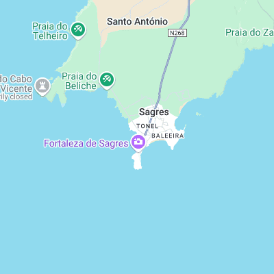
Picks up more swell than any of the other south coast spots but is fairly average overall. Gets busy in the summer due to its proximity to the town
Surf spots nearby
- Mareta (0.5 mi)
- Martinhal (1.5 mi)
- Beliche (1.6 mi)
- Ponta Ruiva (4.5 mi)
- Zavial (5 mi)
- Castelejo (6.5 mi)
- Cordoama (6.8 mi)
- Salema (7.9 mi)
- Praia do Amado (11.3 mi)
- Luz (13.5 mi)
Not Magic Seaweed (MSW)
Although we look a bit like Magic Seaweed we are not MagicSeaweed as they no longer exist...