Crantock Surf Report
| Wave height * | 3ft / 0.9m |
|---|---|
| Swell period | 12s |
| Swell direction | |
| Wind | |
| Sea temp | 11°C / 53°F |

10 day Crantock surf forecast
Tue
23/Dec
2.5ft
13
12
19
- Low 1:20am
- High 7:02am
- Low 1:45pm
- High 7:21pm
Wed
24/Dec
4ft
16
16
17
- Low 1:58am
- High 7:41am
- Low 2:25pm
- High 8:02pm
Thu
25/Dec
1.5ft
27
23
19
- Low 2:39am
- High 8:24am
- Low 3:09pm
- High 8:48pm
Fri
26/Dec
2.5ft
13
13
15
- Low 3:25am
- High 9:13am
- Low 3:59pm
- High 9:41pm
Sat
27/Dec
2.5ft
13
10
9
- Low 4:21am
- High 10:10am
- Low 4:59pm
- High 10:44pm
Sun
28/Dec
2ft
7
10
12
- Low 5:28am
- High 11:17am
- Low 6:07pm
- High 11:55pm
Mon
29/Dec
1.5ft
5
5
11
- Low 6:40am
- High 12:30pm
- Low 7:17pm
Tue
30/Dec
2.5ft
10
14
14
- High 1:08am
- Low 7:52am
- High 1:41pm
- Low 8:24pm
Wed
31/Dec
2ft
16
18
18
- High 2:16am
- Low 8:58am
- High 2:47pm
- Low 9:25pm
Thu
1/Jan
6.5ft
17
21
25
- High 3:15am
- Low 9:59am
- High 3:43pm
Tue 23rd Dec
| 3:00 | 3.5ft | 5.2ft | 10s | 17mph (25mph) | |||
| 6:00 | 3ft | 4.7ft | 10s | 13mph (24mph) | |||
| 9:00 | 2.5ft | 4.2ft | 10s | 11mph (21mph) | |||
| 12:00 | 2.5ft | 3.8ft | 10s | 12mph (22mph) | |||
| 15:00 | 2.5ft | 3.9ft | 9s | 13mph (17mph) | |||
| 18:00 | 3ft | 4.4ft | 12s | 19mph (26mph) | |||
| 21:00 | 3.5ft | 4.8ft | 11s | 16mph (22mph) |
| Tide times |
|---|
| Low 1:20am (1.44m) |
| High 7:02am (5.18m) |
| Low 1:45pm (1.38m) |
| High 7:21pm (4.85m) |
| Daylight | |
|---|---|
| First light | 07:40 |
| Sunrise | 08:19 |
| Sunset | 16:20 |
| Dark | 16:58 |
Wed 24th Dec
| 3:00 | 3.5ft | 5.2ft | 12s | 15mph (23mph) | |||
| 6:00 | 4ft | 5.4ft | 11s | 16mph (24mph) | |||
| 9:00 | 4ft | 5.4ft | 12s | 16mph (25mph) | |||
| 12:00 | 4ft | 5.4ft | 12s | 16mph (27mph) | |||
| 15:00 | 3.5ft | 5.2ft | 12s | 14mph (24mph) | |||
| 18:00 | 3.5ft | 5.1ft | 12s | 17mph (28mph) | |||
| 21:00 | 3.5ft | 5.3ft | 12s | 19mph (35mph) |
| Tide times |
|---|
| Low 1:58am (1.52m) |
| High 7:41am (5.10m) |
| Low 2:25pm (1.46m) |
| High 8:02pm (4.76m) |
| Daylight | |
|---|---|
| First light | 07:40 |
| Sunrise | 08:19 |
| Sunset | 16:20 |
| Dark | 16:59 |
Thu 25th Dec
| 3:00 | 4ft | 5.6ft | 10s | 24mph (40mph) | |||
| 6:00 | 4ft | 5.9ft | 8s | 27mph (44mph) | |||
| 9:00 | 1.5ft | 6.6ft | 7s | 25mph (41mph) | |||
| 12:00 | 1.5ft | 6.8ft | 7s | 23mph (34mph) | |||
| 15:00 | 1.5ft | 6.2ft | 7s | 21mph (30mph) | |||
| 18:00 | 2ft | 5.9ft | 7s | 19mph (30mph) | |||
| 21:00 | 1.5ft | 5.5ft | 7s | 18mph (28mph) |
| Tide times |
|---|
| Low 2:39am (1.61m) |
| High 8:24am (5.00m) |
| Low 3:09pm (1.55m) |
| High 8:48pm (4.67m) |
| Daylight | |
|---|---|
| First light | 07:41 |
| Sunrise | 08:19 |
| Sunset | 16:21 |
| Dark | 17:00 |
Fri 26th Dec
| 3:00 | 3ft | 4.6ft | 9s | 15mph (25mph) | |||
| 6:00 | 2.5ft | 4.3ft | 9s | 13mph (21mph) | |||
| 9:00 | 2.5ft | 3.9ft | 8s | 12mph (22mph) | |||
| 12:00 | 2.5ft | 3.6ft | 8s | 13mph (22mph) | |||
| 15:00 | 2.5ft | 3.8ft | 9s | 13mph (23mph) | |||
| 18:00 | 1.5ft | 4.7ft | 6s | 15mph (28mph) | |||
| 21:00 | 2ft | 5.2ft | 6s | 17mph (33mph) |
| Tide times |
|---|
| Low 3:25am (1.71m) |
| High 9:13am (4.91m) |
| Low 3:59pm (1.63m) |
| High 9:41pm (4.60m) |
| Daylight | |
|---|---|
| First light | 07:41 |
| Sunrise | 08:20 |
| Sunset | 16:22 |
| Dark | 17:00 |
Sat 27th Dec
| 3:00 | 3ft | 4.9ft | 9s | 16mph (30mph) | |||
| 6:00 | 3ft | 4.7ft | 10s | 13mph (30mph) | |||
| 9:00 | 2.5ft | 4.4ft | 10s | 11mph (23mph) | |||
| 12:00 | 2.5ft | 4ft | 12s | 10mph (17mph) | |||
| 15:00 | 2.5ft | 3.9ft | 13s | 8mph (13mph) | |||
| 18:00 | 2.5ft | 3.9ft | 12s | 9mph (15mph) | |||
| 21:00 | 2.5ft | 4ft | 12s | 9mph (16mph) |
| Tide times |
|---|
| Low 4:21am (1.79m) |
| High 10:10am (4.82m) |
| Low 4:59pm (1.70m) |
| High 10:44pm (4.57m) |
| Daylight | |
|---|---|
| First light | 07:41 |
| Sunrise | 08:20 |
| Sunset | 16:22 |
| Dark | 17:01 |
Sun 28th Dec
| 3:00 | 2.5ft | 3.7ft | 11s | 7mph (10mph) | |||
| 6:00 | 2ft | 3.5ft | 11s | 7mph (9mph) | |||
| 9:00 | 2.5ft | 3.5ft | 10s | 10mph (13mph) | |||
| 12:00 | 2ft | 3.5ft | 10s | 10mph (13mph) | |||
| 15:00 | 2ft | 3.3ft | 14s | 11mph (15mph) | |||
| 18:00 | 2ft | 3.3ft | 14s | 12mph (19mph) | |||
| 21:00 | 2ft | 3.2ft | 13s | 11mph (18mph) |
| Tide times |
|---|
| Low 5:28am (1.83m) |
| High 11:17am (4.77m) |
| Low 6:07pm (1.70m) |
| High 11:55pm (4.61m) |
| Daylight | |
|---|---|
| First light | 07:41 |
| Sunrise | 08:20 |
| Sunset | 16:23 |
| Dark | 17:02 |
Mon 29th Dec
| 3:00 | 2ft | 2.8ft | 12s | 2mph (2mph) | |||
| 6:00 | 1.5ft | 2.5ft | 14s | 5mph (6mph) | |||
| 9:00 | 1.5ft | 2.3ft | 13s | 7mph (8mph) | |||
| 12:00 | 1.5ft | 2.2ft | 13s | 5mph (6mph) | |||
| 15:00 | 1.5ft | 2.2ft | 13s | 7mph (9mph) | |||
| 18:00 | 1.5ft | 2.4ft | 13s | 11mph (14mph) | |||
| 21:00 | 1.5ft | 2.9ft | 13s | 13mph (17mph) |
| Tide times |
|---|
| Low 6:40am (1.76m) |
| High 12:30pm (4.79m) |
| Low 7:17pm (1.62m) |
| Daylight | |
|---|---|
| First light | 07:42 |
| Sunrise | 08:20 |
| Sunset | 16:24 |
| Dark | 17:03 |
Tue 30th Dec
| 3:00 | 2ft | 3.2ft | 16s | 10mph (15mph) | |||
| 6:00 | 2ft | 3.4ft | 18s | 10mph (15mph) | |||
| 9:00 | 2.5ft | 3.6ft | 18s | 13mph (24mph) | |||
| 12:00 | 2.5ft | 3.6ft | 16s | 14mph (20mph) | |||
| 15:00 | 2ft | 3.5ft | 16s | 14mph (20mph) | |||
| 18:00 | 2ft | 3.5ft | 15s | 14mph (19mph) | |||
| 21:00 | 2ft | 3.3ft | 15s | 15mph (20mph) |
| Tide times |
|---|
| High 1:08am (4.75m) |
| Low 7:52am (1.60m) |
| High 1:41pm (4.91m) |
| Low 8:24pm (1.46m) |
| Daylight | |
|---|---|
| First light | 07:42 |
| Sunrise | 08:20 |
| Sunset | 16:25 |
| Dark | 17:04 |
Wed 31st Dec
| 3:00 | 2ft | 2.9ft | 14s | 17mph (23mph) | |||
| 6:00 | 1.5ft | 2.7ft | 13s | 16mph (23mph) | |||
| 9:00 | 1.5ft | 2.5ft | 13s | 18mph (22mph) | |||
| 12:00 | 2ft | 2.8ft | 13s | 18mph (19mph) | |||
| 15:00 | 2ft | 3ft | 12s | 15mph (18mph) | |||
| 18:00 | 2ft | 3ft | 12s | 18mph (21mph) | |||
| 21:00 | 2ft | 3.5ft | 12s | 19mph (21mph) |
| Tide times |
|---|
| High 2:16am (4.94m) |
| Low 8:58am (1.42m) |
| High 2:47pm (5.04m) |
| Low 9:25pm (1.31m) |
| Daylight | |
|---|---|
| First light | 07:42 |
| Sunrise | 08:20 |
| Sunset | 16:26 |
| Dark | 17:04 |
Thu 1st Jan
| 3:00 | 4.5ft | 5.3ft | 5s | 15mph (21mph) | |||
| 6:00 | 5.5ft | 6.4ft | 6s | 17mph (21mph) | |||
| 9:00 | 6.5ft | 7.2ft | 6s | 19mph (24mph) | |||
| 12:00 | 6.5ft | 7.4ft | 7s | 21mph (24mph) | |||
| 15:00 | 6ft | 7.1ft | 7s | 23mph (26mph) | |||
| 18:00 | 6ft | 7.5ft | 7s | 25mph (30mph) | |||
| 21:00 | 6.5ft | 7.5ft | 7s | 22mph (27mph) |
| Tide times |
|---|
| High 3:15am (5.22m) |
| Low 9:59am (1.16m) |
| High 3:43pm (5.24m) |
| Daylight | |
|---|---|
| First light | 07:42 |
| Sunrise | 08:20 |
| Sunset | 16:27 |
| Dark | 17:05 |
Nearest buoys
Located just across the river Gannel from Newquay Crantock can be a good get away spot in the summer. Reasonably sheltered from westerly winds there can be a long left under the cliffs and a sucky right off the rivermouth
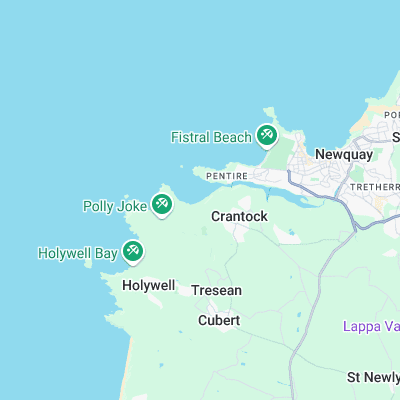
Surf spots nearby
- South Fistral (1.1 mi)
- Fistral (1.3 mi)
- Holywell Bay (1.4 mi)
- Little Fistral (1.7 mi)
- The Cribber (1.7 mi)
- Towan (1.9 mi)
- Great Western (2.1 mi)
- Tolcarne, The Wedge (2.4 mi)
- Penhale (2.6 mi)
- Lusty Glaze (2.9 mi)
Not Magic Seaweed (MSW)
Although we look a bit like Magic Seaweed we are not MagicSeaweed as they no longer exist...