Fistral Surf Report
| Wave height * | 11.5ft / 3.6m |
|---|---|
| Swell period | 14s |
| Swell direction | |
| Wind | |
| Sea temp | 10°C / 49°F |

10 day Fistral surf forecast
Wed
11/Feb
11.5ft
26
20
7
- Low 5:15am
- High 11:12am
- Low 5:57pm
Thu
12/Feb
13ft
31
25
24
- High 12:11am
- Low 6:47am
- High 12:58pm
- Low 7:31pm
Fri
13/Feb
7.5ft
11
4
33
- High 1:40am
- Low 8:17am
- High 2:14pm
- Low 8:46pm
Sat
14/Feb
4.5ft
14
4
14
- High 2:40am
- Low 9:19am
- High 3:05pm
- Low 9:39pm
Sun
15/Feb
7.5ft
22
17
16
- High 3:25am
- Low 10:05am
- High 3:45pm
- Low 10:21pm
Mon
16/Feb
8ft
27
23
19
- High 4:02am
- Low 10:44am
- High 4:21pm
- Low 10:59pm
Tue
17/Feb
8ft
3
11
25
- High 4:37am
- Low 11:20am
- High 4:56pm
- Low 11:35pm
Wed
18/Feb
5.5ft
22
17
29
- High 5:11am
- Low 11:56am
- High 5:29pm
Thu
19/Feb
10.5ft
32
35
33
- Low 12:10am
- High 5:46am
- Low 12:31pm
- High 6:04pm
Fri
20/Feb
8ft
21
11
22
- Low 12:46am
- High 6:21am
- Low 1:07pm
- High 6:38pm
Wed 11th Feb
| 3:00 | 9.5ft | 11.5ft | 14s | 26mph (38mph) | |||
| 6:00 | 11ft | 13.5ft | 14s | 26mph (38mph) | |||
| 9:00 | 12ft | 14.4ft | 14s | 25mph (35mph) | |||
| 12:00 | 11.5ft | 14.1ft | 14s | 20mph (29mph) | |||
| 15:00 | 11.5ft | 13.9ft | 14s | 14mph (21mph) | |||
| 18:00 | 11.5ft | 14ft | 15s | 7mph (9mph) | |||
| 21:00 | 11.5ft | 13.8ft | 15s | 3mph (3mph) |
| Tide times |
|---|
| Low 5:15am (2.29m) |
| High 11:12am (3.96m) |
| Low 5:57pm (2.34m) |
| Daylight | |
|---|---|
| First light | 07:04 |
| Sunrise | 07:38 |
| Sunset | 17:30 |
| Dark | 18:04 |
Thu 12th Feb
| 3:00 | 12ft | 13.8ft | 18s | 23mph (32mph) | |||
| 6:00 | 12.5ft | 15.3ft | 17s | 31mph (40mph) | |||
| 9:00 | 13.5ft | 16.6ft | 17s | 30mph (38mph) | |||
| 12:00 | 13ft | 16.6ft | 16s | 25mph (32mph) | |||
| 15:00 | 13ft | 15.8ft | 16s | 24mph (32mph) | |||
| 18:00 | 12.5ft | 15.2ft | 15s | 24mph (32mph) | |||
| 21:00 | 11.5ft | 13.9ft | 15s | 23mph (34mph) |
| Tide times |
|---|
| High 12:11am (4.01m) |
| Low 6:47am (2.37m) |
| High 12:58pm (3.94m) |
| Low 7:31pm (2.29m) |
| Daylight | |
|---|---|
| First light | 07:02 |
| Sunrise | 07:36 |
| Sunset | 17:32 |
| Dark | 18:06 |
Fri 13th Feb
| 3:00 | 9.5ft | 11.6ft | 14s | 14mph (22mph) | |||
| 6:00 | 9ft | 10.7ft | 14s | 11mph (17mph) | |||
| 9:00 | 8ft | 9.8ft | 13s | 7mph (10mph) | |||
| 12:00 | 7.5ft | 9ft | 13s | 4mph (4mph) | |||
| 15:00 | 6.5ft | 8.1ft | 12s | 18mph (19mph) | |||
| 18:00 | 7ft | 8.7ft | 11s | 33mph (40mph) | |||
| 21:00 | 8ft | 10.3ft | 10s | 29mph (34mph) |
| Tide times |
|---|
| High 1:40am (4.18m) |
| Low 8:17am (2.18m) |
| High 2:14pm (4.16m) |
| Low 8:46pm (2.03m) |
| Daylight | |
|---|---|
| First light | 07:01 |
| Sunrise | 07:35 |
| Sunset | 17:34 |
| Dark | 18:07 |
Sat 14th Feb
| 3:00 | 5ft | 8ft | 9s | 18mph (23mph) | |||
| 6:00 | 5.5ft | 6.8ft | 13s | 14mph (19mph) | |||
| 9:00 | 5ft | 5.7ft | 13s | 11mph (15mph) | |||
| 12:00 | 4.5ft | 5.1ft | 13s | 4mph (4mph) | |||
| 15:00 | 4ft | 4.8ft | 13s | 7mph (9mph) | |||
| 18:00 | 4ft | 4.8ft | 12s | 14mph (22mph) | |||
| 21:00 | 4.5ft | 5.3ft | 12s | 22mph (32mph) |
| Tide times |
|---|
| High 2:40am (4.48m) |
| Low 9:19am (1.84m) |
| High 3:05pm (4.46m) |
| Low 9:39pm (1.71m) |
| Daylight | |
|---|---|
| First light | 06:59 |
| Sunrise | 07:33 |
| Sunset | 17:35 |
| Dark | 18:09 |
Sun 15th Feb
| 3:00 | 6.5ft | 7.8ft | 11s | 21mph (25mph) | |||
| 6:00 | 7.5ft | 9.2ft | 10s | 22mph (32mph) | |||
| 9:00 | 8ft | 9.5ft | 11s | 16mph (23mph) | |||
| 12:00 | 7.5ft | 8.8ft | 11s | 17mph (23mph) | |||
| 15:00 | 7ft | 8.3ft | 12s | 12mph (17mph) | |||
| 18:00 | 7ft | 8.4ft | 12s | 16mph (32mph) | |||
| 21:00 | 7.5ft | 9.1ft | 12s | 28mph (44mph) |
| Tide times |
|---|
| High 3:25am (4.81m) |
| Low 10:05am (1.50m) |
| High 3:45pm (4.75m) |
| Low 10:21pm (1.40m) |
| Daylight | |
|---|---|
| First light | 06:57 |
| Sunrise | 07:31 |
| Sunset | 17:37 |
| Dark | 18:11 |
Mon 16th Feb
| 3:00 | 7.5ft | 9.1ft | 12s | 20mph (29mph) | |||
| 6:00 | 8ft | 9.8ft | 12s | 27mph (36mph) | |||
| 9:00 | 8.5ft | 10ft | 12s | 27mph (36mph) | |||
| 12:00 | 8ft | 9.8ft | 12s | 23mph (31mph) | |||
| 15:00 | 8ft | 9.8ft | 12s | 23mph (32mph) | |||
| 18:00 | 8ft | 9.8ft | 12s | 19mph (28mph) | |||
| 21:00 | 8ft | 9.8ft | 13s | 15mph (22mph) |
| Tide times |
|---|
| High 4:02am (5.10m) |
| Low 10:44am (1.19m) |
| High 4:21pm (5.00m) |
| Low 10:59pm (1.13m) |
| Daylight | |
|---|---|
| First light | 06:56 |
| Sunrise | 07:29 |
| Sunset | 17:39 |
| Dark | 18:12 |
Tue 17th Feb
| 3:00 | 8.5ft | 9.7ft | 13s | 5mph (8mph) | |||
| 6:00 | 8.5ft | 9.8ft | 12s | 3mph (3mph) | |||
| 9:00 | 8.5ft | 9.4ft | 12s | 7mph (10mph) | |||
| 12:00 | 8ft | 9.1ft | 12s | 11mph (16mph) | |||
| 15:00 | 8ft | 9ft | 12s | 17mph (24mph) | |||
| 18:00 | 8ft | 9.1ft | 12s | 25mph (34mph) | |||
| 21:00 | 9ft | 10.1ft | 12s | 23mph (35mph) |
| Tide times |
|---|
| High 4:37am (5.33m) |
| Low 11:20am (0.94m) |
| High 4:56pm (5.19m) |
| Low 11:35pm (0.92m) |
| Daylight | |
|---|---|
| First light | 06:54 |
| Sunrise | 07:27 |
| Sunset | 17:41 |
| Dark | 18:14 |
Wed 18th Feb
| 3:00 | 7.5ft | 8.7ft | 12s | 25mph (37mph) | |||
| 6:00 | 7ft | 7.9ft | 12s | 22mph (34mph) | |||
| 9:00 | 6ft | 7.1ft | 12s | 19mph (28mph) | |||
| 12:00 | 5.5ft | 6.5ft | 11s | 17mph (27mph) | |||
| 15:00 | 5ft | 6.2ft | 11s | 25mph (39mph) | |||
| 18:00 | 5ft | 6.3ft | 10s | 29mph (43mph) | |||
| 21:00 | 6.5ft | 7.7ft | 8s | 29mph (43mph) |
| Tide times |
|---|
| High 5:11am (5.51m) |
| Low 11:56am (0.75m) |
| High 5:29pm (5.33m) |
| Daylight | |
|---|---|
| First light | 06:52 |
| Sunrise | 07:25 |
| Sunset | 17:42 |
| Dark | 18:16 |
Thu 19th Feb
| 3:00 | 7.5ft | 11.5ft | 9s | 26mph (35mph) | |||
| 6:00 | 8ft | 12.2ft | 10s | 32mph (40mph) | |||
| 9:00 | 9.5ft | 12.9ft | 10s | 33mph (41mph) | |||
| 12:00 | 10.5ft | 14.4ft | 11s | 35mph (45mph) | |||
| 15:00 | 12.5ft | 16.2ft | 12s | 36mph (46mph) | |||
| 18:00 | 13ft | 17ft | 13s | 33mph (45mph) | |||
| 21:00 | 12ft | 15.5ft | 13s | 36mph (49mph) |
| Tide times |
|---|
| Low 12:10am (0.78m) |
| High 5:46am (5.62m) |
| Low 12:31pm (0.65m) |
| High 6:04pm (5.40m) |
| Daylight | |
|---|---|
| First light | 06:50 |
| Sunrise | 07:23 |
| Sunset | 17:44 |
| Dark | 18:17 |
Fri 20th Feb
| 3:00 | 10ft | 13.2ft | 13s | 27mph (35mph) | |||
| 6:00 | 10ft | 12.3ft | 16s | 21mph (27mph) | |||
| 9:00 | 9ft | 10.9ft | 15s | 12mph (17mph) | |||
| 12:00 | 8ft | 9.4ft | 15s | 11mph (15mph) | |||
| 15:00 | 7ft | 8.3ft | 14s | 15mph (22mph) | |||
| 18:00 | 6.5ft | 7.8ft | 14s | 22mph (34mph) | |||
| 21:00 | 6ft | 7.2ft | 11s | 28mph (39mph) |
| Tide times |
|---|
| Low 12:46am (0.72m) |
| High 6:21am (5.65m) |
| Low 1:07pm (0.65m) |
| High 6:38pm (5.40m) |
| Daylight | |
|---|---|
| First light | 06:48 |
| Sunrise | 07:21 |
| Sunset | 17:46 |
| Dark | 18:19 |
Nearest buoys
Perhaps the UK's best known surf beach. Picks up plenty of swell and consistently produces a range of decent waves. Holds a big swell better than most nearby beaches
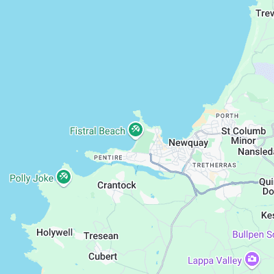
Surf spots nearby
- South Fistral (0.2 mi)
- Little Fistral (0.4 mi)
- The Cribber (0.6 mi)
- Towan (0.6 mi)
- Great Western (0.9 mi)
- Tolcarne, The Wedge (1.1 mi)
- Crantock (1.3 mi)
- Lusty Glaze (1.6 mi)
- Porth (2 mi)
- Whipsiderry (2.3 mi)
Not Magic Seaweed (MSW)
Although we look a bit like Magic Seaweed we are not MagicSeaweed as they no longer exist...