Longsands Surf Report
| Wave height * | 4ft / 1.2m |
|---|---|
| Swell period | 8s |
| Swell direction | |
| Wind | |
| Sea temp | 9°C / 48°F |

10 day Longsands surf forecast
Sun
28/Dec
4ft
8
5
4
- Low 2:54am
- High 9:14am
- Low 3:08pm
- High 9:19pm
Mon
29/Dec
3.5ft
6
8
12
- Low 3:58am
- High 10:17am
- Low 4:18pm
- High 10:27pm
Tue
30/Dec
6ft
10
7
6
- Low 5:07am
- High 11:22am
- Low 5:31pm
- High 11:37pm
Wed
31/Dec
4.5ft
10
12
13
- Low 6:15am
- High 12:24pm
- Low 6:42pm
Thu
1/Jan
5.5ft
16
16
15
- High 12:42am
- Low 7:19am
- High 1:21pm
- Low 7:47pm
Fri
2/Jan
6ft
15
13
13
- High 1:48am
- Low 8:16am
- High 2:17pm
- Low 8:45pm
Sat
3/Jan
6ft
11
11
12
- High 2:47am
- Low 9:09am
- High 3:09pm
- Low 9:38pm
Sun
4/Jan
8ft
12
13
10
- High 3:42am
- Low 9:58am
- High 3:58pm
- Low 10:28pm
Mon
5/Jan
4ft
9
12
10
- High 4:33am
- Low 10:43am
- High 4:45pm
- Low 11:16pm
Tue
6/Jan
4.5ft
9
9
5
- High 5:21am
- Low 11:27am
- High 5:30pm
Sun 28th Dec
| 3:00 | 5ft | 6ft | 8s | 8mph (12mph) | |||
| 6:00 | 5ft | 6.4ft | 9s | 8mph (11mph) | |||
| 9:00 | 5ft | 6.1ft | 9s | 6mph (9mph) | |||
| 12:00 | 4ft | 5.6ft | 9s | 5mph (7mph) | |||
| 15:00 | 4ft | 5.2ft | 8s | 5mph (8mph) | |||
| 18:00 | 3.5ft | 4.8ft | 10s | 4mph (7mph) | |||
| 21:00 | 3.5ft | 4.5ft | 11s | 4mph (6mph) |
| Tide times |
|---|
| Low 2:54am (1.39m) |
| High 9:14am (4.22m) |
| Low 3:08pm (1.92m) |
| High 9:19pm (4.52m) |
| Daylight | |
|---|---|
| First light | 07:45 |
| Sunrise | 08:30 |
| Sunset | 15:43 |
| Dark | 16:29 |
Mon 29th Dec
| 3:00 | 3ft | 4.2ft | 13s | 6mph (11mph) | |||
| 6:00 | 3ft | 4.2ft | 13s | 6mph (11mph) | |||
| 9:00 | 3ft | 4.2ft | 12s | 6mph (13mph) | |||
| 12:00 | 3.5ft | 4.5ft | 12s | 8mph (17mph) | |||
| 15:00 | 3.5ft | 5.3ft | 11s | 11mph (19mph) | |||
| 18:00 | 4.5ft | 6.1ft | 7s | 12mph (19mph) | |||
| 21:00 | 4.5ft | 6.7ft | 7s | 13mph (19mph) |
| Tide times |
|---|
| Low 3:58am (1.44m) |
| High 10:17am (4.22m) |
| Low 4:18pm (1.91m) |
| High 10:27pm (4.52m) |
| Daylight | |
|---|---|
| First light | 07:45 |
| Sunrise | 08:30 |
| Sunset | 15:44 |
| Dark | 16:29 |
Tue 30th Dec
| 3:00 | 5.5ft | 7.3ft | 9s | 11mph (19mph) | |||
| 6:00 | 6ft | 7.7ft | 10s | 10mph (17mph) | |||
| 9:00 | 6ft | 7.8ft | 9s | 8mph (13mph) | |||
| 12:00 | 6ft | 7.8ft | 10s | 7mph (12mph) | |||
| 15:00 | 6ft | 7.7ft | 13s | 8mph (13mph) | |||
| 18:00 | 5.5ft | 7.5ft | 12s | 6mph (11mph) | |||
| 21:00 | 5.5ft | 7.1ft | 12s | 5mph (12mph) |
| Tide times |
|---|
| Low 5:07am (1.44m) |
| High 11:22am (4.30m) |
| Low 5:31pm (1.80m) |
| High 11:37pm (4.60m) |
| Daylight | |
|---|---|
| First light | 07:45 |
| Sunrise | 08:30 |
| Sunset | 15:45 |
| Dark | 16:30 |
Wed 31st Dec
| 3:00 | 4.5ft | 6.1ft | 12s | 10mph (21mph) | |||
| 6:00 | 4.5ft | 5.8ft | 12s | 10mph (23mph) | |||
| 9:00 | 4ft | 5.6ft | 12s | 11mph (26mph) | |||
| 12:00 | 4.5ft | 6ft | 11s | 12mph (26mph) | |||
| 15:00 | 5ft | 6.6ft | 11s | 13mph (27mph) | |||
| 18:00 | 5ft | 6.8ft | 10s | 13mph (26mph) | |||
| 21:00 | 4.5ft | 6.7ft | 10s | 13mph (27mph) |
| Tide times |
|---|
| Low 6:15am (1.38m) |
| High 12:24pm (4.45m) |
| Low 6:42pm (1.58m) |
| Daylight | |
|---|---|
| First light | 07:45 |
| Sunrise | 08:30 |
| Sunset | 15:46 |
| Dark | 16:31 |
Thu 1st Jan
| 3:00 | 4.5ft | 6.3ft | 10s | 17mph (34mph) | |||
| 6:00 | 5ft | 6.4ft | 11s | 16mph (33mph) | |||
| 9:00 | 4.5ft | 6.7ft | 11s | 13mph (24mph) | |||
| 12:00 | 5.5ft | 7.8ft | 11s | 16mph (30mph) | |||
| 15:00 | 6ft | 8.6ft | 11s | 17mph (32mph) | |||
| 18:00 | 6.5ft | 9.7ft | 10s | 15mph (29mph) | |||
| 21:00 | 6.5ft | 9.4ft | 10s | 15mph (29mph) |
| Tide times |
|---|
| High 12:42am (4.69m) |
| Low 7:19am (1.34m) |
| High 1:21pm (4.61m) |
| Low 7:47pm (1.32m) |
| Daylight | |
|---|---|
| First light | 07:45 |
| Sunrise | 08:30 |
| Sunset | 15:48 |
| Dark | 16:32 |
Fri 2nd Jan
| 3:00 | 6.5ft | 9.1ft | 10s | 14mph (27mph) | |||
| 6:00 | 6.5ft | 9.3ft | 10s | 15mph (28mph) | |||
| 9:00 | 6.5ft | 8.8ft | 11s | 13mph (25mph) | |||
| 12:00 | 6ft | 8.1ft | 11s | 13mph (23mph) | |||
| 15:00 | 5.5ft | 7.4ft | 11s | 13mph (26mph) | |||
| 18:00 | 5ft | 7.1ft | 10s | 13mph (29mph) | |||
| 21:00 | 4.5ft | 6.6ft | 10s | 12mph (26mph) |
| Tide times |
|---|
| High 1:48am (4.85m) |
| Low 8:16am (1.23m) |
| High 2:17pm (4.83m) |
| Low 8:45pm (1.01m) |
| Daylight | |
|---|---|
| First light | 07:45 |
| Sunrise | 08:30 |
| Sunset | 15:49 |
| Dark | 16:34 |
Sat 3rd Jan
| 3:00 | 5ft | 7.2ft | 9s | 12mph (25mph) | |||
| 6:00 | 4.5ft | 6.7ft | 8s | 11mph (26mph) | |||
| 9:00 | 4ft | 5.8ft | 7s | 11mph (27mph) | |||
| 12:00 | 6ft | 7.6ft | 7s | 11mph (26mph) | |||
| 15:00 | 8ft | 9.1ft | 8s | 13mph (26mph) | |||
| 18:00 | 7ft | 8.1ft | 8s | 12mph (27mph) | |||
| 21:00 | 7ft | 7.9ft | 8s | 11mph (27mph) |
| Tide times |
|---|
| High 2:47am (5.01m) |
| Low 9:09am (1.13m) |
| High 3:09pm (5.03m) |
| Low 9:38pm (0.74m) |
| Daylight | |
|---|---|
| First light | 07:45 |
| Sunrise | 08:29 |
| Sunset | 15:50 |
| Dark | 16:35 |
Sun 4th Jan
| 3:00 | 7.5ft | 10.1ft | 9s | 11mph (27mph) | |||
| 6:00 | 7.5ft | 10.1ft | 9s | 12mph (26mph) | |||
| 9:00 | 7ft | 9.8ft | 9s | 13mph (29mph) | |||
| 12:00 | 8ft | 10.6ft | 12s | 13mph (26mph) | |||
| 15:00 | 8ft | 10.7ft | 12s | 12mph (27mph) | |||
| 18:00 | 7.5ft | 10.2ft | 11s | 10mph (27mph) | |||
| 21:00 | 6.5ft | 9.3ft | 10s | 8mph (23mph) |
| Tide times |
|---|
| High 3:42am (5.11m) |
| Low 9:58am (1.08m) |
| High 3:58pm (5.18m) |
| Low 10:28pm (0.57m) |
| Daylight | |
|---|---|
| First light | 07:44 |
| Sunrise | 08:29 |
| Sunset | 15:51 |
| Dark | 16:36 |
Mon 5th Jan
| 3:00 | 5.5ft | 7.7ft | 10s | 7mph (19mph) | |||
| 6:00 | 5.5ft | 7ft | 11s | 9mph (26mph) | |||
| 9:00 | 5ft | 6.4ft | 11s | 10mph (28mph) | |||
| 12:00 | 4ft | 5.8ft | 10s | 12mph (29mph) | |||
| 15:00 | 4ft | 5.8ft | 10s | 12mph (31mph) | |||
| 18:00 | 5ft | 7.4ft | 8s | 10mph (28mph) | |||
| 21:00 | 6ft | 8.4ft | 8s | 11mph (27mph) |
| Tide times |
|---|
| High 4:33am (5.13m) |
| Low 10:43am (1.08m) |
| High 4:45pm (5.25m) |
| Low 11:16pm (0.50m) |
| Daylight | |
|---|---|
| First light | 07:44 |
| Sunrise | 08:29 |
| Sunset | 15:53 |
| Dark | 16:37 |
Tue 6th Jan
| 3:00 | 6ft | 8.2ft | 9s | 8mph (23mph) | |||
| 6:00 | 6ft | 7.8ft | 9s | 9mph (25mph) | |||
| 9:00 | 5.5ft | 7.1ft | 9s | 9mph (25mph) | |||
| 12:00 | 4.5ft | 6.5ft | 9s | 9mph (20mph) | |||
| 15:00 | 4ft | 6.1ft | 9s | 6mph (17mph) | |||
| 18:00 | 4ft | 5.7ft | 9s | 5mph (8mph) | |||
| 21:00 | 3.5ft | 5.3ft | 9s | 4mph (4mph) |
| Tide times |
|---|
| High 5:21am (5.06m) |
| Low 11:27am (1.16m) |
| High 5:30pm (5.24m) |
| Daylight | |
|---|---|
| First light | 07:44 |
| Sunrise | 08:28 |
| Sunset | 15:54 |
| Dark | 16:38 |
Nearest buoys
Longsands is at the heart of the Geordie surf scene. This popular beachbreak is fairly consistent, working through the tide with peaks up and down the beach. Good waves for all levels including a few home grown pros.
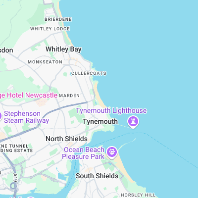
Surf spots nearby
- Longsands (0.1 mi)
- Eddies Bay (0.6 mi)
- Black Middens (1 mi)
- Whitley Bay (1.9 mi)
- South Shields (2.2 mi)
- Hartley Reef (3.1 mi)
- Seaton Sluice (5.2 mi)
- Whitburn (5.4 mi)
- Blyth (6.7 mi)
- Roker Beach (7.5 mi)
Not Magic Seaweed (MSW)
Although we look a bit like Magic Seaweed we are not MagicSeaweed as they no longer exist...