Cocoa Beach (Cocoa Beach Pier) Surf Report
| Wave height * | 4.5ft / 1.4m |
|---|---|
| Swell period | 7s |
| Swell direction | |
| Wind | |
| Sea temp | 20°C / 68°F |

10 day Cocoa Beach surf forecast
Thu
18/Dec
5ft
17
18
17
- Low 12:27am
- High 7:04am
- Low 1:33pm
- High 7:15pm
Fri
19/Dec
3.5ft
11
10
16
- Low 1:08am
- High 7:45am
- Low 2:08pm
- High 7:56pm
Sat
20/Dec
3ft
14
7
6
- Low 1:46am
- High 8:24am
- Low 2:43pm
- High 8:36pm
Sun
21/Dec
2.5ft
5
13
15
- Low 2:22am
- High 9:03am
- Low 3:20pm
- High 9:16pm
Mon
22/Dec
7ft
21
25
22
- Low 3:01am
- High 9:44am
- Low 4:02pm
- High 10:00pm
Tue
23/Dec
5.5ft
19
17
18
- Low 3:45am
- High 10:27am
- Low 4:47pm
- High 10:48pm
Wed
24/Dec
3.5ft
11
12
13
- Low 4:39am
- High 11:12am
- Low 5:34pm
- High 11:39pm
Thu
25/Dec
3ft
8
6
7
- Low 5:39am
- High 11:58am
- Low 6:19pm
Fri
26/Dec
2ft
7
2
9
- High 12:31am
- Low 6:38am
- High 12:46pm
- Low 7:05pm
Thu 18th Dec
| 4:00 | 4.5ft | 5.3ft | 7s | 15mph (20mph) | |||
| 7:00 | 4.5ft | 5.2ft | 7s | 17mph (23mph) | |||
| 10:00 | 4.5ft | 5.2ft | 7s | 17mph (24mph) | |||
| 13:00 | 5ft | 5.8ft | 7s | 18mph (25mph) | |||
| 16:00 | 5ft | 5.7ft | 7s | 16mph (23mph) | |||
| 19:00 | 5ft | 5.5ft | 7s | 17mph (24mph) |
| Tide times |
|---|
| Low 12:27am (0.20m) |
| High 7:04am (3.93m) |
| Low 1:33pm (0.52m) |
| High 7:15pm (2.75m) |
| Daylight | |
|---|---|
| First light | 06:43 |
| Sunrise | 07:08 |
| Sunset | 17:29 |
| Dark | 17:55 |
Fri 19th Dec
| 4:00 | 4ft | 4.5ft | 8s | 11mph (18mph) | |||
| 7:00 | 4ft | 4.3ft | 9s | 11mph (21mph) | |||
| 10:00 | 3.5ft | 4.1ft | 9s | 11mph (15mph) | |||
| 13:00 | 3.5ft | 3.9ft | 9s | 10mph (10mph) | |||
| 16:00 | 3.5ft | 3.9ft | 9s | 10mph (12mph) | |||
| 19:00 | 3.5ft | 4.1ft | 9s | 16mph (20mph) |
| Tide times |
|---|
| Low 1:08am (0.18m) |
| High 7:45am (3.98m) |
| Low 2:08pm (0.46m) |
| High 7:56pm (2.77m) |
| Daylight | |
|---|---|
| First light | 06:43 |
| Sunrise | 07:09 |
| Sunset | 17:29 |
| Dark | 17:55 |
Sat 20th Dec
| 4:00 | 4ft | 4.5ft | 9s | 19mph (18mph) | |||
| 7:00 | 3.5ft | 4.1ft | 9s | 14mph (15mph) | |||
| 10:00 | 3.5ft | 3.8ft | 9s | 11mph (12mph) | |||
| 13:00 | 3ft | 3.6ft | 9s | 7mph (8mph) | |||
| 16:00 | 3ft | 3.4ft | 9s | 6mph (6mph) | |||
| 19:00 | 3ft | 3.2ft | 9s | 6mph (6mph) |
| Tide times |
|---|
| Low 1:46am (0.17m) |
| High 8:24am (4.00m) |
| Low 2:43pm (0.44m) |
| High 8:36pm (2.77m) |
| Daylight | |
|---|---|
| First light | 06:44 |
| Sunrise | 07:10 |
| Sunset | 17:30 |
| Dark | 17:56 |
Sun 21st Dec
| 4:00 | 2.5ft | 2.8ft | 9s | 4mph (4mph) | |||
| 7:00 | 2.5ft | 2.7ft | 9s | 5mph (5mph) | |||
| 10:00 | 2.5ft | 2.7ft | 9s | 10mph (10mph) | |||
| 13:00 | 2.5ft | 2.8ft | 9s | 13mph (13mph) | |||
| 16:00 | 3ft | 3ft | 9s | 14mph (13mph) | |||
| 19:00 | 3ft | 3.3ft | 11s | 15mph (17mph) |
| Tide times |
|---|
| Low 2:22am (0.19m) |
| High 9:03am (3.96m) |
| Low 3:20pm (0.44m) |
| High 9:16pm (2.76m) |
| Daylight | |
|---|---|
| First light | 06:44 |
| Sunrise | 07:10 |
| Sunset | 17:30 |
| Dark | 17:56 |
Mon 22nd Dec
| 4:00 | 4ft | 4.4ft | 11s | 17mph (21mph) | |||
| 7:00 | 4.5ft | 5.5ft | 6s | 21mph (25mph) | |||
| 10:00 | 6ft | 7.1ft | 7s | 20mph (25mph) | |||
| 13:00 | 7ft | 8.2ft | 8s | 25mph (29mph) | |||
| 16:00 | 7ft | 8ft | 8s | 27mph (30mph) | |||
| 19:00 | 7ft | 8ft | 8s | 22mph (26mph) |
| Tide times |
|---|
| Low 3:01am (0.24m) |
| High 9:44am (3.89m) |
| Low 4:02pm (0.43m) |
| High 10:00pm (2.78m) |
| Daylight | |
|---|---|
| First light | 06:45 |
| Sunrise | 07:10 |
| Sunset | 17:31 |
| Dark | 17:57 |
Tue 23rd Dec
| 4:00 | 6.5ft | 7.3ft | 9s | 21mph (22mph) | |||
| 7:00 | 6.5ft | 7ft | 9s | 19mph (21mph) | |||
| 10:00 | 6ft | 6.7ft | 9s | 18mph (19mph) | |||
| 13:00 | 5.5ft | 6.3ft | 9s | 17mph (18mph) | |||
| 16:00 | 5ft | 5.8ft | 9s | 13mph (15mph) | |||
| 19:00 | 5ft | 5.4ft | 9s | 18mph (19mph) |
| Tide times |
|---|
| Low 3:45am (0.32m) |
| High 10:27am (3.77m) |
| Low 4:47pm (0.39m) |
| High 10:48pm (2.85m) |
| Daylight | |
|---|---|
| First light | 06:45 |
| Sunrise | 07:11 |
| Sunset | 17:31 |
| Dark | 17:57 |
Wed 24th Dec
| 4:00 | 4.5ft | 4.5ft | 9s | 11mph (13mph) | |||
| 7:00 | 4ft | 4.3ft | 9s | 11mph (14mph) | |||
| 10:00 | 3.5ft | 4.1ft | 8s | 13mph (16mph) | |||
| 13:00 | 3.5ft | 3.9ft | 8s | 12mph (14mph) | |||
| 16:00 | 3.5ft | 3.8ft | 8s | 11mph (13mph) | |||
| 19:00 | 3.5ft | 3.6ft | 8s | 13mph (16mph) |
| Tide times |
|---|
| Low 4:39am (0.41m) |
| High 11:12am (3.64m) |
| Low 5:34pm (0.29m) |
| High 11:39pm (2.98m) |
| Daylight | |
|---|---|
| First light | 06:46 |
| Sunrise | 07:11 |
| Sunset | 17:32 |
| Dark | 17:58 |
Thu 25th Dec
| 4:00 | 3ft | 3.3ft | 9s | 9mph (10mph) | |||
| 7:00 | 3ft | 3.2ft | 9s | 8mph (9mph) | |||
| 10:00 | 3ft | 3.1ft | 9s | 9mph (10mph) | |||
| 13:00 | 3ft | 3.1ft | 9s | 6mph (7mph) | |||
| 16:00 | 3ft | 2.9ft | 9s | 6mph (6mph) | |||
| 19:00 | 2.5ft | 2.8ft | 9s | 7mph (7mph) |
| Tide times |
|---|
| Low 5:39am (0.46m) |
| High 11:58am (3.48m) |
| Low 6:19pm (0.15m) |
| Daylight | |
|---|---|
| First light | 06:46 |
| Sunrise | 07:12 |
| Sunset | 17:33 |
| Dark | 17:58 |
Fri 26th Dec
| 4:00 | 2.5ft | 2.6ft | 9s | 6mph (5mph) | |||
| 7:00 | 2.5ft | 2.5ft | 9s | 7mph (6mph) | |||
| 10:00 | 2ft | 2.4ft | 9s | 6mph (6mph) | |||
| 13:00 | 2ft | 2.3ft | 9s | 2mph (2mph) | |||
| 16:00 | 2ft | 2.2ft | 9s | 7mph (6mph) | |||
| 19:00 | 2ft | 2.2ft | 9s | 9mph (10mph) |
| Tide times |
|---|
| High 12:31am (3.17m) |
| Low 6:38am (0.49m) |
| High 12:46pm (3.31m) |
| Low 7:05pm (-0.00m) |
| Daylight | |
|---|---|
| First light | 06:46 |
| Sunrise | 07:12 |
| Sunset | 17:33 |
| Dark | 17:59 |
Sat 27th Dec
| 4:00 | 1.5ft | 2ft | 9s | 10mph (11mph) | |||
| 7:00 | 1.5ft | 1.9ft | 9s | 9mph (10mph) | |||
| 10:00 | 1.5ft | 1.8ft | 9s | 8mph (9mph) | |||
| 13:00 | 1.5ft | 1.8ft | 9s | 2mph (2mph) | |||
| 16:00 | 1.5ft | 1.7ft | 9s | 6mph (5mph) | |||
| 19:00 | 1.5ft | 1.7ft | 9s | 6mph (6mph) |
| Tide times |
|---|
| High 1:28am (3.38m) |
| Daylight | |
|---|---|
| First light | 06:47 |
| Sunrise | 07:13 |
| Sunset | 17:34 |
| Dark | 18:00 |
Nearest buoys
There are several remarkable things about Cocoa Beach, unfortunately the surf is not one of them! Its main claim to fame is it is where Kelly Slater grew up. Waves tend to be fairly weak owing to gently sloping shelf. The pier is usually the best spot
Other interesting facts about Cocoa beach are; it is home to Ron Jons - the World's biggest surf shop which actually pre-dates Kelly Slater's rise to fame.
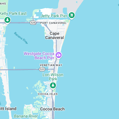
Surf spots nearby
- Lori Wilson Park (2.2 mi)
- Jetty Park (2.8 mi)
- Cape Canaveral (5.9 mi)
- Tables (6.9 mi)
- Patrick Air Force Base (7.5 mi)
- 2nd Light (7.9 mi)
- Hangars (8.6 mi)
- Seagulls (11.2 mi)
- Hightower (12 mi)
- Buccaneer (13.1 mi)
Not Magic Seaweed (MSW)
Although we look a bit like Magic Seaweed we are not MagicSeaweed as they no longer exist...