Hangars (Hangers) Surf Report
| Wave height * | 4ft / 1.3m |
|---|---|
| Swell period | 7s |
| Swell direction | |
| Wind | |
| Sea temp | 21°C / 69°F |

10 day Hangars surf forecast
Thu
18/Dec
4.5ft
17
18
17
- Low 12:39am
- High 7:02am
- Low 1:14pm
- High 6:54pm
Fri
19/Dec
3ft
11
10
16
- Low 1:17am
- High 7:39am
- Low 1:52pm
- High 7:32pm
Sat
20/Dec
3ft
14
7
6
- Low 1:55am
- High 8:16am
- Low 2:29pm
- High 8:12pm
Sun
21/Dec
2.5ft
5
13
15
- Low 2:34am
- High 8:53am
- Low 3:07pm
- High 8:53pm
Mon
22/Dec
7.5ft
21
25
22
- Low 3:14am
- High 9:31am
- Low 3:47pm
- High 9:37pm
Tue
23/Dec
5.5ft
19
17
18
- Low 3:57am
- High 10:11am
- Low 4:29pm
- High 10:25pm
Wed
24/Dec
3.5ft
11
12
13
- Low 4:43am
- High 10:54am
- Low 5:16pm
- High 11:18pm
Thu
25/Dec
2.5ft
8
6
7
- Low 5:34am
- High 11:41am
- Low 6:07pm
Fri
26/Dec
2ft
7
2
9
- High 12:17am
- Low 6:31am
- High 12:33pm
- Low 7:03pm
Thu 18th Dec
| 4:00 | 4ft | 5.4ft | 7s | 15mph (20mph) | |||
| 7:00 | 4ft | 5.3ft | 7s | 17mph (23mph) | |||
| 10:00 | 4ft | 5.4ft | 7s | 17mph (24mph) | |||
| 13:00 | 4.5ft | 5.9ft | 7s | 18mph (25mph) | |||
| 16:00 | 4ft | 5.7ft | 7s | 16mph (23mph) | |||
| 19:00 | 4.5ft | 5.5ft | 7s | 17mph (24mph) |
| Tide times |
|---|
| Low 12:39am (0.09m) |
| High 7:02am (3.84m) |
| Low 1:14pm (0.73m) |
| High 6:54pm (3.43m) |
| Daylight | |
|---|---|
| First light | 06:42 |
| Sunrise | 07:08 |
| Sunset | 17:29 |
| Dark | 17:55 |
Fri 19th Dec
| 4:00 | 3.5ft | 4.5ft | 8s | 11mph (18mph) | |||
| 7:00 | 3.5ft | 4.3ft | 9s | 11mph (21mph) | |||
| 10:00 | 3ft | 4.1ft | 9s | 11mph (15mph) | |||
| 13:00 | 3ft | 3.9ft | 9s | 10mph (10mph) | |||
| 16:00 | 3ft | 3.9ft | 9s | 10mph (12mph) | |||
| 19:00 | 3ft | 4.1ft | 9s | 16mph (20mph) |
| Tide times |
|---|
| Low 1:17am (0.06m) |
| High 7:39am (3.85m) |
| Low 1:52pm (0.69m) |
| High 7:32pm (3.43m) |
| Daylight | |
|---|---|
| First light | 06:43 |
| Sunrise | 07:09 |
| Sunset | 17:30 |
| Dark | 17:55 |
Sat 20th Dec
| 4:00 | 3.5ft | 4.5ft | 9s | 19mph (18mph) | |||
| 7:00 | 3ft | 4.1ft | 9s | 14mph (15mph) | |||
| 10:00 | 3ft | 3.8ft | 9s | 11mph (12mph) | |||
| 13:00 | 3ft | 3.6ft | 9s | 7mph (8mph) | |||
| 16:00 | 3ft | 3.4ft | 9s | 6mph (6mph) | |||
| 19:00 | 2.5ft | 3.2ft | 9s | 6mph (6mph) |
| Tide times |
|---|
| Low 1:55am (0.05m) |
| High 8:16am (3.82m) |
| Low 2:29pm (0.65m) |
| High 8:12pm (3.42m) |
| Daylight | |
|---|---|
| First light | 06:43 |
| Sunrise | 07:09 |
| Sunset | 17:30 |
| Dark | 17:56 |
Sun 21st Dec
| 4:00 | 2.5ft | 2.8ft | 9s | 4mph (4mph) | |||
| 7:00 | 2.5ft | 2.7ft | 9s | 5mph (5mph) | |||
| 10:00 | 2.5ft | 2.7ft | 9s | 10mph (10mph) | |||
| 13:00 | 2.5ft | 2.8ft | 9s | 13mph (13mph) | |||
| 16:00 | 2.5ft | 3ft | 9s | 14mph (13mph) | |||
| 19:00 | 3ft | 3.3ft | 11s | 15mph (17mph) |
| Tide times |
|---|
| Low 2:34am (0.09m) |
| High 8:53am (3.77m) |
| Low 3:07pm (0.61m) |
| High 8:53pm (3.40m) |
| Daylight | |
|---|---|
| First light | 06:44 |
| Sunrise | 07:10 |
| Sunset | 17:31 |
| Dark | 17:56 |
Mon 22nd Dec
| 4:00 | 3.5ft | 4.5ft | 11s | 17mph (21mph) | |||
| 7:00 | 5ft | 5.6ft | 6s | 21mph (25mph) | |||
| 10:00 | 6.5ft | 7ft | 7s | 20mph (25mph) | |||
| 13:00 | 7.5ft | 8.2ft | 8s | 25mph (29mph) | |||
| 16:00 | 7.5ft | 8.1ft | 8s | 27mph (30mph) | |||
| 19:00 | 7ft | 8.1ft | 8s | 22mph (26mph) |
| Tide times |
|---|
| Low 3:14am (0.15m) |
| High 9:31am (3.69m) |
| Low 3:47pm (0.57m) |
| High 9:37pm (3.38m) |
| Daylight | |
|---|---|
| First light | 06:44 |
| Sunrise | 07:10 |
| Sunset | 17:31 |
| Dark | 17:57 |
Tue 23rd Dec
| 4:00 | 6.5ft | 7.5ft | 9s | 21mph (22mph) | |||
| 7:00 | 6.5ft | 7.2ft | 9s | 19mph (21mph) | |||
| 10:00 | 6ft | 6.8ft | 9s | 18mph (19mph) | |||
| 13:00 | 5.5ft | 6.4ft | 9s | 17mph (18mph) | |||
| 16:00 | 5ft | 6ft | 9s | 13mph (15mph) | |||
| 19:00 | 5ft | 5.6ft | 9s | 18mph (19mph) |
| Tide times |
|---|
| Low 3:57am (0.24m) |
| High 10:11am (3.60m) |
| Low 4:29pm (0.51m) |
| High 10:25pm (3.36m) |
| Daylight | |
|---|---|
| First light | 06:45 |
| Sunrise | 07:11 |
| Sunset | 17:32 |
| Dark | 17:57 |
Wed 24th Dec
| 4:00 | 4ft | 4.6ft | 9s | 11mph (13mph) | |||
| 7:00 | 4ft | 4.4ft | 8s | 11mph (14mph) | |||
| 10:00 | 3.5ft | 4.2ft | 8s | 13mph (16mph) | |||
| 13:00 | 3.5ft | 4ft | 8s | 12mph (14mph) | |||
| 16:00 | 3ft | 3.8ft | 8s | 11mph (13mph) | |||
| 19:00 | 3ft | 3.7ft | 8s | 13mph (16mph) |
| Tide times |
|---|
| Low 4:43am (0.34m) |
| High 10:54am (3.52m) |
| Low 5:16pm (0.43m) |
| High 11:18pm (3.35m) |
| Daylight | |
|---|---|
| First light | 06:45 |
| Sunrise | 07:11 |
| Sunset | 17:32 |
| Dark | 17:58 |
Thu 25th Dec
| 4:00 | 3ft | 3.4ft | 9s | 9mph (10mph) | |||
| 7:00 | 2.5ft | 3.3ft | 9s | 8mph (9mph) | |||
| 10:00 | 2.5ft | 3.2ft | 9s | 9mph (10mph) | |||
| 13:00 | 2.5ft | 3.1ft | 9s | 6mph (7mph) | |||
| 16:00 | 2.5ft | 3ft | 9s | 6mph (6mph) | |||
| 19:00 | 2.5ft | 2.9ft | 9s | 7mph (7mph) |
| Tide times |
|---|
| Low 5:34am (0.44m) |
| High 11:41am (3.45m) |
| Low 6:07pm (0.32m) |
| Daylight | |
|---|---|
| First light | 06:46 |
| Sunrise | 07:12 |
| Sunset | 17:33 |
| Dark | 17:59 |
Fri 26th Dec
| 4:00 | 2ft | 2.6ft | 9s | 6mph (5mph) | |||
| 7:00 | 2ft | 2.5ft | 9s | 7mph (6mph) | |||
| 10:00 | 2ft | 2.4ft | 9s | 6mph (6mph) | |||
| 13:00 | 2ft | 2.3ft | 9s | 2mph (2mph) | |||
| 16:00 | 2ft | 2.2ft | 9s | 7mph (6mph) | |||
| 19:00 | 2ft | 2.2ft | 9s | 9mph (10mph) |
| Tide times |
|---|
| High 12:17am (3.37m) |
| Low 6:31am (0.53m) |
| High 12:33pm (3.42m) |
| Low 7:03pm (0.19m) |
| Daylight | |
|---|---|
| First light | 06:46 |
| Sunrise | 07:12 |
| Sunset | 17:33 |
| Dark | 17:59 |
Sat 27th Dec
| 4:00 | 1.5ft | 2ft | 9s | 10mph (11mph) | |||
| 7:00 | 1.5ft | 1.9ft | 9s | 9mph (10mph) | |||
| 10:00 | 1.5ft | 1.8ft | 9s | 8mph (9mph) | |||
| 13:00 | 1.5ft | 1.8ft | 9s | 2mph (2mph) | |||
| 16:00 | 1.5ft | 1.8ft | 9s | 6mph (5mph) | |||
| 19:00 | 1.5ft | 1.7ft | 9s | 6mph (6mph) |
| Tide times |
|---|
| High 1:20am (3.43m) |
| Low 7:33am (0.57m) |
| High 1:31pm (3.42m) |
| Low 8:03pm (0.02m) |
| Daylight | |
|---|---|
| First light | 06:47 |
| Sunrise | 07:12 |
| Sunset | 17:34 |
| Dark | 18:00 |
Nearest buoys
This was originally the site of Patrik pier but now all that is left are some of the pilings which help keep the sand in place
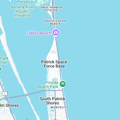
Surf spots nearby
- 2nd Light (0.7 mi)
- Patrick Air Force Base (1.1 mi)
- Tables (1.7 mi)
- Seagulls (2.6 mi)
- Hightower (3.4 mi)
- Buccaneer (4.5 mi)
- Satellite Beach (4.9 mi)
- Pelican Beach Park (5.4 mi)
- Peg Leg's (5.5 mi)
- Hess (5.9 mi)
Not Magic Seaweed (MSW)
Although we look a bit like Magic Seaweed we are not MagicSeaweed as they no longer exist...