Satellite Beach (RCs) Surf Report
| Wave height * | 4ft / 1.3m |
|---|---|
| Swell period | 7s |
| Swell direction | |
| Wind | |
| Sea temp | 21°C / 69°F |

10 day Satellite Beach surf forecast
Thu
18/Dec
4.5ft
17
18
17
- Low 12:52am
- High 7:11am
- Low 1:21pm
- High 7:10pm
Fri
19/Dec
3ft
11
10
16
- Low 1:30am
- High 7:51am
- Low 1:59pm
- High 7:50pm
Sat
20/Dec
3ft
14
7
6
- Low 2:07am
- High 8:30am
- Low 2:36pm
- High 8:31pm
Sun
21/Dec
2.5ft
5
13
15
- Low 2:44am
- High 9:09am
- Low 3:14pm
- High 9:13pm
Mon
22/Dec
7.5ft
21
25
22
- Low 3:22am
- High 9:49am
- Low 3:54pm
- High 9:56pm
Tue
23/Dec
5.5ft
19
17
18
- Low 4:03am
- High 10:28am
- Low 4:36pm
- High 10:42pm
Wed
24/Dec
3.5ft
11
12
13
- Low 4:49am
- High 11:10am
- Low 5:24pm
- High 11:33pm
Thu
25/Dec
2.5ft
8
6
7
- Low 5:41am
- High 11:54am
- Low 6:16pm
Fri
26/Dec
2ft
7
2
9
- High 12:30am
- Low 6:40am
- High 12:43pm
- Low 7:14pm
Thu 18th Dec
| 4:00 | 4ft | 5.4ft | 7s | 15mph (20mph) | |||
| 7:00 | 4ft | 5.3ft | 7s | 17mph (23mph) | |||
| 10:00 | 4ft | 5.4ft | 7s | 17mph (24mph) | |||
| 13:00 | 4.5ft | 5.9ft | 7s | 18mph (25mph) | |||
| 16:00 | 4ft | 5.7ft | 7s | 16mph (23mph) | |||
| 19:00 | 4.5ft | 5.5ft | 7s | 17mph (24mph) |
| Tide times |
|---|
| Low 12:52am (0.01m) |
| High 7:11am (3.65m) |
| Low 1:21pm (0.64m) |
| High 7:10pm (3.32m) |
| Daylight | |
|---|---|
| First light | 06:42 |
| Sunrise | 07:08 |
| Sunset | 17:29 |
| Dark | 17:55 |
Fri 19th Dec
| 4:00 | 3.5ft | 4.5ft | 8s | 11mph (18mph) | |||
| 7:00 | 3.5ft | 4.3ft | 9s | 11mph (21mph) | |||
| 10:00 | 3ft | 4.1ft | 9s | 11mph (15mph) | |||
| 13:00 | 3ft | 3.9ft | 9s | 10mph (10mph) | |||
| 16:00 | 3ft | 3.9ft | 9s | 10mph (12mph) | |||
| 19:00 | 3ft | 4.1ft | 9s | 16mph (20mph) |
| Tide times |
|---|
| Low 1:30am (-0.03m) |
| High 7:51am (3.67m) |
| Low 1:59pm (0.61m) |
| High 7:50pm (3.32m) |
| Daylight | |
|---|---|
| First light | 06:43 |
| Sunrise | 07:08 |
| Sunset | 17:30 |
| Dark | 17:56 |
Sat 20th Dec
| 4:00 | 3.5ft | 4.5ft | 9s | 19mph (18mph) | |||
| 7:00 | 3ft | 4.1ft | 9s | 14mph (15mph) | |||
| 10:00 | 3ft | 3.8ft | 9s | 11mph (12mph) | |||
| 13:00 | 3ft | 3.6ft | 9s | 7mph (8mph) | |||
| 16:00 | 3ft | 3.4ft | 9s | 6mph (6mph) | |||
| 19:00 | 2.5ft | 3.2ft | 9s | 6mph (6mph) |
| Tide times |
|---|
| Low 2:07am (-0.04m) |
| High 8:30am (3.67m) |
| Low 2:36pm (0.58m) |
| High 8:31pm (3.30m) |
| Daylight | |
|---|---|
| First light | 06:43 |
| Sunrise | 07:09 |
| Sunset | 17:30 |
| Dark | 17:56 |
Sun 21st Dec
| 4:00 | 2.5ft | 2.8ft | 9s | 4mph (4mph) | |||
| 7:00 | 2.5ft | 2.7ft | 9s | 5mph (5mph) | |||
| 10:00 | 2.5ft | 2.7ft | 9s | 10mph (10mph) | |||
| 13:00 | 2.5ft | 2.8ft | 9s | 13mph (13mph) | |||
| 16:00 | 2.5ft | 3ft | 9s | 14mph (13mph) | |||
| 19:00 | 3ft | 3.3ft | 11s | 15mph (17mph) |
| Tide times |
|---|
| Low 2:44am (-0.03m) |
| High 9:09am (3.63m) |
| Low 3:14pm (0.54m) |
| High 9:13pm (3.26m) |
| Daylight | |
|---|---|
| First light | 06:44 |
| Sunrise | 07:10 |
| Sunset | 17:31 |
| Dark | 17:57 |
Mon 22nd Dec
| 4:00 | 3.5ft | 4.5ft | 11s | 17mph (21mph) | |||
| 7:00 | 5ft | 5.6ft | 6s | 21mph (25mph) | |||
| 10:00 | 6.5ft | 7ft | 7s | 20mph (25mph) | |||
| 13:00 | 7.5ft | 8.2ft | 8s | 25mph (29mph) | |||
| 16:00 | 7.5ft | 8.1ft | 8s | 27mph (30mph) | |||
| 19:00 | 7ft | 8.1ft | 8s | 22mph (26mph) |
| Tide times |
|---|
| Low 3:22am (0.02m) |
| High 9:49am (3.57m) |
| Low 3:54pm (0.49m) |
| High 9:56pm (3.23m) |
| Daylight | |
|---|---|
| First light | 06:44 |
| Sunrise | 07:10 |
| Sunset | 17:31 |
| Dark | 17:57 |
Tue 23rd Dec
| 4:00 | 6.5ft | 7.5ft | 9s | 21mph (22mph) | |||
| 7:00 | 6.5ft | 7.2ft | 9s | 19mph (21mph) | |||
| 10:00 | 6ft | 6.8ft | 9s | 18mph (19mph) | |||
| 13:00 | 5.5ft | 6.4ft | 9s | 17mph (18mph) | |||
| 16:00 | 5ft | 6ft | 9s | 13mph (15mph) | |||
| 19:00 | 5ft | 5.6ft | 9s | 18mph (19mph) |
| Tide times |
|---|
| Low 4:03am (0.10m) |
| High 10:28am (3.50m) |
| Low 4:36pm (0.42m) |
| High 10:42pm (3.20m) |
| Daylight | |
|---|---|
| First light | 06:45 |
| Sunrise | 07:10 |
| Sunset | 17:32 |
| Dark | 17:58 |
Wed 24th Dec
| 4:00 | 4ft | 4.6ft | 9s | 11mph (13mph) | |||
| 7:00 | 4ft | 4.4ft | 8s | 11mph (14mph) | |||
| 10:00 | 3.5ft | 4.2ft | 8s | 13mph (16mph) | |||
| 13:00 | 3.5ft | 4ft | 8s | 12mph (14mph) | |||
| 16:00 | 3ft | 3.8ft | 8s | 11mph (13mph) | |||
| 19:00 | 3ft | 3.7ft | 8s | 13mph (16mph) |
| Tide times |
|---|
| Low 4:49am (0.21m) |
| High 11:10am (3.41m) |
| Low 5:24pm (0.32m) |
| High 11:33pm (3.20m) |
| Daylight | |
|---|---|
| First light | 06:45 |
| Sunrise | 07:11 |
| Sunset | 17:32 |
| Dark | 17:58 |
Thu 25th Dec
| 4:00 | 3ft | 3.4ft | 9s | 9mph (10mph) | |||
| 7:00 | 2.5ft | 3.3ft | 9s | 8mph (9mph) | |||
| 10:00 | 2.5ft | 3.2ft | 9s | 9mph (10mph) | |||
| 13:00 | 2.5ft | 3.1ft | 9s | 6mph (7mph) | |||
| 16:00 | 2.5ft | 3ft | 9s | 6mph (6mph) | |||
| 19:00 | 2.5ft | 2.9ft | 9s | 7mph (7mph) |
| Tide times |
|---|
| Low 5:41am (0.33m) |
| High 11:54am (3.33m) |
| Low 6:16pm (0.19m) |
| Daylight | |
|---|---|
| First light | 06:46 |
| Sunrise | 07:11 |
| Sunset | 17:33 |
| Dark | 17:59 |
Fri 26th Dec
| 4:00 | 2ft | 2.6ft | 9s | 6mph (5mph) | |||
| 7:00 | 2ft | 2.5ft | 9s | 7mph (6mph) | |||
| 10:00 | 2ft | 2.4ft | 9s | 6mph (6mph) | |||
| 13:00 | 2ft | 2.3ft | 9s | 2mph (2mph) | |||
| 16:00 | 2ft | 2.2ft | 9s | 7mph (6mph) | |||
| 19:00 | 2ft | 2.2ft | 9s | 9mph (10mph) |
| Tide times |
|---|
| High 12:30am (3.22m) |
| Low 6:40am (0.44m) |
| High 12:43pm (3.27m) |
| Low 7:14pm (0.03m) |
| Daylight | |
|---|---|
| First light | 06:46 |
| Sunrise | 07:12 |
| Sunset | 17:34 |
| Dark | 17:59 |
Sat 27th Dec
| 4:00 | 1.5ft | 2ft | 9s | 10mph (11mph) | |||
| 7:00 | 1.5ft | 1.9ft | 9s | 9mph (10mph) | |||
| 10:00 | 1.5ft | 1.8ft | 9s | 8mph (9mph) | |||
| 13:00 | 1.5ft | 1.8ft | 9s | 2mph (2mph) | |||
| 16:00 | 1.5ft | 1.8ft | 9s | 6mph (5mph) | |||
| 19:00 | 1.5ft | 1.7ft | 9s | 6mph (6mph) |
| Tide times |
|---|
| High 1:31am (3.28m) |
| Daylight | |
|---|---|
| First light | 06:46 |
| Sunrise | 07:12 |
| Sunset | 17:34 |
| Dark | 18:00 |
Nearest buoys
Several good quality lefts can be found up and down Satellite Beach breaking over the coquina shelf reefs just offshore. The best of these is RC's which can take any swell thrown at it and is often hollow
The name R.C.'s comes from the harmburger stall called 'The Royal Castle' that was there when the spot was first surfed back in the '60s. Potential negative points about RCs are the complete lack of parking, loads of water moving around when it's bigger, the odd shark sighting and the shallow reef with plenty of holes ideal for sticking your foot in!
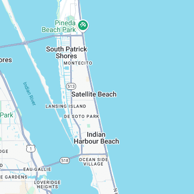
Surf spots nearby
- Buccaneer (0.4 mi)
- Pelican Beach Park (0.5 mi)
- Peg Leg's (0.6 mi)
- Hess (1.1 mi)
- Hightower (1.4 mi)
- Indian Harbor Beach (1.7 mi)
- Seagulls (2.3 mi)
- Canova Beach (2.4 mi)
- Paradise Beach (3.6 mi)
- Hangars (4.9 mi)
Not Magic Seaweed (MSW)
Although we look a bit like Magic Seaweed we are not MagicSeaweed as they no longer exist...