Gazos Creek Surf Report
| Wave height * | 9ft / 2.7m |
|---|---|
| Swell period | 14s |
| Swell direction | |
| Wind | |
| Sea temp | 14°C / 57°F |

10 day Gazos Creek surf forecast
Sun
4/Jan
7.5ft
2
3
3
- Low 4:12am
- High 9:53am
- Low 5:10pm
Mon
5/Jan
5ft
7
9
3
- High 12:06am
- Low 5:07am
- High 10:44am
- Low 5:53pm
Tue
6/Jan
4.5ft
4
1
3
- High 12:48am
- Low 6:04am
- High 11:34am
- Low 6:35pm
Wed
7/Jan
3.5ft
3
7
4
- High 1:28am
- Low 7:05am
- High 12:27pm
- Low 7:17pm
Thu
8/Jan
5.5ft
2
4
5
- High 2:08am
- Low 8:11am
- High 1:26pm
- Low 7:59pm
Fri
9/Jan
5ft
5
3
5
- High 2:48am
- Low 9:20am
- High 2:39pm
- Low 8:44pm
Sat
10/Jan
3ft
5
2
5
- High 3:28am
- Low 10:30am
- High 4:13pm
- Low 9:35pm
Sun
11/Jan
3ft
5
2
6
- High 4:09am
- Low 11:36am
- High 5:59pm
- Low 10:35pm
Mon
12/Jan
6ft
4
4
6
- High 4:52am
- Low 12:33pm
- High 7:26pm
- Low 11:39pm
Sun 4th Jan
| 4:00 | 8.5ft | 11.6ft | 15s | 7mph (21mph) | |||
| 7:00 | 9ft | 12.2ft | 14s | 2mph (5mph) | |||
| 10:00 | 8ft | 12ft | 14s | 3mph (5mph) | |||
| 13:00 | 7.5ft | 11.2ft | 13s | 3mph (5mph) | |||
| 16:00 | 7ft | 10.2ft | 13s | 4mph (6mph) | |||
| 19:00 | 5.5ft | 9.1ft | 12s | 3mph (3mph) |
| Tide times |
|---|
| Low 4:12am (2.77m) |
| High 9:53am (6.22m) |
| Low 5:10pm (-1.61m) |
| Daylight | |
|---|---|
| First light | 06:54 |
| Sunrise | 07:23 |
| Sunset | 17:05 |
| Dark | 17:34 |
Mon 5th Jan
| 4:00 | 4.5ft | 6.7ft | 10s | 6mph (13mph) | |||
| 7:00 | 4.5ft | 6.4ft | 10s | 7mph (16mph) | |||
| 10:00 | 4ft | 6.7ft | 10s | 8mph (23mph) | |||
| 13:00 | 5ft | 7.4ft | 9s | 9mph (21mph) | |||
| 16:00 | 5ft | 7.6ft | 11s | 6mph (15mph) | |||
| 19:00 | 5ft | 7.5ft | 12s | 3mph (3mph) |
| Tide times |
|---|
| High 12:06am (4.55m) |
| Low 5:07am (2.59m) |
| High 10:44am (5.82m) |
| Low 5:53pm (-1.27m) |
| Daylight | |
|---|---|
| First light | 06:54 |
| Sunrise | 07:23 |
| Sunset | 17:06 |
| Dark | 17:35 |
Tue 6th Jan
| 4:00 | 4.5ft | 6.7ft | 11s | 5mph (4mph) | |||
| 7:00 | 5ft | 6.6ft | 12s | 4mph (4mph) | |||
| 10:00 | 5ft | 6.7ft | 12s | 3mph (3mph) | |||
| 13:00 | 4.5ft | 6.5ft | 12s | 1mph (2mph) | |||
| 16:00 | 4.5ft | 6.1ft | 12s | 3mph (4mph) | |||
| 19:00 | 4ft | 5.8ft | 12s | 3mph (3mph) |
| Tide times |
|---|
| High 12:48am (4.61m) |
| Low 6:04am (2.42m) |
| High 11:34am (5.27m) |
| Low 6:35pm (-0.78m) |
| Daylight | |
|---|---|
| First light | 06:54 |
| Sunrise | 07:23 |
| Sunset | 17:07 |
| Dark | 17:36 |
Wed 7th Jan
| 4:00 | 3.5ft | 5.1ft | 11s | 3mph (3mph) | |||
| 7:00 | 3.5ft | 4.9ft | 11s | 3mph (3mph) | |||
| 10:00 | 3.5ft | 5ft | 11s | 4mph (7mph) | |||
| 13:00 | 3.5ft | 5.1ft | 13s | 7mph (11mph) | |||
| 16:00 | 3ft | 5.2ft | 21s | 7mph (11mph) | |||
| 19:00 | 3.5ft | 5.5ft | 20s | 4mph (6mph) |
| Tide times |
|---|
| High 1:28am (4.67m) |
| Low 7:05am (2.24m) |
| High 12:27pm (4.59m) |
| Low 7:17pm (-0.15m) |
| Daylight | |
|---|---|
| First light | 06:54 |
| Sunrise | 07:23 |
| Sunset | 17:08 |
| Dark | 17:36 |
Thu 8th Jan
| 4:00 | 5ft | 8.1ft | 18s | 2mph (3mph) | |||
| 7:00 | 6ft | 8.6ft | 17s | 2mph (3mph) | |||
| 10:00 | 5.5ft | 8.9ft | 17s | 4mph (6mph) | |||
| 13:00 | 5.5ft | 9ft | 16s | 4mph (6mph) | |||
| 16:00 | 5.5ft | 9.3ft | 16s | 5mph (7mph) | |||
| 19:00 | 6ft | 9.5ft | 16s | 5mph (4mph) |
| Tide times |
|---|
| High 2:08am (4.73m) |
| Low 8:11am (2.03m) |
| High 1:26pm (3.88m) |
| Low 7:59pm (0.56m) |
| Daylight | |
|---|---|
| First light | 06:54 |
| Sunrise | 07:23 |
| Sunset | 17:09 |
| Dark | 17:37 |
Fri 9th Jan
| 4:00 | 5.5ft | 9ft | 16s | 6mph (5mph) | |||
| 7:00 | 5.5ft | 8.6ft | 15s | 5mph (4mph) | |||
| 10:00 | 5ft | 8.3ft | 15s | 4mph (5mph) | |||
| 13:00 | 5ft | 8ft | 15s | 3mph (3mph) | |||
| 16:00 | 4.5ft | 7.6ft | 15s | 4mph (4mph) | |||
| 19:00 | 4.5ft | 7.2ft | 14s | 5mph (4mph) |
| Tide times |
|---|
| High 2:48am (4.79m) |
| Low 9:20am (1.75m) |
| High 2:39pm (3.26m) |
| Low 8:44pm (1.31m) |
| Daylight | |
|---|---|
| First light | 06:54 |
| Sunrise | 07:23 |
| Sunset | 17:10 |
| Dark | 17:38 |
Sat 10th Jan
| 4:00 | 4ft | 6.1ft | 14s | 5mph (4mph) | |||
| 7:00 | 3.5ft | 5.7ft | 13s | 5mph (4mph) | |||
| 10:00 | 3.5ft | 5.3ft | 13s | 5mph (5mph) | |||
| 13:00 | 3ft | 4.9ft | 13s | 2mph (3mph) | |||
| 16:00 | 3ft | 4.6ft | 13s | 3mph (3mph) | |||
| 19:00 | 2.5ft | 4.2ft | 13s | 5mph (4mph) |
| Tide times |
|---|
| High 3:28am (4.85m) |
| Low 10:30am (1.39m) |
| High 4:13pm (2.87m) |
| Low 9:35pm (2.02m) |
| Daylight | |
|---|---|
| First light | 06:54 |
| Sunrise | 07:23 |
| Sunset | 17:11 |
| Dark | 17:39 |
Sun 11th Jan
| 4:00 | 2.5ft | 3.7ft | 12s | 5mph (4mph) | |||
| 7:00 | 2.5ft | 4ft | 12s | 5mph (4mph) | |||
| 10:00 | 3ft | 4.2ft | 12s | 4mph (4mph) | |||
| 13:00 | 3ft | 4.3ft | 12s | 2mph (3mph) | |||
| 16:00 | 3ft | 4.3ft | 11s | 4mph (4mph) | |||
| 19:00 | 3ft | 4.2ft | 11s | 6mph (5mph) |
| Tide times |
|---|
| High 4:09am (4.91m) |
| Low 11:36am (0.97m) |
| High 5:59pm (2.87m) |
| Low 10:35pm (2.61m) |
| Daylight | |
|---|---|
| First light | 06:54 |
| Sunrise | 07:22 |
| Sunset | 17:12 |
| Dark | 17:40 |
Mon 12th Jan
| 4:00 | 4ft | 5.8ft | 17s | 6mph (5mph) | |||
| 7:00 | 4.5ft | 7ft | 17s | 4mph (4mph) | |||
| 10:00 | 5.5ft | 8.2ft | 16s | 4mph (5mph) | |||
| 13:00 | 6ft | 8.7ft | 16s | 4mph (4mph) | |||
| 16:00 | 6ft | 8.6ft | 16s | 5mph (7mph) | |||
| 19:00 | 5.5ft | 8.2ft | 15s | 6mph (5mph) |
| Tide times |
|---|
| High 4:52am (4.99m) |
| Low 12:33pm (0.55m) |
| High 7:26pm (3.15m) |
| Low 11:39pm (3.03m) |
| Daylight | |
|---|---|
| First light | 06:54 |
| Sunrise | 07:22 |
| Sunset | 17:13 |
| Dark | 17:41 |
Tue 13th Jan
| 4:00 | 4.5ft | 7.1ft | 14s | 7mph (6mph) | |||
| 7:00 | 4.5ft | 6.6ft | 14s | 6mph (5mph) | |||
| 10:00 | 4ft | 6.2ft | 13s | 5mph (6mph) | |||
| 13:00 | 4ft | 5.8ft | 13s | 4mph (5mph) | |||
| 16:00 | 3.5ft | 5.5ft | 13s | 5mph (6mph) |
| Tide times |
|---|
| High 5:36am (5.08m) |
| Low 1:22pm (0.17m) |
| Daylight | |
|---|---|
| First light | 06:54 |
| Sunrise | 07:22 |
| Sunset | 17:14 |
| Dark | 17:42 |
Nearest buoys
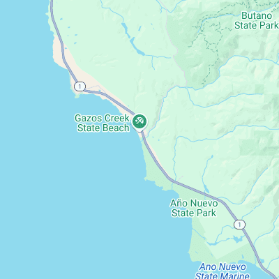
Surf spots nearby
- Pigeon Point (2.4 mi)
- Año Nuevo (4.5 mi)
- Bean Hollow State Beach (4.9 mi)
- Waddell Creek (6.8 mi)
- Pescadero State Beach (7.5 mi)
- Pomponio State Beach (9 mi)
- San Gregorio State Beach (11.1 mi)
- Scott Creek (11.5 mi)
- Davenport Landing (12.7 mi)
- Tunitas Creek (13.3 mi)
Not Magic Seaweed (MSW)
Although we look a bit like Magic Seaweed we are not MagicSeaweed as they no longer exist...