Ponto Surf Report
| Wave height * | 4.5ft / 1.3m |
|---|---|
| Swell period | 16s |
| Swell direction | |
| Wind | |
| Sea temp | 17°C / 63°F |

10 day Ponto surf forecast
Sun
4/Jan
4.5ft
5
6
7
- Low 3:32am
- High 9:43am
- Low 4:56pm
- High 11:32pm
Mon
5/Jan
3.5ft
4
8
4
- Low 4:27am
- High 10:29am
- Low 5:36pm
Tue
6/Jan
2ft
2
3
0
- High 12:16am
- Low 5:27am
- High 11:17am
- Low 6:14pm
Wed
7/Jan
2ft
4
9
8
- High 1:02am
- Low 6:39am
- High 12:10pm
- Low 6:52pm
Thu
8/Jan
2ft
5
6
2
- High 1:50am
- Low 8:09am
- High 1:21pm
- Low 7:30pm
Fri
9/Jan
1.5ft
3
5
5
- High 2:40am
- Low 9:52am
- High 3:12pm
- Low 8:12pm
Sat
10/Jan
2ft
6
5
5
- High 3:31am
- Low 11:16am
- High 5:31pm
- Low 9:08pm
Sun
11/Jan
1.5ft
4
6
4
- High 4:21am
- Low 12:13pm
- High 7:02pm
- Low 10:17pm
Mon
12/Jan
2ft
4
3
5
- High 5:07am
- Low 12:54pm
- High 7:49pm
- Low 11:19pm
Sun 4th Jan
| 4:00 | 4ft | 4.7ft | 11s | 7mph (10mph) | |||
| 7:00 | 4.5ft | 4.9ft | 16s | 5mph (7mph) | |||
| 10:00 | 4.5ft | 5.2ft | 16s | 6mph (7mph) | |||
| 13:00 | 4.5ft | 5.5ft | 14s | 6mph (7mph) | |||
| 16:00 | 4.5ft | 5.6ft | 12s | 8mph (10mph) | |||
| 19:00 | 4.5ft | 5.5ft | 12s | 7mph (9mph) |
| Tide times |
|---|
| Low 3:32am (1.94m) |
| High 9:43am (6.36m) |
| Low 4:56pm (-1.18m) |
| High 11:32pm (4.09m) |
| Daylight | |
|---|---|
| First light | 06:25 |
| Sunrise | 06:52 |
| Sunset | 16:55 |
| Dark | 17:22 |
Mon 5th Jan
| 4:00 | 3ft | 4.4ft | 12s | 2mph (2mph) | |||
| 7:00 | 3.5ft | 4ft | 15s | 4mph (5mph) | |||
| 10:00 | 3.5ft | 3.7ft | 15s | 6mph (7mph) | |||
| 13:00 | 3.5ft | 3.5ft | 15s | 8mph (8mph) | |||
| 16:00 | 3ft | 3.4ft | 15s | 5mph (7mph) | |||
| 19:00 | 3ft | 3.2ft | 15s | 4mph (7mph) |
| Tide times |
|---|
| Low 4:27am (1.98m) |
| High 10:29am (5.72m) |
| Low 5:36pm (-0.64m) |
| Daylight | |
|---|---|
| First light | 06:25 |
| Sunrise | 06:53 |
| Sunset | 16:56 |
| Dark | 17:23 |
Tue 6th Jan
| 4:00 | 2ft | 2.8ft | 15s | 5mph (7mph) | |||
| 7:00 | 2ft | 2.7ft | 15s | 2mph (3mph) | |||
| 10:00 | 2ft | 2.6ft | 15s | 3mph (4mph) | |||
| 13:00 | 2ft | 2.6ft | 14s | 3mph (4mph) | |||
| 16:00 | 2ft | 2.7ft | 14s | 7mph (6mph) | |||
| 19:00 | 2ft | 2.8ft | 14s | 0mph (1mph) |
| Tide times |
|---|
| High 12:16am (4.19m) |
| Low 5:27am (2.06m) |
| High 11:17am (4.92m) |
| Low 6:14pm (-0.02m) |
| Daylight | |
|---|---|
| First light | 06:26 |
| Sunrise | 06:53 |
| Sunset | 16:57 |
| Dark | 17:24 |
Wed 7th Jan
| 4:00 | 3ft | 3.3ft | 13s | 4mph (5mph) | |||
| 7:00 | 3ft | 3.2ft | 13s | 4mph (5mph) | |||
| 10:00 | 2.5ft | 3ft | 13s | 4mph (7mph) | |||
| 13:00 | 2ft | 2.8ft | 13s | 9mph (8mph) | |||
| 16:00 | 2ft | 2.7ft | 13s | 10mph (12mph) | |||
| 19:00 | 2ft | 2.8ft | 13s | 8mph (10mph) |
| Tide times |
|---|
| High 1:02am (4.29m) |
| Low 6:39am (2.12m) |
| High 12:10pm (4.07m) |
| Low 6:52pm (0.64m) |
| Daylight | |
|---|---|
| First light | 06:26 |
| Sunrise | 06:53 |
| Sunset | 16:58 |
| Dark | 17:25 |
Thu 8th Jan
| 4:00 | 2ft | 2.5ft | 13s | 4mph (4mph) | |||
| 7:00 | 2ft | 2.6ft | 15s | 5mph (5mph) | |||
| 10:00 | 2ft | 2.6ft | 15s | 2mph (2mph) | |||
| 13:00 | 2ft | 2.6ft | 15s | 6mph (3mph) | |||
| 16:00 | 2ft | 2.6ft | 15s | 7mph (6mph) | |||
| 19:00 | 2ft | 2.6ft | 15s | 2mph (2mph) |
| Tide times |
|---|
| High 1:50am (4.40m) |
| Low 8:09am (2.02m) |
| High 1:21pm (3.26m) |
| Low 7:30pm (1.28m) |
| Daylight | |
|---|---|
| First light | 06:26 |
| Sunrise | 06:53 |
| Sunset | 16:59 |
| Dark | 17:26 |
Fri 9th Jan
| 4:00 | 2ft | 2.5ft | 13s | 3mph (3mph) | |||
| 7:00 | 2ft | 2.5ft | 13s | 3mph (3mph) | |||
| 10:00 | 2ft | 2.4ft | 13s | 3mph (4mph) | |||
| 13:00 | 1.5ft | 2.4ft | 14s | 5mph (4mph) | |||
| 16:00 | 1.5ft | 2.3ft | 15s | 7mph (8mph) | |||
| 19:00 | 2ft | 2.3ft | 15s | 5mph (5mph) |
| Tide times |
|---|
| High 2:40am (4.52m) |
| Low 9:52am (1.68m) |
| High 3:12pm (2.70m) |
| Low 8:12pm (1.85m) |
| Daylight | |
|---|---|
| First light | 06:26 |
| Sunrise | 06:53 |
| Sunset | 16:59 |
| Dark | 17:26 |
Sat 10th Jan
| 4:00 | 2ft | 2.4ft | 14s | 6mph (7mph) | |||
| 7:00 | 2ft | 2.3ft | 14s | 6mph (6mph) | |||
| 10:00 | 2ft | 2.3ft | 14s | 4mph (7mph) | |||
| 13:00 | 2ft | 2.2ft | 14s | 5mph (7mph) | |||
| 16:00 | 2ft | 2.2ft | 14s | 8mph (9mph) | |||
| 19:00 | 2ft | 2.3ft | 14s | 5mph (5mph) |
| Tide times |
|---|
| High 3:31am (4.66m) |
| Low 11:16am (1.14m) |
| High 5:31pm (2.63m) |
| Low 9:08pm (2.30m) |
| Daylight | |
|---|---|
| First light | 06:26 |
| Sunrise | 06:53 |
| Sunset | 17:00 |
| Dark | 17:27 |
Sun 11th Jan
| 4:00 | 2ft | 2.1ft | 13s | 5mph (4mph) | |||
| 7:00 | 1.5ft | 2ft | 13s | 4mph (4mph) | |||
| 10:00 | 1.5ft | 1.9ft | 13s | 3mph (4mph) | |||
| 13:00 | 1.5ft | 1.9ft | 13s | 6mph (4mph) | |||
| 16:00 | 1.5ft | 1.9ft | 13s | 8mph (9mph) | |||
| 19:00 | 1.5ft | 2ft | 13s | 4mph (4mph) |
| Tide times |
|---|
| High 4:21am (4.83m) |
| Low 12:13pm (0.60m) |
| High 7:02pm (2.86m) |
| Low 10:17pm (2.58m) |
| Daylight | |
|---|---|
| First light | 06:26 |
| Sunrise | 06:52 |
| Sunset | 17:01 |
| Dark | 17:28 |
Mon 12th Jan
| 4:00 | 1.5ft | 1.9ft | 12s | 4mph (4mph) | |||
| 7:00 | 1.5ft | 1.9ft | 12s | 4mph (4mph) | |||
| 10:00 | 1.5ft | 1.9ft | 12s | 2mph (3mph) | |||
| 13:00 | 2ft | 2.1ft | 13s | 3mph (3mph) | |||
| 16:00 | 2ft | 2.4ft | 18s | 8mph (9mph) | |||
| 19:00 | 2ft | 2.7ft | 18s | 5mph (5mph) |
| Tide times |
|---|
| High 5:07am (5.03m) |
| Low 12:54pm (0.14m) |
| High 7:49pm (3.10m) |
| Low 11:19pm (2.66m) |
| Daylight | |
|---|---|
| First light | 06:25 |
| Sunrise | 06:52 |
| Sunset | 17:02 |
| Dark | 17:29 |
Tue 13th Jan
| 4:00 | 2ft | 2.7ft | 15s | 7mph (7mph) | |||
| 7:00 | 2ft | 2.7ft | 14s | 7mph (7mph) | |||
| 10:00 | 2ft | 2.6ft | 15s | 7mph (11mph) | |||
| 13:00 | 2ft | 2.5ft | 14s | 7mph (13mph) | |||
| 16:00 | 2ft | 2.6ft | 14s | 3mph (7mph) |
| Tide times |
|---|
| High 5:49am (5.26m) |
| Daylight | |
|---|---|
| First light | 06:25 |
| Sunrise | 06:52 |
| Sunset | 17:03 |
| Dark | 17:30 |
Nearest buoys
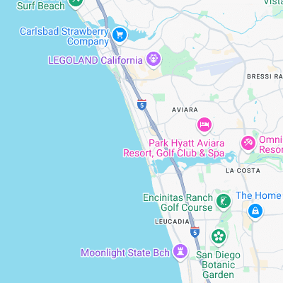
Surf spots nearby
- North Carlsbad State Beach (0.4 mi)
- Grandview (1.4 mi)
- Beacons (2.3 mi)
- Terra Mar Cove (2.5 mi)
- Carlsbad State Beach (2.9 mi)
- Stone Steps (3.1 mi)
- Moonlight Beach (3.5 mi)
- D Street (3.7 mi)
- Encinatas - D Street (3.7 mi)
- Tamarack Street (3.8 mi)
Not Magic Seaweed (MSW)
Although we look a bit like Magic Seaweed we are not MagicSeaweed as they no longer exist...