San Buenaventura State Beach Surf Report
| Wave height * | 3ft / 0.9m |
|---|---|
| Swell period | 15s |
| Swell direction | |
| Wind | |
| Sea temp | 16°C / 60°F |

10 day San Buenaventura State Beach surf forecast
Sun
4/Jan
2.5ft
3
3
1
- Low 3:10am
- High 9:17am
- Low 4:40pm
- High 11:08pm
Mon
5/Jan
2ft
5
3
4
- Low 4:01am
- High 10:02am
- Low 5:21pm
- High 11:50pm
Tue
6/Jan
1.5ft
9
7
2
- Low 4:55am
- High 10:48am
- Low 6:00pm
Wed
7/Jan
1.5ft
2
3
6
- High 12:33am
- Low 5:54am
- High 11:36am
- Low 6:39pm
Thu
8/Jan
1ft
6
1
5
- High 1:18am
- Low 7:04am
- High 12:29pm
- Low 7:16pm
Fri
9/Jan
1ft
7
8
4
- High 2:06am
- Low 8:29am
- High 1:37pm
- Low 7:55pm
Sat
10/Jan
1ft
5
1
3
- High 2:56am
- Low 10:08am
- High 3:21pm
- Low 8:38pm
Sun
11/Jan
1ft
6
2
4
- High 3:47am
- Low 11:35am
- High 5:36pm
- Low 9:33pm
Mon
12/Jan
1ft
5
2
3
- High 4:38am
- Low 12:35pm
- High 7:12pm
- Low 10:40pm
Sun 4th Jan
| 4:00 | 3ft | 4.1ft | 13s | 4mph (4mph) | |||
| 7:00 | 3ft | 4.3ft | 15s | 3mph (4mph) | |||
| 10:00 | 3ft | 4.3ft | 14s | 5mph (9mph) | |||
| 13:00 | 2.5ft | 4.2ft | 15s | 3mph (4mph) | |||
| 16:00 | 2.5ft | 3.9ft | 15s | 4mph (4mph) | |||
| 19:00 | 2ft | 3.7ft | 15s | 1mph (2mph) |
| Tide times |
|---|
| Low 3:10am (2.03m) |
| High 9:17am (6.88m) |
| Low 4:40pm (-1.63m) |
| High 11:08pm (4.13m) |
| Daylight | |
|---|---|
| First light | 06:36 |
| Sunrise | 07:03 |
| Sunset | 17:00 |
| Dark | 17:28 |
Mon 5th Jan
| 4:00 | 2ft | 3.1ft | 14s | 2mph (2mph) | |||
| 7:00 | 2ft | 2.9ft | 14s | 5mph (5mph) | |||
| 10:00 | 2ft | 2.6ft | 14s | 5mph (6mph) | |||
| 13:00 | 2ft | 2.5ft | 14s | 3mph (3mph) | |||
| 16:00 | 1.5ft | 2.4ft | 14s | 6mph (7mph) | |||
| 19:00 | 1.5ft | 2.3ft | 14s | 4mph (6mph) |
| Tide times |
|---|
| Low 4:01am (2.00m) |
| High 10:02am (6.45m) |
| Low 5:21pm (-1.22m) |
| High 11:50pm (4.22m) |
| Daylight | |
|---|---|
| First light | 06:36 |
| Sunrise | 07:03 |
| Sunset | 17:01 |
| Dark | 17:29 |
Tue 6th Jan
| 4:00 | 1.5ft | 2.1ft | 13s | 6mph (9mph) | |||
| 7:00 | 1.5ft | 2.1ft | 13s | 9mph (15mph) | |||
| 10:00 | 1.5ft | 2.2ft | 13s | 8mph (13mph) | |||
| 13:00 | 1.5ft | 2.3ft | 13s | 7mph (9mph) | |||
| 16:00 | 1.5ft | 2.4ft | 14s | 7mph (8mph) | |||
| 19:00 | 1.5ft | 2.5ft | 14s | 2mph (3mph) |
| Tide times |
|---|
| Low 4:55am (2.04m) |
| High 10:48am (5.80m) |
| Low 6:00pm (-0.67m) |
| Daylight | |
|---|---|
| First light | 06:36 |
| Sunrise | 07:03 |
| Sunset | 17:02 |
| Dark | 17:29 |
Wed 7th Jan
| 4:00 | 1.5ft | 2.3ft | 13s | 4mph (4mph) | |||
| 7:00 | 1.5ft | 2.1ft | 13s | 2mph (2mph) | |||
| 10:00 | 1ft | 2ft | 13s | 4mph (4mph) | |||
| 13:00 | 1.5ft | 1.9ft | 13s | 3mph (3mph) | |||
| 16:00 | 1.5ft | 1.9ft | 13s | 4mph (4mph) | |||
| 19:00 | 2ft | 2.1ft | 13s | 6mph (7mph) |
| Tide times |
|---|
| High 12:33am (4.30m) |
| Low 5:54am (2.12m) |
| High 11:36am (5.00m) |
| Low 6:39pm (-0.03m) |
| Daylight | |
|---|---|
| First light | 06:36 |
| Sunrise | 07:03 |
| Sunset | 17:03 |
| Dark | 17:30 |
Thu 8th Jan
| 4:00 | 1ft | 2ft | 16s | 4mph (4mph) | |||
| 7:00 | 1ft | 1.9ft | 17s | 6mph (6mph) | |||
| 10:00 | 1ft | 1.8ft | 16s | 3mph (5mph) | |||
| 13:00 | 1ft | 1.8ft | 16s | 1mph (3mph) | |||
| 16:00 | 1ft | 1.8ft | 16s | 4mph (4mph) | |||
| 19:00 | 1ft | 1.8ft | 16s | 5mph (6mph) |
| Tide times |
|---|
| High 1:18am (4.39m) |
| Low 7:04am (2.16m) |
| High 12:29pm (4.15m) |
| Low 7:16pm (0.64m) |
| Daylight | |
|---|---|
| First light | 06:36 |
| Sunrise | 07:03 |
| Sunset | 17:04 |
| Dark | 17:31 |
Fri 9th Jan
| 4:00 | 1ft | 1.9ft | 15s | 7mph (9mph) | |||
| 7:00 | 1ft | 1.9ft | 14s | 7mph (9mph) | |||
| 10:00 | 1ft | 1.9ft | 14s | 7mph (11mph) | |||
| 13:00 | 1ft | 1.8ft | 15s | 8mph (12mph) | |||
| 16:00 | 1ft | 1.7ft | 14s | 6mph (12mph) | |||
| 19:00 | 1ft | 1.7ft | 14s | 4mph (6mph) |
| Tide times |
|---|
| High 2:06am (4.47m) |
| Low 8:29am (2.08m) |
| High 1:37pm (3.34m) |
| Low 7:55pm (1.30m) |
| Daylight | |
|---|---|
| First light | 06:36 |
| Sunrise | 07:03 |
| Sunset | 17:05 |
| Dark | 17:32 |
Sat 10th Jan
| 4:00 | 1ft | 1.7ft | 13s | 7mph (11mph) | |||
| 7:00 | 1ft | 1.7ft | 13s | 5mph (7mph) | |||
| 10:00 | 1ft | 1.7ft | 13s | 1mph (6mph) | |||
| 13:00 | 1ft | 1.6ft | 13s | 1mph (6mph) | |||
| 16:00 | 1ft | 1.6ft | 13s | 5mph (7mph) | |||
| 19:00 | 1ft | 1.6ft | 13s | 3mph (4mph) |
| Tide times |
|---|
| High 2:56am (4.57m) |
| Low 10:08am (1.77m) |
| High 3:21pm (2.76m) |
| Low 8:38pm (1.88m) |
| Daylight | |
|---|---|
| First light | 06:36 |
| Sunrise | 07:03 |
| Sunset | 17:05 |
| Dark | 17:33 |
Sun 11th Jan
| 4:00 | 1ft | 1.5ft | 13s | 6mph (7mph) | |||
| 7:00 | 1.5ft | 1.4ft | 13s | 6mph (8mph) | |||
| 10:00 | 1.5ft | 1.4ft | 13s | 5mph (7mph) | |||
| 13:00 | 1ft | 1.4ft | 13s | 2mph (4mph) | |||
| 16:00 | 1.5ft | 1.4ft | 13s | 3mph (4mph) | |||
| 19:00 | 1.5ft | 1.4ft | 13s | 4mph (6mph) |
| Tide times |
|---|
| High 3:47am (4.70m) |
| Low 11:35am (1.27m) |
| High 5:36pm (2.64m) |
| Low 9:33pm (2.34m) |
| Daylight | |
|---|---|
| First light | 06:36 |
| Sunrise | 07:03 |
| Sunset | 17:06 |
| Dark | 17:34 |
Mon 12th Jan
| 4:00 | 1ft | 1.5ft | 12s | 3mph (3mph) | |||
| 7:00 | 1ft | 1.5ft | 12s | 5mph (6mph) | |||
| 10:00 | 1ft | 1.6ft | 15s | 2mph (4mph) | |||
| 13:00 | 1ft | 1.8ft | 18s | 2mph (4mph) | |||
| 16:00 | 1.5ft | 1.9ft | 17s | 6mph (6mph) | |||
| 19:00 | 1ft | 2ft | 17s | 3mph (4mph) |
| Tide times |
|---|
| High 4:38am (4.86m) |
| Low 12:35pm (0.72m) |
| High 7:12pm (2.85m) |
| Low 10:40pm (2.63m) |
| Daylight | |
|---|---|
| First light | 06:36 |
| Sunrise | 07:03 |
| Sunset | 17:07 |
| Dark | 17:35 |
Tue 13th Jan
| 4:00 | 1.5ft | 2.1ft | 14s | 7mph (12mph) | |||
| 7:00 | 1.5ft | 2.1ft | 14s | 7mph (11mph) | |||
| 10:00 | 1ft | 2ft | 14s | 5mph (10mph) | |||
| 13:00 | 1ft | 1.9ft | 14s | 3mph (13mph) | |||
| 16:00 | 1ft | 1.8ft | 13s | 2mph (11mph) |
| Tide times |
|---|
| High 5:25am (5.07m) |
| Low 1:19pm (0.25m) |
| Daylight | |
|---|---|
| First light | 06:35 |
| Sunrise | 07:03 |
| Sunset | 17:08 |
| Dark | 17:35 |
Nearest buoys
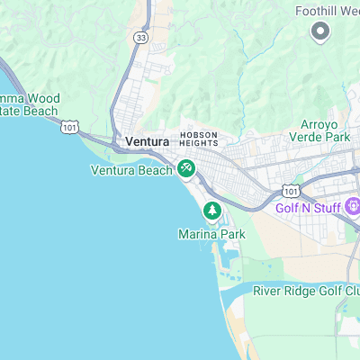
Surf spots nearby
- Ventura Point (1.4 mi)
- Ventura Jetty (1.8 mi)
- Santa Clara Rivermouth (2.6 mi)
- Emma Wood (3 mi)
- McGrath State Beach (3.5 mi)
- Ventura Overhead (3.9 mi)
- Solimar (5.1 mi)
- Oxnard (5.9 mi)
- Mondos (6.5 mi)
- Pitas Point (7 mi)
Not Magic Seaweed (MSW)
Although we look a bit like Magic Seaweed we are not MagicSeaweed as they no longer exist...