13th Beach Surf Report
| Wave height * | 2ft / 0.6m |
|---|---|
| Swell period | 12s |
| Swell direction | |
| Wind | |
| Sea temp | 16°C / 62°F |

10 day 13th Beach surf forecast
Fri
19/Dec
2ft
8
5
12
- High 12:18am
- Low 6:01am
- High 10:59am
- Low 5:53pm
Sat
20/Dec
2.5ft
6
14
13
- High 1:08am
- Low 7:05am
- High 11:53am
- Low 6:41pm
Sun
21/Dec
2.5ft
5
13
16
- High 1:51am
- Low 7:55am
- High 12:45pm
- Low 7:26pm
Mon
22/Dec
3ft
10
7
10
- High 2:30am
- Low 8:38am
- High 1:34pm
- Low 8:08pm
Tue
23/Dec
3.5ft
13
12
13
- High 3:07am
- Low 9:16am
- High 2:21pm
- Low 8:49pm
Wed
24/Dec
4.5ft
14
20
20
- High 3:42am
- Low 9:51am
- High 3:06pm
- Low 9:29pm
Thu
25/Dec
4ft
12
17
16
- High 4:15am
- Low 10:24am
- High 3:50pm
- Low 10:08pm
Fri
26/Dec
3.5ft
9
20
19
- High 4:46am
- Low 10:57am
- High 4:35pm
- Low 10:47pm
Sat
27/Dec
4ft
16
18
14
- High 5:17am
- Low 11:31am
- High 5:23pm
- Low 11:27pm
Fri 19th Dec
| 5:00 | 2ft | 2.1ft | 13s | 7mph (9mph) | |||
| 8:00 | 2ft | 2.1ft | 12s | 8mph (10mph) | |||
| 11:00 | 2ft | 2.1ft | 12s | 6mph (13mph) | |||
| 14:00 | 2ft | 2.1ft | 12s | 5mph (5mph) | |||
| 17:00 | 2ft | 2.2ft | 12s | 4mph (5mph) | |||
| 20:00 | 2ft | 2.4ft | 11s | 12mph (26mph) |
| Tide times |
|---|
| High 12:18am (1.28m) |
| Low 6:01am (0.84m) |
| High 10:59am (1.15m) |
| Low 5:53pm (0.28m) |
| Daylight | |
|---|---|
| First light | 05:22 |
| Sunrise | 05:53 |
| Sunset | 20:43 |
| Dark | 21:15 |
Sat 20th Dec
| 5:00 | 2.5ft | 3.1ft | 9s | 7mph (15mph) | |||
| 8:00 | 2.5ft | 2.9ft | 10s | 6mph (9mph) | |||
| 11:00 | 2.5ft | 2.7ft | 10s | 8mph (8mph) | |||
| 14:00 | 2.5ft | 2.7ft | 10s | 14mph (11mph) | |||
| 17:00 | 3ft | 3.2ft | 7s | 14mph (15mph) | |||
| 20:00 | 3ft | 3.2ft | 7s | 13mph (15mph) |
| Tide times |
|---|
| High 1:08am (1.35m) |
| Low 7:05am (0.79m) |
| High 11:53am (1.14m) |
| Low 6:41pm (0.23m) |
| Daylight | |
|---|---|
| First light | 05:22 |
| Sunrise | 05:54 |
| Sunset | 20:44 |
| Dark | 21:15 |
Sun 21st Dec
| 5:00 | 2ft | 2.6ft | 9s | 3mph (4mph) | |||
| 8:00 | 2ft | 2.5ft | 9s | 5mph (6mph) | |||
| 11:00 | 2ft | 2.5ft | 9s | 5mph (4mph) | |||
| 14:00 | 2.5ft | 2.8ft | 8s | 13mph (22mph) | |||
| 17:00 | 2.5ft | 3.4ft | 6s | 21mph (29mph) | |||
| 20:00 | 4ft | 4.6ft | 6s | 16mph (23mph) |
| Tide times |
|---|
| High 1:51am (1.41m) |
| Low 7:55am (0.73m) |
| High 12:45pm (1.14m) |
| Low 7:26pm (0.18m) |
| Daylight | |
|---|---|
| First light | 05:23 |
| Sunrise | 05:54 |
| Sunset | 20:44 |
| Dark | 21:16 |
Mon 22nd Dec
| 5:00 | 3.5ft | 4.3ft | 8s | 9mph (17mph) | |||
| 8:00 | 3.5ft | 4.1ft | 8s | 10mph (17mph) | |||
| 11:00 | 3ft | 3.8ft | 8s | 9mph (13mph) | |||
| 14:00 | 3ft | 3.4ft | 8s | 7mph (13mph) | |||
| 17:00 | 2.5ft | 3.2ft | 8s | 14mph (12mph) | |||
| 20:00 | 2.5ft | 3.1ft | 10s | 10mph (14mph) |
| Tide times |
|---|
| High 2:30am (1.45m) |
| Low 8:38am (0.67m) |
| High 1:34pm (1.15m) |
| Low 8:08pm (0.15m) |
| Daylight | |
|---|---|
| First light | 05:23 |
| Sunrise | 05:55 |
| Sunset | 20:45 |
| Dark | 21:16 |
Tue 23rd Dec
| 5:00 | 2.5ft | 3ft | 11s | 8mph (17mph) | |||
| 8:00 | 2.5ft | 3ft | 11s | 13mph (23mph) | |||
| 11:00 | 2.5ft | 3.4ft | 11s | 12mph (16mph) | |||
| 14:00 | 3.5ft | 4.2ft | 15s | 12mph (17mph) | |||
| 17:00 | 4.5ft | 5.4ft | 16s | 14mph (20mph) | |||
| 20:00 | 5ft | 6.1ft | 18s | 13mph (22mph) |
| Tide times |
|---|
| High 3:07am (1.48m) |
| Low 9:16am (0.61m) |
| High 2:21pm (1.16m) |
| Low 8:49pm (0.13m) |
| Daylight | |
|---|---|
| First light | 05:23 |
| Sunrise | 05:55 |
| Sunset | 20:45 |
| Dark | 21:17 |
Wed 24th Dec
| 5:00 | 5ft | 6.1ft | 16s | 11mph (21mph) | |||
| 8:00 | 4.5ft | 5.9ft | 16s | 14mph (24mph) | |||
| 11:00 | 4.5ft | 5.7ft | 16s | 17mph (25mph) | |||
| 14:00 | 4.5ft | 5.7ft | 15s | 20mph (25mph) | |||
| 17:00 | 5ft | 6.5ft | 15s | 23mph (27mph) | |||
| 20:00 | 5.5ft | 6.8ft | 15s | 20mph (23mph) |
| Tide times |
|---|
| High 3:42am (1.48m) |
| Low 9:51am (0.55m) |
| High 3:06pm (1.18m) |
| Low 9:29pm (0.14m) |
| Daylight | |
|---|---|
| First light | 05:24 |
| Sunrise | 05:56 |
| Sunset | 20:46 |
| Dark | 21:17 |
Thu 25th Dec
| 5:00 | 4ft | 5.3ft | 13s | 11mph (16mph) | |||
| 8:00 | 4ft | 5ft | 13s | 12mph (16mph) | |||
| 11:00 | 4ft | 4.7ft | 13s | 14mph (15mph) | |||
| 14:00 | 4ft | 4.7ft | 13s | 17mph (18mph) | |||
| 17:00 | 4.5ft | 5.4ft | 13s | 17mph (20mph) | |||
| 20:00 | 4.5ft | 5.4ft | 12s | 16mph (21mph) |
| Tide times |
|---|
| High 4:15am (1.47m) |
| Low 10:24am (0.50m) |
| High 3:50pm (1.20m) |
| Low 10:08pm (0.17m) |
| Daylight | |
|---|---|
| First light | 05:25 |
| Sunrise | 05:56 |
| Sunset | 20:46 |
| Dark | 21:18 |
Fri 26th Dec
| 5:00 | 4ft | 4.8ft | 12s | 6mph (11mph) | |||
| 8:00 | 4ft | 4.6ft | 11s | 9mph (17mph) | |||
| 11:00 | 4ft | 4.5ft | 11s | 18mph (21mph) | |||
| 14:00 | 3.5ft | 4.5ft | 10s | 20mph (23mph) | |||
| 17:00 | 4ft | 4.7ft | 10s | 21mph (26mph) | |||
| 20:00 | 4ft | 5ft | 10s | 19mph (22mph) |
| Tide times |
|---|
| High 4:46am (1.44m) |
| Low 10:57am (0.44m) |
| High 4:35pm (1.22m) |
| Low 10:47pm (0.24m) |
| Daylight | |
|---|---|
| First light | 05:25 |
| Sunrise | 05:57 |
| Sunset | 20:47 |
| Dark | 21:18 |
Sat 27th Dec
| 5:00 | 5.5ft | 6.1ft | 7s | 16mph (22mph) | |||
| 8:00 | 5.5ft | 5.8ft | 7s | 16mph (19mph) | |||
| 11:00 | 4.5ft | 5.4ft | 9s | 17mph (19mph) | |||
| 14:00 | 4ft | 4.9ft | 14s | 18mph (19mph) | |||
| 17:00 | 3.5ft | 4.6ft | 13s | 17mph (20mph) | |||
| 20:00 | 3.5ft | 4.4ft | 13s | 14mph (17mph) |
| Tide times |
|---|
| High 5:17am (1.41m) |
| Low 11:31am (0.39m) |
| High 5:23pm (1.24m) |
| Low 11:27pm (0.32m) |
| Daylight | |
|---|---|
| First light | 05:26 |
| Sunrise | 05:57 |
| Sunset | 20:47 |
| Dark | 21:18 |
Sun 28th Dec
| 5:00 | 4ft | 4.7ft | 9s | 9mph (14mph) | |||
| 8:00 | 3.5ft | 4.4ft | 11s | 14mph (21mph) | |||
| 11:00 | 3ft | 3.7ft | 13s | 10mph (14mph) |
Beachbreak that picks up plenty of swell. There are a few reefs dotted along the beach which help form some decent banks. Generally gets bigger towards the eastern end (The Beacon)
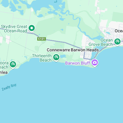
Surf spots nearby
- Bancoora (3 mi)
- Ocean Grove (3.5 mi)
- Point Impossible (4.9 mi)
- Torquay Point (8.5 mi)
- Jan Juc (9.3 mi)
- Quarantines (9.9 mi)
- Bird Rock (10.1 mi)
- Winkipop (11.1 mi)
- Bells Beach (11.5 mi)
- Spooks (12.5 mi)
Not Magic Seaweed (MSW)
Although we look a bit like Magic Seaweed we are not MagicSeaweed as they no longer exist...