Bells Beach Surf Report
| Wave height * | 1.5ft / 0.4m |
|---|---|
| Swell period | 11s |
| Swell direction | |
| Wind | |
| Sea temp | 17°C / 62°F |

10 day Bells Beach surf forecast
Tue
6/Jan
1.5ft
1
6
7
- High 6:28am
- Low 12:35pm
- High 6:03pm
Wed
7/Jan
1.5ft
4
16
3
- Low 12:35am
- High 7:07am
- Low 1:15pm
- High 6:57pm
Thu
8/Jan
2ft
6
11
10
- Low 1:18am
- High 7:43am
- Low 1:54pm
- High 7:44pm
Fri
9/Jan
2ft
4
20
4
- Low 1:58am
- High 8:18am
- Low 2:32pm
- High 8:29pm
Sat
10/Jan
1.5ft
13
17
14
- Low 2:36am
- High 8:51am
- Low 3:09pm
- High 9:12pm
Sun
11/Jan
2.5ft
8
12
10
- Low 3:12am
- High 9:23am
- Low 3:45pm
- High 9:55pm
Mon
12/Jan
1.5ft
6
10
11
- Low 3:48am
- High 9:55am
- Low 4:21pm
- High 10:38pm
Tue
13/Jan
2ft
8
15
12
- Low 4:24am
- High 10:28am
- Low 4:59pm
- High 11:22pm
Wed
14/Jan
3ft
11
13
14
- Low 5:01am
- High 11:02am
- Low 5:37pm
Tue 6th Jan
| 5:00 | 1.5ft | 3ft | 11s | 2mph (2mph) | |||
| 8:00 | 1.5ft | 3.1ft | 11s | 1mph (2mph) | |||
| 11:00 | 1.5ft | 3ft | 11s | 3mph (3mph) | |||
| 14:00 | 1.5ft | 3ft | 11s | 6mph (8mph) | |||
| 17:00 | 1.5ft | 3.2ft | 11s | 12mph (14mph) | |||
| 20:00 | 1.5ft | 3.1ft | 11s | 7mph (11mph) |
| Tide times |
|---|
| High 6:28am (0.95m) |
| Low 12:35pm (0.38m) |
| High 6:03pm (0.82m) |
| Daylight | |
|---|---|
| First light | 05:34 |
| Sunrise | 06:06 |
| Sunset | 20:50 |
| Dark | 21:21 |
Wed 7th Jan
| 5:00 | 1.5ft | 3.1ft | 12s | 3mph (3mph) | |||
| 8:00 | 1.5ft | 3.3ft | 12s | 4mph (7mph) | |||
| 11:00 | 1.5ft | 3.4ft | 12s | 11mph (21mph) | |||
| 14:00 | 1.5ft | 3.5ft | 12s | 16mph (20mph) | |||
| 17:00 | 1.5ft | 3.7ft | 12s | 13mph (20mph) | |||
| 20:00 | 1.5ft | 3.7ft | 12s | 3mph (6mph) |
| Tide times |
|---|
| Low 12:35am (0.06m) |
| High 7:07am (0.97m) |
| Low 1:15pm (0.31m) |
| High 6:57pm (0.85m) |
| Daylight | |
|---|---|
| First light | 05:35 |
| Sunrise | 06:06 |
| Sunset | 20:50 |
| Dark | 21:21 |
Thu 8th Jan
| 5:00 | 2ft | 3.9ft | 16s | 7mph (17mph) | |||
| 8:00 | 2ft | 4.1ft | 15s | 6mph (5mph) | |||
| 11:00 | 2ft | 4.8ft | 15s | 12mph (13mph) | |||
| 14:00 | 2ft | 4.7ft | 15s | 11mph (9mph) | |||
| 17:00 | 2ft | 4.7ft | 15s | 12mph (13mph) | |||
| 20:00 | 2ft | 4.6ft | 15s | 10mph (19mph) |
| Tide times |
|---|
| Low 1:18am (0.08m) |
| High 7:43am (0.98m) |
| Low 1:54pm (0.26m) |
| High 7:44pm (0.85m) |
| Daylight | |
|---|---|
| First light | 05:36 |
| Sunrise | 06:07 |
| Sunset | 20:50 |
| Dark | 21:21 |
Fri 9th Jan
| 5:00 | 2ft | 4.3ft | 14s | 3mph (3mph) | |||
| 8:00 | 2ft | 4.1ft | 14s | 4mph (4mph) | |||
| 11:00 | 1.5ft | 3.9ft | 14s | 14mph (37mph) | |||
| 14:00 | 2ft | 3.9ft | 13s | 20mph (39mph) | |||
| 17:00 | 2ft | 4.7ft | 13s | 10mph (11mph) | |||
| 20:00 | 2ft | 4.7ft | 13s | 4mph (6mph) |
| Tide times |
|---|
| Low 1:58am (0.13m) |
| High 8:18am (0.98m) |
| Low 2:32pm (0.22m) |
| High 8:29pm (0.85m) |
| Daylight | |
|---|---|
| First light | 05:37 |
| Sunrise | 06:08 |
| Sunset | 20:50 |
| Dark | 21:21 |
Sat 10th Jan
| 5:00 | 1.5ft | 3.6ft | 12s | 9mph (20mph) | |||
| 8:00 | 1.5ft | 3.4ft | 12s | 13mph (26mph) | |||
| 11:00 | 1.5ft | 3.2ft | 12s | 15mph (23mph) | |||
| 14:00 | 1.5ft | 3.6ft | 12s | 17mph (27mph) | |||
| 17:00 | 2ft | 4.6ft | 12s | 18mph (24mph) | |||
| 20:00 | 2.5ft | 5.2ft | 9s | 14mph (21mph) |
| Tide times |
|---|
| Low 2:36am (0.18m) |
| High 8:51am (0.96m) |
| Low 3:09pm (0.18m) |
| High 9:12pm (0.83m) |
| Daylight | |
|---|---|
| First light | 05:38 |
| Sunrise | 06:09 |
| Sunset | 20:49 |
| Dark | 21:20 |
Sun 11th Jan
| 5:00 | 2.5ft | 6.7ft | 12s | 8mph (15mph) | |||
| 8:00 | 2.5ft | 6.3ft | 12s | 8mph (16mph) | |||
| 11:00 | 2.5ft | 5.8ft | 12s | 11mph (12mph) | |||
| 14:00 | 2.5ft | 5.4ft | 12s | 12mph (12mph) | |||
| 17:00 | 2ft | 5ft | 11s | 12mph (13mph) | |||
| 20:00 | 2ft | 4.8ft | 11s | 10mph (15mph) |
| Tide times |
|---|
| Low 3:12am (0.24m) |
| High 9:23am (0.94m) |
| Low 3:45pm (0.16m) |
| High 9:55pm (0.80m) |
| Daylight | |
|---|---|
| First light | 05:39 |
| Sunrise | 06:10 |
| Sunset | 20:49 |
| Dark | 21:20 |
Mon 12th Jan
| 5:00 | 2ft | 4.4ft | 9s | 4mph (11mph) | |||
| 8:00 | 2ft | 4.1ft | 9s | 6mph (9mph) | |||
| 11:00 | 1.5ft | 3.9ft | 9s | 9mph (7mph) | |||
| 14:00 | 1.5ft | 3.7ft | 9s | 10mph (10mph) | |||
| 17:00 | 1.5ft | 3.8ft | 9s | 12mph (14mph) | |||
| 20:00 | 4ft | 4.2ft | 5s | 11mph (20mph) |
| Tide times |
|---|
| Low 3:48am (0.30m) |
| High 9:55am (0.91m) |
| Low 4:21pm (0.14m) |
| High 10:38pm (0.77m) |
| Daylight | |
|---|---|
| First light | 05:40 |
| Sunrise | 06:11 |
| Sunset | 20:49 |
| Dark | 21:20 |
Tue 13th Jan
| 5:00 | 4ft | 4.2ft | 5s | 9mph (15mph) | |||
| 8:00 | 2ft | 4.1ft | 7s | 8mph (15mph) | |||
| 11:00 | 2ft | 4.2ft | 8s | 12mph (16mph) | |||
| 14:00 | 2ft | 4.4ft | 8s | 15mph (17mph) | |||
| 17:00 | 2.5ft | 4.7ft | 8s | 15mph (18mph) | |||
| 20:00 | 2.5ft | 5ft | 8s | 12mph (20mph) |
| Tide times |
|---|
| Low 4:24am (0.35m) |
| High 10:28am (0.88m) |
| Low 4:59pm (0.14m) |
| High 11:22pm (0.74m) |
| Daylight | |
|---|---|
| First light | 05:42 |
| Sunrise | 06:12 |
| Sunset | 20:49 |
| Dark | 21:20 |
Wed 14th Jan
| 5:00 | 3ft | 5.6ft | 16s | 10mph (22mph) | |||
| 8:00 | 3ft | 5.7ft | 16s | 11mph (18mph) | |||
| 11:00 | 3ft | 5.8ft | 16s | 12mph (13mph) | |||
| 14:00 | 3ft | 5.8ft | 16s | 13mph (14mph) | |||
| 17:00 | 3ft | 5.8ft | 15s | 15mph (19mph) | |||
| 20:00 | 3ft | 5.9ft | 15s | 14mph (26mph) |
| Tide times |
|---|
| Low 5:01am (0.41m) |
| High 11:02am (0.84m) |
| Low 5:37pm (0.13m) |
| Daylight | |
|---|---|
| First light | 05:43 |
| Sunrise | 06:13 |
| Sunset | 20:49 |
| Dark | 21:19 |
Thu 15th Jan
| 5:00 | 3.5ft | 6.5ft | 14s | 10mph (18mph) | |||
| 8:00 | 6.5ft | 7.1ft | 6s | 11mph (17mph) | |||
| 11:00 | 7ft | 7.6ft | 7s | 11mph (13mph) |
Epic righthand pointbreak. Bell's is fed by the huge southern ocean swells that consistently sweep through the Tasman Sea
Bells is split into several breaks best known of which are Rincon and Bell's Bowl. Rincon breaks over a ledge and the reels along the point and will work on most tides. The Bowl is the performance wave, breaking best at low tide and doing just what it says on the tin! On a big enough swell they can join together finishing up in the shorey
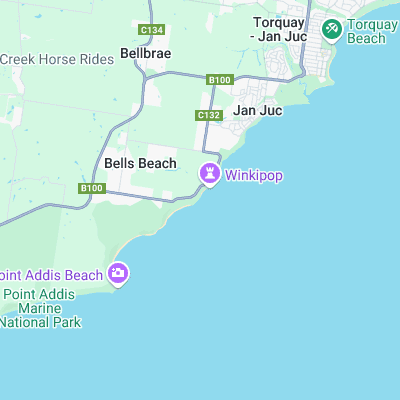
Surf spots nearby
- Winkipop (0.3 mi)
- Bird Rock (1.5 mi)
- Point Addis (2.1 mi)
- Jan Juc (2.4 mi)
- Torquay Point (3 mi)
- Anglesea (5.9 mi)
- Soapys (6.4 mi)
- Roadnight Point (6.5 mi)
- Point Impossible (6.8 mi)
- Bancoora (8.8 mi)
Not Magic Seaweed (MSW)
Although we look a bit like Magic Seaweed we are not MagicSeaweed as they no longer exist...