Pippies (Pippi Beach) Surf Report
| Wave height * | 4ft / 1.2m |
|---|---|
| Swell period | 6s |
| Swell direction | |
| Wind | |
| Sea temp | 24°C / 75°F |

10 day Pippies surf forecast
Fri
19/Dec
4ft
4
10
5
- Low 1:46am
- High 8:35am
- Low 3:15pm
- High 8:45pm
Sat
20/Dec
3.5ft
5
11
1
- Low 2:24am
- High 9:13am
- Low 3:56pm
- High 9:28pm
Sun
21/Dec
4ft
5
9
7
- Low 3:02am
- High 9:50am
- Low 4:36pm
- High 10:11pm
Mon
22/Dec
3ft
5
10
2
- Low 3:40am
- High 10:28am
- Low 5:15pm
- High 10:53pm
Tue
23/Dec
2ft
3
4
5
- Low 4:20am
- High 11:07am
- Low 5:54pm
- High 11:37pm
Wed
24/Dec
4ft
5
10
3
- Low 5:01am
- High 11:46am
- Low 6:34pm
Thu
25/Dec
3ft
5
12
7
- High 12:22am
- Low 5:47am
- High 12:29pm
- Low 7:15pm
Fri
26/Dec
3ft
4
8
4
- High 1:11am
- Low 6:40am
- High 1:15pm
- Low 7:58pm
Sat
27/Dec
5.5ft
3
8
10
- High 2:05am
- Low 7:43am
- High 2:07pm
- Low 8:46pm
Fri 19th Dec
| 5:00 | 3.5ft | 4ft | 8s | 3mph (7mph) | |||
| 8:00 | 3.5ft | 3.8ft | 8s | 4mph (10mph) | |||
| 11:00 | 3ft | 3.7ft | 8s | 5mph (5mph) | |||
| 14:00 | 4ft | 4.6ft | 5s | 10mph (9mph) | |||
| 17:00 | 3.5ft | 5.5ft | 5s | 11mph (21mph) | |||
| 20:00 | 4ft | 5.7ft | 6s | 5mph (18mph) |
| Tide times |
|---|
| Low 1:46am (0.39m) |
| High 8:35am (1.62m) |
| Low 3:15pm (0.45m) |
| High 8:45pm (1.08m) |
| Daylight | |
|---|---|
| First light | 05:15 |
| Sunrise | 05:42 |
| Sunset | 19:44 |
| Dark | 20:11 |
Sat 20th Dec
| 5:00 | 3.5ft | 4.7ft | 6s | 3mph (6mph) | |||
| 8:00 | 3ft | 4.3ft | 6s | 5mph (11mph) | |||
| 11:00 | 3ft | 4.4ft | 6s | 5mph (7mph) | |||
| 14:00 | 3.5ft | 5.9ft | 6s | 11mph (10mph) | |||
| 17:00 | 4.5ft | 7ft | 6s | 11mph (20mph) | |||
| 20:00 | 4ft | 7.1ft | 7s | 1mph (2mph) |
| Tide times |
|---|
| Low 2:24am (0.37m) |
| High 9:13am (1.65m) |
| Low 3:56pm (0.39m) |
| High 9:28pm (1.05m) |
| Daylight | |
|---|---|
| First light | 05:15 |
| Sunrise | 05:42 |
| Sunset | 19:45 |
| Dark | 20:12 |
Sun 21st Dec
| 5:00 | 3ft | 4.9ft | 6s | 4mph (15mph) | |||
| 8:00 | 3ft | 4.8ft | 7s | 5mph (12mph) | |||
| 11:00 | 3ft | 4.9ft | 7s | 6mph (10mph) | |||
| 14:00 | 4ft | 6.4ft | 7s | 9mph (11mph) | |||
| 17:00 | 4.5ft | 8.2ft | 7s | 10mph (22mph) | |||
| 20:00 | 4.5ft | 8.3ft | 7s | 7mph (21mph) |
| Tide times |
|---|
| Low 3:02am (0.35m) |
| High 9:50am (1.66m) |
| Low 4:36pm (0.34m) |
| High 10:11pm (1.03m) |
| Daylight | |
|---|---|
| First light | 05:16 |
| Sunrise | 05:43 |
| Sunset | 19:45 |
| Dark | 20:12 |
Mon 22nd Dec
| 5:00 | 3ft | 5.7ft | 7s | 5mph (21mph) | |||
| 8:00 | 3ft | 5.5ft | 7s | 5mph (11mph) | |||
| 11:00 | 3ft | 5.1ft | 7s | 5mph (11mph) | |||
| 14:00 | 3ft | 5.5ft | 7s | 10mph (9mph) | |||
| 17:00 | 3.5ft | 6.2ft | 7s | 9mph (24mph) | |||
| 20:00 | 3ft | 5.1ft | 7s | 2mph (7mph) |
| Tide times |
|---|
| Low 3:40am (0.34m) |
| High 10:28am (1.64m) |
| Low 5:15pm (0.31m) |
| High 10:53pm (1.01m) |
| Daylight | |
|---|---|
| First light | 05:16 |
| Sunrise | 05:43 |
| Sunset | 19:46 |
| Dark | 20:13 |
Tue 23rd Dec
| 5:00 | 2ft | 3.8ft | 7s | 5mph (15mph) | |||
| 8:00 | 2.5ft | 3.7ft | 7s | 3mph (14mph) | |||
| 11:00 | 2.5ft | 3.7ft | 7s | 4mph (14mph) | |||
| 14:00 | 2ft | 3.9ft | 7s | 4mph (13mph) | |||
| 17:00 | 3ft | 4ft | 7s | 5mph (15mph) | |||
| 20:00 | 3ft | 4.2ft | 8s | 5mph (16mph) |
| Tide times |
|---|
| Low 4:20am (0.35m) |
| High 11:07am (1.61m) |
| Low 5:54pm (0.30m) |
| High 11:37pm (1.01m) |
| Daylight | |
|---|---|
| First light | 05:17 |
| Sunrise | 05:44 |
| Sunset | 19:46 |
| Dark | 20:13 |
Wed 24th Dec
| 5:00 | 2.5ft | 3.4ft | 8s | 3mph (8mph) | |||
| 8:00 | 2.5ft | 3.8ft | 6s | 5mph (13mph) | |||
| 11:00 | 4ft | 6.5ft | 6s | 6mph (6mph) | |||
| 14:00 | 4ft | 7.1ft | 7s | 10mph (8mph) | |||
| 17:00 | 4ft | 6.8ft | 7s | 8mph (12mph) | |||
| 20:00 | 4ft | 6.2ft | 7s | 3mph (8mph) |
| Tide times |
|---|
| Low 5:01am (0.37m) |
| High 11:46am (1.57m) |
| Low 6:34pm (0.30m) |
| Daylight | |
|---|---|
| First light | 05:17 |
| Sunrise | 05:44 |
| Sunset | 19:47 |
| Dark | 20:14 |
Thu 25th Dec
| 5:00 | 3ft | 5.3ft | 8s | 3mph (6mph) | |||
| 8:00 | 3ft | 5.2ft | 8s | 5mph (15mph) | |||
| 11:00 | 3ft | 5.2ft | 9s | 10mph (14mph) | |||
| 14:00 | 3ft | 4.9ft | 9s | 12mph (15mph) | |||
| 17:00 | 3ft | 4.8ft | 9s | 11mph (19mph) | |||
| 20:00 | 3ft | 4.9ft | 7s | 7mph (19mph) |
| Tide times |
|---|
| High 12:22am (1.02m) |
| Low 5:47am (0.41m) |
| High 12:29pm (1.51m) |
| Low 7:15pm (0.32m) |
| Daylight | |
|---|---|
| First light | 05:18 |
| Sunrise | 05:45 |
| Sunset | 19:47 |
| Dark | 20:14 |
Fri 26th Dec
| 5:00 | 2.5ft | 4.5ft | 11s | 2mph (2mph) | |||
| 8:00 | 2.5ft | 4.3ft | 10s | 4mph (11mph) | |||
| 11:00 | 2.5ft | 3.9ft | 10s | 6mph (8mph) | |||
| 14:00 | 3ft | 4.2ft | 10s | 8mph (8mph) | |||
| 17:00 | 3.5ft | 5.1ft | 5s | 5mph (8mph) | |||
| 20:00 | 4ft | 6.2ft | 6s | 4mph (13mph) |
| Tide times |
|---|
| High 1:11am (1.06m) |
| Low 6:40am (0.46m) |
| High 1:15pm (1.45m) |
| Low 7:58pm (0.35m) |
| Daylight | |
|---|---|
| First light | 05:19 |
| Sunrise | 05:46 |
| Sunset | 19:47 |
| Dark | 20:14 |
Sat 27th Dec
| 5:00 | 3.5ft | 5.5ft | 5s | 3mph (4mph) | |||
| 8:00 | 4.5ft | 7.3ft | 6s | 3mph (5mph) | |||
| 11:00 | 5ft | 8.7ft | 7s | 4mph (3mph) | |||
| 14:00 | 5.5ft | 9.2ft | 8s | 8mph (8mph) | |||
| 17:00 | 5ft | 8.6ft | 8s | 8mph (17mph) | |||
| 20:00 | 6.5ft | 9ft | 8s | 10mph (22mph) |
| Tide times |
|---|
| High 2:05am (1.13m) |
| Low 7:43am (0.52m) |
| High 2:07pm (1.39m) |
| Low 8:46pm (0.37m) |
| Daylight | |
|---|---|
| First light | 05:19 |
| Sunrise | 05:46 |
| Sunset | 19:48 |
| Dark | 20:15 |
Sun 28th Dec
| 5:00 | 4.5ft | 8.7ft | 12s | 9mph (22mph) | |||
| 8:00 | 5ft | 8.8ft | 14s | 10mph (23mph) | |||
| 11:00 | 5ft | 8.8ft | 13s | 10mph (23mph) |
Powerful beach-break with quality peaks. Always less crowded than the nearby point at Anguorie
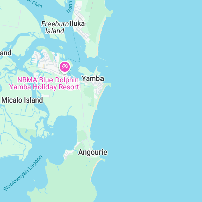
Surf spots nearby
- North Wall - Iluka (2 mi)
- Angourie Point (2.4 mi)
- Iluka Bluff (3.4 mi)
- Woody Head (5.7 mi)
- Minnie Water (21.7 mi)
- Corby's left (23.5 mi)
- Evans Head (23.7 mi)
Not Magic Seaweed (MSW)
Although we look a bit like Magic Seaweed we are not MagicSeaweed as they no longer exist...