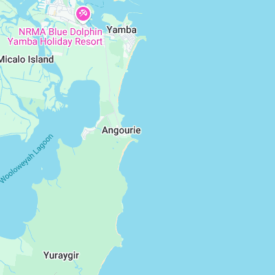
Angourie Point Surf Report
| Wave height * | 3ft / 0.9m |
|---|---|
| Swell period | 6s |
| Swell direction | |
| Wind | |
| Sea temp | 24°C / 75°F |

10 day Angourie Point surf forecast
Sat
20/Dec
3.5ft
5
12
6
- Low 2:24am
- High 9:13am
- Low 3:56pm
- High 9:28pm
Sun
21/Dec
3.5ft
6
10
8
- Low 3:02am
- High 9:50am
- Low 4:36pm
- High 10:11pm
Mon
22/Dec
3ft
7
5
6
- Low 3:40am
- High 10:28am
- Low 5:15pm
- High 10:53pm
Tue
23/Dec
2.5ft
4
4
2
- Low 4:20am
- High 11:07am
- Low 5:54pm
- High 11:37pm
Wed
24/Dec
4ft
5
6
4
- Low 5:01am
- High 11:46am
- Low 6:34pm
Thu
25/Dec
4ft
5
15
10
- High 12:22am
- Low 5:47am
- High 12:29pm
- Low 7:15pm
Fri
26/Dec
4ft
7
11
6
- High 1:11am
- Low 6:40am
- High 1:15pm
- Low 7:58pm
Sat
27/Dec
3ft
4
11
6
- High 2:05am
- Low 7:43am
- High 2:07pm
- Low 8:46pm
Sun
28/Dec
3.5ft
5
10
5
- High 3:05am
- Low 8:57am
- High 3:06pm
- Low 9:38pm
Sat 20th Dec
| 5:00 | 3ft | 4.3ft | 6s | 3mph (4mph) | |||
| 8:00 | 3ft | 4.1ft | 6s | 5mph (11mph) | |||
| 11:00 | 3ft | 4.1ft | 6s | 6mph (8mph) | |||
| 14:00 | 3.5ft | 5.4ft | 6s | 12mph (12mph) | |||
| 17:00 | 4.5ft | 6.9ft | 6s | 12mph (25mph) | |||
| 20:00 | 4ft | 7.2ft | 6s | 6mph (21mph) |
| Tide times |
|---|
| Low 2:24am (0.37m) |
| High 9:13am (1.65m) |
| Low 3:56pm (0.39m) |
| High 9:28pm (1.05m) |
| Daylight | |
|---|---|
| First light | 05:15 |
| Sunrise | 05:42 |
| Sunset | 19:44 |
| Dark | 20:11 |
Sun 21st Dec
| 5:00 | 3ft | 4.8ft | 6s | 4mph (16mph) | |||
| 8:00 | 3ft | 4.5ft | 6s | 6mph (15mph) | |||
| 11:00 | 2.5ft | 4.3ft | 6s | 5mph (10mph) | |||
| 14:00 | 3.5ft | 5.8ft | 6s | 10mph (11mph) | |||
| 17:00 | 4.5ft | 7.6ft | 7s | 13mph (27mph) | |||
| 20:00 | 4.5ft | 8ft | 7s | 8mph (27mph) |
| Tide times |
|---|
| Low 3:02am (0.35m) |
| High 9:50am (1.66m) |
| Low 4:36pm (0.34m) |
| High 10:11pm (1.03m) |
| Daylight | |
|---|---|
| First light | 05:15 |
| Sunrise | 05:42 |
| Sunset | 19:45 |
| Dark | 20:12 |
Mon 22nd Dec
| 5:00 | 3.5ft | 5.9ft | 7s | 7mph (26mph) | |||
| 8:00 | 3ft | 5.5ft | 7s | 7mph (18mph) | |||
| 11:00 | 3ft | 4.9ft | 7s | 7mph (13mph) | |||
| 14:00 | 3ft | 5.6ft | 7s | 5mph (10mph) | |||
| 17:00 | 4.5ft | 8.1ft | 7s | 5mph (13mph) | |||
| 20:00 | 5ft | 8.4ft | 7s | 6mph (17mph) |
| Tide times |
|---|
| Low 3:40am (0.34m) |
| High 10:28am (1.64m) |
| Low 5:15pm (0.31m) |
| High 10:53pm (1.01m) |
| Daylight | |
|---|---|
| First light | 05:16 |
| Sunrise | 05:43 |
| Sunset | 19:45 |
| Dark | 20:12 |
Tue 23rd Dec
| 5:00 | 2.5ft | 4.5ft | 7s | 3mph (4mph) | |||
| 8:00 | 2.5ft | 4.3ft | 7s | 4mph (9mph) | |||
| 11:00 | 2.5ft | 4.1ft | 7s | 7mph (17mph) | |||
| 14:00 | 2.5ft | 4ft | 7s | 4mph (12mph) | |||
| 17:00 | 2.5ft | 4.1ft | 7s | 4mph (11mph) | |||
| 20:00 | 3ft | 4.9ft | 7s | 2mph (10mph) |
| Tide times |
|---|
| Low 4:20am (0.35m) |
| High 11:07am (1.61m) |
| Low 5:54pm (0.30m) |
| High 11:37pm (1.01m) |
| Daylight | |
|---|---|
| First light | 05:16 |
| Sunrise | 05:43 |
| Sunset | 19:46 |
| Dark | 20:13 |
Wed 24th Dec
| 5:00 | 3ft | 4.1ft | 7s | 10mph (21mph) | |||
| 8:00 | 3.5ft | 5.2ft | 5s | 5mph (16mph) | |||
| 11:00 | 4ft | 5.6ft | 6s | 6mph (9mph) | |||
| 14:00 | 4ft | 5.4ft | 6s | 6mph (7mph) | |||
| 17:00 | 4.5ft | 5.3ft | 6s | 7mph (9mph) | |||
| 20:00 | 5ft | 5.7ft | 7s | 4mph (10mph) |
| Tide times |
|---|
| Low 5:01am (0.37m) |
| High 11:46am (1.57m) |
| Low 6:34pm (0.30m) |
| Daylight | |
|---|---|
| First light | 05:17 |
| Sunrise | 05:44 |
| Sunset | 19:46 |
| Dark | 20:13 |
Thu 25th Dec
| 5:00 | 2.5ft | 5ft | 8s | 2mph (2mph) | |||
| 8:00 | 2.5ft | 4.4ft | 8s | 5mph (9mph) | |||
| 11:00 | 3.5ft | 4.1ft | 9s | 11mph (13mph) | |||
| 14:00 | 4ft | 5.7ft | 5s | 15mph (18mph) | |||
| 17:00 | 5ft | 8.7ft | 7s | 15mph (25mph) | |||
| 20:00 | 6ft | 10.1ft | 8s | 10mph (21mph) |
| Tide times |
|---|
| High 12:22am (1.02m) |
| Low 5:47am (0.41m) |
| High 12:29pm (1.51m) |
| Low 7:15pm (0.32m) |
| Daylight | |
|---|---|
| First light | 05:17 |
| Sunrise | 05:44 |
| Sunset | 19:47 |
| Dark | 20:14 |
Fri 26th Dec
| 5:00 | 5ft | 8.6ft | 9s | 5mph (14mph) | |||
| 8:00 | 5ft | 8.4ft | 9s | 7mph (13mph) | |||
| 11:00 | 4.5ft | 7.8ft | 9s | 9mph (9mph) | |||
| 14:00 | 4ft | 7.3ft | 9s | 11mph (12mph) | |||
| 17:00 | 4ft | 6.9ft | 11s | 10mph (13mph) | |||
| 20:00 | 4ft | 6.5ft | 10s | 6mph (15mph) |
| Tide times |
|---|
| High 1:11am (1.06m) |
| Low 6:40am (0.46m) |
| High 1:15pm (1.45m) |
| Low 7:58pm (0.35m) |
| Daylight | |
|---|---|
| First light | 05:18 |
| Sunrise | 05:45 |
| Sunset | 19:47 |
| Dark | 20:14 |
Sat 27th Dec
| 5:00 | 3.5ft | 5.6ft | 9s | 3mph (5mph) | |||
| 8:00 | 3ft | 5.4ft | 9s | 4mph (13mph) | |||
| 11:00 | 3ft | 5.2ft | 10s | 9mph (14mph) | |||
| 14:00 | 3ft | 5.2ft | 10s | 11mph (14mph) | |||
| 17:00 | 3ft | 5.1ft | 9s | 10mph (13mph) | |||
| 20:00 | 3ft | 5ft | 9s | 6mph (17mph) |
| Tide times |
|---|
| High 2:05am (1.13m) |
| Low 7:43am (0.52m) |
| High 2:07pm (1.39m) |
| Low 8:46pm (0.37m) |
| Daylight | |
|---|---|
| First light | 05:18 |
| Sunrise | 05:46 |
| Sunset | 19:47 |
| Dark | 20:15 |
Sun 28th Dec
| 5:00 | 3ft | 4.8ft | 9s | 4mph (13mph) | |||
| 8:00 | 3ft | 4.9ft | 9s | 5mph (13mph) | |||
| 11:00 | 3ft | 5.3ft | 9s | 8mph (14mph) | |||
| 14:00 | 3.5ft | 5.5ft | 8s | 10mph (14mph) | |||
| 17:00 | 3ft | 5.4ft | 8s | 10mph (14mph) | |||
| 20:00 | 3.5ft | 5.7ft | 7s | 5mph (13mph) |
| Tide times |
|---|
| High 3:05am (1.22m) |
| Low 8:57am (0.57m) |
| High 3:06pm (1.32m) |
| Low 9:38pm (0.39m) |
| Daylight | |
|---|---|
| First light | 05:19 |
| Sunrise | 05:46 |
| Sunset | 19:48 |
| Dark | 20:15 |
Mon 29th Dec
| 5:00 | 4.5ft | 5.2ft | 7s | 4mph (12mph) | |||
| 8:00 | 4.5ft | 5.2ft | 7s | 4mph (12mph) | |||
| 11:00 | 4ft | 5.1ft | 8s | 7mph (10mph) |
Famous right hand point break that gets more intense the more northerly the swell is. On a good day produces a workable wall with good barrel sections
Angourie hit the World headlines in 2000 when surf legend Nat Young received a beating in what was from then on known as ‘surf rage’
Surf spots nearby
- Pippies (2.4 mi)
- North Wall - Iluka (4.4 mi)
- Iluka Bluff (5.7 mi)
- Woody Head (8 mi)
- Minnie Water (19.5 mi)
- Corby's left (21.2 mi)
Not Magic Seaweed (MSW)
Although we look a bit like Magic Seaweed we are not MagicSeaweed as they no longer exist...