La Paz Surf Report
| Wave height * | 4ft / 1.2m |
|---|---|
| Swell period | 14s |
| Swell direction | |
| Wind | |
| Sea temp | 29°C / 84°F |

10 day La Paz surf forecast
Wed
29/Oct
4ft
4
7
1
- Low 2:12am
- High 8:44am
- Low 2:39pm
- High 9:19pm
Thu
30/Oct
4.5ft
7
2
1
- Low 3:16am
- High 9:45am
- Low 3:40pm
- High 10:22pm
Fri
31/Oct
4.5ft
7
6
4
- Low 4:25am
- High 10:49am
- Low 4:45pm
- High 11:24pm
Sat
1/Nov
5.5ft
6
6
6
- Low 5:32am
- High 11:51am
- Low 5:47pm
Sun
2/Nov
4.5ft
5
8
4
- High 12:22am
- Low 6:32am
- High 12:49pm
- Low 6:44pm
Mon
3/Nov
4ft
7
1
5
- High 1:16am
- Low 7:26am
- High 1:44pm
- Low 7:38pm
Tue
4/Nov
4ft
6
4
8
- High 2:08am
- Low 8:16am
- High 2:36pm
- Low 8:28pm
Wed
5/Nov
3.5ft
9
3
6
- High 2:58am
- Low 9:04am
- High 3:27pm
- Low 9:18pm
Thu
6/Nov
4ft
9
2
4
- High 3:48am
- Low 9:52am
- High 4:17pm
- Low 10:07pm
Wed 29th Oct
| 3:00 | 4ft | 4.2ft | 14s | 7mph (12mph) | |||
| 6:00 | 4ft | 4.3ft | 14s | 4mph (5mph) | |||
| 9:00 | 4ft | 4.3ft | 14s | 3mph (5mph) | |||
| 12:00 | 4ft | 4.3ft | 14s | 7mph (5mph) | |||
| 15:00 | 4ft | 4.3ft | 14s | 5mph (5mph) | |||
| 18:00 | 4ft | 4.2ft | 14s | 1mph (1mph) | |||
| 21:00 | 4ft | 4.2ft | 14s | 2mph (2mph) |
| Tide times |
|---|
| Low 2:12am (2.52m) |
| High 8:44am (7.84m) |
| Low 2:39pm (2.18m) |
| High 9:19pm (7.65m) |
| Daylight | |
|---|---|
| First light | 05:29 |
| Sunrise | 05:50 |
| Sunset | 17:31 |
| Dark | 17:52 |
Thu 30th Oct
| 3:00 | 4ft | 4.1ft | 26s | 5mph (7mph) | |||
| 6:00 | 4ft | 4.2ft | 26s | 7mph (8mph) | |||
| 9:00 | 4ft | 4.5ft | 24s | 6mph (9mph) | |||
| 12:00 | 4.5ft | 4.7ft | 24s | 2mph (5mph) | |||
| 15:00 | 4ft | 4.6ft | 24s | 6mph (5mph) | |||
| 18:00 | 4ft | 4.5ft | 24s | 1mph (2mph) | |||
| 21:00 | 4ft | 4.5ft | 23s | 5mph (6mph) |
| Tide times |
|---|
| Low 3:16am (2.52m) |
| High 9:45am (7.76m) |
| Low 3:40pm (2.20m) |
| High 10:22pm (7.96m) |
| Daylight | |
|---|---|
| First light | 05:29 |
| Sunrise | 05:51 |
| Sunset | 17:30 |
| Dark | 17:52 |
Fri 31st Oct
| 3:00 | 5ft | 5.7ft | 21s | 7mph (9mph) | |||
| 6:00 | 5ft | 5.6ft | 21s | 7mph (9mph) | |||
| 9:00 | 4.5ft | 5.2ft | 21s | 3mph (6mph) | |||
| 12:00 | 4.5ft | 5.1ft | 21s | 6mph (5mph) | |||
| 15:00 | 5.5ft | 5.9ft | 20s | 6mph (5mph) | |||
| 18:00 | 6ft | 6.7ft | 20s | 4mph (4mph) | |||
| 21:00 | 6ft | 6.6ft | 19s | 3mph (3mph) |
| Tide times |
|---|
| Low 4:25am (2.23m) |
| High 10:49am (7.90m) |
| Low 4:45pm (1.97m) |
| High 11:24pm (8.50m) |
| Daylight | |
|---|---|
| First light | 05:29 |
| Sunrise | 05:51 |
| Sunset | 17:30 |
| Dark | 17:52 |
Sat 1st Nov
| 3:00 | 5ft | 5.7ft | 19s | 6mph (7mph) | |||
| 6:00 | 5.5ft | 5.9ft | 18s | 6mph (7mph) | |||
| 9:00 | 5.5ft | 6.1ft | 18s | 1mph (3mph) | |||
| 12:00 | 5.5ft | 6.3ft | 18s | 6mph (5mph) | |||
| 15:00 | 6ft | 6.3ft | 18s | 6mph (6mph) | |||
| 18:00 | 5.5ft | 6.2ft | 17s | 6mph (8mph) | |||
| 21:00 | 5.5ft | 5.8ft | 17s | 3mph (3mph) |
| Tide times |
|---|
| Low 5:32am (1.64m) |
| High 11:51am (8.25m) |
| Low 5:47pm (1.50m) |
| Daylight | |
|---|---|
| First light | 05:29 |
| Sunrise | 05:51 |
| Sunset | 17:30 |
| Dark | 17:51 |
Sun 2nd Nov
| 3:00 | 5ft | 5.3ft | 16s | 4mph (5mph) | |||
| 6:00 | 5ft | 5.3ft | 16s | 5mph (6mph) | |||
| 9:00 | 5ft | 5.2ft | 16s | 2mph (3mph) | |||
| 12:00 | 4.5ft | 5.1ft | 16s | 8mph (4mph) | |||
| 15:00 | 4.5ft | 5ft | 16s | 5mph (5mph) | |||
| 18:00 | 4.5ft | 5.1ft | 16s | 4mph (5mph) | |||
| 21:00 | 4.5ft | 4.9ft | 15s | 3mph (3mph) |
| Tide times |
|---|
| High 12:22am (9.20m) |
| Low 6:32am (0.88m) |
| High 12:49pm (8.73m) |
| Low 6:44pm (0.89m) |
| Daylight | |
|---|---|
| First light | 05:30 |
| Sunrise | 05:51 |
| Sunset | 17:29 |
| Dark | 17:51 |
Mon 3rd Nov
| 3:00 | 4ft | 4.6ft | 15s | 7mph (8mph) | |||
| 6:00 | 4ft | 4.7ft | 15s | 7mph (8mph) | |||
| 9:00 | 4ft | 4.7ft | 14s | 5mph (9mph) | |||
| 12:00 | 4ft | 4.5ft | 14s | 1mph (8mph) | |||
| 15:00 | 4ft | 4.3ft | 15s | 3mph (5mph) | |||
| 18:00 | 4ft | 4.5ft | 15s | 5mph (6mph) | |||
| 21:00 | 4ft | 4.6ft | 16s | 6mph (7mph) |
| Tide times |
|---|
| High 1:16am (9.94m) |
| Low 7:26am (0.08m) |
| High 1:44pm (9.23m) |
| Low 7:38pm (0.27m) |
| Daylight | |
|---|---|
| First light | 05:30 |
| Sunrise | 05:52 |
| Sunset | 17:29 |
| Dark | 17:51 |
Tue 4th Nov
| 3:00 | 4.5ft | 4.6ft | 16s | 6mph (7mph) | |||
| 6:00 | 4ft | 4.4ft | 14s | 6mph (8mph) | |||
| 9:00 | 4ft | 4.4ft | 14s | 5mph (10mph) | |||
| 12:00 | 4ft | 4.4ft | 14s | 4mph (9mph) | |||
| 15:00 | 4ft | 4.3ft | 15s | 8mph (13mph) | |||
| 18:00 | 4ft | 4.2ft | 15s | 8mph (13mph) | |||
| 21:00 | 3.5ft | 4.1ft | 14s | 7mph (14mph) |
| Tide times |
|---|
| High 2:08am (10.59m) |
| Low 8:16am (-0.61m) |
| High 2:36pm (9.67m) |
| Low 8:28pm (-0.24m) |
| Daylight | |
|---|---|
| First light | 05:30 |
| Sunrise | 05:52 |
| Sunset | 17:29 |
| Dark | 17:51 |
Wed 5th Nov
| 3:00 | 3.5ft | 4.1ft | 13s | 9mph (14mph) | |||
| 6:00 | 4ft | 4.1ft | 13s | 9mph (14mph) | |||
| 9:00 | 3.5ft | 4ft | 13s | 9mph (13mph) | |||
| 12:00 | 3.5ft | 3.8ft | 13s | 3mph (7mph) | |||
| 15:00 | 3.5ft | 3.8ft | 13s | 2mph (7mph) | |||
| 18:00 | 3.5ft | 4.1ft | 18s | 6mph (9mph) | |||
| 21:00 | 3.5ft | 4.1ft | 18s | 9mph (13mph) |
| Tide times |
|---|
| High 2:58am (11.07m) |
| Low 9:04am (-1.09m) |
| High 3:27pm (9.97m) |
| Low 9:18pm (-0.54m) |
| Daylight | |
|---|---|
| First light | 05:30 |
| Sunrise | 05:52 |
| Sunset | 17:28 |
| Dark | 17:50 |
Thu 6th Nov
| 3:00 | 3.5ft | 3.7ft | 13s | 9mph (13mph) | |||
| 6:00 | 3.5ft | 3.8ft | 15s | 9mph (12mph) | |||
| 9:00 | 3.5ft | 4ft | 16s | 6mph (9mph) | |||
| 12:00 | 4ft | 4.2ft | 16s | 2mph (5mph) | |||
| 15:00 | 4ft | 4.2ft | 16s | 6mph (7mph) | |||
| 18:00 | 3.5ft | 4ft | 16s | 4mph (6mph) | |||
| 21:00 | 3ft | 3.6ft | 16s | 4mph (5mph) |
| Tide times |
|---|
| High 3:48am (11.28m) |
| Low 9:52am (-1.30m) |
| High 4:17pm (10.08m) |
| Low 10:07pm (-0.60m) |
| Daylight | |
|---|---|
| First light | 05:31 |
| Sunrise | 05:53 |
| Sunset | 17:28 |
| Dark | 17:50 |
Fri 7th Nov
| 3:00 | 3ft | 3.4ft | 14s | 6mph (8mph) | |||
| 6:00 | 3ft | 3.6ft | 15s | 6mph (7mph) | |||
| 9:00 | 3ft | 3.6ft | 15s | 3mph (6mph) | |||
| 12:00 | 3ft | 3.6ft | 15s | 5mph (6mph) | |||
| 15:00 | 3ft | 3.5ft | 14s | 7mph (7mph) | |||
| 18:00 | 3ft | 3.4ft | 14s | 6mph (7mph) |
| Tide times |
|---|
| High 4:38am (11.21m) |
| Daylight | |
|---|---|
| First light | 05:31 |
| Sunrise | 05:53 |
| Sunset | 17:28 |
| Dark | 17:50 |
Less full on inside section of Punta Roca. A better option for less experienced surfers or those who can't be bothered with a long walk!
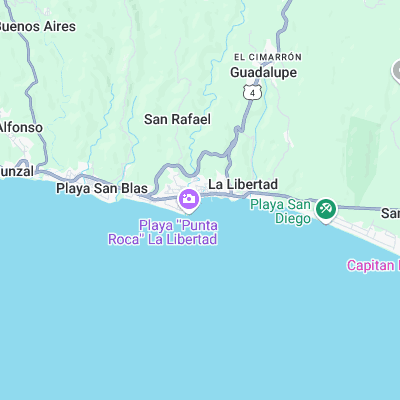
Surf spots nearby
- The Pier (0.3 mi)
- Punta Roca (0.4 mi)
- Sunzal (4.6 mi)
- El Zonte (7.8 mi)
- Mizata (18.4 mi)
Not Magic Seaweed (MSW)
Although we look a bit like Magic Seaweed we are not MagicSeaweed as they no longer exist...