Vieux Boucau Surf Report
| Wave height * | 12.5ft / 3.8m |
|---|---|
| Swell period | 17s |
| Swell direction | |
| Wind | |
| Sea temp | 14°C / 58°F |

10 day Vieux Boucau surf forecast
Fri
19/Dec
12.5ft
8
8
14
- High 4:28am
- Low 11:03am
- High 4:48pm
- Low 11:12pm
Sat
20/Dec
9.5ft
7
11
8
- High 5:02am
- Low 11:39am
- High 5:23pm
- Low 11:48pm
Sun
21/Dec
11ft
19
15
16
- High 5:36am
- Low 12:15pm
- High 5:58pm
Mon
22/Dec
9.5ft
17
21
15
- Low 12:24am
- High 6:12am
- Low 12:52pm
- High 6:35pm
Tue
23/Dec
7ft
11
12
27
- Low 1:01am
- High 6:50am
- Low 1:31pm
- High 7:14pm
Wed
24/Dec
12ft
9
3
4
- Low 1:40am
- High 7:31am
- Low 2:12pm
- High 7:59pm
Thu
25/Dec
6ft
18
14
9
- Low 2:22am
- High 8:18am
- Low 2:58pm
- High 8:50pm
Fri
26/Dec
3.5ft
4
4
11
- Low 3:11am
- High 9:14am
- Low 3:50pm
- High 9:52pm
Sat
27/Dec
5ft
6
3
9
- Low 4:08am
- High 10:20am
- Low 4:49pm
- High 11:03pm
Sun
28/Dec
4.5ft
6
2
8
- Low 5:13am
- High 11:32am
- Low 5:55pm
Fri 19th Dec
| 4:00 | 13.5ft | 14.8ft | 18s | 7mph (11mph) | |||
| 7:00 | 13ft | 14.4ft | 18s | 8mph (11mph) | |||
| 10:00 | 12.5ft | 13.9ft | 17s | 5mph (6mph) | |||
| 13:00 | 12.5ft | 13.7ft | 17s | 8mph (11mph) | |||
| 16:00 | 12.5ft | 13.5ft | 17s | 13mph (17mph) | |||
| 19:00 | 11.5ft | 13.4ft | 17s | 14mph (17mph) |
| Tide times |
|---|
| High 4:28am (3.93m) |
| Low 11:03am (1.30m) |
| High 4:48pm (3.77m) |
| Low 11:12pm (1.38m) |
| Daylight | |
|---|---|
| First light | 08:02 |
| Sunrise | 08:35 |
| Sunset | 17:30 |
| Dark | 18:03 |
Sat 20th Dec
| 4:00 | 11.5ft | 12.5ft | 16s | 10mph (11mph) | |||
| 7:00 | 10ft | 11.9ft | 16s | 7mph (9mph) | |||
| 10:00 | 9.5ft | 11.1ft | 15s | 10mph (19mph) | |||
| 13:00 | 9.5ft | 10.3ft | 15s | 11mph (20mph) | |||
| 16:00 | 8.5ft | 9.5ft | 15s | 14mph (22mph) | |||
| 19:00 | 7.5ft | 8.5ft | 14s | 8mph (11mph) |
| Tide times |
|---|
| High 5:02am (3.97m) |
| Low 11:39am (1.27m) |
| High 5:23pm (3.78m) |
| Low 11:48pm (1.38m) |
| Daylight | |
|---|---|
| First light | 08:03 |
| Sunrise | 08:35 |
| Sunset | 17:30 |
| Dark | 18:03 |
Sun 21st Dec
| 4:00 | 8ft | 8.9ft | 13s | 17mph (20mph) | |||
| 7:00 | 9ft | 9.9ft | 13s | 19mph (20mph) | |||
| 10:00 | 10ft | 11.2ft | 13s | 22mph (22mph) | |||
| 13:00 | 11ft | 12.2ft | 14s | 15mph (19mph) | |||
| 16:00 | 11.5ft | 12.5ft | 15s | 15mph (20mph) | |||
| 19:00 | 11.5ft | 12.7ft | 15s | 16mph (21mph) |
| Tide times |
|---|
| High 5:36am (3.98m) |
| Low 12:15pm (1.28m) |
| High 5:58pm (3.76m) |
| Daylight | |
|---|---|
| First light | 08:03 |
| Sunrise | 08:36 |
| Sunset | 17:31 |
| Dark | 18:04 |
Mon 22nd Dec
| 4:00 | 11.5ft | 12.4ft | 16s | 15mph (17mph) | |||
| 7:00 | 11ft | 12.2ft | 16s | 17mph (21mph) | |||
| 10:00 | 10ft | 11.6ft | 15s | 21mph (24mph) | |||
| 13:00 | 9.5ft | 10.9ft | 15s | 21mph (24mph) | |||
| 16:00 | 8.5ft | 10.2ft | 15s | 19mph (21mph) | |||
| 19:00 | 8ft | 9.6ft | 14s | 15mph (18mph) |
| Tide times |
|---|
| Low 12:24am (1.40m) |
| High 6:12am (3.96m) |
| Low 12:52pm (1.30m) |
| High 6:35pm (3.72m) |
| Daylight | |
|---|---|
| First light | 08:04 |
| Sunrise | 08:36 |
| Sunset | 17:31 |
| Dark | 18:04 |
Tue 23rd Dec
| 4:00 | 7.5ft | 8.5ft | 14s | 8mph (9mph) | |||
| 7:00 | 7ft | 8ft | 13s | 11mph (11mph) | |||
| 10:00 | 6.5ft | 7.5ft | 13s | 9mph (8mph) | |||
| 13:00 | 7ft | 7.9ft | 13s | 12mph (13mph) | |||
| 16:00 | 8ft | 8.7ft | 12s | 15mph (19mph) | |||
| 19:00 | 8ft | 8.9ft | 12s | 27mph (31mph) |
| Tide times |
|---|
| Low 1:01am (1.44m) |
| High 6:50am (3.92m) |
| Low 1:31pm (1.35m) |
| High 7:14pm (3.66m) |
| Daylight | |
|---|---|
| First light | 08:04 |
| Sunrise | 08:37 |
| Sunset | 17:32 |
| Dark | 18:05 |
Wed 24th Dec
| 4:00 | 11ft | 12ft | 13s | 8mph (10mph) | |||
| 7:00 | 11ft | 12.1ft | 14s | 9mph (12mph) | |||
| 10:00 | 12ft | 13.1ft | 14s | 5mph (5mph) | |||
| 13:00 | 12ft | 13ft | 14s | 3mph (2mph) | |||
| 16:00 | 11ft | 12.3ft | 13s | 6mph (6mph) | |||
| 19:00 | 10.5ft | 11.7ft | 13s | 4mph (5mph) |
| Tide times |
|---|
| Low 1:40am (1.49m) |
| High 7:31am (3.86m) |
| Low 2:12pm (1.40m) |
| High 7:59pm (3.59m) |
| Daylight | |
|---|---|
| First light | 08:04 |
| Sunrise | 08:37 |
| Sunset | 17:32 |
| Dark | 18:05 |
Thu 25th Dec
| 4:00 | 8ft | 8.8ft | 12s | 17mph (18mph) | |||
| 7:00 | 7ft | 7.9ft | 12s | 18mph (20mph) | |||
| 10:00 | 6.5ft | 7.1ft | 12s | 16mph (18mph) | |||
| 13:00 | 6ft | 6.5ft | 12s | 14mph (14mph) | |||
| 16:00 | 5ft | 6.1ft | 13s | 12mph (12mph) | |||
| 19:00 | 5ft | 5.6ft | 13s | 9mph (9mph) |
| Tide times |
|---|
| Low 2:22am (1.55m) |
| High 8:18am (3.79m) |
| Low 2:58pm (1.47m) |
| High 8:50pm (3.52m) |
| Daylight | |
|---|---|
| First light | 08:05 |
| Sunrise | 08:38 |
| Sunset | 17:33 |
| Dark | 18:06 |
Fri 26th Dec
| 4:00 | 4ft | 4.7ft | 12s | 5mph (4mph) | |||
| 7:00 | 3.5ft | 4.4ft | 12s | 4mph (3mph) | |||
| 10:00 | 3.5ft | 4.1ft | 12s | 4mph (3mph) | |||
| 13:00 | 3.5ft | 3.9ft | 12s | 4mph (5mph) | |||
| 16:00 | 3ft | 3.6ft | 11s | 6mph (6mph) | |||
| 19:00 | 3.5ft | 4ft | 11s | 11mph (11mph) |
| Tide times |
|---|
| Low 3:11am (1.61m) |
| High 9:14am (3.71m) |
| Low 3:50pm (1.52m) |
| High 9:52pm (3.47m) |
| Daylight | |
|---|---|
| First light | 08:05 |
| Sunrise | 08:38 |
| Sunset | 17:34 |
| Dark | 18:07 |
Sat 27th Dec
| 4:00 | 5ft | 5.6ft | 11s | 7mph (8mph) | |||
| 7:00 | 5ft | 5.7ft | 11s | 6mph (7mph) | |||
| 10:00 | 5ft | 5.8ft | 11s | 5mph (4mph) | |||
| 13:00 | 5ft | 5.6ft | 16s | 3mph (3mph) | |||
| 16:00 | 5ft | 5.4ft | 14s | 5mph (3mph) | |||
| 19:00 | 5ft | 5.6ft | 14s | 9mph (8mph) |
| Tide times |
|---|
| Low 4:08am (1.66m) |
| High 10:20am (3.65m) |
| Low 4:49pm (1.56m) |
| High 11:03pm (3.48m) |
| Daylight | |
|---|---|
| First light | 08:05 |
| Sunrise | 08:38 |
| Sunset | 17:34 |
| Dark | 18:07 |
Sun 28th Dec
| 4:00 | 5ft | 5.3ft | 16s | 7mph (7mph) | |||
| 7:00 | 4.5ft | 5.1ft | 14s | 6mph (6mph) | |||
| 10:00 | 4.5ft | 5ft | 14s | 4mph (4mph) | |||
| 13:00 | 4.5ft | 5ft | 14s | 2mph (2mph) | |||
| 16:00 | 4.5ft | 5ft | 13s | 2mph (3mph) | |||
| 19:00 | 4.5ft | 5.1ft | 14s | 8mph (7mph) |
| Tide times |
|---|
| Low 5:13am (1.66m) |
| High 11:32am (3.65m) |
| Low 5:55pm (1.55m) |
| Daylight | |
|---|---|
| First light | 08:06 |
| Sunrise | 08:38 |
| Sunset | 17:35 |
| Dark | 18:08 |
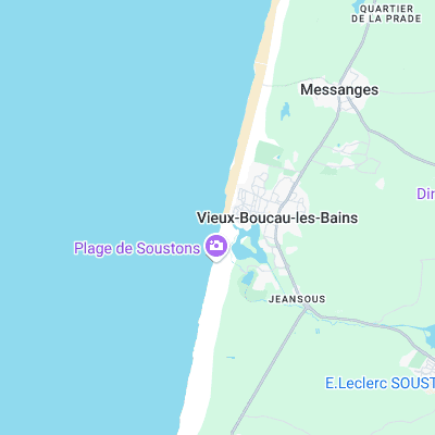
Stretch of beach divided by entrance to lake. Holds the size better than some of the other long beaches to the north and can produce the classic hollow French beachbreak on higher tides
Surf spots nearby
- Messanges (2.2 mi)
- Plage des Casernes (4.4 mi)
- Moliets (4.8 mi)
- Le Penon (5.3 mi)
- Les Bourdaines (6.1 mi)
- Les Estagnots (6.9 mi)
- La Graviere (7.6 mi)
- La Lette Blanche (8.4 mi)
- Les Culs Nuls (8.4 mi)
- La Nord (8.4 mi)
Not Magic Seaweed (MSW)
Although we look a bit like Magic Seaweed we are not MagicSeaweed as they no longer exist...