La Graviere Surf Report
| Wave height * | 2.5ft / 0.8m |
|---|---|
| Swell period | 13s |
| Swell direction | |
| Wind | |
| Sea temp | 14°C / 57°F |

10 day La Graviere surf forecast
Wed
31/Dec
3ft
6
4
1
- High 2:14am
- Low 8:46am
- High 2:44pm
- Low 9:11pm
Thu
1/Jan
2ft
9
3
5
- High 3:08am
- Low 9:45am
- High 3:38pm
- Low 10:05pm
Fri
2/Jan
1ft
8
7
10
- High 3:58am
- Low 10:38am
- High 4:28pm
- Low 10:54pm
Sat
3/Jan
1.5ft
12
13
16
- High 4:46am
- Low 11:26am
- High 5:16pm
- Low 11:40pm
Sun
4/Jan
2ft
13
12
16
- High 5:33am
- Low 12:13pm
- High 6:02pm
Mon
5/Jan
1.5ft
10
10
16
- Low 12:25am
- High 6:18am
- Low 12:58pm
- High 6:47pm
Tue
6/Jan
5.5ft
10
1
5
- Low 1:08am
- High 7:04am
- Low 1:41pm
- High 7:31pm
Wed
7/Jan
2.5ft
18
7
5
- Low 1:51am
- High 7:50am
- Low 2:25pm
- High 8:18pm
Thu
8/Jan
7ft
10
21
20
- Low 2:34am
- High 8:38am
- Low 3:09pm
- High 9:08pm
Fri
9/Jan
8.5ft
21
25
22
- Low 3:20am
- High 9:31am
- Low 3:56pm
- High 10:05pm
Wed 31st Dec
| 4:00 | 3ft | 3.3ft | 15s | 6mph (5mph) | |||
| 7:00 | 3ft | 3.4ft | 15s | 6mph (6mph) | |||
| 10:00 | 3ft | 3.3ft | 14s | 6mph (6mph) | |||
| 13:00 | 3ft | 3.1ft | 14s | 4mph (3mph) | |||
| 16:00 | 3ft | 3ft | 13s | 4mph (3mph) | |||
| 19:00 | 2.5ft | 2.9ft | 13s | 1mph (1mph) |
| Tide times |
|---|
| High 2:14am (3.93m) |
| Low 8:46am (1.27m) |
| High 2:44pm (3.94m) |
| Low 9:11pm (1.27m) |
| Daylight | |
|---|---|
| First light | 08:06 |
| Sunrise | 08:39 |
| Sunset | 17:38 |
| Dark | 18:11 |
Thu 1st Jan
| 4:00 | 2.5ft | 2.4ft | 13s | 8mph (9mph) | |||
| 7:00 | 2ft | 2.3ft | 12s | 9mph (11mph) | |||
| 10:00 | 2ft | 2.2ft | 12s | 8mph (10mph) | |||
| 13:00 | 2ft | 2ft | 12s | 3mph (4mph) | |||
| 16:00 | 2ft | 1.9ft | 12s | 1mph (1mph) | |||
| 19:00 | 1.5ft | 1.7ft | 12s | 5mph (5mph) |
| Tide times |
|---|
| High 3:08am (4.13m) |
| Low 9:45am (1.06m) |
| High 3:38pm (4.06m) |
| Low 10:05pm (1.14m) |
| Daylight | |
|---|---|
| First light | 08:06 |
| Sunrise | 08:39 |
| Sunset | 17:39 |
| Dark | 18:11 |
Fri 2nd Jan
| 4:00 | 1.5ft | 1.5ft | 11s | 7mph (8mph) | |||
| 7:00 | 1.5ft | 1.4ft | 12s | 8mph (10mph) | |||
| 10:00 | 1.5ft | 1.4ft | 13s | 6mph (6mph) | |||
| 13:00 | 1ft | 1.3ft | 13s | 7mph (7mph) | |||
| 16:00 | 1ft | 1.3ft | 13s | 10mph (11mph) | |||
| 19:00 | 1.5ft | 1.5ft | 12s | 10mph (11mph) |
| Tide times |
|---|
| High 3:58am (4.30m) |
| Low 10:38am (0.89m) |
| High 4:28pm (4.13m) |
| Low 10:54pm (1.04m) |
| Daylight | |
|---|---|
| First light | 08:06 |
| Sunrise | 08:39 |
| Sunset | 17:40 |
| Dark | 18:12 |
Sat 3rd Jan
| 4:00 | 1.5ft | 1.8ft | 14s | 12mph (19mph) | |||
| 7:00 | 1.5ft | 1.8ft | 14s | 12mph (17mph) | |||
| 10:00 | 1.5ft | 1.9ft | 13s | 14mph (18mph) | |||
| 13:00 | 1.5ft | 2.2ft | 12s | 13mph (14mph) | |||
| 16:00 | 1.5ft | 2.5ft | 5s | 12mph (13mph) | |||
| 19:00 | 2ft | 2.7ft | 6s | 16mph (16mph) |
| Tide times |
|---|
| High 4:46am (4.41m) |
| Low 11:26am (0.80m) |
| High 5:16pm (4.15m) |
| Low 11:40pm (1.00m) |
| Daylight | |
|---|---|
| First light | 08:06 |
| Sunrise | 08:39 |
| Sunset | 17:41 |
| Dark | 18:13 |
Sun 4th Jan
| 4:00 | 2ft | 2.5ft | 7s | 12mph (17mph) | |||
| 7:00 | 2ft | 2.4ft | 7s | 13mph (17mph) | |||
| 10:00 | 2ft | 2.5ft | 7s | 13mph (18mph) | |||
| 13:00 | 2ft | 2.7ft | 7s | 12mph (15mph) | |||
| 16:00 | 2ft | 2.9ft | 7s | 13mph (15mph) | |||
| 19:00 | 2.5ft | 3.2ft | 7s | 16mph (17mph) |
| Tide times |
|---|
| High 5:33am (4.44m) |
| Low 12:13pm (0.79m) |
| High 6:02pm (4.10m) |
| Daylight | |
|---|---|
| First light | 08:06 |
| Sunrise | 08:39 |
| Sunset | 17:42 |
| Dark | 18:14 |
Mon 5th Jan
| 4:00 | 2ft | 3ft | 7s | 11mph (13mph) | |||
| 7:00 | 2ft | 2.7ft | 10s | 10mph (13mph) | |||
| 10:00 | 2ft | 2.3ft | 9s | 9mph (12mph) | |||
| 13:00 | 1.5ft | 2ft | 11s | 10mph (12mph) | |||
| 16:00 | 1.5ft | 1.8ft | 12s | 13mph (15mph) | |||
| 19:00 | 1.5ft | 1.7ft | 12s | 16mph (18mph) |
| Tide times |
|---|
| Low 12:25am (1.02m) |
| High 6:18am (4.39m) |
| Low 12:58pm (0.87m) |
| High 6:47pm (3.99m) |
| Daylight | |
|---|---|
| First light | 08:06 |
| Sunrise | 08:39 |
| Sunset | 17:43 |
| Dark | 18:15 |
Tue 6th Jan
| 4:00 | 2ft | 2.5ft | 9s | 13mph (19mph) | |||
| 7:00 | 3.5ft | 4.4ft | 6s | 10mph (13mph) | |||
| 10:00 | 5.5ft | 7.1ft | 9s | 7mph (9mph) | |||
| 13:00 | 5.5ft | 7ft | 10s | 1mph (3mph) | |||
| 16:00 | 5ft | 6ft | 9s | 4mph (4mph) | |||
| 19:00 | 4ft | 5.2ft | 9s | 5mph (7mph) |
| Tide times |
|---|
| Low 1:08am (1.11m) |
| High 7:04am (4.26m) |
| Low 1:41pm (1.02m) |
| High 7:31pm (3.84m) |
| Daylight | |
|---|---|
| First light | 08:06 |
| Sunrise | 08:39 |
| Sunset | 17:44 |
| Dark | 18:16 |
Wed 7th Jan
| 4:00 | 2.5ft | 3.3ft | 7s | 29mph (34mph) | |||
| 7:00 | 2.5ft | 2.9ft | 7s | 18mph (26mph) | |||
| 10:00 | 2ft | 2.7ft | 12s | 10mph (13mph) | |||
| 13:00 | 2.5ft | 2.6ft | 15s | 7mph (8mph) | |||
| 16:00 | 2.5ft | 2.6ft | 15s | 3mph (3mph) | |||
| 19:00 | 3ft | 3.2ft | 13s | 5mph (3mph) |
| Tide times |
|---|
| Low 1:51am (1.24m) |
| High 7:50am (4.07m) |
| Low 2:25pm (1.22m) |
| High 8:18pm (3.67m) |
| Daylight | |
|---|---|
| First light | 08:06 |
| Sunrise | 08:38 |
| Sunset | 17:45 |
| Dark | 18:17 |
Thu 8th Jan
| 4:00 | 8ft | 9.2ft | 8s | 9mph (11mph) | |||
| 7:00 | 7.5ft | 9.1ft | 8s | 10mph (12mph) | |||
| 10:00 | 7ft | 8.4ft | 8s | 14mph (17mph) | |||
| 13:00 | 7ft | 8.4ft | 9s | 21mph (30mph) | |||
| 16:00 | 7.5ft | 8.6ft | 9s | 19mph (30mph) | |||
| 19:00 | 7.5ft | 8.7ft | 10s | 20mph (29mph) |
| Tide times |
|---|
| Low 2:34am (1.41m) |
| High 8:38am (3.85m) |
| Low 3:09pm (1.43m) |
| High 9:08pm (3.50m) |
| Daylight | |
|---|---|
| First light | 08:06 |
| Sunrise | 08:38 |
| Sunset | 17:46 |
| Dark | 18:18 |
Fri 9th Jan
| 4:00 | 7.5ft | 8.6ft | 11s | 22mph (27mph) | |||
| 7:00 | 7.5ft | 9ft | 11s | 21mph (28mph) | |||
| 10:00 | 8ft | 9.4ft | 11s | 22mph (28mph) | |||
| 13:00 | 8.5ft | 9.9ft | 11s | 25mph (31mph) | |||
| 16:00 | 9ft | 10.8ft | 11s | 21mph (32mph) | |||
| 19:00 | 10ft | 11.8ft | 11s | 22mph (28mph) |
| Tide times |
|---|
| Low 3:20am (1.60m) |
| High 9:31am (3.62m) |
| Low 3:56pm (1.64m) |
| High 10:05pm (3.36m) |
| Daylight | |
|---|---|
| First light | 08:06 |
| Sunrise | 08:38 |
| Sunset | 17:47 |
| Dark | 18:19 |
The best known of Hossegor's insanely hollow, super heavy beachbreaks. Often just closes out on the beach, but when it's on produces a board-breaking, fast, dredging top to bottom barrel
The name, ‘La Graviere’ comes from the fact the wave is situated on an old gravel pit - ‘Gravel Pits’ doesn’t sound quite so exotic!
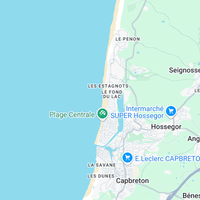
Surf spots nearby
- Les Estagnots (0.7 mi)
- Les Culs Nuls (0.8 mi)
- La Nord (0.9 mi)
- La Sud (1.1 mi)
- Les Bourdaines (1.4 mi)
- Le Prévent (1.9 mi)
- Le Santocha (2.1 mi)
- Le Penon (2.3 mi)
- La Piste (2.3 mi)
- Plage des Casernes (3.2 mi)
Not Magic Seaweed (MSW)
Although we look a bit like Magic Seaweed we are not MagicSeaweed as they no longer exist...