Teahupoo (Teahupo'o) Surf Report
| Wave height * | 0ft / 0m |
|---|---|
| Swell period | 0s |
| Swell direction | |
| Wind | |
| Sea temp | 28°C / 83°F |

10 day Teahupoo surf forecast
Sat
6
7
6
- High 3:11am
- Low 8:46am
- High 2:40pm
- Low 9:05pm
Sun
6
5
7
- High 2:55am
- Low 7:41am
- High 1:12pm
- Low 7:56pm
Mon
8
6
9
- High 1:26am
- Low 6:19am
- High 11:59am
- Low 5:59pm
- High 11:56pm
Tue
13
10
10
- Low 5:54am
- High 11:51am
- Low 5:44pm
- High 11:43pm
Wed
14
15
14
- Low 5:56am
- High 11:59am
- Low 5:51pm
- High 11:52pm
Thu
13
15
15
- Low 6:06am
- High 12:11pm
- Low 6:04pm
Fri
15
14
13
- High 12:05am
- Low 6:19am
- High 12:25pm
- Low 6:19pm
Sat
13
11
13
- High 12:22am
- Low 6:34am
- High 12:39pm
- Low 6:35pm
Sun
16
12
11
- High 12:40am
- Low 6:51am
- High 12:53pm
- Low 6:51pm
Sat 7th Feb
| 5:00 | 5.5ft | 5.9ft | 14s | 6mph (6mph) | |||
| 8:00 | 5ft | 5.7ft | 14s | 6mph (6mph) | |||
| 11:00 | 5ft | 5.4ft | 14s | 6mph (5mph) | |||
| 14:00 | 1ft | 5.4ft | 14s | 7mph (7mph) | |||
| 17:00 | 1ft | 5.3ft | 14s | 7mph (6mph) | |||
| 20:00 | 1.5ft | 5.1ft | 13s | 6mph (6mph) |
| Tide times |
|---|
| High 3:11am (0.35m) |
| Low 8:46am (0.27m) |
| High 2:40pm (0.34m) |
| Low 9:05pm (0.25m) |
| Daylight | |
|---|---|
| First light | 05:24 |
| Sunrise | 05:46 |
| Sunset | 18:35 |
| Dark | 18:57 |
Sun 8th Feb
| 5:00 | 2ft | 4.6ft | 13s | 5mph (5mph) | |||
| 8:00 | 1.5ft | 4.4ft | 13s | 6mph (6mph) | |||
| 11:00 | 1ft | 4.4ft | 12s | 6mph (6mph) | |||
| 14:00 | 3.5ft | 4.4ft | 12s | 5mph (4mph) | |||
| 17:00 | 3.5ft | 4.4ft | 12s | 5mph (4mph) | |||
| 20:00 | 3.5ft | 4.4ft | 12s | 7mph (7mph) |
| Tide times |
|---|
| High 2:55am (0.32m) |
| Low 7:41am (0.29m) |
| High 1:12pm (0.33m) |
| Low 7:56pm (0.28m) |
| Daylight | |
|---|---|
| First light | 05:24 |
| Sunrise | 05:47 |
| Sunset | 18:34 |
| Dark | 18:57 |
Mon 9th Feb
| 5:00 | 3.5ft | 4.7ft | 11s | 9mph (9mph) | |||
| 8:00 | 4.5ft | 4.9ft | 11s | 8mph (8mph) | |||
| 11:00 | 4.5ft | 5.1ft | 11s | 7mph (6mph) | |||
| 14:00 | 5ft | 5.2ft | 11s | 6mph (5mph) | |||
| 17:00 | 5ft | 5.1ft | 11s | 7mph (6mph) | |||
| 20:00 | 4.5ft | 4.9ft | 11s | 9mph (9mph) |
| Tide times |
|---|
| High 1:26am (0.31m) |
| Low 6:19am (0.28m) |
| High 11:59am (0.34m) |
| Low 5:59pm (0.27m) |
| High 11:56pm (0.33m) |
| Daylight | |
|---|---|
| First light | 05:25 |
| Sunrise | 05:47 |
| Sunset | 18:34 |
| Dark | 18:56 |
Tue 10th Feb
| 5:00 | 4.5ft | 5ft | 13s | 11mph (12mph) | |||
| 8:00 | 1.5ft | 4.9ft | 14s | 13mph (14mph) | |||
| 11:00 | 3ft | 4.8ft | 13s | 14mph (14mph) | |||
| 14:00 | 1.5ft | 4.9ft | 14s | 10mph (10mph) | |||
| 17:00 | 1.5ft | 5.1ft | 14s | 9mph (9mph) | |||
| 20:00 | 1.5ft | 5.1ft | 13s | 10mph (11mph) |
| Tide times |
|---|
| Low 5:54am (0.26m) |
| High 11:51am (0.36m) |
| Low 5:44pm (0.24m) |
| High 11:43pm (0.36m) |
| Daylight | |
|---|---|
| First light | 05:25 |
| Sunrise | 05:48 |
| Sunset | 18:33 |
| Dark | 18:56 |
Wed 11th Feb
| 5:00 | 4.5ft | 4.8ft | 12s | 13mph (13mph) | |||
| 8:00 | 4ft | 4.7ft | 12s | 14mph (15mph) | |||
| 11:00 | 1.5ft | 4.7ft | 12s | 14mph (16mph) | |||
| 14:00 | 2ft | 4.7ft | 12s | 15mph (15mph) | |||
| 17:00 | 2ft | 4.7ft | 13s | 15mph (15mph) | |||
| 20:00 | 2.5ft | 4.6ft | 13s | 14mph (14mph) |
| Tide times |
|---|
| Low 5:56am (0.23m) |
| High 11:59am (0.37m) |
| Low 5:51pm (0.22m) |
| High 11:52pm (0.38m) |
| Daylight | |
|---|---|
| First light | 05:26 |
| Sunrise | 05:48 |
| Sunset | 18:33 |
| Dark | 18:56 |
Thu 12th Feb
| 5:00 | 3ft | 4.4ft | 13s | 12mph (13mph) | |||
| 8:00 | 3ft | 4.4ft | 13s | 13mph (14mph) | |||
| 11:00 | 3ft | 4.6ft | 13s | 16mph (17mph) | |||
| 14:00 | 3.5ft | 4.7ft | 13s | 15mph (16mph) | |||
| 17:00 | 4ft | 4.8ft | 12s | 14mph (14mph) | |||
| 20:00 | 4.5ft | 4.9ft | 14s | 15mph (16mph) |
| Tide times |
|---|
| Low 6:06am (0.21m) |
| High 12:11pm (0.39m) |
| Low 6:04pm (0.20m) |
| Daylight | |
|---|---|
| First light | 05:26 |
| Sunrise | 05:49 |
| Sunset | 18:33 |
| Dark | 18:55 |
Fri 13th Feb
| 5:00 | 4.5ft | 5ft | 14s | 15mph (16mph) | |||
| 8:00 | 4.5ft | 5ft | 13s | 15mph (15mph) | |||
| 11:00 | 4.5ft | 5ft | 13s | 15mph (16mph) | |||
| 14:00 | 4.5ft | 5ft | 13s | 14mph (15mph) | |||
| 17:00 | 4.5ft | 4.9ft | 13s | 13mph (14mph) | |||
| 20:00 | 4.5ft | 4.9ft | 13s | 13mph (14mph) |
| Tide times |
|---|
| High 12:05am (0.41m) |
| Low 6:19am (0.19m) |
| High 12:25pm (0.40m) |
| Low 6:19pm (0.19m) |
| Daylight | |
|---|---|
| First light | 05:27 |
| Sunrise | 05:49 |
| Sunset | 18:32 |
| Dark | 18:55 |
Sat 14th Feb
| 5:00 | 4.5ft | 4.7ft | 12s | 12mph (13mph) | |||
| 8:00 | 4ft | 4.6ft | 12s | 13mph (13mph) | |||
| 11:00 | 4ft | 4.6ft | 12s | 12mph (13mph) | |||
| 14:00 | 4ft | 4.6ft | 12s | 11mph (11mph) | |||
| 17:00 | 4ft | 4.5ft | 12s | 13mph (14mph) | |||
| 20:00 | 4ft | 4.5ft | 12s | 13mph (14mph) |
| Tide times |
|---|
| High 12:22am (0.43m) |
| Low 6:34am (0.18m) |
| High 12:39pm (0.41m) |
| Low 6:35pm (0.17m) |
| Daylight | |
|---|---|
| First light | 05:27 |
| Sunrise | 05:50 |
| Sunset | 18:32 |
| Dark | 18:54 |
Sun 15th Feb
| 5:00 | 4ft | 4.3ft | 12s | 13mph (14mph) | |||
| 8:00 | 4ft | 4.4ft | 12s | 16mph (17mph) | |||
| 11:00 | 4ft | 4.5ft | 12s | 16mph (17mph) | |||
| 14:00 | 4ft | 4.4ft | 12s | 12mph (13mph) | |||
| 17:00 | 4ft | 4.4ft | 12s | 11mph (12mph) | |||
| 20:00 | 4ft | 4.3ft | 11s | 11mph (11mph) |
| Tide times |
|---|
| High 12:40am (0.45m) |
| Low 6:51am (0.17m) |
| High 12:53pm (0.41m) |
| Low 6:51pm (0.16m) |
| Daylight | |
|---|---|
| First light | 05:28 |
| Sunrise | 05:50 |
| Sunset | 18:31 |
| Dark | 18:53 |
Mon 16th Feb
| 5:00 | 4ft | 4.1ft | 11s | 12mph (12mph) | |||
| 8:00 | 4ft | 4.1ft | 11s | 10mph (11mph) | |||
| 11:00 | 3.5ft | 4ft | 11s | 11mph (11mph) | |||
| 14:00 | 3.5ft | 3.9ft | 11s | 10mph (11mph) |
| Tide times |
|---|
| High 12:59am (0.46m) |
| Daylight | |
|---|---|
| First light | 05:28 |
| Sunrise | 05:51 |
| Sunset | 18:31 |
| Dark | 18:53 |
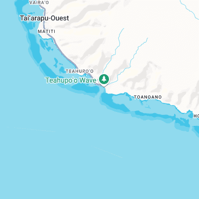
'Chopes' is possibly the heaviest wave on Earth. A beyond thick, mauling, lethal left barrel that comes straight out of deep water to unload on a shallow, live coral reef.
Pronounced cho-po, Teahupo’o hit the world stage in 1998 with the second Gotcha Tahiti Pro WQS event. A year later the event was the centrepiece of the WCT with Occy winning in awesome conditions.
Teahupoo raised the bar for the surfing world and has resulted in the pioneering of other ultra-gnarly spots around the world. Killer waves like Pipeline have been reduced to the rank of sideshow and new contenders such as Shipstern’s and Cyclops are now surfed.
The wave at Teahupoo is (like many famous spots) a glorified close out. Fast moving SW swells hit the shallow reef on the eastern side of the Passe Havae and stop dead sending ultra-thick lips towards the flats where they explode with ferocity.
The reef is also curved creating a horseshoe shaped bowl. Riders often comment that you can’t actually see out of the barrel it’s so curved.
There is actually a right here too. But it isn’t as good as the left and the possibility of getting drilled into the reef on the paddle back out makes it somewhat unappealing!
Teahupo’o is the ultimate media wave. Tropical, mountainous backdrop, crystal clear blue water, Tahitian sunshine, death defying barrelling monster waves and to top it off a massive channel where you can park a boat and watch it all like an arena sport! It’ll take something quite unimaginable to steal Chopes’ limelight…
Surf spots nearby
- Vairao (6 mi)
- Faaone (13.7 mi)
- Paparaa (16.2 mi)
- Paparaa - Outer Reefs (16.4 mi)
- Maraa (23 mi)
Not Magic Seaweed (MSW)
Although we look a bit like Magic Seaweed we are not MagicSeaweed as they no longer exist...