Bingin Surf Report
| Wave height * | 2ft / 0.7m |
|---|---|
| Swell period | 14s |
| Swell direction | |
| Wind | |
| Sea temp | 29°C / 84°F |

10 day Bingin surf forecast
Fri
6/Feb
2ft
0
16
19
- High 1:19am
- Low 7:58am
- High 2:41pm
- Low 8:36pm
Sat
7/Feb
2ft
16
12
20
- High 1:51am
- Low 8:01am
- High 2:58pm
- Low 10:01pm
Sun
8/Feb
2ft
9
8
6
- High 2:30am
- Low 7:27am
- High 3:22pm
Mon
9/Feb
2.5ft
7
6
10
- Low 2:01am
- High 4:10pm
Tue
10/Feb
2.5ft
7
14
13
- Low 3:06am
- High 6:01pm
Wed
11/Feb
2ft
7
11
10
- Low 3:39am
- High 7:35pm
Thu
12/Feb
1.5ft
10
14
14
- Low 4:09am
- High 12:23pm
- Low 2:07pm
- High 8:34pm
Fri
13/Feb
1.5ft
9
13
14
- Low 4:36am
- High 11:56am
- Low 3:02pm
- High 9:19pm
Sat
14/Feb
1.5ft
13
15
12
- Low 5:01am
- High 11:52am
- Low 3:41pm
- High 9:58pm
Fri 6th Feb
| 5:00 | 1.5ft | 4.8ft | 16s | 0mph (0mph) | |||
| 8:00 | 1.5ft | 4.9ft | 15s | 0mph (0mph) | |||
| 11:00 | 2ft | 5.1ft | 15s | 14mph (19mph) | |||
| 14:00 | 2ft | 5.3ft | 15s | 16mph (19mph) | |||
| 17:00 | 2ft | 5.3ft | 14s | 20mph (23mph) | |||
| 20:00 | 2ft | 5.4ft | 14s | 19mph (25mph) |
| Tide times |
|---|
| High 1:19am (2.04m) |
| Low 7:58am (0.86m) |
| High 2:41pm (1.99m) |
| Low 8:36pm (1.32m) |
| Daylight | |
|---|---|
| First light | 05:58 |
| Sunrise | 06:20 |
| Sunset | 18:47 |
| Dark | 19:08 |
Sat 7th Feb
| 5:00 | 2ft | 5.6ft | 13s | 17mph (22mph) | |||
| 8:00 | 2ft | 5.6ft | 13s | 16mph (20mph) | |||
| 11:00 | 2ft | 5.6ft | 13s | 12mph (17mph) | |||
| 14:00 | 2ft | 5.5ft | 13s | 12mph (17mph) | |||
| 17:00 | 2ft | 5.5ft | 13s | 18mph (20mph) | |||
| 20:00 | 2ft | 5.5ft | 12s | 20mph (23mph) |
| Tide times |
|---|
| High 1:51am (1.75m) |
| Low 8:01am (1.10m) |
| High 2:58pm (2.00m) |
| Low 10:01pm (1.31m) |
| Daylight | |
|---|---|
| First light | 05:58 |
| Sunrise | 06:20 |
| Sunset | 18:46 |
| Dark | 19:08 |
Sun 8th Feb
| 5:00 | 2ft | 5.4ft | 12s | 13mph (17mph) | |||
| 8:00 | 2ft | 5.6ft | 12s | 9mph (13mph) | |||
| 11:00 | 2ft | 5.6ft | 12s | 6mph (8mph) | |||
| 14:00 | 2ft | 5.5ft | 12s | 8mph (10mph) | |||
| 17:00 | 2ft | 5.5ft | 12s | 10mph (14mph) | |||
| 20:00 | 2ft | 5.7ft | 12s | 6mph (10mph) |
| Tide times |
|---|
| High 2:30am (1.46m) |
| Low 7:27am (1.27m) |
| High 3:22pm (2.03m) |
| Daylight | |
|---|---|
| First light | 05:58 |
| Sunrise | 06:20 |
| Sunset | 18:46 |
| Dark | 19:08 |
Mon 9th Feb
| 5:00 | 2ft | 6.4ft | 12s | 10mph (17mph) | |||
| 8:00 | 2ft | 6.1ft | 12s | 7mph (10mph) | |||
| 11:00 | 2.5ft | 6ft | 13s | 5mph (9mph) | |||
| 14:00 | 2.5ft | 5.9ft | 15s | 6mph (7mph) | |||
| 17:00 | 2.5ft | 5.7ft | 12s | 9mph (11mph) | |||
| 20:00 | 2ft | 5.4ft | 11s | 10mph (12mph) |
| Tide times |
|---|
| Low 2:01am (1.17m) |
| High 4:10pm (2.05m) |
| Daylight | |
|---|---|
| First light | 05:59 |
| Sunrise | 06:20 |
| Sunset | 18:46 |
| Dark | 19:08 |
Tue 10th Feb
| 5:00 | 2.5ft | 5.1ft | 12s | 6mph (8mph) | |||
| 8:00 | 2ft | 5ft | 14s | 7mph (9mph) | |||
| 11:00 | 2ft | 5ft | 14s | 10mph (12mph) | |||
| 14:00 | 2.5ft | 5.1ft | 14s | 14mph (15mph) | |||
| 17:00 | 2.5ft | 5.1ft | 14s | 14mph (16mph) | |||
| 20:00 | 1.5ft | 4.9ft | 11s | 13mph (15mph) |
| Tide times |
|---|
| Low 3:06am (0.90m) |
| High 6:01pm (2.11m) |
| Daylight | |
|---|---|
| First light | 05:59 |
| Sunrise | 06:21 |
| Sunset | 18:46 |
| Dark | 19:07 |
Wed 11th Feb
| 5:00 | 2ft | 4.2ft | 12s | 8mph (9mph) | |||
| 8:00 | 2ft | 4.1ft | 13s | 7mph (7mph) | |||
| 11:00 | 2ft | 4.1ft | 13s | 8mph (9mph) | |||
| 14:00 | 2ft | 4.3ft | 13s | 11mph (11mph) | |||
| 17:00 | 2ft | 4.4ft | 13s | 12mph (12mph) | |||
| 20:00 | 2ft | 4.1ft | 13s | 10mph (12mph) |
| Tide times |
|---|
| Low 3:39am (0.67m) |
| High 7:35pm (2.24m) |
| Daylight | |
|---|---|
| First light | 05:59 |
| Sunrise | 06:21 |
| Sunset | 18:46 |
| Dark | 19:07 |
Thu 12th Feb
| 5:00 | 1.5ft | 3.7ft | 16s | 9mph (10mph) | |||
| 8:00 | 1.5ft | 3.6ft | 16s | 10mph (11mph) | |||
| 11:00 | 1.5ft | 3.5ft | 16s | 9mph (11mph) | |||
| 14:00 | 1.5ft | 3.6ft | 14s | 14mph (15mph) | |||
| 17:00 | 1.5ft | 3.9ft | 15s | 15mph (16mph) | |||
| 20:00 | 1.5ft | 4.1ft | 15s | 14mph (14mph) |
| Tide times |
|---|
| Low 4:09am (0.49m) |
| High 12:23pm (1.79m) |
| Low 2:07pm (1.77m) |
| High 8:34pm (2.41m) |
| Daylight | |
|---|---|
| First light | 06:00 |
| Sunrise | 06:21 |
| Sunset | 18:45 |
| Dark | 19:07 |
Fri 13th Feb
| 5:00 | 1.5ft | 3.8ft | 14s | 8mph (11mph) | |||
| 8:00 | 1.5ft | 3.9ft | 13s | 9mph (11mph) | |||
| 11:00 | 1.5ft | 4.1ft | 13s | 9mph (13mph) | |||
| 14:00 | 1.5ft | 4.1ft | 13s | 13mph (17mph) | |||
| 17:00 | 1.5ft | 4ft | 13s | 15mph (18mph) | |||
| 20:00 | 1.5ft | 4.1ft | 13s | 14mph (18mph) |
| Tide times |
|---|
| Low 4:36am (0.36m) |
| High 11:56am (1.76m) |
| Low 3:02pm (1.64m) |
| High 9:19pm (2.56m) |
| Daylight | |
|---|---|
| First light | 06:00 |
| Sunrise | 06:21 |
| Sunset | 18:45 |
| Dark | 19:07 |
Sat 14th Feb
| 5:00 | 1.5ft | 4.8ft | 15s | 15mph (17mph) | |||
| 8:00 | 1.5ft | 4.8ft | 14s | 13mph (15mph) | |||
| 11:00 | 1.5ft | 4.9ft | 14s | 14mph (17mph) | |||
| 14:00 | 1.5ft | 4.9ft | 13s | 15mph (17mph) | |||
| 17:00 | 1.5ft | 5ft | 13s | 14mph (16mph) | |||
| 20:00 | 1.5ft | 4.9ft | 13s | 12mph (13mph) |
| Tide times |
|---|
| Low 5:01am (0.29m) |
| High 11:52am (1.77m) |
| Low 3:41pm (1.48m) |
| High 9:58pm (2.66m) |
| Daylight | |
|---|---|
| First light | 06:00 |
| Sunrise | 06:21 |
| Sunset | 18:45 |
| Dark | 19:06 |
Sun 15th Feb
| 5:00 | 1.5ft | 4.7ft | 12s | 15mph (17mph) | |||
| 8:00 | 1.5ft | 4.8ft | 12s | 13mph (15mph) | |||
| 20:00 | 2ft | 4.7ft | 15s | 18mph (20mph) |
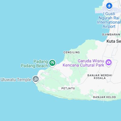
Surf spots nearby
- Impossibles (0.4 mi)
- Dreamland (0.4 mi)
- Balangan (0.9 mi)
- Padang Padang (1.1 mi)
- Uluwatu (1.9 mi)
- Nyang-Nyang (2.7 mi)
- Jimbaran Shorey (3.8 mi)
- Nikko Hotel (4.5 mi)
- Airport's (4.8 mi)
- Green Ball (5.1 mi)
Not Magic Seaweed (MSW)
Although we look a bit like Magic Seaweed we are not MagicSeaweed as they no longer exist...