Uluwatu Surf Report
| Wave height * | 3ft / 1m |
|---|---|
| Swell period | 13s |
| Swell direction | |
| Wind | |
| Sea temp | 29°C / 84°F |

10 day Uluwatu surf forecast
Fri
0
19
19
- Low 4:36am
- High 11:56am
- Low 3:02pm
- High 9:19pm
Sat
22
16
13
- Low 5:01am
- High 11:52am
- Low 3:41pm
- High 9:58pm
Sun
14
14
10
- Low 5:24am
- High 11:57am
- Low 4:18pm
- High 10:33pm
Mon
13
16
12
- Low 5:45am
- High 12:08pm
- Low 4:55pm
- High 11:05pm
Tue
11
10
10
- Low 6:05am
- High 12:23pm
- Low 5:33pm
- High 11:37pm
Wed
5
7
6
- Low 6:23am
- High 12:43pm
- Low 6:13pm
Thu
4
6
14
- High 12:09am
- Low 6:41am
- High 1:05pm
- Low 6:56pm
Fri
20
8
17
- High 12:42am
- Low 6:58am
- High 1:30pm
- Low 7:44pm
Sat
7
7
14
- High 1:16am
- Low 7:13am
- High 1:59pm
- Low 8:45pm
Fri 13th Feb
| 5:00 | 2.5ft | 4.2ft | 14s | 0mph (0mph) | |||
| 8:00 | 2.5ft | 4.3ft | 13s | 0mph (0mph) | |||
| 11:00 | 2.5ft | 4.3ft | 13s | 18mph (22mph) | |||
| 14:00 | 3ft | 4.6ft | 13s | 19mph (23mph) | |||
| 17:00 | 3ft | 5.1ft | 13s | 20mph (24mph) | |||
| 20:00 | 3ft | 5.1ft | 13s | 19mph (22mph) |
| Tide times |
|---|
| Low 4:36am (0.36m) |
| High 11:56am (1.76m) |
| Low 3:02pm (1.64m) |
| High 9:19pm (2.56m) |
| Daylight | |
|---|---|
| First light | 06:00 |
| Sunrise | 06:21 |
| Sunset | 18:45 |
| Dark | 19:07 |
Sat 14th Feb
| 5:00 | 3ft | 5.1ft | 14s | 19mph (24mph) | |||
| 8:00 | 3ft | 5.1ft | 14s | 22mph (25mph) | |||
| 11:00 | 3ft | 5.2ft | 13s | 17mph (21mph) | |||
| 14:00 | 3ft | 5.2ft | 13s | 16mph (19mph) | |||
| 17:00 | 3ft | 5.2ft | 13s | 15mph (18mph) | |||
| 20:00 | 3ft | 5ft | 13s | 13mph (16mph) |
| Tide times |
|---|
| Low 5:01am (0.29m) |
| High 11:52am (1.77m) |
| Low 3:41pm (1.48m) |
| High 9:58pm (2.66m) |
| Daylight | |
|---|---|
| First light | 06:00 |
| Sunrise | 06:22 |
| Sunset | 18:45 |
| Dark | 19:07 |
Sun 15th Feb
| 5:00 | 2.5ft | 4.7ft | 12s | 13mph (15mph) | |||
| 8:00 | 2.5ft | 4.7ft | 12s | 14mph (16mph) | |||
| 11:00 | 3ft | 4.7ft | 17s | 12mph (15mph) | |||
| 14:00 | 3.5ft | 4.8ft | 20s | 14mph (16mph) | |||
| 17:00 | 3ft | 4.7ft | 20s | 13mph (15mph) | |||
| 20:00 | 3.5ft | 4.8ft | 19s | 10mph (12mph) |
| Tide times |
|---|
| Low 5:24am (0.28m) |
| High 11:57am (1.81m) |
| Low 4:18pm (1.34m) |
| High 10:33pm (2.69m) |
| Daylight | |
|---|---|
| First light | 06:00 |
| Sunrise | 06:22 |
| Sunset | 18:45 |
| Dark | 19:06 |
Mon 16th Feb
| 5:00 | 3.5ft | 5ft | 18s | 13mph (16mph) | |||
| 8:00 | 3.5ft | 4.9ft | 18s | 13mph (15mph) | |||
| 11:00 | 3.5ft | 5ft | 17s | 13mph (15mph) | |||
| 14:00 | 3.5ft | 5.1ft | 16s | 16mph (18mph) | |||
| 17:00 | 3.5ft | 5ft | 16s | 13mph (15mph) | |||
| 20:00 | 3.5ft | 4.9ft | 16s | 12mph (15mph) |
| Tide times |
|---|
| Low 5:45am (0.30m) |
| High 12:08pm (1.89m) |
| Low 4:55pm (1.21m) |
| High 11:05pm (2.65m) |
| Daylight | |
|---|---|
| First light | 06:01 |
| Sunrise | 06:22 |
| Sunset | 18:45 |
| Dark | 19:06 |
Tue 17th Feb
| 5:00 | 3ft | 4.6ft | 15s | 14mph (14mph) | |||
| 8:00 | 3ft | 4.4ft | 15s | 11mph (12mph) | |||
| 11:00 | 3ft | 4.4ft | 15s | 8mph (9mph) | |||
| 14:00 | 3ft | 4.3ft | 15s | 10mph (11mph) | |||
| 17:00 | 3ft | 4.3ft | 14s | 10mph (13mph) | |||
| 20:00 | 3ft | 4.3ft | 14s | 10mph (11mph) |
| Tide times |
|---|
| Low 6:05am (0.36m) |
| High 12:23pm (2.00m) |
| Low 5:33pm (1.11m) |
| High 11:37pm (2.54m) |
| Daylight | |
|---|---|
| First light | 06:01 |
| Sunrise | 06:22 |
| Sunset | 18:44 |
| Dark | 19:06 |
Wed 18th Feb
| 5:00 | 3ft | 4.5ft | 18s | 6mph (7mph) | |||
| 8:00 | 3ft | 4.8ft | 19s | 5mph (5mph) | |||
| 11:00 | 3ft | 4.8ft | 19s | 2mph (3mph) | |||
| 14:00 | 3ft | 5.1ft | 18s | 7mph (7mph) | |||
| 17:00 | 3ft | 5.5ft | 18s | 5mph (5mph) | |||
| 20:00 | 3ft | 5.5ft | 17s | 6mph (6mph) |
| Tide times |
|---|
| Low 6:23am (0.45m) |
| High 12:43pm (2.12m) |
| Low 6:13pm (1.05m) |
| Daylight | |
|---|---|
| First light | 06:01 |
| Sunrise | 06:22 |
| Sunset | 18:44 |
| Dark | 19:05 |
Thu 19th Feb
| 5:00 | 3ft | 5.6ft | 16s | 13mph (14mph) | |||
| 8:00 | 3ft | 5.6ft | 16s | 4mph (5mph) | |||
| 11:00 | 3.5ft | 5.8ft | 15s | 2mph (2mph) | |||
| 14:00 | 3.5ft | 6.2ft | 15s | 6mph (7mph) | |||
| 17:00 | 3.5ft | 6.2ft | 15s | 20mph (20mph) | |||
| 20:00 | 3.5ft | 5.9ft | 14s | 14mph (16mph) |
| Tide times |
|---|
| High 12:09am (2.36m) |
| Low 6:41am (0.57m) |
| High 1:05pm (2.22m) |
| Low 6:56pm (1.03m) |
| Daylight | |
|---|---|
| First light | 06:01 |
| Sunrise | 06:22 |
| Sunset | 18:44 |
| Dark | 19:05 |
Fri 20th Feb
| 5:00 | 3.5ft | 6.3ft | 14s | 12mph (15mph) | |||
| 8:00 | 7ft | 8.1ft | 12s | 20mph (21mph) | |||
| 11:00 | 7ft | 8.1ft | 13s | 12mph (13mph) | |||
| 14:00 | 4.5ft | 7.5ft | 13s | 8mph (10mph) | |||
| 17:00 | 4.5ft | 7.5ft | 13s | 8mph (11mph) | |||
| 20:00 | 5ft | 7.5ft | 13s | 17mph (21mph) |
| Tide times |
|---|
| High 12:42am (2.14m) |
| Low 6:58am (0.71m) |
| High 1:30pm (2.30m) |
| Low 7:44pm (1.04m) |
| Daylight | |
|---|---|
| First light | 06:01 |
| Sunrise | 06:22 |
| Sunset | 18:43 |
| Dark | 19:05 |
Sat 21st Feb
| 5:00 | 4.5ft | 7.3ft | 14s | 10mph (13mph) | |||
| 8:00 | 4.5ft | 7.4ft | 18s | 7mph (8mph) | |||
| 11:00 | 4ft | 7.3ft | 17s | 5mph (8mph) | |||
| 14:00 | 4ft | 7.2ft | 16s | 7mph (8mph) | |||
| 17:00 | 4ft | 7ft | 16s | 12mph (14mph) | |||
| 20:00 | 4ft | 6.7ft | 16s | 14mph (17mph) |
| Tide times |
|---|
| High 1:16am (1.88m) |
| Low 7:13am (0.87m) |
| High 1:59pm (2.34m) |
| Low 8:45pm (1.07m) |
| Daylight | |
|---|---|
| First light | 06:01 |
| Sunrise | 06:23 |
| Sunset | 18:43 |
| Dark | 19:04 |
Sun 22nd Feb
| 5:00 | 3.5ft | 6.3ft | 14s | 6mph (7mph) | |||
| 8:00 | 3.5ft | 6.3ft | 14s | 9mph (9mph) | |||
| 20:00 | 3.5ft | 5.9ft | 13s | 5mph (5mph) |
Legendary left hander that works in practically any size swell. On smaller days the wave can be a bit sectiony but with a bit of size the whole thing can join up
Ulu can be split up into 3 (or more) separate sections. Outside Corner, Racetracks and Inside Corner (The Peak). Outside Corner needs at least an overhead swell to come to life. The Racetrack, as its name suggests is a walling / barrelling section that grinds down the reef at some speed. It's also one to avoid at lower tides and has a nasty end section. At size there is an outside bommie here too which leads into Outside Corner. There's plenty of footage of people surfing here at over 20ft on perfectly peeling, ruler edged waves. The other famous thing about Uluwatu is the climb down the cliff ladder and paddle in and out through the cave. There is the old horror story about some guys getting stuck out at high tide and having to paddle in at 8ft Padang Padang in the dark!
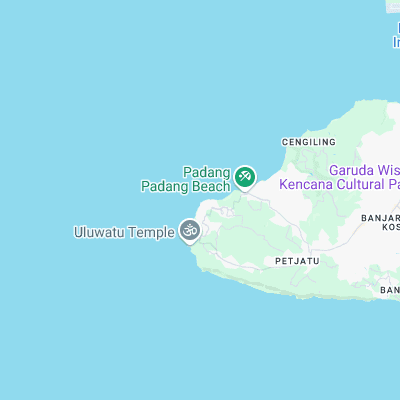
Surf spots nearby
- Padang Padang (0.8 mi)
- Impossibles (1.5 mi)
- Bingin (1.9 mi)
- Dreamland (2.3 mi)
- Nyang-Nyang (2.4 mi)
- Balangan (2.7 mi)
- Jimbaran Shorey (5.6 mi)
- Nikko Hotel (6 mi)
- Green Ball (6.1 mi)
- Airport's (6.4 mi)
Not Magic Seaweed (MSW)
Although we look a bit like Magic Seaweed we are not MagicSeaweed as they no longer exist...