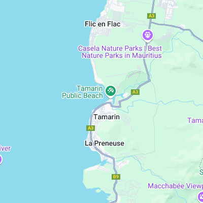
Tamarin Bay (Tamarin) Surf Report
| Wave height * | 3.5ft / 1m |
|---|---|
| Swell period | 12s |
| Swell direction | |
| Wind | |
| Sea temp | 27°C / 80°F |

10 day Tamarin Bay surf forecast
Sun
21/Dec
3.5ft
14
16
13
- High 2:43am
- Low 8:11am
- High 2:04pm
- Low 8:46pm
Mon
22/Dec
3ft
10
9
7
- High 3:15am
- Low 8:44am
- High 2:36pm
- Low 9:19pm
Tue
23/Dec
4ft
7
4
16
- High 3:49am
- Low 9:20am
- High 3:10pm
- Low 9:53pm
Wed
24/Dec
3.5ft
14
14
15
- High 4:27am
- Low 9:59am
- High 3:47pm
- Low 10:31pm
Thu
25/Dec
3ft
10
12
14
- High 5:08am
- Low 10:46am
- High 4:31pm
- Low 11:14pm
Fri
26/Dec
2.5ft
11
16
14
- High 5:56am
- Low 11:43am
- High 5:26pm
Sat
27/Dec
2ft
14
14
13
- Low 12:04am
- High 6:52am
- Low 12:57pm
- High 6:40pm
Sun
28/Dec
0ft
13
16
13
- Low 1:06am
- High 7:56am
- Low 2:25pm
- High 8:18pm
Mon
29/Dec
3ft
8
11
15
- Low 2:23am
- High 9:04am
- Low 3:49pm
- High 10:01pm
Sun 21st Dec
| 4:00 | 3.5ft | 5.4ft | 13s | 0mph (0mph) | |||
| 7:00 | 3.5ft | 5.4ft | 13s | 14mph (17mph) | |||
| 10:00 | 3.5ft | 5.5ft | 13s | 12mph (15mph) | |||
| 13:00 | 3.5ft | 5.4ft | 12s | 16mph (16mph) | |||
| 16:00 | 3.5ft | 5.3ft | 11s | 13mph (15mph) | |||
| 19:00 | 3.5ft | 5.3ft | 12s | 13mph (15mph) |
| Tide times |
|---|
| High 2:43am (0.72m) |
| Low 8:11am (0.43m) |
| High 2:04pm (0.78m) |
| Low 8:46pm (0.24m) |
| Daylight | |
|---|---|
| First light | 05:03 |
| Sunrise | 05:27 |
| Sunset | 18:49 |
| Dark | 19:14 |
Mon 22nd Dec
| 4:00 | 3ft | 5ft | 12s | 10mph (12mph) | |||
| 7:00 | 3ft | 4.9ft | 11s | 10mph (12mph) | |||
| 10:00 | 3ft | 4.8ft | 11s | 8mph (10mph) | |||
| 13:00 | 3ft | 4.9ft | 14s | 9mph (10mph) | |||
| 16:00 | 3.5ft | 5.3ft | 17s | 8mph (11mph) | |||
| 19:00 | 3.5ft | 5.8ft | 16s | 7mph (10mph) |
| Tide times |
|---|
| High 3:15am (0.72m) |
| Low 8:44am (0.44m) |
| High 2:36pm (0.78m) |
| Low 9:19pm (0.25m) |
| Daylight | |
|---|---|
| First light | 05:03 |
| Sunrise | 05:28 |
| Sunset | 18:50 |
| Dark | 19:14 |
Tue 23rd Dec
| 4:00 | 4.5ft | 6.8ft | 15s | 10mph (13mph) | |||
| 7:00 | 4.5ft | 6.8ft | 15s | 7mph (11mph) | |||
| 10:00 | 4.5ft | 6.8ft | 14s | 7mph (10mph) | |||
| 13:00 | 4ft | 6.7ft | 14s | 4mph (7mph) | |||
| 16:00 | 4ft | 6.7ft | 14s | 6mph (7mph) | |||
| 19:00 | 4ft | 6.5ft | 14s | 16mph (17mph) |
| Tide times |
|---|
| High 3:49am (0.72m) |
| Low 9:20am (0.44m) |
| High 3:10pm (0.77m) |
| Low 9:53pm (0.26m) |
| Daylight | |
|---|---|
| First light | 05:04 |
| Sunrise | 05:28 |
| Sunset | 18:50 |
| Dark | 19:15 |
Wed 24th Dec
| 4:00 | 4ft | 6.4ft | 13s | 13mph (18mph) | |||
| 7:00 | 4ft | 6.4ft | 13s | 14mph (18mph) | |||
| 10:00 | 4ft | 6ft | 13s | 12mph (15mph) | |||
| 13:00 | 3.5ft | 5.7ft | 13s | 14mph (16mph) | |||
| 16:00 | 3.5ft | 5.5ft | 13s | 13mph (15mph) | |||
| 19:00 | 3.5ft | 5.5ft | 13s | 15mph (16mph) |
| Tide times |
|---|
| High 4:27am (0.72m) |
| Low 9:59am (0.45m) |
| High 3:47pm (0.75m) |
| Low 10:31pm (0.28m) |
| Daylight | |
|---|---|
| First light | 05:04 |
| Sunrise | 05:29 |
| Sunset | 18:51 |
| Dark | 19:15 |
Thu 25th Dec
| 4:00 | 3.5ft | 5.2ft | 11s | 12mph (15mph) | |||
| 7:00 | 3.5ft | 5.2ft | 11s | 10mph (13mph) | |||
| 10:00 | 3.5ft | 5.2ft | 11s | 9mph (12mph) | |||
| 13:00 | 3ft | 5.1ft | 11s | 12mph (14mph) | |||
| 16:00 | 3ft | 5ft | 11s | 10mph (14mph) | |||
| 19:00 | 3ft | 5ft | 10s | 14mph (15mph) |
| Tide times |
|---|
| High 5:08am (0.72m) |
| Low 10:46am (0.46m) |
| High 4:31pm (0.73m) |
| Low 11:14pm (0.30m) |
| Daylight | |
|---|---|
| First light | 05:05 |
| Sunrise | 05:29 |
| Sunset | 18:51 |
| Dark | 19:16 |
Fri 26th Dec
| 4:00 | 3ft | 4.8ft | 10s | 9mph (13mph) | |||
| 7:00 | 2.5ft | 4.7ft | 10s | 11mph (15mph) | |||
| 10:00 | 2.5ft | 4.6ft | 10s | 13mph (15mph) | |||
| 13:00 | 2.5ft | 4.5ft | 10s | 16mph (17mph) | |||
| 16:00 | 2.5ft | 4.5ft | 10s | 15mph (15mph) | |||
| 19:00 | 2.5ft | 4.5ft | 10s | 14mph (15mph) |
| Tide times |
|---|
| High 5:56am (0.71m) |
| Low 11:43am (0.47m) |
| High 5:26pm (0.69m) |
| Daylight | |
|---|---|
| First light | 05:05 |
| Sunrise | 05:30 |
| Sunset | 18:51 |
| Dark | 19:16 |
Sat 27th Dec
| 4:00 | 2ft | 4.2ft | 9s | 15mph (17mph) | |||
| 7:00 | 2ft | 4.1ft | 9s | 14mph (17mph) | |||
| 10:00 | 2ft | 4.1ft | 9s | 16mph (18mph) | |||
| 13:00 | 2ft | 4ft | 9s | 14mph (17mph) | |||
| 16:00 | 2ft | 4ft | 9s | 14mph (16mph) | |||
| 19:00 | 0.5ft | 4ft | 9s | 13mph (15mph) |
| Tide times |
|---|
| Low 12:04am (0.34m) |
| High 6:52am (0.71m) |
| Low 12:57pm (0.46m) |
| High 6:40pm (0.66m) |
| Daylight | |
|---|---|
| First light | 05:06 |
| Sunrise | 05:30 |
| Sunset | 18:52 |
| Dark | 19:16 |
Sun 28th Dec
| 4:00 | 0.5ft | 3.8ft | 9s | 12mph (13mph) | |||
| 7:00 | 0.5ft | 3.7ft | 9s | 13mph (14mph) | |||
| 10:00 | 0ft | 3.7ft | 9s | 13mph (13mph) | |||
| 13:00 | 0ft | 3.7ft | 8s | 16mph (16mph) | |||
| 16:00 | 0ft | 3.6ft | 8s | 15mph (15mph) | |||
| 19:00 | 0ft | 3.6ft | 8s | 13mph (14mph) |
| Tide times |
|---|
| Low 1:06am (0.38m) |
| High 7:56am (0.71m) |
| Low 2:25pm (0.44m) |
| High 8:18pm (0.64m) |
| Daylight | |
|---|---|
| First light | 05:06 |
| Sunrise | 05:31 |
| Sunset | 18:52 |
| Dark | 19:17 |
Mon 29th Dec
| 4:00 | 2.5ft | 3.7ft | 9s | 9mph (10mph) | |||
| 7:00 | 2.5ft | 3.7ft | 9s | 8mph (10mph) | |||
| 10:00 | 2.5ft | 3.9ft | 9s | 9mph (10mph) | |||
| 13:00 | 3ft | 4.1ft | 9s | 11mph (12mph) | |||
| 16:00 | 3ft | 4.2ft | 9s | 13mph (13mph) | |||
| 19:00 | 3ft | 4.3ft | 9s | 15mph (17mph) |
| Tide times |
|---|
| Low 2:23am (0.42m) |
| High 9:04am (0.73m) |
| Low 3:49pm (0.39m) |
| High 10:01pm (0.65m) |
| Daylight | |
|---|---|
| First light | 05:07 |
| Sunrise | 05:32 |
| Sunset | 18:53 |
| Dark | 19:17 |
Tue 30th Dec
| 4:00 | 3.5ft | 5.2ft | 8s | 11mph (13mph) | |||
| 16:00 | 3ft | 5.4ft | 7s | 15mph (15mph) |
Epic left breaking over a sharp, shallow coral reef. Also infamous for the local 'White Shorts' who pretty much control the break - expect intimidation. Pretty inconsistent, requiring a big SW swell to wrap around.
Surf spots nearby
- Black Rocks (0.8 mi)
Not Magic Seaweed (MSW)
Although we look a bit like Magic Seaweed we are not MagicSeaweed as they no longer exist...