Boilers (The Boiler) Surf Report
| Wave height * | 5.5ft / 1.6m |
|---|---|
| Swell period | 10s |
| Swell direction | |
| Wind | |
| Sea temp | 17°C / 63°F |

10 day Boilers surf forecast
Sun
4/Jan
7ft
20
15
15
- High 3:46am
- Low 10:06am
- High 4:14pm
- Low 10:15pm
Mon
5/Jan
3ft
8
3
29
- High 4:28am
- Low 10:48am
- High 4:56pm
- Low 10:56pm
Tue
6/Jan
3.5ft
34
30
36
- High 5:10am
- Low 11:30am
- High 5:38pm
- Low 11:37pm
Wed
7/Jan
3ft
36
25
31
- High 5:51am
- Low 12:12pm
- High 6:20pm
Thu
8/Jan
1.5ft
2
5
9
- Low 12:21am
- High 6:34am
- Low 12:56pm
- High 7:07pm
Fri
9/Jan
1.5ft
7
7
22
- Low 1:09am
- High 7:22am
- Low 1:45pm
- High 8:00pm
Sat
10/Jan
3ft
1
1
11
- Low 2:06am
- High 8:19am
- Low 2:44pm
- High 9:05pm
Sun
11/Jan
2.5ft
3
2
8
- Low 3:17am
- High 9:30am
- Low 3:53pm
- High 10:17pm
Mon
12/Jan
2ft
4
5
6
- Low 4:35am
- High 10:47am
- Low 5:03pm
- High 11:24pm
Tue
13/Jan
2.5ft
28
33
30
- Low 5:44am
- High 11:54am
- Low 6:02pm
Sun 4th Jan
| 4:00 | 8.5ft | 12.5ft | 12s | 22mph (29mph) | |||
| 7:00 | 8ft | 11.7ft | 12s | 20mph (24mph) | |||
| 10:00 | 7.5ft | 10.9ft | 11s | 18mph (22mph) | |||
| 13:00 | 7ft | 10.4ft | 11s | 15mph (20mph) | |||
| 16:00 | 6.5ft | 9.8ft | 11s | 14mph (19mph) | |||
| 19:00 | 6ft | 9.1ft | 10s | 15mph (21mph) |
| Tide times |
|---|
| High 3:46am (3.61m) |
| Low 10:06am (0.83m) |
| High 4:14pm (3.32m) |
| Low 10:15pm (1.02m) |
| Daylight | |
|---|---|
| First light | 08:11 |
| Sunrise | 08:37 |
| Sunset | 18:52 |
| Dark | 19:18 |
Mon 5th Jan
| 4:00 | 5ft | 7.3ft | 10s | 2mph (5mph) | |||
| 7:00 | 4.5ft | 6.7ft | 10s | 8mph (7mph) | |||
| 10:00 | 4ft | 6.1ft | 9s | 7mph (6mph) | |||
| 13:00 | 3ft | 5.7ft | 10s | 3mph (4mph) | |||
| 16:00 | 2.5ft | 5.9ft | 11s | 19mph (20mph) | |||
| 19:00 | 3ft | 6.8ft | 11s | 29mph (30mph) |
| Tide times |
|---|
| High 4:28am (3.55m) |
| Low 10:48am (0.92m) |
| High 4:56pm (3.23m) |
| Low 10:56pm (1.11m) |
| Daylight | |
|---|---|
| First light | 08:11 |
| Sunrise | 08:37 |
| Sunset | 18:53 |
| Dark | 19:19 |
Tue 6th Jan
| 4:00 | 4ft | 9.1ft | 11s | 34mph (39mph) | |||
| 7:00 | 4.5ft | 10.3ft | 11s | 34mph (39mph) | |||
| 10:00 | 4.5ft | 10ft | 11s | 31mph (41mph) | |||
| 13:00 | 3.5ft | 9.1ft | 11s | 30mph (36mph) | |||
| 16:00 | 4ft | 9.5ft | 11s | 35mph (39mph) | |||
| 19:00 | 4ft | 10.4ft | 10s | 36mph (42mph) |
| Tide times |
|---|
| High 5:10am (3.43m) |
| Low 11:30am (1.05m) |
| High 5:38pm (3.11m) |
| Low 11:37pm (1.24m) |
| Daylight | |
|---|---|
| First light | 08:11 |
| Sunrise | 08:37 |
| Sunset | 18:53 |
| Dark | 19:20 |
Wed 7th Jan
| 4:00 | 3.5ft | 9ft | 10s | 36mph (42mph) | |||
| 7:00 | 3.5ft | 8.9ft | 10s | 36mph (43mph) | |||
| 10:00 | 3ft | 8.5ft | 10s | 34mph (41mph) | |||
| 13:00 | 3ft | 7.8ft | 9s | 25mph (30mph) | |||
| 16:00 | 3ft | 7.7ft | 9s | 34mph (33mph) | |||
| 19:00 | 2.5ft | 7.7ft | 8s | 31mph (31mph) |
| Tide times |
|---|
| High 5:51am (3.27m) |
| Low 12:12pm (1.20m) |
| High 6:20pm (2.98m) |
| Daylight | |
|---|---|
| First light | 08:11 |
| Sunrise | 08:37 |
| Sunset | 18:54 |
| Dark | 19:20 |
Thu 8th Jan
| 4:00 | 2ft | 5.5ft | 9s | 4mph (3mph) | |||
| 7:00 | 2ft | 4.9ft | 9s | 2mph (1mph) | |||
| 10:00 | 2ft | 4.4ft | 9s | 2mph (1mph) | |||
| 13:00 | 1.5ft | 4ft | 9s | 5mph (5mph) | |||
| 16:00 | 1.5ft | 3.7ft | 9s | 2mph (2mph) | |||
| 19:00 | 2ft | 3.4ft | 11s | 9mph (9mph) |
| Tide times |
|---|
| Low 12:21am (1.39m) |
| High 6:34am (3.09m) |
| Low 12:56pm (1.36m) |
| High 7:07pm (2.85m) |
| Daylight | |
|---|---|
| First light | 08:11 |
| Sunrise | 08:37 |
| Sunset | 18:55 |
| Dark | 19:21 |
Fri 9th Jan
| 4:00 | 1.5ft | 3.3ft | 9s | 8mph (8mph) | |||
| 7:00 | 1.5ft | 3.2ft | 9s | 7mph (8mph) | |||
| 10:00 | 1.5ft | 3.2ft | 9s | 11mph (11mph) | |||
| 13:00 | 1.5ft | 3.1ft | 9s | 7mph (8mph) | |||
| 16:00 | 1.5ft | 3.3ft | 9s | 13mph (14mph) | |||
| 19:00 | 2ft | 4.4ft | 7s | 22mph (23mph) |
| Tide times |
|---|
| Low 1:09am (1.54m) |
| High 7:22am (2.92m) |
| Low 1:45pm (1.51m) |
| High 8:00pm (2.74m) |
| Daylight | |
|---|---|
| First light | 08:11 |
| Sunrise | 08:37 |
| Sunset | 18:56 |
| Dark | 19:22 |
Sat 10th Jan
| 4:00 | 1.5ft | 4.4ft | 8s | 7mph (6mph) | |||
| 7:00 | 2ft | 4.3ft | 14s | 1mph (1mph) | |||
| 10:00 | 2.5ft | 4.5ft | 13s | 1mph (2mph) | |||
| 13:00 | 3ft | 5ft | 12s | 1mph (1mph) | |||
| 16:00 | 2.5ft | 5.3ft | 14s | 9mph (9mph) | |||
| 19:00 | 2.5ft | 5.4ft | 14s | 11mph (12mph) |
| Tide times |
|---|
| Low 2:06am (1.67m) |
| High 8:19am (2.76m) |
| Low 2:44pm (1.62m) |
| High 9:05pm (2.68m) |
| Daylight | |
|---|---|
| First light | 08:11 |
| Sunrise | 08:37 |
| Sunset | 18:57 |
| Dark | 19:23 |
Sun 11th Jan
| 4:00 | 2.5ft | 5.7ft | 14s | 9mph (9mph) | |||
| 7:00 | 2.5ft | 5.8ft | 13s | 3mph (3mph) | |||
| 10:00 | 2.5ft | 5.8ft | 13s | 4mph (4mph) | |||
| 13:00 | 2.5ft | 5.8ft | 12s | 2mph (2mph) | |||
| 16:00 | 2.5ft | 5.6ft | 12s | 6mph (6mph) | |||
| 19:00 | 2.5ft | 5.3ft | 12s | 8mph (8mph) |
| Tide times |
|---|
| Low 3:17am (1.74m) |
| High 9:30am (2.66m) |
| Low 3:53pm (1.68m) |
| High 10:17pm (2.68m) |
| Daylight | |
|---|---|
| First light | 08:11 |
| Sunrise | 08:37 |
| Sunset | 18:58 |
| Dark | 19:24 |
Mon 12th Jan
| 4:00 | 2.5ft | 4.9ft | 11s | 1mph (1mph) | |||
| 7:00 | 2ft | 4.7ft | 11s | 4mph (4mph) | |||
| 10:00 | 2ft | 4.4ft | 11s | 1mph (1mph) | |||
| 13:00 | 2ft | 4.2ft | 11s | 5mph (5mph) | |||
| 16:00 | 2ft | 4.2ft | 10s | 5mph (6mph) | |||
| 19:00 | 1.5ft | 4.9ft | 9s | 6mph (7mph) |
| Tide times |
|---|
| Low 4:35am (1.73m) |
| High 10:47am (2.65m) |
| Low 5:03pm (1.67m) |
| High 11:24pm (2.76m) |
| Daylight | |
|---|---|
| First light | 08:11 |
| Sunrise | 08:37 |
| Sunset | 18:58 |
| Dark | 19:24 |
Tue 13th Jan
| 4:00 | 3ft | 5ft | 13s | 7mph (9mph) | |||
| 7:00 | 2.5ft | 5ft | 12s | 28mph (34mph) | |||
| 10:00 | 2.5ft | 4.8ft | 11s | 31mph (32mph) | |||
| 13:00 | 2.5ft | 4.9ft | 11s | 33mph (38mph) | |||
| 16:00 | 2.5ft | 5.4ft | 14s | 29mph (34mph) | |||
| 19:00 | 3ft | 6.7ft | 14s | 30mph (32mph) |
| Tide times |
|---|
| Low 5:44am (1.64m) |
| High 11:54am (2.72m) |
| Low 6:02pm (1.59m) |
| Daylight | |
|---|---|
| First light | 08:11 |
| Sunrise | 08:37 |
| Sunset | 18:59 |
| Dark | 19:25 |
Fast, powerful right point breaking over a sharp, urchin infested reef - lots of fun getting in and out! Picks up more swell than the Taghazoute breaks so can be super crowded when small
Like most spots named 'Boilers' this one gets its name from the rusty old ship's boiler that is just visible at low tide
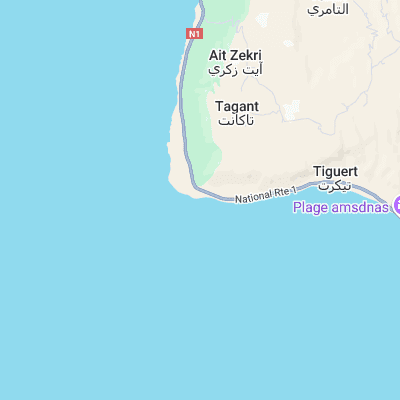
Surf spots nearby
- Draculas (0.3 mi)
- Tamri (6 mi)
- Killer Point (9.7 mi)
- La Source (10.1 mi)
- Anchor Point (10.6 mi)
- Mysteries (11 mi)
- Hash Point (11.3 mi)
- Panoramas (11.6 mi)
- Devil's rock (14 mi)
- 14th Km (14 mi)
Not Magic Seaweed (MSW)
Although we look a bit like Magic Seaweed we are not MagicSeaweed as they no longer exist...