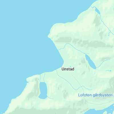
Unstad (Lofoten Islands) Surf Report
| Wave height * | 3.5ft / 1.1m |
|---|---|
| Swell period | 18s |
| Swell direction | |
| Wind | |
| Sea temp | 8°C / 46°F |

10 day Unstad surf forecast
Sun
7/Dec
3ft
5
7
6
- High 2:21am
- Low 8:32am
- High 2:39pm
- Low 9:16pm
Mon
8/Dec
3ft
3
3
5
- High 3:15am
- Low 9:24am
- High 3:30pm
- Low 10:13pm
Tue
9/Dec
4ft
5
3
4
- High 4:13am
- Low 10:20am
- High 4:25pm
- Low 11:16pm
Wed
10/Dec
3.5ft
8
10
29
- High 5:15am
- Low 11:24am
- High 5:24pm
Thu
11/Dec
3.5ft
28
26
15
- Low 12:23am
- High 6:24am
- Low 12:35pm
- High 6:29pm
Fri
12/Dec
5.5ft
23
33
23
- Low 1:30am
- High 7:35am
- Low 1:48pm
- High 7:38pm
Sat
13/Dec
7ft
17
19
17
- Low 2:32am
- High 8:42am
- Low 2:55pm
- High 8:43pm
Sun
14/Dec
10ft
16
22
23
- Low 3:26am
- High 9:38am
- Low 3:52pm
- High 9:41pm
Mon
15/Dec
12.5ft
12
11
14
- Low 4:12am
- High 10:25am
- Low 4:41pm
- High 10:31pm
Tue
16/Dec
5.5ft
15
8
4
- Low 4:51am
- High 11:05am
Sun 7th Dec
| 4:00 | 2.5ft | 3.2ft | 12s | 6mph (7mph) | |||
| 7:00 | 2.5ft | 3.2ft | 11s | 5mph (6mph) | |||
| 10:00 | 2.5ft | 3.1ft | 14s | 8mph (9mph) | |||
| 13:00 | 3ft | 3.2ft | 20s | 7mph (8mph) | |||
| 16:00 | 3ft | 3.5ft | 19s | 8mph (9mph) | |||
| 19:00 | 3.5ft | 3.7ft | 18s | 6mph (7mph) |
| Tide times |
|---|
| High 2:21am (2.75m) |
| Low 8:32am (0.68m) |
| High 2:39pm (2.97m) |
| Low 9:16pm (0.54m) |
| Daylight | |
|---|---|
| First light | 09:08 |
| Sunrise | 01:00 |
| Sunset | 01:00 |
| Dark | 14:45 |
Mon 8th Dec
| 4:00 | 3ft | 3.6ft | 16s | 4mph (5mph) | |||
| 7:00 | 3ft | 3.4ft | 15s | 3mph (4mph) | |||
| 10:00 | 3ft | 3.2ft | 14s | 3mph (3mph) | |||
| 13:00 | 3ft | 3.1ft | 14s | 3mph (2mph) | |||
| 16:00 | 2.5ft | 3ft | 14s | 4mph (4mph) | |||
| 19:00 | 2.5ft | 2.8ft | 13s | 5mph (5mph) |
| Tide times |
|---|
| High 3:15am (2.62m) |
| Low 9:24am (0.83m) |
| High 3:30pm (2.85m) |
| Low 10:13pm (0.64m) |
| Daylight | |
|---|---|
| First light | 09:10 |
| Sunrise | 01:00 |
| Sunset | 01:00 |
| Dark | 14:44 |
Tue 9th Dec
| 4:00 | 2.5ft | 2.9ft | 20s | 4mph (5mph) | |||
| 7:00 | 3ft | 3.4ft | 22s | 5mph (5mph) | |||
| 10:00 | 3.5ft | 4.2ft | 20s | 6mph (6mph) | |||
| 13:00 | 4ft | 4.7ft | 20s | 3mph (3mph) | |||
| 16:00 | 5ft | 5.1ft | 18s | 1mph (2mph) | |||
| 19:00 | 5ft | 5.5ft | 18s | 4mph (4mph) |
| Tide times |
|---|
| High 4:13am (2.47m) |
| Low 10:20am (0.99m) |
| High 4:25pm (2.71m) |
| Low 11:16pm (0.75m) |
| Daylight | |
|---|---|
| First light | 09:13 |
| Sunrise | 01:00 |
| Sunset | 01:00 |
| Dark | 14:43 |
Wed 10th Dec
| 4:00 | 3.5ft | 6.8ft | 14s | 6mph (6mph) | |||
| 7:00 | 4ft | 6.7ft | 13s | 8mph (8mph) | |||
| 10:00 | 4.5ft | 6.5ft | 13s | 8mph (9mph) | |||
| 13:00 | 3.5ft | 6.7ft | 13s | 10mph (11mph) | |||
| 16:00 | 4ft | 7.1ft | 13s | 14mph (24mph) | |||
| 19:00 | 5ft | 7.7ft | 8s | 29mph (33mph) |
| Tide times |
|---|
| High 5:15am (2.33m) |
| Low 11:24am (1.13m) |
| High 5:24pm (2.57m) |
| Daylight | |
|---|---|
| First light | 09:15 |
| Sunrise | 01:00 |
| Sunset | 01:00 |
| Dark | 14:42 |
Thu 11th Dec
| 4:00 | 5.5ft | 8ft | 8s | 28mph (32mph) | |||
| 7:00 | 4ft | 7.5ft | 11s | 28mph (32mph) | |||
| 10:00 | 4ft | 7.1ft | 11s | 27mph (30mph) | |||
| 13:00 | 3.5ft | 6.9ft | 11s | 26mph (29mph) | |||
| 16:00 | 3ft | 6.7ft | 12s | 24mph (27mph) | |||
| 19:00 | 3.5ft | 6.9ft | 12s | 15mph (22mph) |
| Tide times |
|---|
| Low 12:23am (0.84m) |
| High 6:24am (2.24m) |
| Low 12:35pm (1.22m) |
| High 6:29pm (2.45m) |
| Daylight | |
|---|---|
| First light | 09:16 |
| Sunrise | 01:00 |
| Sunset | 01:00 |
| Dark | 14:41 |
Fri 12th Dec
| 4:00 | 6.5ft | 8.1ft | 13s | 19mph (22mph) | |||
| 7:00 | 6.5ft | 7.9ft | 12s | 23mph (28mph) | |||
| 10:00 | 6ft | 7.5ft | 12s | 27mph (34mph) | |||
| 13:00 | 5.5ft | 7ft | 11s | 33mph (41mph) | |||
| 16:00 | 6.5ft | 7ft | 13s | 23mph (36mph) | |||
| 19:00 | 6.5ft | 7.2ft | 11s | 23mph (34mph) |
| Tide times |
|---|
| Low 1:30am (0.90m) |
| High 7:35am (2.22m) |
| Low 1:48pm (1.25m) |
| High 7:38pm (2.38m) |
| Daylight | |
|---|---|
| First light | 09:18 |
| Sunrise | 01:00 |
| Sunset | 01:00 |
| Dark | 14:40 |
Sat 13th Dec
| 4:00 | 7.5ft | 7.8ft | 12s | 18mph (20mph) | |||
| 7:00 | 7.5ft | 7.9ft | 13s | 17mph (20mph) | |||
| 10:00 | 7.5ft | 8.2ft | 11s | 17mph (19mph) | |||
| 13:00 | 7ft | 7.9ft | 12s | 19mph (20mph) | |||
| 16:00 | 6.5ft | 7.4ft | 11s | 17mph (19mph) | |||
| 19:00 | 6.5ft | 7.4ft | 11s | 17mph (20mph) |
| Tide times |
|---|
| Low 2:32am (0.92m) |
| High 8:42am (2.25m) |
| Low 2:55pm (1.21m) |
| High 8:43pm (2.35m) |
| Daylight | |
|---|---|
| First light | 09:20 |
| Sunrise | 01:00 |
| Sunset | 01:00 |
| Dark | 14:39 |
Sun 14th Dec
| 4:00 | 6ft | 7.3ft | 13s | 17mph (25mph) | |||
| 7:00 | 8ft | 9.5ft | 14s | 16mph (23mph) | |||
| 10:00 | 9ft | 11.5ft | 13s | 19mph (31mph) | |||
| 13:00 | 10ft | 12.4ft | 13s | 22mph (37mph) | |||
| 16:00 | 10.5ft | 13.5ft | 12s | 27mph (39mph) | |||
| 19:00 | 11.5ft | 14.3ft | 12s | 23mph (33mph) |
| Tide times |
|---|
| Low 3:26am (0.92m) |
| High 9:38am (2.32m) |
| Low 3:52pm (1.15m) |
| High 9:41pm (2.34m) |
| Daylight | |
|---|---|
| First light | 09:21 |
| Sunrise | 01:00 |
| Sunset | 01:00 |
| Dark | 14:38 |
Mon 15th Dec
| 4:00 | 15ft | 16.8ft | 13s | 18mph (26mph) | |||
| 7:00 | 16ft | 16.9ft | 13s | 12mph (14mph) | |||
| 10:00 | 15ft | 15.9ft | 13s | 11mph (11mph) | |||
| 13:00 | 12.5ft | 13.9ft | 12s | 11mph (15mph) | |||
| 16:00 | 11ft | 12.3ft | 12s | 13mph (23mph) | |||
| 19:00 | 10ft | 11.4ft | 11s | 14mph (23mph) |
| Tide times |
|---|
| Low 4:12am (0.90m) |
| High 10:25am (2.41m) |
| Low 4:41pm (1.07m) |
| High 10:31pm (2.35m) |
| Daylight | |
|---|---|
| First light | 09:23 |
| Sunrise | 01:00 |
| Sunset | 01:00 |
| Dark | 14:38 |
Tue 16th Dec
| 4:00 | 6.5ft | 7.6ft | 10s | 16mph (21mph) | |||
| 7:00 | 7.5ft | 7.8ft | 9s | 15mph (22mph) | |||
| 10:00 | 7ft | 8ft | 9s | 11mph (14mph) | |||
| 13:00 | 5.5ft | 7.7ft | 9s | 8mph (8mph) | |||
| 16:00 | 5ft | 7.5ft | 9s | 6mph (7mph) | |||
| 19:00 | 4.5ft | 7ft | 9s | 4mph (5mph) |
| Tide times |
|---|
| Low 4:51am (0.88m) |
| High 11:05am (2.49m) |
| Daylight | |
|---|---|
| First light | 09:24 |
| Sunrise | 01:00 |
| Sunset | 01:00 |
| Dark | 14:38 |
One of the best spots in Norway. Occasionally hollow right and a less intense but longer left break in a mountain flanked bay
The islands are within the Arctic Circle yet the temperature rarely falls below zero due to the gulf stream. Made famous by the Rip Curl Search team in 2008, but the quality of the waves speak for themselves
Surf spots nearby
Not Magic Seaweed (MSW)
Although we look a bit like Magic Seaweed we are not MagicSeaweed as they no longer exist...