Costa da Caparica Surf Report
| Wave height * | 4ft / 1.2m |
|---|---|
| Swell period | 9s |
| Swell direction | |
| Wind | |
| Sea temp | 15°C / 59°F |

10 day Costa da Caparica surf forecast
Sun
4/Jan
5ft
8
8
9
- High 4:13am
- Low 10:01am
- High 4:42pm
- Low 10:10pm
Mon
5/Jan
4.5ft
8
18
15
- High 4:57am
- Low 10:46am
- High 5:26pm
- Low 10:54pm
Tue
6/Jan
4.5ft
16
18
13
- High 5:41am
- Low 11:30am
- High 6:09pm
- Low 11:38pm
Wed
7/Jan
1.5ft
3
1
4
- High 6:25am
- Low 12:15pm
- High 6:53pm
Thu
8/Jan
3ft
2
3
6
- Low 12:23am
- High 7:10am
- Low 1:02pm
- High 7:39pm
Fri
9/Jan
5.5ft
17
13
8
- Low 1:13am
- High 7:58am
- Low 1:54pm
- High 8:30pm
Sat
10/Jan
5.5ft
3
4
5
- Low 2:13am
- High 8:52am
- Low 2:54pm
- High 9:30pm
Sun
11/Jan
3.5ft
1
7
10
- Low 3:25am
- High 9:58am
- Low 4:01pm
- High 10:40pm
Mon
12/Jan
6ft
20
24
13
- Low 4:38am
- High 11:14am
- Low 5:03pm
- High 11:51pm
Tue
13/Jan
5ft
10
16
14
- Low 5:42am
- High 12:23pm
Sun 4th Jan
| 3:00 | 6.5ft | 6.8ft | 9s | 8mph (19mph) | |||
| 6:00 | 5.5ft | 6.6ft | 9s | 8mph (21mph) | |||
| 9:00 | 5ft | 6.5ft | 9s | 8mph (22mph) | |||
| 12:00 | 5ft | 6.3ft | 9s | 8mph (21mph) | |||
| 15:00 | 6ft | 6.2ft | 9s | 9mph (17mph) | |||
| 18:00 | 4.5ft | 6.4ft | 9s | 9mph (21mph) | |||
| 21:00 | 4.5ft | 6.9ft | 9s | 7mph (20mph) |
| Tide times |
|---|
| High 4:13am (4.03m) |
| Low 10:01am (0.50m) |
| High 4:42pm (3.69m) |
| Low 10:10pm (0.70m) |
| Daylight | |
|---|---|
| First light | 07:25 |
| Sunrise | 07:54 |
| Sunset | 17:29 |
| Dark | 17:59 |
Mon 5th Jan
| 3:00 | 4ft | 8.3ft | 11s | 7mph (22mph) | |||
| 6:00 | 4.5ft | 8.9ft | 11s | 8mph (26mph) | |||
| 9:00 | 4.5ft | 9.1ft | 11s | 12mph (30mph) | |||
| 12:00 | 4.5ft | 9.3ft | 10s | 18mph (28mph) | |||
| 15:00 | 4.5ft | 9.7ft | 10s | 18mph (34mph) | |||
| 18:00 | 4.5ft | 9.5ft | 9s | 15mph (30mph) | |||
| 21:00 | 3.5ft | 8.1ft | 9s | 17mph (32mph) |
| Tide times |
|---|
| High 4:57am (3.98m) |
| Low 10:46am (0.60m) |
| High 5:26pm (3.60m) |
| Low 10:54pm (0.80m) |
| Daylight | |
|---|---|
| First light | 07:25 |
| Sunrise | 07:54 |
| Sunset | 17:30 |
| Dark | 18:00 |
Tue 6th Jan
| 3:00 | 6ft | 11.5ft | 10s | 18mph (35mph) | |||
| 6:00 | 5.5ft | 11.2ft | 10s | 16mph (31mph) | |||
| 9:00 | 5ft | 10.1ft | 10s | 17mph (29mph) | |||
| 12:00 | 4.5ft | 9.2ft | 10s | 18mph (26mph) | |||
| 15:00 | 4ft | 8.7ft | 10s | 17mph (26mph) | |||
| 18:00 | 3.5ft | 8.1ft | 9s | 13mph (27mph) | |||
| 21:00 | 3.5ft | 7.3ft | 9s | 12mph (25mph) |
| Tide times |
|---|
| High 5:41am (3.85m) |
| Low 11:30am (0.76m) |
| High 6:09pm (3.46m) |
| Low 11:38pm (0.95m) |
| Daylight | |
|---|---|
| First light | 07:25 |
| Sunrise | 07:54 |
| Sunset | 17:31 |
| Dark | 18:00 |
Wed 7th Jan
| 3:00 | 2.5ft | 5.5ft | 9s | 3mph (5mph) | |||
| 6:00 | 2ft | 4.9ft | 9s | 3mph (6mph) | |||
| 9:00 | 2ft | 4.3ft | 10s | 2mph (2mph) | |||
| 12:00 | 1.5ft | 4ft | 10s | 1mph (3mph) | |||
| 15:00 | 2.5ft | 4.1ft | 12s | 7mph (10mph) | |||
| 18:00 | 2.5ft | 4.6ft | 9s | 4mph (10mph) | |||
| 21:00 | 2.5ft | 4.9ft | 9s | 3mph (3mph) |
| Tide times |
|---|
| High 6:25am (3.67m) |
| Low 12:15pm (0.95m) |
| High 6:53pm (3.29m) |
| Daylight | |
|---|---|
| First light | 07:25 |
| Sunrise | 07:54 |
| Sunset | 17:32 |
| Dark | 18:01 |
Thu 8th Jan
| 3:00 | 2.5ft | 4.8ft | 9s | 2mph (2mph) | |||
| 6:00 | 2.5ft | 4.6ft | 9s | 2mph (2mph) | |||
| 9:00 | 3ft | 4.5ft | 11s | 1mph (1mph) | |||
| 12:00 | 3ft | 4.3ft | 11s | 3mph (4mph) | |||
| 15:00 | 3ft | 4.1ft | 11s | 6mph (7mph) | |||
| 18:00 | 3ft | 3.8ft | 11s | 6mph (10mph) | |||
| 21:00 | 2.5ft | 3.7ft | 11s | 8mph (17mph) |
| Tide times |
|---|
| Low 12:23am (1.13m) |
| High 7:10am (3.44m) |
| Low 1:02pm (1.15m) |
| High 7:39pm (3.12m) |
| Daylight | |
|---|---|
| First light | 07:25 |
| Sunrise | 07:54 |
| Sunset | 17:33 |
| Dark | 18:02 |
Fri 9th Jan
| 3:00 | 3.5ft | 4.9ft | 10s | 12mph (25mph) | |||
| 6:00 | 4ft | 6.2ft | 6s | 17mph (30mph) | |||
| 9:00 | 5ft | 7.8ft | 8s | 11mph (22mph) | |||
| 12:00 | 5.5ft | 9.3ft | 11s | 13mph (19mph) | |||
| 15:00 | 6.5ft | 10.3ft | 12s | 13mph (18mph) | |||
| 18:00 | 6.5ft | 11.7ft | 14s | 8mph (18mph) | |||
| 21:00 | 7ft | 12.3ft | 14s | 5mph (16mph) |
| Tide times |
|---|
| Low 1:13am (1.32m) |
| High 7:58am (3.21m) |
| Low 1:54pm (1.33m) |
| High 8:30pm (2.97m) |
| Daylight | |
|---|---|
| First light | 07:25 |
| Sunrise | 07:54 |
| Sunset | 17:34 |
| Dark | 18:03 |
Sat 10th Jan
| 3:00 | 6.5ft | 11.1ft | 13s | 5mph (13mph) | |||
| 6:00 | 6ft | 10.5ft | 13s | 3mph (3mph) | |||
| 9:00 | 5.5ft | 10.1ft | 13s | 2mph (2mph) | |||
| 12:00 | 5.5ft | 9.6ft | 13s | 4mph (6mph) | |||
| 15:00 | 5ft | 9ft | 12s | 6mph (6mph) | |||
| 18:00 | 5ft | 8.4ft | 12s | 5mph (10mph) | |||
| 21:00 | 4.5ft | 7.7ft | 12s | 3mph (3mph) |
| Tide times |
|---|
| Low 2:13am (1.48m) |
| High 8:52am (3.00m) |
| Low 2:54pm (1.47m) |
| High 9:30pm (2.88m) |
| Daylight | |
|---|---|
| First light | 07:25 |
| Sunrise | 07:54 |
| Sunset | 17:35 |
| Dark | 18:04 |
Sun 11th Jan
| 3:00 | 3.5ft | 6.5ft | 11s | 1mph (1mph) | |||
| 6:00 | 3.5ft | 5.9ft | 11s | 1mph (1mph) | |||
| 9:00 | 3ft | 5.7ft | 11s | 2mph (2mph) | |||
| 12:00 | 3.5ft | 6ft | 11s | 7mph (11mph) | |||
| 15:00 | 3.5ft | 6.5ft | 10s | 11mph (14mph) | |||
| 18:00 | 4ft | 7ft | 10s | 10mph (17mph) | |||
| 21:00 | 5ft | 7.9ft | 10s | 12mph (19mph) |
| Tide times |
|---|
| Low 3:25am (1.58m) |
| High 9:58am (2.86m) |
| Low 4:01pm (1.54m) |
| High 10:40pm (2.86m) |
| Daylight | |
|---|---|
| First light | 07:24 |
| Sunrise | 07:54 |
| Sunset | 17:36 |
| Dark | 18:05 |
Mon 12th Jan
| 3:00 | 6.5ft | 10.2ft | 12s | 16mph (27mph) | |||
| 6:00 | 6.5ft | 10.6ft | 11s | 20mph (33mph) | |||
| 9:00 | 6.5ft | 9.7ft | 11s | 25mph (41mph) | |||
| 12:00 | 6ft | 8.9ft | 11s | 24mph (41mph) | |||
| 15:00 | 5.5ft | 8.4ft | 10s | 11mph (24mph) | |||
| 18:00 | 5.5ft | 8.7ft | 13s | 13mph (24mph) | |||
| 21:00 | 5ft | 9.3ft | 13s | 15mph (25mph) |
| Tide times |
|---|
| Low 4:38am (1.58m) |
| High 11:14am (2.81m) |
| Low 5:03pm (1.53m) |
| High 11:51pm (2.93m) |
| Daylight | |
|---|---|
| First light | 07:24 |
| Sunrise | 07:53 |
| Sunset | 17:37 |
| Dark | 18:06 |
Tue 13th Jan
| 3:00 | 5ft | 9.1ft | 13s | 15mph (26mph) | |||
| 6:00 | 5.5ft | 8.6ft | 12s | 10mph (27mph) | |||
| 9:00 | 5ft | 8.4ft | 12s | 13mph (28mph) | |||
| 12:00 | 5ft | 8.1ft | 12s | 16mph (30mph) | |||
| 15:00 | 5ft | 7.9ft | 12s | 17mph (30mph) | |||
| 18:00 | 5ft | 8.3ft | 12s | 14mph (27mph) | |||
| 21:00 | 5.5ft | 9.1ft | 11s | 13mph (27mph) |
| Tide times |
|---|
| Low 5:42am (1.50m) |
| High 12:23pm (2.87m) |
| Daylight | |
|---|---|
| First light | 07:24 |
| Sunrise | 07:53 |
| Sunset | 17:38 |
| Dark | 18:07 |
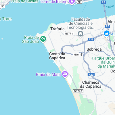
Long stretch of beaches with groynes at the northern end providing more consistent banks. Generally fairly mellow wave and less crowded than the beaches north of the River Tejo
Surf spots nearby
- Praia da Saude (0.9 mi)
- Carcavelos (6.1 mi)
- Sao Pedro (8.3 mi)
- Praia da Foz- Cabo Espichel Sesimbra (13.1 mi)
- Cresmina (14.4 mi)
- Guincho (14.4 mi)
- Bicas (15.2 mi)
- Praia Grande (17.8 mi)
- Praia Pequena (17.9 mi)
- Sao Juliao (22.4 mi)
Not Magic Seaweed (MSW)
Although we look a bit like Magic Seaweed we are not MagicSeaweed as they no longer exist...