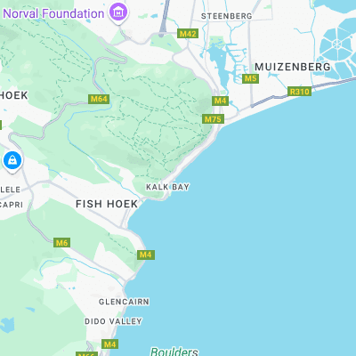
Kalk Bay Reef Surf Report
| Wave height * | 1.5ft / 0.4m |
|---|---|
| Swell period | 19s |
| Swell direction | |
| Wind | |
| Sea temp | 19°C / 66°F |

10 day Kalk Bay Reef surf forecast
Fri
2/Jan
1.5ft
5
15
14
- High 3:09am
- Low 9:17am
- High 3:23pm
- Low 9:40pm
Sat
3/Jan
3ft
24
29
31
- High 3:54am
- Low 10:04am
- High 4:08pm
- Low 10:21pm
Sun
4/Jan
3ft
32
31
32
- High 4:37am
- Low 10:50am
- High 4:52pm
- Low 11:02pm
Mon
5/Jan
2ft
13
9
9
- High 5:19am
- Low 11:34am
- High 5:34pm
- Low 11:41pm
Tue
6/Jan
2ft
7
17
12
- High 6:00am
- Low 12:17pm
- High 6:16pm
Wed
7/Jan
7.5ft
14
15
19
- Low 12:20am
- High 6:42am
- Low 1:02pm
- High 6:58pm
Thu
8/Jan
4ft
19
22
28
- Low 1:00am
- High 7:26am
- Low 1:50pm
- High 7:45pm
Fri
9/Jan
3ft
17
22
29
- Low 1:44am
- High 8:14am
- Low 2:46pm
- High 8:41pm
Sat
10/Jan
2.5ft
6
14
26
- Low 2:38am
- High 9:12am
- Low 3:56pm
- High 9:56pm
Sun
11/Jan
3ft
19
20
23
Fri 2nd Jan
| 5:00 | 1.5ft | 3.5ft | 12s | 6mph (6mph) | |||
| 8:00 | 1.5ft | 3.4ft | 12s | 5mph (5mph) | |||
| 11:00 | 1.5ft | 3.5ft | 19s | 6mph (6mph) | |||
| 14:00 | 1.5ft | 3.7ft | 19s | 15mph (19mph) | |||
| 17:00 | 1.5ft | 4.3ft | 18s | 15mph (20mph) | |||
| 20:00 | 2ft | 5.1ft | 18s | 14mph (19mph) |
| Tide times |
|---|
| High 3:09am (1.78m) |
| Low 9:17am (0.41m) |
| High 3:23pm (1.81m) |
| Low 9:40pm (0.29m) |
| Daylight | |
|---|---|
| First light | 05:10 |
| Sunrise | 05:39 |
| Sunset | 20:01 |
| Dark | 20:30 |
Sat 3rd Jan
| 5:00 | 3ft | 7.1ft | 16s | 25mph (31mph) | |||
| 8:00 | 3ft | 7.5ft | 15s | 24mph (31mph) | |||
| 11:00 | 3ft | 7.7ft | 15s | 26mph (31mph) | |||
| 14:00 | 3ft | 7.9ft | 14s | 29mph (34mph) | |||
| 17:00 | 3ft | 8.1ft | 14s | 31mph (37mph) | |||
| 20:00 | 3ft | 8.1ft | 14s | 31mph (37mph) |
| Tide times |
|---|
| High 3:54am (1.83m) |
| Low 10:04am (0.39m) |
| High 4:08pm (1.79m) |
| Low 10:21pm (0.30m) |
| Daylight | |
|---|---|
| First light | 05:10 |
| Sunrise | 05:39 |
| Sunset | 20:01 |
| Dark | 20:30 |
Sun 4th Jan
| 5:00 | 3ft | 7.3ft | 13s | 33mph (38mph) | |||
| 8:00 | 3ft | 7.2ft | 9s | 32mph (36mph) | |||
| 11:00 | 2.5ft | 6.9ft | 9s | 32mph (34mph) | |||
| 14:00 | 3ft | 7.1ft | 8s | 31mph (38mph) | |||
| 17:00 | 3ft | 7.2ft | 8s | 32mph (38mph) | |||
| 20:00 | 2.5ft | 6.9ft | 9s | 32mph (38mph) |
| Tide times |
|---|
| High 4:37am (1.85m) |
| Low 10:50am (0.40m) |
| High 4:52pm (1.75m) |
| Low 11:02pm (0.34m) |
| Daylight | |
|---|---|
| First light | 05:11 |
| Sunrise | 05:40 |
| Sunset | 20:01 |
| Dark | 20:30 |
Mon 5th Jan
| 5:00 | 2ft | 4.9ft | 12s | 18mph (22mph) | |||
| 8:00 | 2ft | 4.6ft | 12s | 13mph (16mph) | |||
| 11:00 | 2ft | 4.6ft | 11s | 10mph (12mph) | |||
| 14:00 | 2ft | 4.5ft | 11s | 9mph (12mph) | |||
| 17:00 | 2ft | 4.6ft | 13s | 13mph (17mph) | |||
| 20:00 | 2ft | 4.6ft | 12s | 9mph (11mph) |
| Tide times |
|---|
| High 5:19am (1.83m) |
| Low 11:34am (0.44m) |
| High 5:34pm (1.67m) |
| Low 11:41pm (0.41m) |
| Daylight | |
|---|---|
| First light | 05:12 |
| Sunrise | 05:41 |
| Sunset | 20:01 |
| Dark | 20:30 |
Tue 6th Jan
| 5:00 | 2ft | 5ft | 12s | 6mph (6mph) | |||
| 8:00 | 2ft | 5.2ft | 11s | 7mph (8mph) | |||
| 11:00 | 2ft | 5.3ft | 11s | 10mph (13mph) | |||
| 14:00 | 2ft | 5.4ft | 11s | 17mph (20mph) | |||
| 17:00 | 2ft | 5.5ft | 11s | 18mph (22mph) | |||
| 20:00 | 2ft | 5.6ft | 11s | 12mph (16mph) |
| Tide times |
|---|
| High 6:00am (1.77m) |
| Low 12:17pm (0.51m) |
| High 6:16pm (1.58m) |
| Daylight | |
|---|---|
| First light | 05:13 |
| Sunrise | 05:42 |
| Sunset | 20:01 |
| Dark | 20:30 |
Wed 7th Jan
| 5:00 | 4.5ft | 9.1ft | 11s | 13mph (16mph) | |||
| 8:00 | 5.5ft | 10.3ft | 13s | 14mph (14mph) | |||
| 11:00 | 6.5ft | 12ft | 14s | 13mph (13mph) | |||
| 14:00 | 7.5ft | 13.4ft | 15s | 15mph (15mph) | |||
| 17:00 | 7.5ft | 13.6ft | 15s | 18mph (19mph) | |||
| 20:00 | 7ft | 13.1ft | 15s | 19mph (21mph) |
| Tide times |
|---|
| Low 12:20am (0.50m) |
| High 6:42am (1.70m) |
| Low 1:02pm (0.60m) |
| High 6:58pm (1.47m) |
| Daylight | |
|---|---|
| First light | 05:14 |
| Sunrise | 05:43 |
| Sunset | 20:01 |
| Dark | 20:30 |
Thu 8th Jan
| 5:00 | 5.5ft | 10.8ft | 14s | 21mph (22mph) | |||
| 8:00 | 5ft | 10.2ft | 13s | 19mph (21mph) | |||
| 11:00 | 4.5ft | 9.6ft | 13s | 22mph (22mph) | |||
| 14:00 | 4ft | 9ft | 13s | 22mph (24mph) | |||
| 17:00 | 3.5ft | 8.6ft | 13s | 24mph (28mph) | |||
| 20:00 | 4ft | 8.5ft | 12s | 28mph (31mph) |
| Tide times |
|---|
| Low 1:00am (0.60m) |
| High 7:26am (1.60m) |
| Low 1:50pm (0.69m) |
| High 7:45pm (1.37m) |
| Daylight | |
|---|---|
| First light | 05:15 |
| Sunrise | 05:43 |
| Sunset | 20:01 |
| Dark | 20:30 |
Fri 9th Jan
| 5:00 | 3.5ft | 7.6ft | 12s | 26mph (30mph) | |||
| 8:00 | 3ft | 7.1ft | 12s | 17mph (19mph) | |||
| 11:00 | 2.5ft | 6.8ft | 11s | 8mph (9mph) | |||
| 14:00 | 3ft | 7.3ft | 11s | 22mph (29mph) | |||
| 17:00 | 3.5ft | 7.9ft | 10s | 29mph (40mph) | |||
| 20:00 | 3.5ft | 7.9ft | 10s | 29mph (36mph) |
| Tide times |
|---|
| Low 1:44am (0.70m) |
| High 8:14am (1.51m) |
| Low 2:46pm (0.76m) |
| High 8:41pm (1.29m) |
| Daylight | |
|---|---|
| First light | 05:16 |
| Sunrise | 05:44 |
| Sunset | 20:01 |
| Dark | 20:30 |
Sat 10th Jan
| 5:00 | 2.5ft | 5.6ft | 10s | 9mph (11mph) | |||
| 8:00 | 2.5ft | 5.3ft | 10s | 6mph (7mph) | |||
| 11:00 | 2.5ft | 5ft | 10s | 8mph (9mph) | |||
| 14:00 | 2.5ft | 4.9ft | 10s | 14mph (19mph) | |||
| 17:00 | 2.5ft | 5.2ft | 10s | 18mph (26mph) | |||
| 20:00 | 2.5ft | 5.2ft | 9s | 26mph (35mph) |
| Tide times |
|---|
| Low 2:38am (0.80m) |
| High 9:12am (1.42m) |
| Low 3:56pm (0.81m) |
| High 9:56pm (1.23m) |
| Daylight | |
|---|---|
| First light | 05:17 |
| Sunrise | 05:45 |
| Sunset | 20:01 |
| Dark | 20:30 |
Sun 11th Jan
| 5:00 | 2ft | 5.1ft | 10s | 21mph (28mph) | |||
| 8:00 | 2ft | 5.1ft | 10s | 19mph (23mph) | |||
| 11:00 | 2ft | 5.5ft | 9s | 17mph (22mph) | |||
| 14:00 | 3ft | 6.3ft | 10s | 20mph (29mph) | |||
| 17:00 | 3.5ft | 6.9ft | 10s | 22mph (31mph) | |||
| 20:00 | 3.5ft | 7.5ft | 12s | 23mph (31mph) |
| Tide times |
|---|
| Daylight | |
|---|---|
| First light | 05:18 |
| Sunrise | 05:46 |
| Sunset | 20:01 |
| Dark | 20:30 |
Shallow, heavy reefbreak with hairy drop into a barrel section. Gnarly at low tide and when it gets big
Surf spots nearby
- Clovelly (0.8 mi)
- Clovelly Wedge (0.8 mi)
- Muizenburg Corner (1.5 mi)
- Noordhoek Beach (6 mi)
- The Hoek (6.1 mi)
- Witsands (6.8 mi)
- Scarborough Beach (6.9 mi)
- Scarborough (7 mi)
- Long Beach (7.2 mi)
- Crayfish Factory (7.4 mi)
Not Magic Seaweed (MSW)
Although we look a bit like Magic Seaweed we are not MagicSeaweed as they no longer exist...