Hierro (La Izquierda / Yarro) Surf Report
| Wave height * | 3ft / 1m |
|---|---|
| Swell period | 13s |
| Swell direction | |
| Wind | |
| Sea temp | 20°C / 68°F |

10 day Hierro surf forecast
Mon
29/Dec
4ft
5
3
4
- Low 3:06am
- High 9:19am
- Low 3:40pm
- High 10:00pm
Tue
30/Dec
3.5ft
4
4
6
- Low 4:16am
- High 10:25am
- Low 4:40pm
- High 10:58pm
Wed
31/Dec
3.5ft
3
3
1
- Low 5:17am
- High 11:27am
- Low 5:34pm
- High 11:52pm
Thu
1/Jan
3.5ft
9
9
13
- Low 6:12am
- High 12:22pm
- Low 6:24pm
Fri
2/Jan
5ft
23
15
10
- High 12:41am
- Low 7:01am
- High 1:12pm
- Low 7:11pm
Sat
3/Jan
8ft
17
17
20
- High 1:28am
- Low 7:48am
- High 1:59pm
- Low 7:55pm
Sun
4/Jan
7ft
23
20
22
- High 2:13am
- Low 8:33am
- High 2:44pm
- Low 8:38pm
Mon
5/Jan
7.5ft
27
22
24
- High 2:57am
- Low 9:17am
- High 3:28pm
- Low 9:20pm
Tue
6/Jan
6.5ft
23
23
25
- High 3:41am
- Low 10:00am
- High 4:12pm
- Low 10:01pm
Wed
7/Jan
6ft
25
26
27
- High 4:24am
- Low 10:44am
Mon 29th Dec
| 3:00 | 5ft | 5.1ft | 10s | 4mph (4mph) | |||
| 6:00 | 4.5ft | 4.8ft | 10s | 5mph (4mph) | |||
| 9:00 | 4.5ft | 4.7ft | 10s | 4mph (4mph) | |||
| 12:00 | 4ft | 4.6ft | 10s | 3mph (2mph) | |||
| 15:00 | 4ft | 4.5ft | 11s | 5mph (3mph) | |||
| 18:00 | 3.5ft | 4.5ft | 12s | 4mph (4mph) | |||
| 21:00 | 4ft | 4.5ft | 13s | 3mph (3mph) |
| Tide times |
|---|
| Low 3:06am (0.82m) |
| High 9:19am (2.11m) |
| Low 3:40pm (0.67m) |
| High 10:00pm (2.18m) |
| Daylight | |
|---|---|
| First light | 07:22 |
| Sunrise | 07:48 |
| Sunset | 18:08 |
| Dark | 18:34 |
Tue 30th Dec
| 3:00 | 3ft | 4.3ft | 13s | 2mph (2mph) | |||
| 6:00 | 3.5ft | 4.4ft | 13s | 4mph (3mph) | |||
| 9:00 | 3.5ft | 4.7ft | 14s | 4mph (4mph) | |||
| 12:00 | 3.5ft | 4.9ft | 16s | 4mph (4mph) | |||
| 15:00 | 3.5ft | 4.9ft | 16s | 7mph (7mph) | |||
| 18:00 | 4ft | 5.2ft | 15s | 6mph (6mph) | |||
| 21:00 | 4ft | 5.4ft | 15s | 2mph (2mph) |
| Tide times |
|---|
| Low 4:16am (0.69m) |
| High 10:25am (2.18m) |
| Low 4:40pm (0.59m) |
| High 10:58pm (2.33m) |
| Daylight | |
|---|---|
| First light | 07:22 |
| Sunrise | 07:48 |
| Sunset | 18:09 |
| Dark | 18:35 |
Wed 31st Dec
| 3:00 | 4ft | 5.2ft | 14s | 2mph (1mph) | |||
| 6:00 | 3.5ft | 5ft | 14s | 3mph (2mph) | |||
| 9:00 | 3.5ft | 4.8ft | 13s | 5mph (5mph) | |||
| 12:00 | 3.5ft | 4.6ft | 13s | 3mph (5mph) | |||
| 15:00 | 3ft | 4.3ft | 13s | 4mph (4mph) | |||
| 18:00 | 3ft | 4ft | 13s | 1mph (3mph) | |||
| 21:00 | 3ft | 3.7ft | 12s | 6mph (7mph) |
| Tide times |
|---|
| Low 5:17am (0.55m) |
| High 11:27am (2.24m) |
| Low 5:34pm (0.52m) |
| High 11:52pm (2.46m) |
| Daylight | |
|---|---|
| First light | 07:23 |
| Sunrise | 07:48 |
| Sunset | 18:09 |
| Dark | 18:35 |
Thu 1st Jan
| 3:00 | 2.5ft | 3.4ft | 12s | 7mph (8mph) | |||
| 6:00 | 2.5ft | 3.5ft | 13s | 9mph (13mph) | |||
| 9:00 | 3ft | 4.1ft | 14s | 7mph (10mph) | |||
| 12:00 | 3.5ft | 5ft | 14s | 9mph (15mph) | |||
| 15:00 | 4.5ft | 5.8ft | 12s | 15mph (22mph) | |||
| 18:00 | 4.5ft | 6.3ft | 12s | 13mph (19mph) | |||
| 21:00 | 5ft | 6.3ft | 12s | 18mph (30mph) |
| Tide times |
|---|
| Low 6:12am (0.41m) |
| High 12:22pm (2.32m) |
| Low 6:24pm (0.45m) |
| Daylight | |
|---|---|
| First light | 07:23 |
| Sunrise | 07:49 |
| Sunset | 18:10 |
| Dark | 18:36 |
Fri 2nd Jan
| 3:00 | 4.5ft | 6.3ft | 12s | 20mph (28mph) | |||
| 6:00 | 5ft | 6.4ft | 12s | 23mph (26mph) | |||
| 9:00 | 5ft | 6.4ft | 12s | 19mph (24mph) | |||
| 12:00 | 5ft | 6.4ft | 12s | 15mph (17mph) | |||
| 15:00 | 4.5ft | 6.3ft | 13s | 12mph (14mph) | |||
| 18:00 | 5ft | 6.4ft | 13s | 10mph (12mph) | |||
| 21:00 | 5ft | 6.6ft | 13s | 11mph (17mph) |
| Tide times |
|---|
| High 12:41am (2.57m) |
| Low 7:01am (0.31m) |
| High 1:12pm (2.37m) |
| Low 7:11pm (0.41m) |
| Daylight | |
|---|---|
| First light | 07:23 |
| Sunrise | 07:49 |
| Sunset | 18:11 |
| Dark | 18:37 |
Sat 3rd Jan
| 3:00 | 5.5ft | 7.2ft | 12s | 13mph (18mph) | |||
| 6:00 | 6.5ft | 8ft | 12s | 17mph (20mph) | |||
| 9:00 | 7.5ft | 9.2ft | 12s | 16mph (20mph) | |||
| 12:00 | 8ft | 9.7ft | 12s | 17mph (23mph) | |||
| 15:00 | 8ft | 10.2ft | 12s | 21mph (27mph) | |||
| 18:00 | 9ft | 10.5ft | 12s | 20mph (27mph) | |||
| 21:00 | 9ft | 10.5ft | 12s | 21mph (26mph) |
| Tide times |
|---|
| High 1:28am (2.64m) |
| Low 7:48am (0.25m) |
| High 1:59pm (2.38m) |
| Low 7:55pm (0.41m) |
| Daylight | |
|---|---|
| First light | 07:23 |
| Sunrise | 07:49 |
| Sunset | 18:12 |
| Dark | 18:37 |
Sun 4th Jan
| 3:00 | 9ft | 10.3ft | 12s | 20mph (26mph) | |||
| 6:00 | 8ft | 9.6ft | 11s | 23mph (26mph) | |||
| 9:00 | 7.5ft | 9.1ft | 11s | 20mph (24mph) | |||
| 12:00 | 7ft | 8.8ft | 11s | 20mph (22mph) | |||
| 15:00 | 6.5ft | 8.2ft | 11s | 20mph (22mph) | |||
| 18:00 | 7ft | 7.9ft | 12s | 22mph (24mph) | |||
| 21:00 | 7.5ft | 8.1ft | 13s | 21mph (23mph) |
| Tide times |
|---|
| High 2:13am (2.66m) |
| Low 8:33am (0.26m) |
| High 2:44pm (2.34m) |
| Low 8:38pm (0.45m) |
| Daylight | |
|---|---|
| First light | 07:23 |
| Sunrise | 07:49 |
| Sunset | 18:12 |
| Dark | 18:38 |
Mon 5th Jan
| 3:00 | 7ft | 8.1ft | 12s | 24mph (25mph) | |||
| 6:00 | 7ft | 8.1ft | 12s | 27mph (28mph) | |||
| 9:00 | 7ft | 8.5ft | 11s | 25mph (24mph) | |||
| 12:00 | 7.5ft | 8.4ft | 10s | 22mph (24mph) | |||
| 15:00 | 7ft | 8.1ft | 10s | 26mph (26mph) | |||
| 18:00 | 7ft | 7.8ft | 11s | 24mph (27mph) | |||
| 21:00 | 6.5ft | 7.7ft | 11s | 25mph (26mph) |
| Tide times |
|---|
| High 2:57am (2.62m) |
| Low 9:17am (0.32m) |
| High 3:28pm (2.27m) |
| Low 9:20pm (0.52m) |
| Daylight | |
|---|---|
| First light | 07:24 |
| Sunrise | 07:49 |
| Sunset | 18:13 |
| Dark | 18:39 |
Tue 6th Jan
| 3:00 | 7ft | 7.8ft | 11s | 21mph (25mph) | |||
| 6:00 | 7ft | 7.8ft | 11s | 23mph (25mph) | |||
| 9:00 | 6.5ft | 8ft | 12s | 26mph (28mph) | |||
| 12:00 | 6.5ft | 8.1ft | 12s | 23mph (26mph) | |||
| 15:00 | 6.5ft | 8ft | 12s | 27mph (27mph) | |||
| 18:00 | 6.5ft | 7.8ft | 12s | 25mph (26mph) | |||
| 21:00 | 6.5ft | 7.7ft | 12s | 27mph (28mph) |
| Tide times |
|---|
| High 3:41am (2.53m) |
| Low 10:00am (0.43m) |
| High 4:12pm (2.17m) |
| Low 10:01pm (0.63m) |
| Daylight | |
|---|---|
| First light | 07:24 |
| Sunrise | 07:49 |
| Sunset | 18:14 |
| Dark | 18:40 |
Wed 7th Jan
| 3:00 | 6ft | 7.5ft | 11s | 24mph (26mph) | |||
| 6:00 | 6ft | 7.4ft | 11s | 25mph (27mph) | |||
| 9:00 | 6ft | 7.3ft | 10s | 24mph (26mph) | |||
| 12:00 | 6ft | 7.4ft | 10s | 26mph (28mph) | |||
| 15:00 | 3.5ft | 7ft | 10s | 28mph (30mph) | |||
| 18:00 | 5.5ft | 6.8ft | 10s | 27mph (30mph) | |||
| 21:00 | 5.5ft | 6.8ft | 9s | 29mph (30mph) |
| Tide times |
|---|
| High 4:24am (2.40m) |
| Low 10:44am (0.57m) |
| Daylight | |
|---|---|
| First light | 07:24 |
| Sunrise | 07:49 |
| Sunset | 18:15 |
| Dark | 18:40 |
The easy option to the Bubble next door. Provides a consistent left with a workable wall. Usually the busiest spot on the North Track
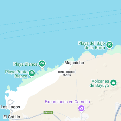
Surf spots nearby
- Derecha de los Alemanes (0.1 mi)
- The Bubble (0.2 mi)
- Majanicho (1.2 mi)
- Mejillones (3.3 mi)
- Suicidios (3.8 mi)
- Spew Pits (4.9 mi)
- Corralejo Harbor (5.4 mi)
- El Muelle (5.6 mi)
- Cotillo Beach (5.7 mi)
- Rocky Point (6 mi)
Not Magic Seaweed (MSW)
Although we look a bit like Magic Seaweed we are not MagicSeaweed as they no longer exist...